Menu

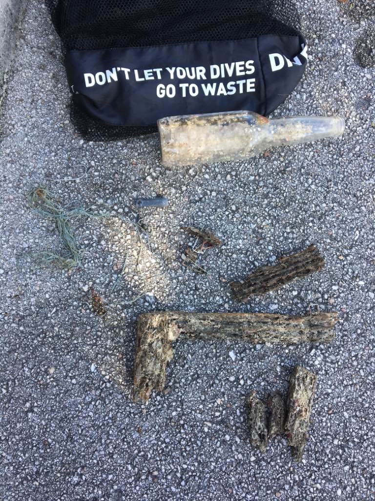
The Trench

24.873283, -80.5713

coral
5
Ongoing commercial and recreational fishing
windy 20+ knot winds for a few days, calm for a few days, silty visibility (30 ft)
1
anchor chain
Key Dives
Alyssa Panzer
14
13.00
38
65.00
45.00
measured
6
300.00
fishing line
On
pounds
I have debris data to report
Slight for waves 0.5 -1.25 meter high m2
feet
rocky reef
3
1
United States
State\Province
FL
City
Islamorada
Map Help


Dive Location

If you know your survey site coordinates, enter them manually in decimal degrees using WGS84 Map Datum. Use the minus sign for latitudes south of the equator and longitudes west of the Prime Meridian to 180 degrees.

If you do not know your survey site coordinates, click the “Map Location” tab to use the map to zoom into your survey site and drop the pin on the map to fall within your survey dive site in the water (not on land or the beach). Ensure you zoom in as much as possible to ensure data accuracy.

Entangled Help


Use the vertical tabs below to record any entangled animals you found of each type.

Pulizia Fondali del Lago di Garda

3
sand
12
4

45.634367475492, 10.599289890765

Annuale appuntamento con al pulizia dei fondali del Golfo di Toscolano Maderno
Astore Santoro
1
3
12
40
6
9
10
5
4
2
3
7
5
6
4
600.00
62
30.00
5.00
estimated
300.00
6
On
kilograms
I have debris data to report
34
Calm (glassy to rippled) for waves 0 – 0.1 meter high
12
m2
meters
other
7
3
23
45
12
23
45
8
Italy
State\Province
Brescia
City
Toscolano Maderno
Map Help


Dive Location

If you know your survey site coordinates, enter them manually in decimal degrees using WGS84 Map Datum. Use the minus sign for latitudes south of the equator and longitudes west of the Prime Meridian to 180 degrees.

If you do not know your survey site coordinates, click the “Map Location” tab to use the map to zoom into your survey site and drop the pin on the map to fall within your survey dive site in the water (not on land or the beach). Ensure you zoom in as much as possible to ensure data accuracy.

Entangled Help


Use the vertical tabs below to record any entangled animals you found of each type.

Ecosystem Other
muddy seabed

Golfo di Toscolano Maderno

5
4
sand
20
0
6

45.634305653301, 10.599243643515

Pulizia dei fondali del Golfo di Toscolano Maderno
Annuale pulizia dei fondali del Golfo di Toscolano Maderno
Astore Santoro
15
17
9
0
0
13
1
7
22
30
5
15
17
19
17
18
21
4
3
8
2
400.00
52
30.00
5.00
estimated
200.00
1
Copertoni
Materiale edile
Biciclette
On
kilograms
I have debris data to report
22
Calm (glassy to rippled) for waves 0 – 0.1 meter high
5
m2
meters
other
3
34
12
5
34
Italy
State\Province
Brescia
City
Toscolano Maderno
Map Help


Dive Location

If you know your survey site coordinates, enter them manually in decimal degrees using WGS84 Map Datum. Use the minus sign for latitudes south of the equator and longitudes west of the Prime Meridian to 180 degrees.

If you do not know your survey site coordinates, click the “Map Location” tab to use the map to zoom into your survey site and drop the pin on the map to fall within your survey dive site in the water (not on land or the beach). Ensure you zoom in as much as possible to ensure data accuracy.

Entangled Help


Use the vertical tabs below to record any entangled animals you found of each type.

Ecosystem Other
muddy seabed

Rainbow reef

0
0
0

25.692724585557, -80.097395628765

0
0
0
coral
0
0
0
0
0
None
None
None
Good
0
0
0
0
0
0
0
0
0
0
0
0
0
0
0
0
0
0
0
0
@scubarocks_
Paulo giraldo
0
0
0
0
0
0
0
0
0
0
0
0
0
0
0
0
0
0
0
2
0
0
0
0
0
0
0
0
0
0
0
0
0
0
2.00
55
26.00
15.00
0
estimated
0
3
100.00
0
0
0
0
0
Plastic
Aluminum cans
Sinkers
0
On
pounds
0
I have debris data to report
1
0
0
Calm (glassy to rippled) for waves 0 – 0.1 meter high
5
0
0
0
0
0
0
ft2
0
0
feet
coral reef
1
5
0
0
0
0
0
0
0
0
0
0
0
0
0
0
0
0
0
0
0
NA
Green
0
0
0
0
0
0
0
0
United States
State\Province
Florida
City
Miami
Map Help


Dive Location

If you know your survey site coordinates, enter them manually in decimal degrees using WGS84 Map Datum. Use the minus sign for latitudes south of the equator and longitudes west of the Prime Meridian to 180 degrees.

If you do not know your survey site coordinates, click the “Map Location” tab to use the map to zoom into your survey site and drop the pin on the map to fall within your survey dive site in the water (not on land or the beach). Ensure you zoom in as much as possible to ensure data accuracy.

Entangled Help


Use the vertical tabs below to record any entangled animals you found of each type.

ADS617 - Something Special

2

12.161424258137, -68.283816576004

1
coral
2
6
1
Face masks due to covid
Fireworks due to new years
Mixture of rain during the mornings and evenings. Daytimes cloudy with spots of rain. Heavy winds
3
Disposable face mask
Dive Friends @ GoodDive
Daniel Guerra
15
3
4
4.50
45
14.00
2.00
estimated
4147.00
1
Fishing Line
Disposable Face Masks
On
kilograms
I have debris data to report
Smooth (wavelets) for waves 0.1 - 0.5 meter high m2
meters
coral reef
2
Netherlands Antilles
State\Province
Bonaire
City
Kralendijk
Map Help


Dive Location

If you know your survey site coordinates, enter them manually in decimal degrees using WGS84 Map Datum. Use the minus sign for latitudes south of the equator and longitudes west of the Prime Meridian to 180 degrees.

If you do not know your survey site coordinates, click the “Map Location” tab to use the map to zoom into your survey site and drop the pin on the map to fall within your survey dive site in the water (not on land or the beach). Ensure you zoom in as much as possible to ensure data accuracy.

Entangled Help


Use the vertical tabs below to record any entangled animals you found of each type.

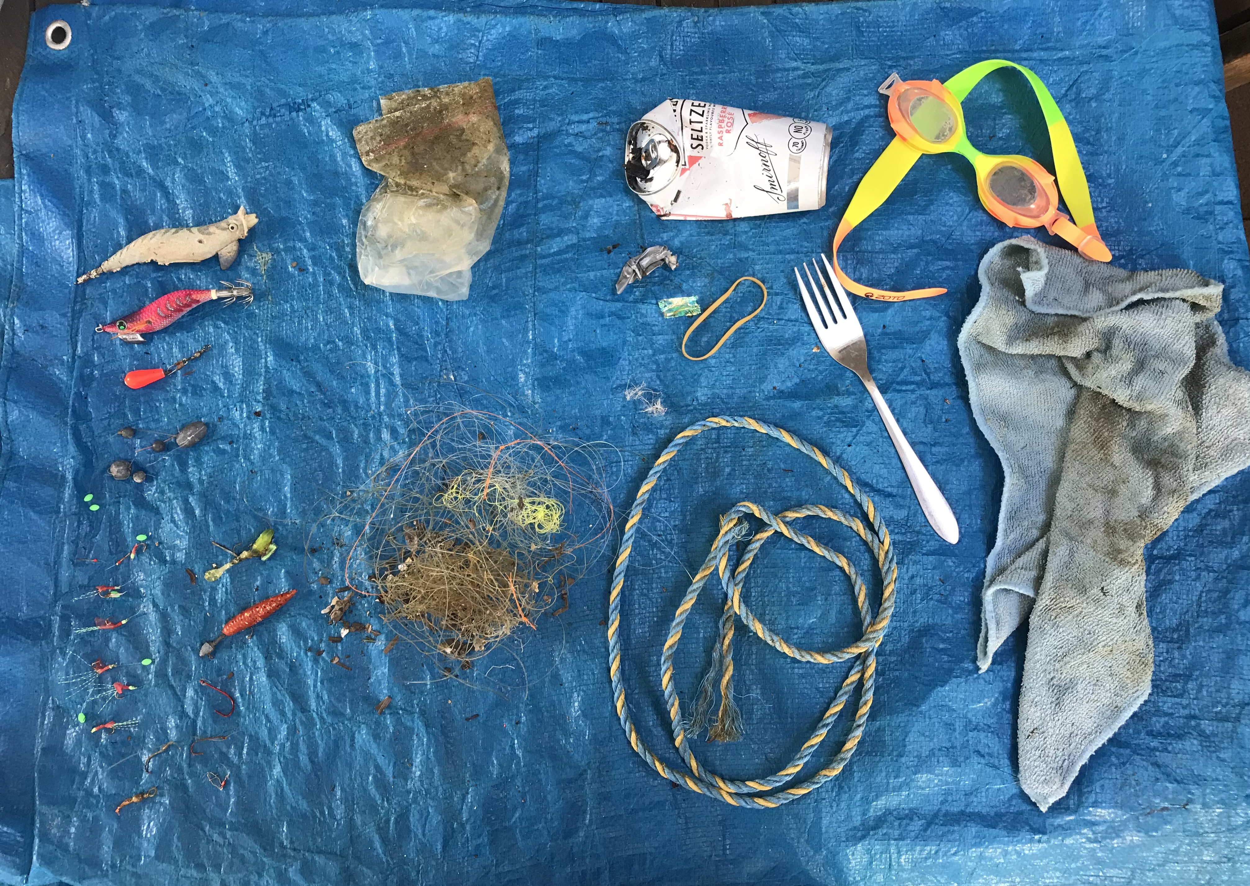
Clifton Gardens / Chowder Bay

1

-33.839584, 151.253121

seagrass
8
fishing activity from the jetty
swimming goggles
Fine, windy
1
swim goggles
private
Brigit Jager
1
1
0.50
60
9.00
3.00
1
measured
22
150.00
fishing line
fishing hooks
squid jigs
1
On
kilograms
I have debris data to report
Smooth (wavelets) for waves 0.1 - 0.5 meter high m2
1
meters
seagrass
1
1
1
Australia
State\Province
NSW
City
Sydney
Map Help


Dive Location

If you know your survey site coordinates, enter them manually in decimal degrees using WGS84 Map Datum. Use the minus sign for latitudes south of the equator and longitudes west of the Prime Meridian to 180 degrees.

If you do not know your survey site coordinates, click the “Map Location” tab to use the map to zoom into your survey site and drop the pin on the map to fall within your survey dive site in the water (not on land or the beach). Ensure you zoom in as much as possible to ensure data accuracy.

Entangled Help


Use the vertical tabs below to record any entangled animals you found of each type.

ADS370 - Blue Bay The Wall & The Garden

30

12.134409, -68.985034

coral
Felicia Dolman
10
1
2
1
3.50
40
40.00
5.00
estimated
1
100.00
On
kilograms
I have debris data to report
5
Smooth (wavelets) for waves 0.1 - 0.5 meter high
4
m2
6
meters
coral reef
1
1
3
4
3
Netherlands Antilles
Map Help


Dive Location

If you know your survey site coordinates, enter them manually in decimal degrees using WGS84 Map Datum. Use the minus sign for latitudes south of the equator and longitudes west of the Prime Meridian to 180 degrees.

If you do not know your survey site coordinates, click the “Map Location” tab to use the map to zoom into your survey site and drop the pin on the map to fall within your survey dive site in the water (not on land or the beach). Ensure you zoom in as much as possible to ensure data accuracy.

Entangled Help


Use the vertical tabs below to record any entangled animals you found of each type.

Kaja Ripnes

1

67.227279, 14.624927

rock
2
1
-11 degrees C when we started and then the sun came out!
NORD&NE
Fredric Ihrsen
1
1.30
53
21.00
3.00
measured
21
1000.00
On
kilograms
I have debris data to report
Smooth (wavelets) for waves 0.1 - 0.5 meter high m2
meters
kelp
Norway
Map Help


Dive Location

If you know your survey site coordinates, enter them manually in decimal degrees using WGS84 Map Datum. Use the minus sign for latitudes south of the equator and longitudes west of the Prime Meridian to 180 degrees.

If you do not know your survey site coordinates, click the “Map Location” tab to use the map to zoom into your survey site and drop the pin on the map to fall within your survey dive site in the water (not on land or the beach). Ensure you zoom in as much as possible to ensure data accuracy.

Entangled Help


Use the vertical tabs below to record any entangled animals you found of each type.

Lagoa Verde - Ilha Grande

sand

-23.139696955675, -44.323182032506

no
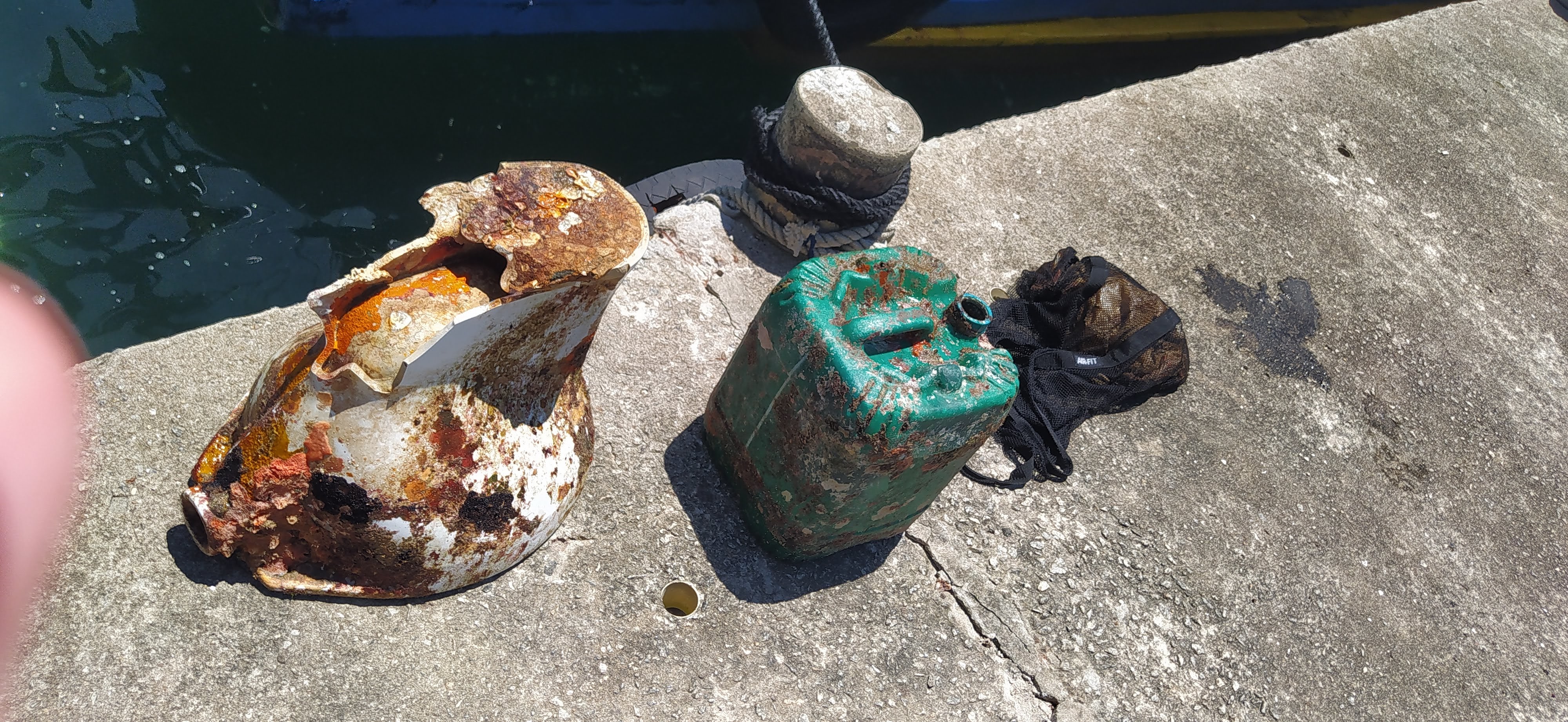
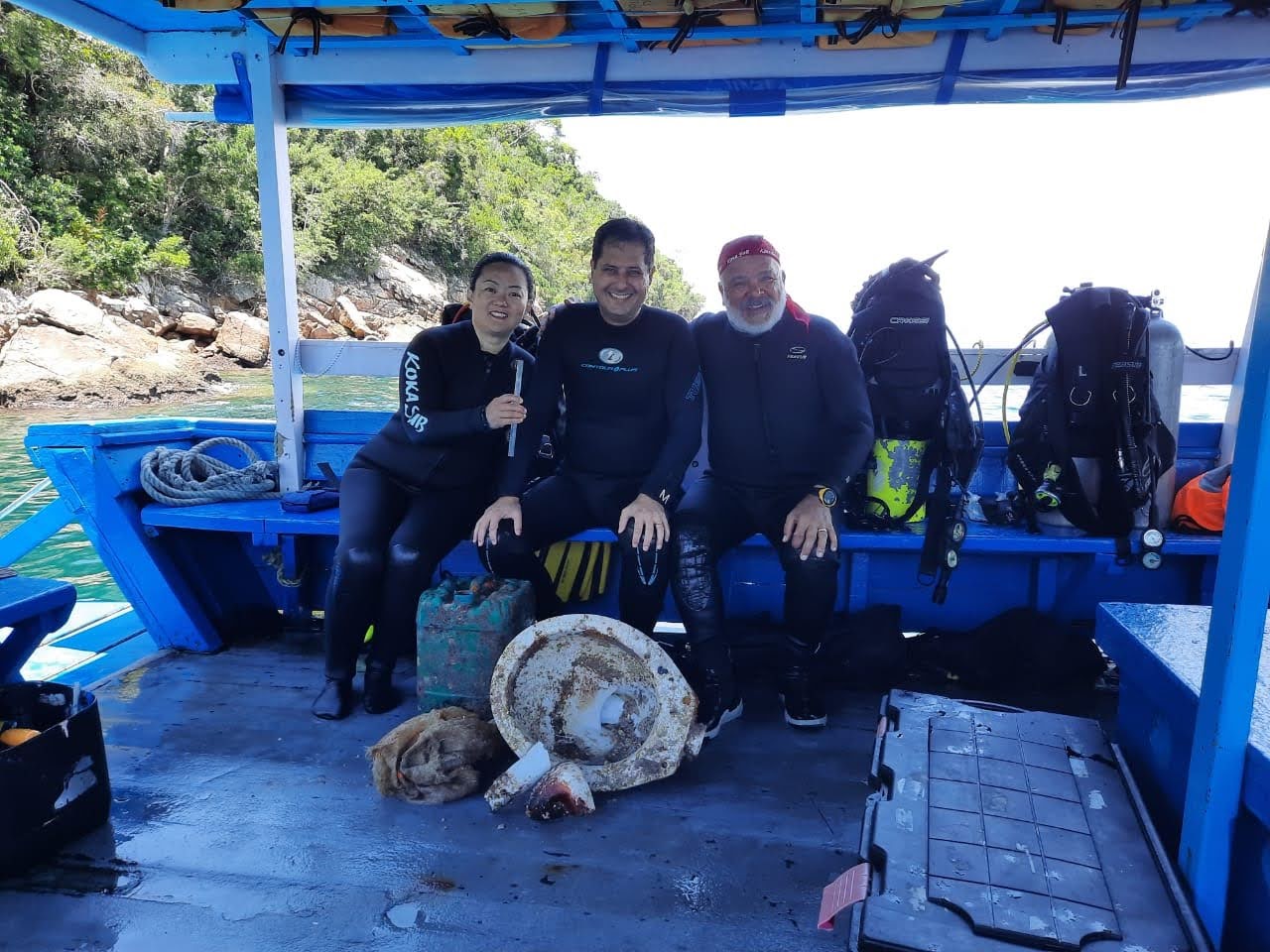
We found a toilet on the sand 11 meters deep.
cloudy
1
toilet
Kokasub
Carlos Eduardo Rodrigues Baladi Martins
1
3
19.30
55
11.00
5.00
measured
400.00
plastic jerrycan 20 liters
On
kilograms
I have debris data to report
Calm (glassy to rippled) for waves 0 – 0.1 meter high m2
meters
coral reef
Brazil
State\Province
RJ
City
Angra dos Reis
Map Help


Dive Location

If you know your survey site coordinates, enter them manually in decimal degrees using WGS84 Map Datum. Use the minus sign for latitudes south of the equator and longitudes west of the Prime Meridian to 180 degrees.

If you do not know your survey site coordinates, click the “Map Location” tab to use the map to zoom into your survey site and drop the pin on the map to fall within your survey dive site in the water (not on land or the beach). Ensure you zoom in as much as possible to ensure data accuracy.

Entangled Help


Use the vertical tabs below to record any entangled animals you found of each type.

um quien, al median site

sand

25.573346572433, 55.551016330719

majellan dive center
10
15.00
100
4.00
3.00
estimated
200.00
On
kilograms
I have debris data to report
Calm (glassy to rippled) for waves 0 – 0.1 meter high m2
meters
rocky reef
United Arab Emirates
City
um quien
Map Help


Dive Location

If you know your survey site coordinates, enter them manually in decimal degrees using WGS84 Map Datum. Use the minus sign for latitudes south of the equator and longitudes west of the Prime Meridian to 180 degrees.

If you do not know your survey site coordinates, click the “Map Location” tab to use the map to zoom into your survey site and drop the pin on the map to fall within your survey dive site in the water (not on land or the beach). Ensure you zoom in as much as possible to ensure data accuracy.

Entangled Help


Use the vertical tabs below to record any entangled animals you found of each type.

Subscribe to