Menu

ADS77 - Nionplas

2
0
0

51.683134091444, 4.8763689397413

0
0
0
sand
0
3
0
0
0
None registered
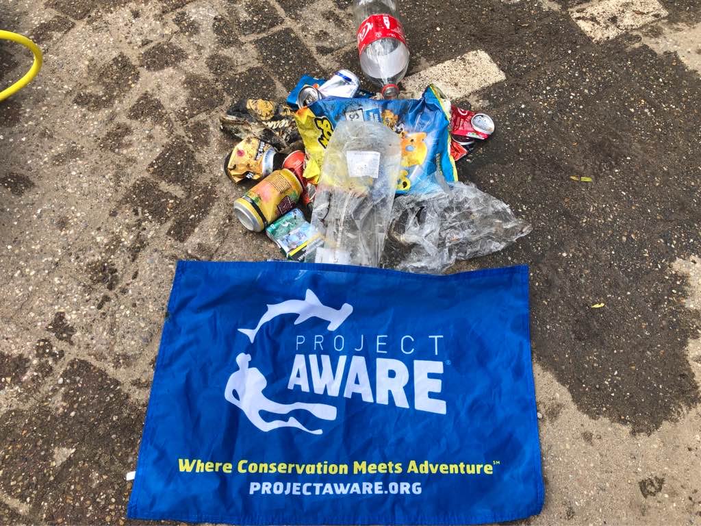
Coca cola bottle
Sunny
0
0
0
0
0
0
0
0
0
0
0
0
0
0
0
0
0
0
0
0
Mega Diving
Frank van Beeck
0
0
0
0
0
0
0
0
0
0
0
0
0
0
0
0
0
0
0
3
1
0
0
0
0
0
0
1
0
0
0
0
0
0
1.00
43
8.00
2.00
0
estimated
0
0
554.78
0
0
0
0
0
Red bull cans
Bags of chips
Chocolate wrapper
0
On
kilograms
0
I have debris data to report
0
0
0
Calm (glassy to rippled) for waves 0 – 0.1 meter high
0
0
0
0
0
0
0
m2
0
0
meters
other
0
0
0
0
0
0
0
0
0
0
0
0
0
0
0
0
5
0
0
0
0
0
0
0
0
0
0
0
Netherlands
State\Province
Noord-Brabant
City
Raamsdonksveer
Map Help


Dive Location

If you know your survey site coordinates, enter them manually in decimal degrees using WGS84 Map Datum. Use the minus sign for latitudes south of the equator and longitudes west of the Prime Meridian to 180 degrees.

If you do not know your survey site coordinates, click the “Map Location” tab to use the map to zoom into your survey site and drop the pin on the map to fall within your survey dive site in the water (not on land or the beach). Ensure you zoom in as much as possible to ensure data accuracy.

Entangled Help


Use the vertical tabs below to record any entangled animals you found of each type.

Diga27

0
0
0
2

44.702824, 12.242545

0
0
0
sand
1
0
0
0
0
GianfryDive
0
0
0
0
0
0
0
0
0
0
0
0
0
0
0
0
0
0
0
4
0
0
0
0
0
0
2
0
3
0
0
0
0
0
0
0
5.00
120
5.00
1.00
0
measured
1
0
0
0
50.00
0
0
0
0
0
0
On
kilograms
0
I have debris data to report
0
0
0
Calm (glassy to rippled) for waves 0 – 0.1 meter high
0
0
0
0
0
0
0
m2
3
0
meters
rocky reef
0
0
0
0
0
0
0
0
0
0
0
0
0
0
0
0
0
0
0
0
0
0
0
0
0
0
0
0
0
Italy
State\Province
Ferrara
City
Lido Degli Scacchi
Map Help


Dive Location

If you know your survey site coordinates, enter them manually in decimal degrees using WGS84 Map Datum. Use the minus sign for latitudes south of the equator and longitudes west of the Prime Meridian to 180 degrees.

If you do not know your survey site coordinates, click the “Map Location” tab to use the map to zoom into your survey site and drop the pin on the map to fall within your survey dive site in the water (not on land or the beach). Ensure you zoom in as much as possible to ensure data accuracy.

Entangled Help


Use the vertical tabs below to record any entangled animals you found of each type.

ADS47 - West Hawk Lake Cats Ass

4
6
3
silt
1

49.745397530919, -95.208336446994

Rainwater runoff and high winds drain directly into dive site
Severe Thundershowers
Diver City SCUBA
Jacqui Dufault
3
1
20
1
2
1
4.00
45
62.00
20.00
estimated
1000.00
Plastic strapping
Food wrappers (plastic)
fishing lures
On
pounds
I have debris data to report
Calm (glassy to rippled) for waves 0 – 0.1 meter high ft2
feet
other
2
1
2
2
2
Canada
State\Province
MB
City
Winnipeg
Map Help


Dive Location

If you know your survey site coordinates, enter them manually in decimal degrees using WGS84 Map Datum. Use the minus sign for latitudes south of the equator and longitudes west of the Prime Meridian to 180 degrees.

If you do not know your survey site coordinates, click the “Map Location” tab to use the map to zoom into your survey site and drop the pin on the map to fall within your survey dive site in the water (not on land or the beach). Ensure you zoom in as much as possible to ensure data accuracy.

Entangled Help


Use the vertical tabs below to record any entangled animals you found of each type.

Ecosystem Other
Freshwater Lake

Diga 27

0
0
0
0

44.702892, 12.242491

0
0
0
rock
0
0
0
0
0
Sereno
Gianfry
0
0
0
0
0
0
0
0
0
0
0
0
0
0
0
0
0
0
0
4
0
0
0
0
0
0
0
0
0
0
0
0
0
0
0
0
0.00
190
5.00
1.00
0
estimated
0
0
0
0
100.00
0
0
0
0
0
0
On
kilograms
0
Our Survey Site was free of debris
0
0
0
Smooth (wavelets) for waves 0.1 - 0.5 meter high
0
0
0
Liberato
Granchio Reale
Injured
1
0
0
0
0
m2
0
0
meters
other
1
0
0
0
0
0
0
0
0
0
0
0
0
0
0
0
0
0
0
0
0
0
n/a
Released Unharmed
Caretta Caretta
0
0
0
0
0
0
0
0
Italy
Map Help


Dive Location

If you know your survey site coordinates, enter them manually in decimal degrees using WGS84 Map Datum. Use the minus sign for latitudes south of the equator and longitudes west of the Prime Meridian to 180 degrees.

If you do not know your survey site coordinates, click the “Map Location” tab to use the map to zoom into your survey site and drop the pin on the map to fall within your survey dive site in the water (not on land or the beach). Ensure you zoom in as much as possible to ensure data accuracy.

Entangled Help


Use the vertical tabs below to record any entangled animals you found of each type.

Shark Island, Koh Tao

1
coral
4

10.062162563165, 99.845204744973

Partially Cloudy & rain
Eco Koh Tao
Jennifer Dowling
4
2
1.10
58
18.00
6.00
estimated
7
90.00
Fishing hooks, lures
Fishing line
On
kilograms
I have debris data to report
Smooth (wavelets) for waves 0.1 - 0.5 meter high m2
meters
coral reef
1
1
1
Thailand
State\Province
Surat Thani
City
Koh Tao
Map Help


Dive Location

If you know your survey site coordinates, enter them manually in decimal degrees using WGS84 Map Datum. Use the minus sign for latitudes south of the equator and longitudes west of the Prime Meridian to 180 degrees.

If you do not know your survey site coordinates, click the “Map Location” tab to use the map to zoom into your survey site and drop the pin on the map to fall within your survey dive site in the water (not on land or the beach). Ensure you zoom in as much as possible to ensure data accuracy.

Entangled Help


Use the vertical tabs below to record any entangled animals you found of each type.

ADS485 - May Day

0
10
0
0

9.334739, -82.241523

0
0
0
sand
0
0
0
0
0
Suny
Bocas Dive Center
Guillermo Veghazi
0
0
0
7
0
0
0
0
0
0
0
0
0
0
0
0
0
0
0
10
0
0
0
0
4
36
26
0
0
0
0
0
0
1
0
0
10.00
50
11.00
2.00
0
estimated
0
0
0
0
120.00
0
0
0
0
0
0
On
kilograms
0
I have debris data to report
6
0
0
Calm (glassy to rippled) for waves 0 – 0.1 meter high
0
0
0
0
3
0
0
m2
0
0
meters
other
0
0
0
0
0
0
0
0
0
0
0
0
0
0
0
0
0
51
0
0
0
0
0
0
0
0
0
0
0
Panama
State\Province
Bocas del Toro
City
Bocas Town
Map Help


Dive Location

If you know your survey site coordinates, enter them manually in decimal degrees using WGS84 Map Datum. Use the minus sign for latitudes south of the equator and longitudes west of the Prime Meridian to 180 degrees.

If you do not know your survey site coordinates, click the “Map Location” tab to use the map to zoom into your survey site and drop the pin on the map to fall within your survey dive site in the water (not on land or the beach). Ensure you zoom in as much as possible to ensure data accuracy.

Entangled Help


Use the vertical tabs below to record any entangled animals you found of each type.

ADS485 - May Day

0
3
0
0

9.334739, -82.241523

0
0
0
sand
0
0
0
0
0
Rainy
Bocas Dive Center
Guillermo Veghazi
0
0
0
1
0
0
0
0
0
0
0
0
1
0
0
0
0
0
0
2
0
0
0
0
0
0
17
0
0
0
0
0
0
0
0
0
2.00
63
12.00
2.00
0
estimated
0
0
0
0
120.00
0
0
0
0
0
0
On
kilograms
0
I have debris data to report
0
0
0
Calm (glassy to rippled) for waves 0 – 0.1 meter high
0
0
0
0
0
0
0
m2
0
0
meters
other
0
0
0
0
0
0
0
0
0
0
0
0
0
0
0
0
0
16
0
0
0
0
0
0
0
0
0
0
0
Panama
State\Province
Bocas del Toro
City
Bocas Town
Map Help


Dive Location

If you know your survey site coordinates, enter them manually in decimal degrees using WGS84 Map Datum. Use the minus sign for latitudes south of the equator and longitudes west of the Prime Meridian to 180 degrees.

If you do not know your survey site coordinates, click the “Map Location” tab to use the map to zoom into your survey site and drop the pin on the map to fall within your survey dive site in the water (not on land or the beach). Ensure you zoom in as much as possible to ensure data accuracy.

Entangled Help


Use the vertical tabs below to record any entangled animals you found of each type.

ADS485 - May Day

0
2
0
0

9.331261, -82.246369

0
0
0
coral
0
0
0
0
0
Rainy
Bocas Dive Center
Guillermo Veghazi
0
0
0
2
0
0
0
0
0
0
0
0
0
0
0
0
0
0
0
2
0
0
0
0
0
0
27
0
0
0
1
0
0
0
0
0
3.00
45
12.00
5.00
0
estimated
0
0
0
0
3284.24
0
0
0
0
0
0
On
kilograms
0
I have debris data to report
0
0
0
Calm (glassy to rippled) for waves 0 – 0.1 meter high
0
0
0
0
0
0
0
m2
0
0
meters
coral reef
0
0
0
0
0
0
0
0
0
0
0
0
0
0
0
0
0
3
0
0
0
0
0
0
0
0
0
0
0
Panama
State\Province
Bocas del Toro
City
Bocas Town
Map Help


Dive Location

If you know your survey site coordinates, enter them manually in decimal degrees using WGS84 Map Datum. Use the minus sign for latitudes south of the equator and longitudes west of the Prime Meridian to 180 degrees.

If you do not know your survey site coordinates, click the “Map Location” tab to use the map to zoom into your survey site and drop the pin on the map to fall within your survey dive site in the water (not on land or the beach). Ensure you zoom in as much as possible to ensure data accuracy.

Entangled Help


Use the vertical tabs below to record any entangled animals you found of each type.

Naufrágios Guarapari

-20.6994673605, -40.4081108406

sand
Private Diver
Vinícius Santos
4
0.00
42
16.00
6.00
measured
50.00
On
kilograms
Our Survey Site was free of debris
Moderate to rough for waves greater than 1.25 meters m2
meters
coral reef
Brazil
State\Province
ES
City
Guarapari
Map Help


Dive Location

If you know your survey site coordinates, enter them manually in decimal degrees using WGS84 Map Datum. Use the minus sign for latitudes south of the equator and longitudes west of the Prime Meridian to 180 degrees.

If you do not know your survey site coordinates, click the “Map Location” tab to use the map to zoom into your survey site and drop the pin on the map to fall within your survey dive site in the water (not on land or the beach). Ensure you zoom in as much as possible to ensure data accuracy.

Entangled Help


Use the vertical tabs below to record any entangled animals you found of each type.

Naufrágios Guarapari

-20.6687319, -40.3590806

sand
Private Diver
Vinícius Santos
4
0.00
29
25.00
18.00
measured
50.00
On
kilograms
Our Survey Site was free of debris
Moderate to rough for waves greater than 1.25 meters m2
meters
coral reef
Brazil
State\Province
ES
City
Guarapari
Map Help


Dive Location

If you know your survey site coordinates, enter them manually in decimal degrees using WGS84 Map Datum. Use the minus sign for latitudes south of the equator and longitudes west of the Prime Meridian to 180 degrees.

If you do not know your survey site coordinates, click the “Map Location” tab to use the map to zoom into your survey site and drop the pin on the map to fall within your survey dive site in the water (not on land or the beach). Ensure you zoom in as much as possible to ensure data accuracy.

Entangled Help


Use the vertical tabs below to record any entangled animals you found of each type.

Subscribe to