Menu

Lighthouse Reef, Lanai, Hawaii

rock
5

20.73381184922, -156.96673583354

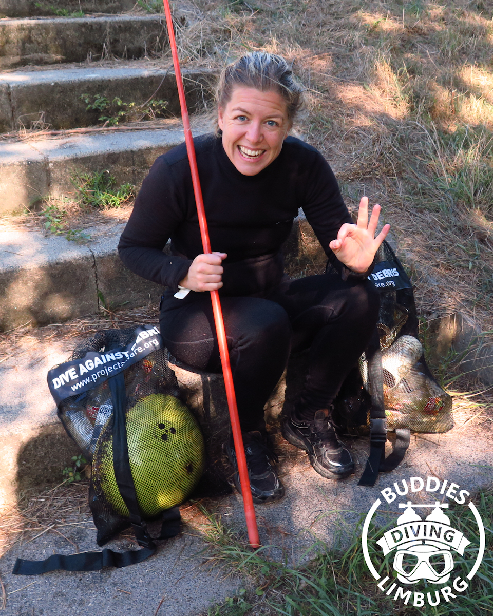
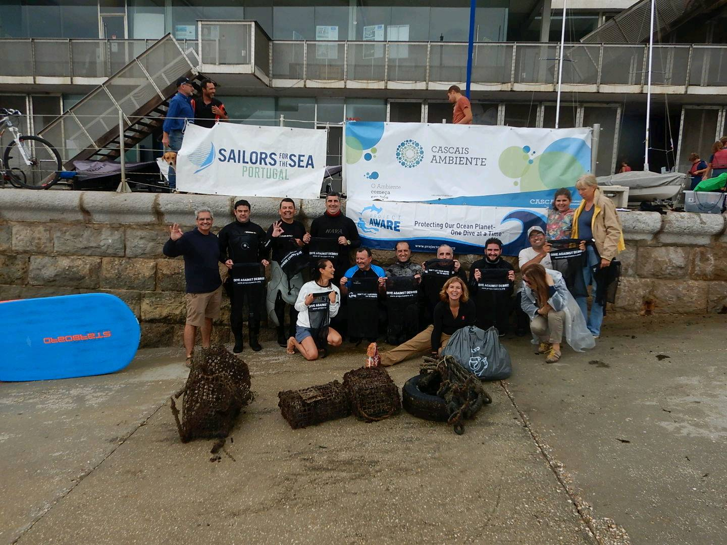
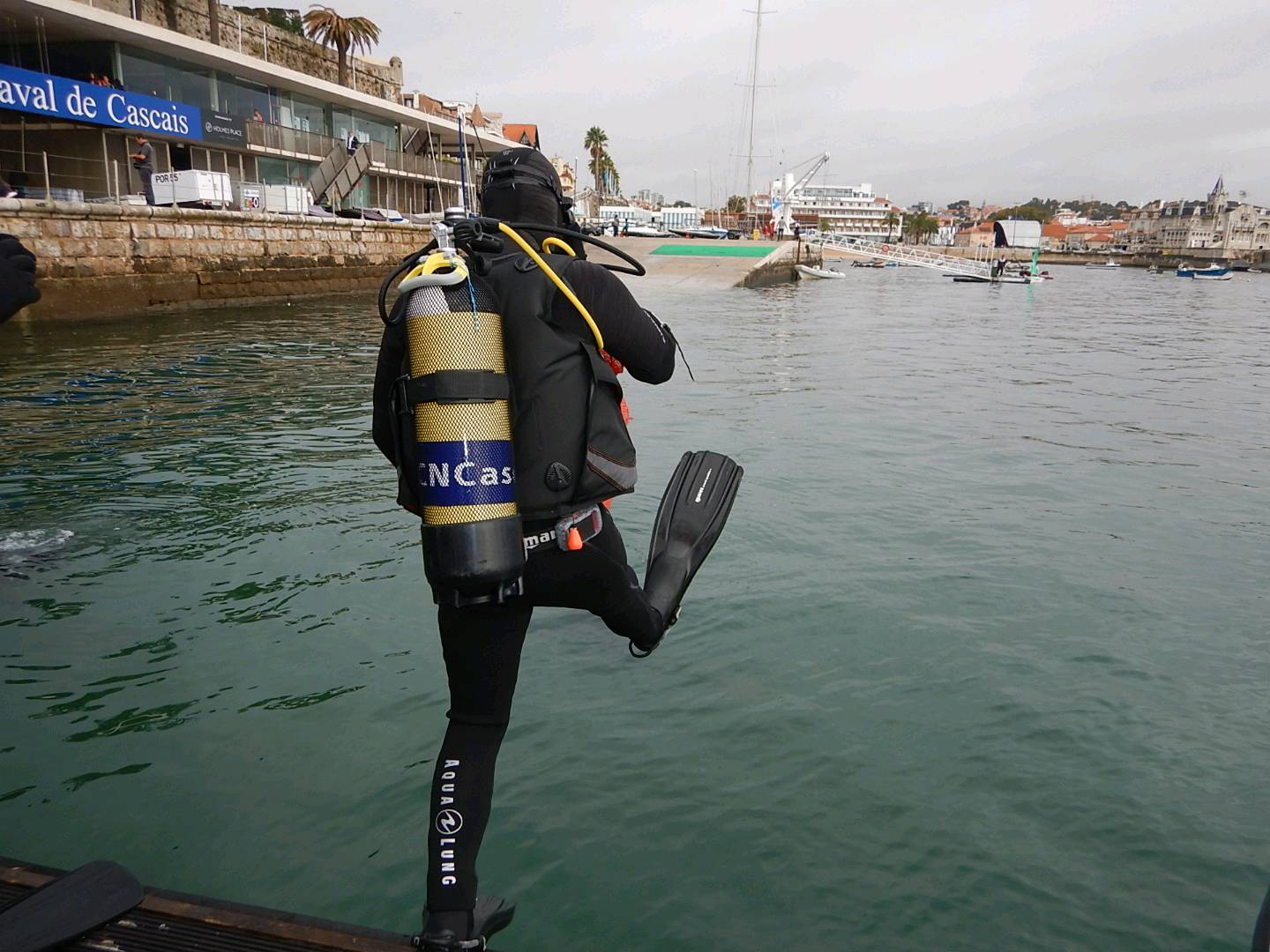
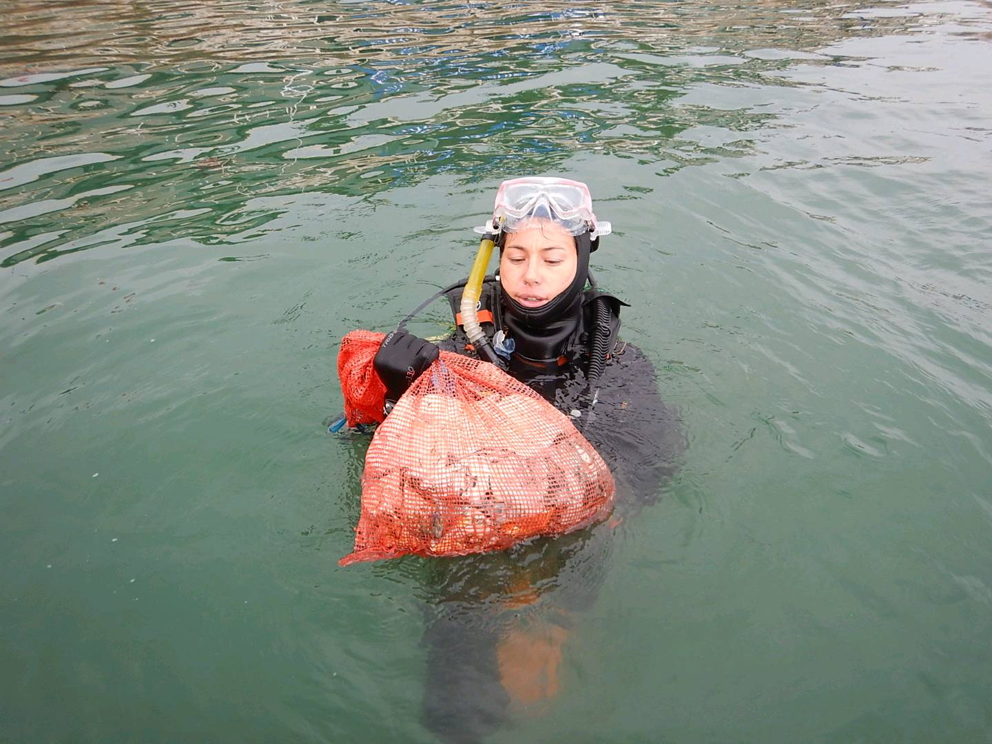
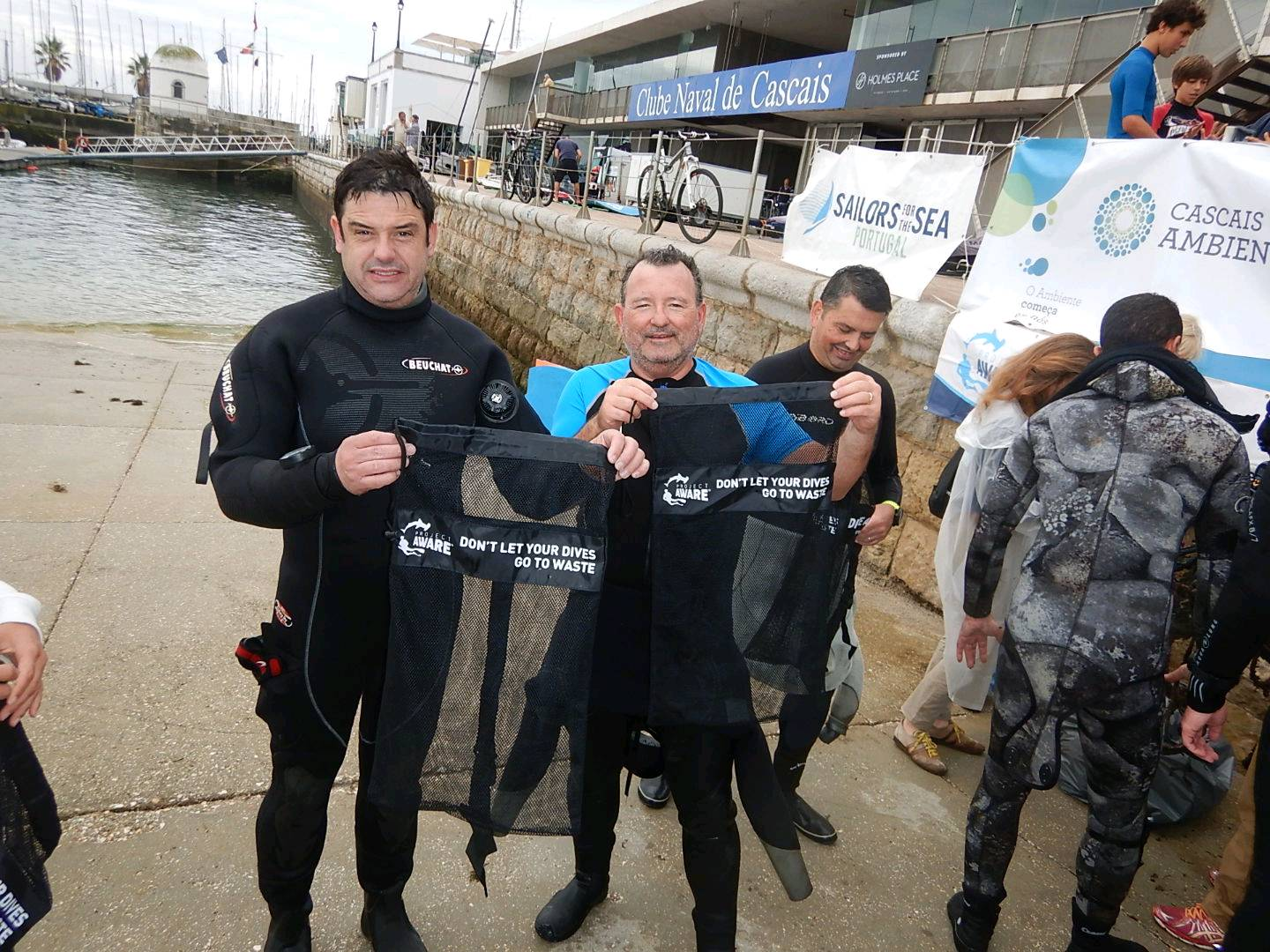
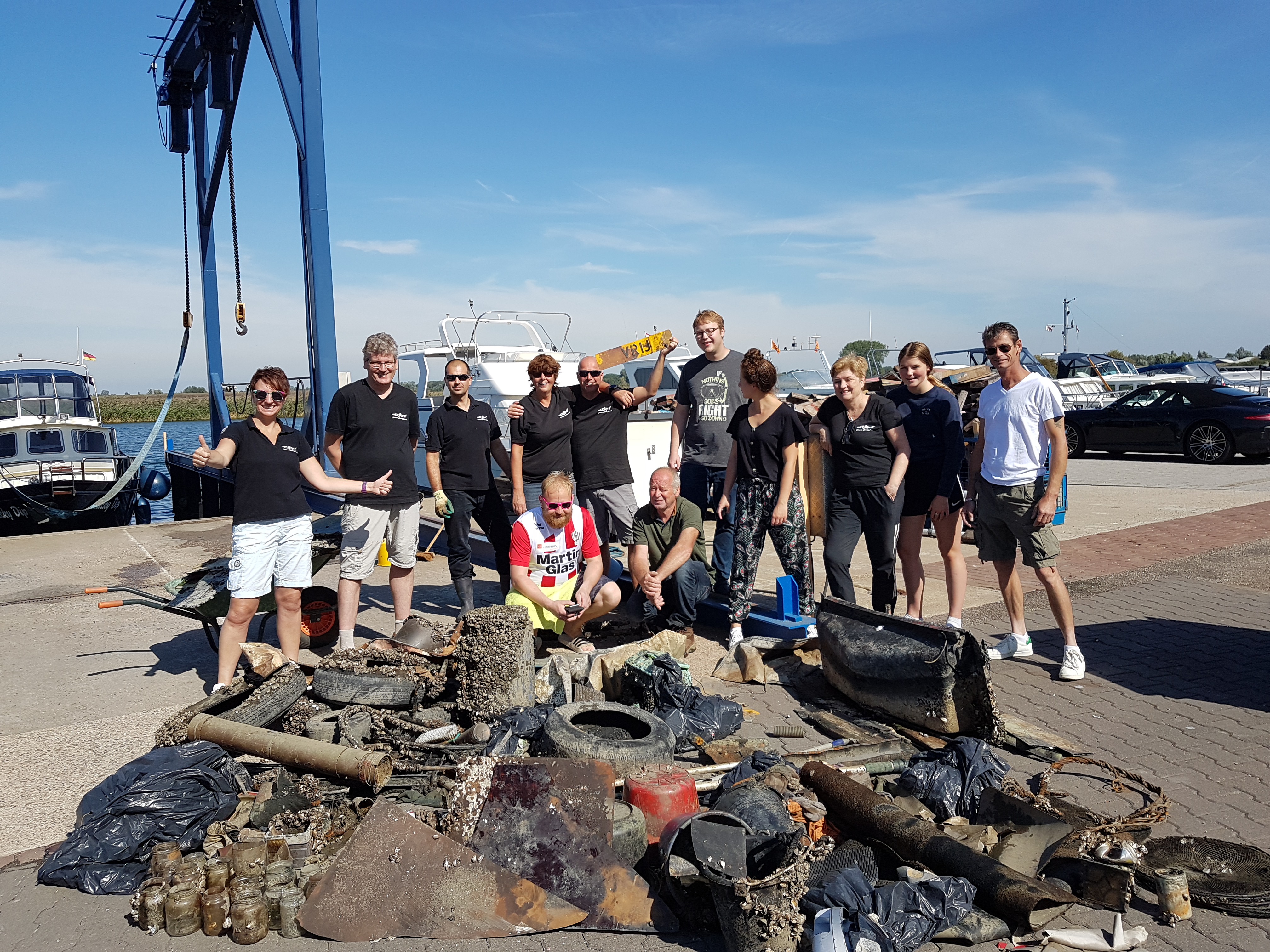
This information is for Dive 1 of 2 for International Coastal Cleanup Day. Thank you to our participants, not just our divers, but our snorkelers who provided surface support, shuttling debris back to the hard-working captain who did almost all of the sorting while the divers where down below! Huge Mahalo to everyone involved and to the owner of Extended Horizons for pulling the boat out of service for the day to enable this great event!
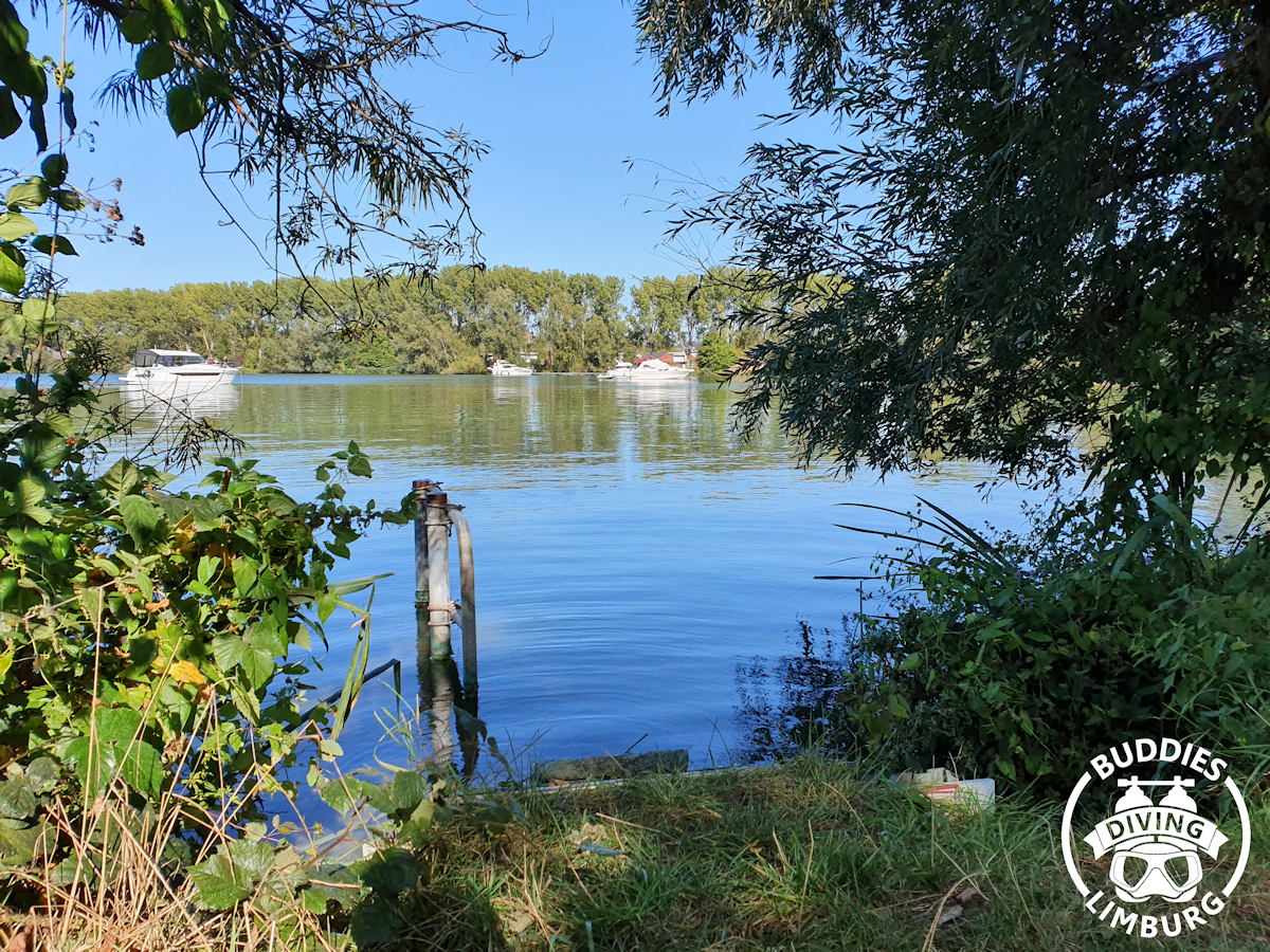
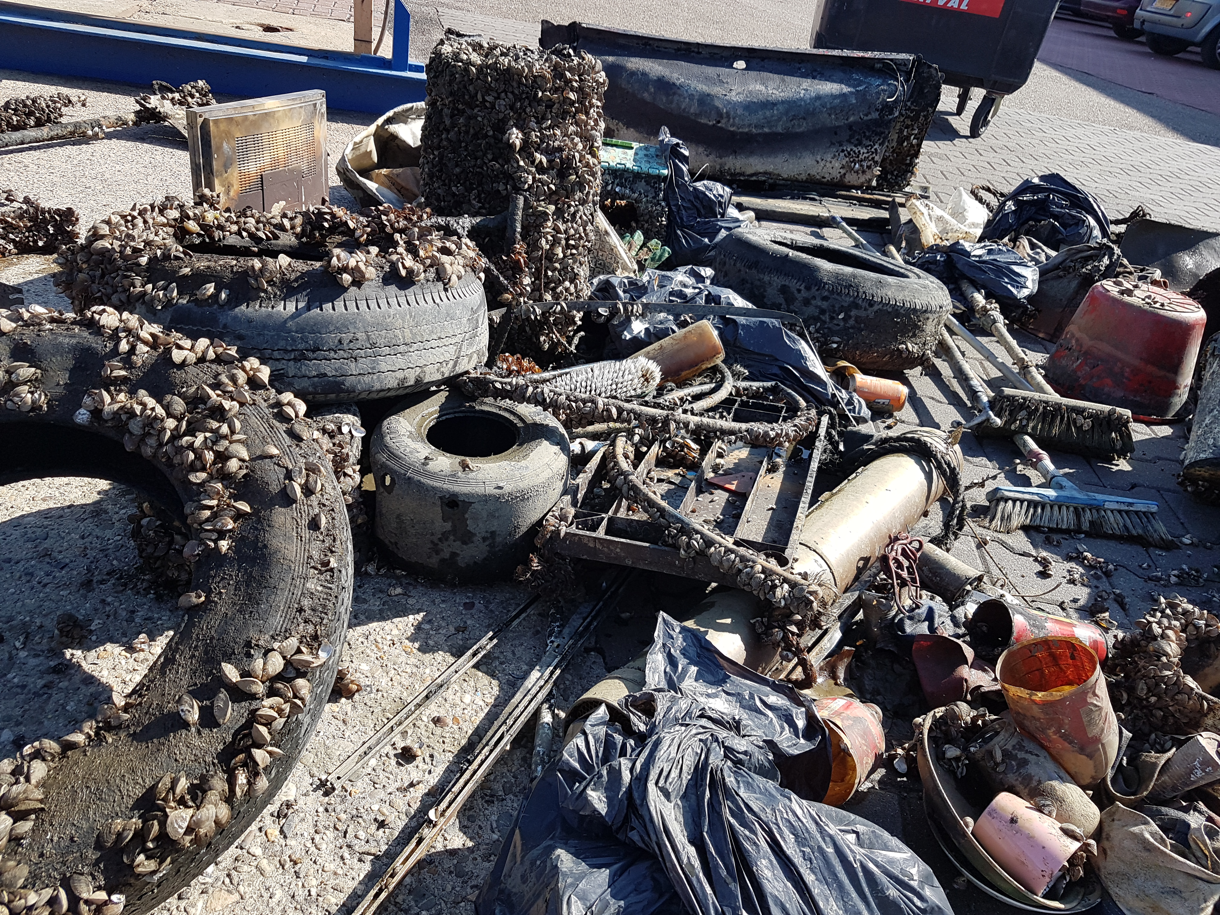
This area of the island is a regular fishing spot for residents, as well as a popular dive and snorkel site. While we were conducting our cleanup dives, land-based fishermen arrived and started casting. Regular use seems to be the contributing factor.
Calm wind. South swell.
Extended Horizons Scuba
Victoria Martocci
12
21.00
50
88.00
32.00
measured
16
145938.00
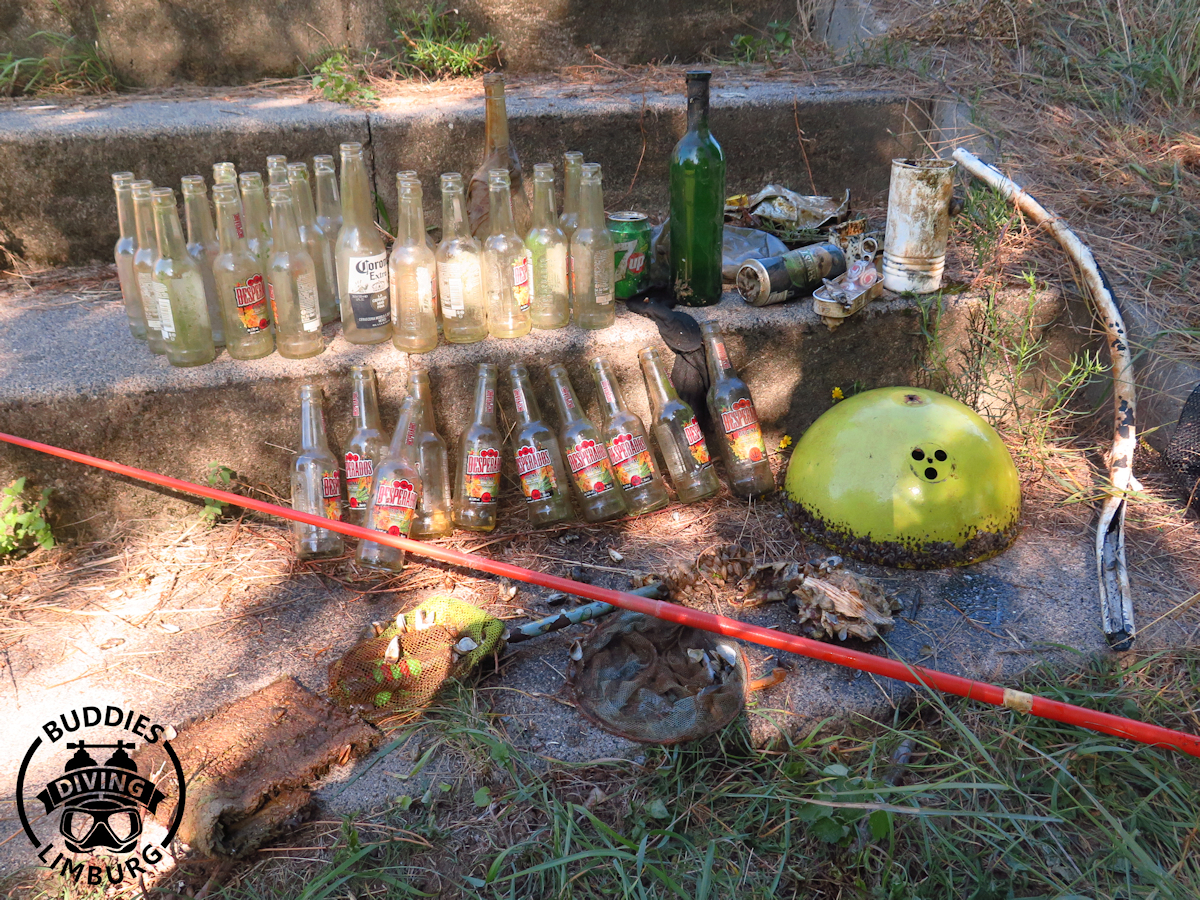
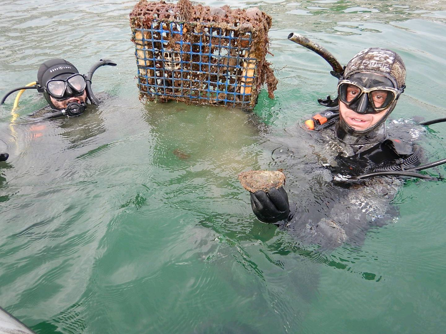
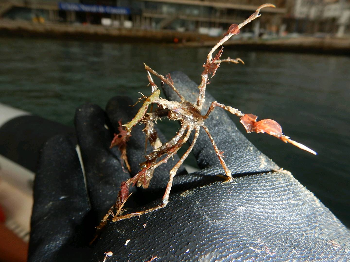
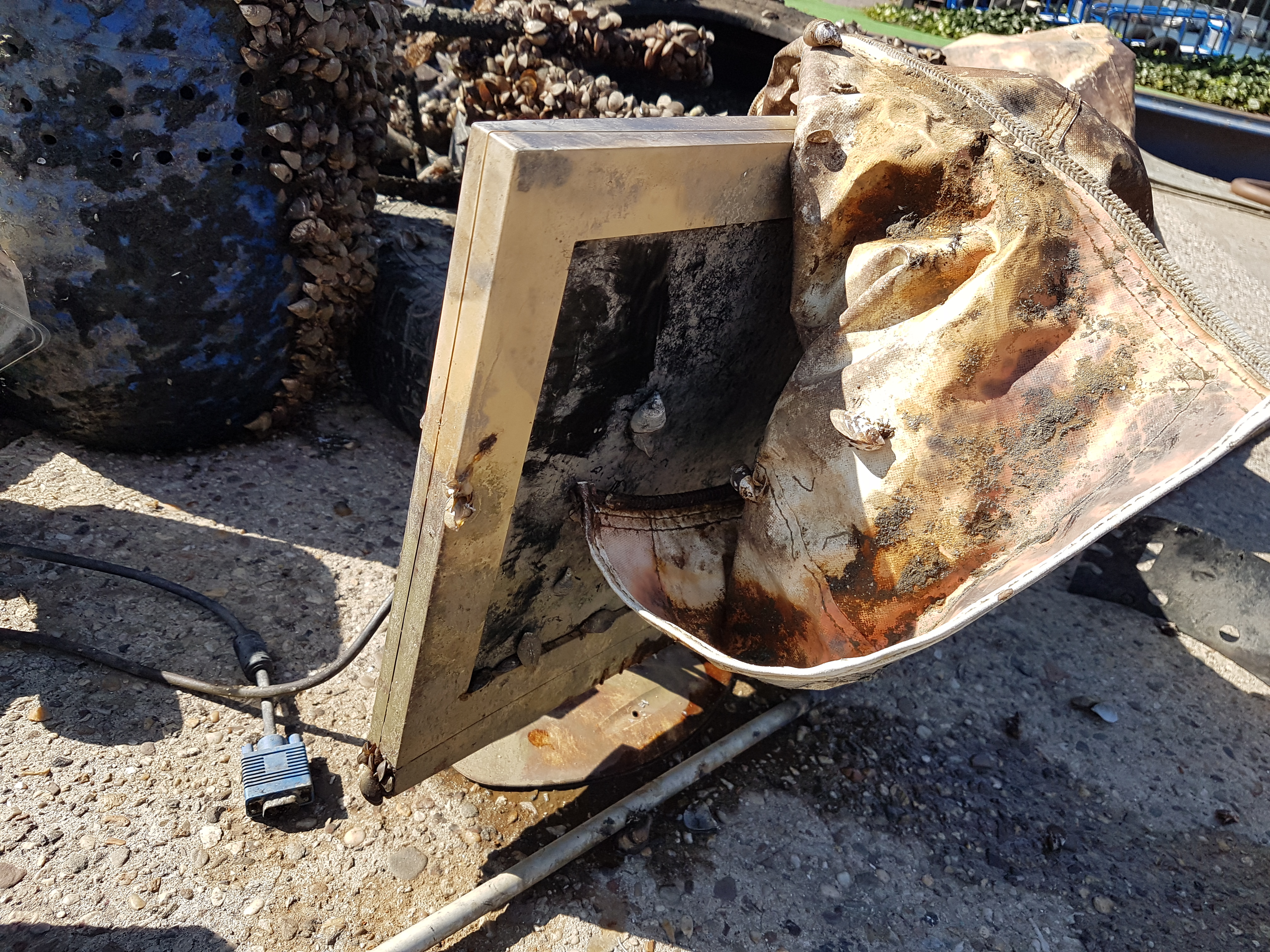
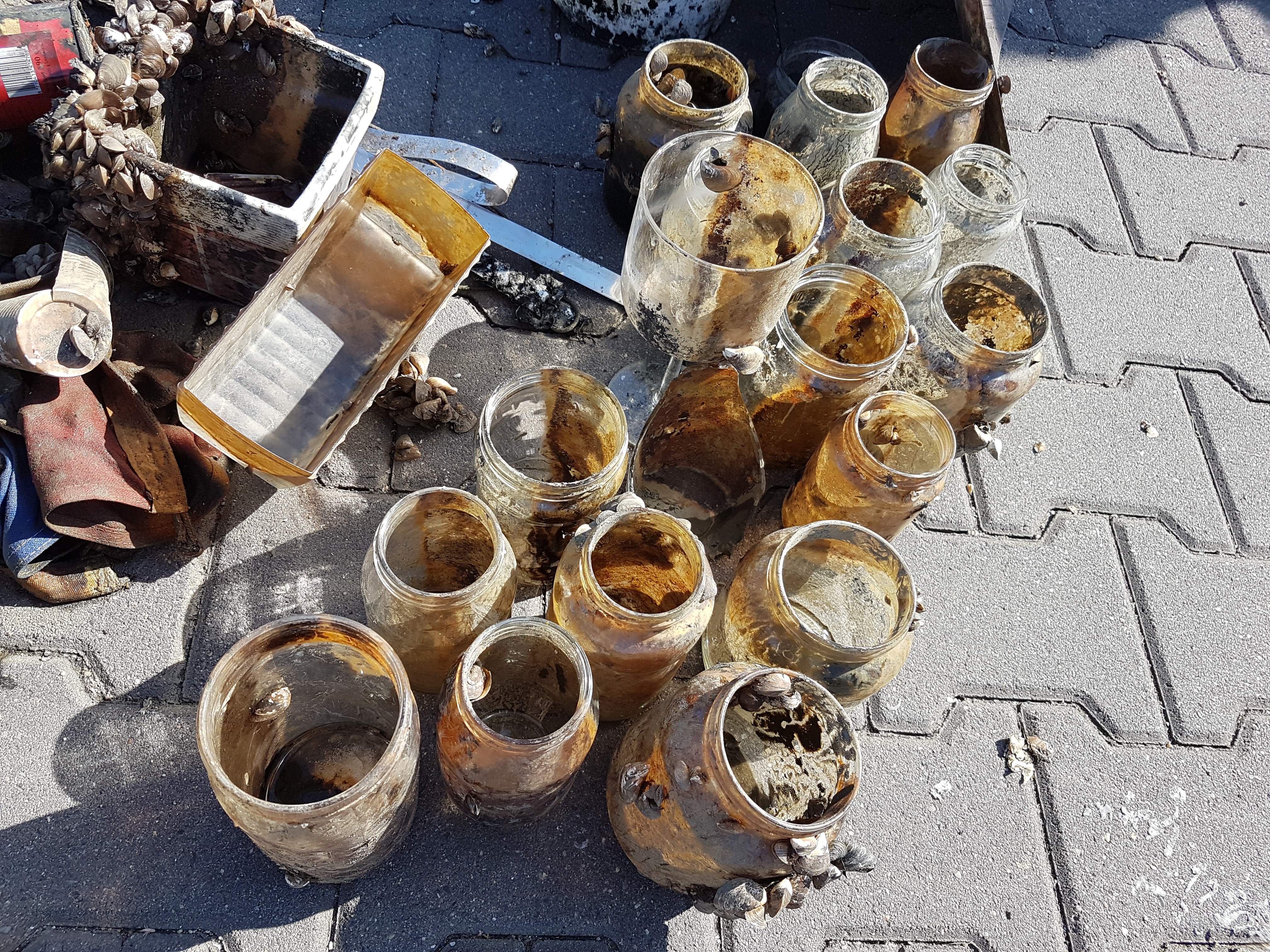
discarded/sacrificial monofiliment fishing line tangles around the live coral heads, allowing algae growth on the filament itself, which then shadows/smothers the coral beneath it
On
pounds
I have debris data to report
Slight for waves 0.5 -1.25 meter high ft2
feet
rocky reef
United States
State\Province
HI
City
Lahaina
Map Help


Dive Location

If you know your survey site coordinates, enter them manually in decimal degrees using WGS84 Map Datum. Use the minus sign for latitudes south of the equator and longitudes west of the Prime Meridian to 180 degrees.

If you do not know your survey site coordinates, click the “Map Location” tab to use the map to zoom into your survey site and drop the pin on the map to fall within your survey dive site in the water (not on land or the beach). Ensure you zoom in as much as possible to ensure data accuracy.

Entangled Help


Use the vertical tabs below to record any entangled animals you found of each type.

Polderveld

7
2
1
other

51.170199690965, 5.8952996034943

n/a
Always a lot of boats in these areas.. and somehow stuff always seems to find its way into the water..
Keep up the good work!
Complete fishing rod with wire, hook and float.
Top lid of bbq.
Good
Buddies Diving Limburg
Vincent Rijnbende
1
2
1
2
1
12.00
60
7.00
3.00
measured
4172.00
1
Glass bottles
On
kilograms
I have debris data to report
31
Calm (glassy to rippled) for waves 0 – 0.1 meter high
2
m2
2
meters
other
1
1
2
Netherlands
State\Province
Limburg
City
Pol
Map Help


Dive Location

If you know your survey site coordinates, enter them manually in decimal degrees using WGS84 Map Datum. Use the minus sign for latitudes south of the equator and longitudes west of the Prime Meridian to 180 degrees.

If you do not know your survey site coordinates, click the “Map Location” tab to use the map to zoom into your survey site and drop the pin on the map to fall within your survey dive site in the water (not on land or the beach). Ensure you zoom in as much as possible to ensure data accuracy.

Entangled Help


Use the vertical tabs below to record any entangled animals you found of each type.

Ecosystem Other
Freshwater, lake with open connection to river
Dominant Substrate Other
Mud / freshwater mussels

ADS546 - Big Rock

19

16.075592930785, -86.942191765513

sand
1
1

16.072828895713, -86.935495508366

diaper
windy for the past 3 months
Ecomarine
Christopher Howell
1
1
2
0.70
50
25.00
4.00
estimated
100.00
On
kilograms
I have debris data to report
Calm (glassy to rippled) for waves 0 – 0.1 meter high m2
meters
coral reef
2
Honduras
Map Help


Dive Location

If you know your survey site coordinates, enter them manually in decimal degrees using WGS84 Map Datum. Use the minus sign for latitudes south of the equator and longitudes west of the Prime Meridian to 180 degrees.

If you do not know your survey site coordinates, click the “Map Location” tab to use the map to zoom into your survey site and drop the pin on the map to fall within your survey dive site in the water (not on land or the beach). Ensure you zoom in as much as possible to ensure data accuracy.

Entangled Help


Use the vertical tabs below to record any entangled animals you found of each type.

Beau Vallon Bay

2
3
sand
1
16

-4.6130973622101, 55.411400470961

Found in seaweed growth on rope
Life raft converted into a Fish Aggregation Device (FAD)
Fair, with intermittent rainfall
1
1
3
Life Raft
Metal fish trap
Rope (cotton and synthetic)
The Ocean Project Seychelles / Underwater Centre
Archil Mondon
1
2
2
1
32
2
5
3
84.00
50
10.00
5.00
estimated
1000.00
3
On
kilograms
I have debris data to report
38
Smooth (wavelets) for waves 0.1 - 0.5 meter high
1
Rope,
Crab
Released Unharmed
5
m2
6
meters
coral reef
10
1
1
5
Seychelles
State\Province
N/A
City
Mahe
Map Help


Dive Location

If you know your survey site coordinates, enter them manually in decimal degrees using WGS84 Map Datum. Use the minus sign for latitudes south of the equator and longitudes west of the Prime Meridian to 180 degrees.

If you do not know your survey site coordinates, click the “Map Location” tab to use the map to zoom into your survey site and drop the pin on the map to fall within your survey dive site in the water (not on land or the beach). Ensure you zoom in as much as possible to ensure data accuracy.

Entangled Help


Use the vertical tabs below to record any entangled animals you found of each type.

Baía de Cascais Portugal

0
14
4
1

38.694833, -9.41775

0
0
2
sand
3
4
0
0
0
Local de amarração de barcos de pesca (fishing boat mooring)
Vela de barco (sailing boat)
Chuva sem vento
Clube Naval de Cascais
Jose Eduardo Santos
0
1
0
2
2
0
0
0
0
0
0
0
0
1
0
0
0
1
4
14
3
0
0
0
0
0
0
0
0
0
2
0
0
0
0
43.30
75
8.00
3.00
3
measured
4
0
0
0
5000.00
0
0
0
0
0
Armadilhas de pesca (fishing traps)
Esferovite usda na pesca (Styrofoam used on fishing floats)
Garrafas de plástico e beatas (plastic bottles and cigarette butts)
0
On
kilograms
0
I have debris data to report
4
0
0
Slight for waves 0.5 -1.25 meter high
3
0
1
pneus, armadilhas de pesca (tyres, fishing traps)
Caranguejo
Released Unharmed
23
0
1
2
0
m2
1
0
16
pneus, armadilhas de pesca (tyres, fishing traps)
Búzios
meters
rocky reef
2
0
0
0
0
0
0
0
0
0
0
0
0
0
0
0
3
7
0
0
1
0
0
1
0
0
0
1
0
Portugal
State\Province
Lisboa
City
Cascais
Map Help


Dive Location

If you know your survey site coordinates, enter them manually in decimal degrees using WGS84 Map Datum. Use the minus sign for latitudes south of the equator and longitudes west of the Prime Meridian to 180 degrees.

If you do not know your survey site coordinates, click the “Map Location” tab to use the map to zoom into your survey site and drop the pin on the map to fall within your survey dive site in the water (not on land or the beach). Ensure you zoom in as much as possible to ensure data accuracy.

Entangled Help


Use the vertical tabs below to record any entangled animals you found of each type.

Lido Jetty

0
1
0

27.309515699873, -82.576475

1
0
0
rock
0
0
0
15
0
Line with 5 hooks
Tangled under rock. Was released.
0
0
0
0
0
0
0
0
0
0
0
0
0
0
0
0
0
0
0
0
Brooke Welch
0
0
0
0
0
0
0
0
0
0
0
0
0
0
0
0
0
0
0
1
0
0
0
0
0
0
0
0
0
0
0
0
0
0
1.00
60
6.50
2.00
1
estimated
0
10
3136.69
0
0
0
0
0
Fishing line
Fishing hooks
0
On
kilograms
0
I have debris data to report
0
0
0
Calm (glassy to rippled) for waves 0 – 0.1 meter high
1
0
0
Injured
Grey Snapper
1
Fishing line/hook
0
0
0
0
ft2
0
0
feet
rocky reef
0
0
0
0
0
0
0
0
0
0
0
0
0
0
1
0
0
0
0
0
0
0
0
0
0
0
0
0
United States
State\Province
Florida
City
Sarasota
Map Help


Dive Location

If you know your survey site coordinates, enter them manually in decimal degrees using WGS84 Map Datum. Use the minus sign for latitudes south of the equator and longitudes west of the Prime Meridian to 180 degrees.

If you do not know your survey site coordinates, click the “Map Location” tab to use the map to zoom into your survey site and drop the pin on the map to fall within your survey dive site in the water (not on land or the beach). Ensure you zoom in as much as possible to ensure data accuracy.

Entangled Help


Use the vertical tabs below to record any entangled animals you found of each type.

ADS63 - Molasses Deep

0
0
0
0

25.010285, -80.373301

0
0
0
sand
0
0
0
0
0
Diving
Rainbow Reef Dive Center/FKNMS
John
0
0
0
0
0
0
0
0
1
0
0
0
0
0
0
0
0
0
0
1
0
0
0
0
0
0
0
0
0
0
0
0
0
0
0
0
9.00
45
60.00
20.00
0
measured
0
0
0
0
21161.50
0
0
0
0
0
0
On
pounds
0
I have debris data to report
0
0
0
Calm (glassy to rippled) for waves 0 – 0.1 meter high
0
0
0
0
0
0
0
m2
0
0
feet
coral reef
0
0
0
0
0
0
0
0
2
0
0
0
0
0
0
0
0
0
0
0
0
0
0
0
0
0
0
0
0
United States
State\Province
Florida
City
Key Largo
Map Help


Dive Location

If you know your survey site coordinates, enter them manually in decimal degrees using WGS84 Map Datum. Use the minus sign for latitudes south of the equator and longitudes west of the Prime Meridian to 180 degrees.

If you do not know your survey site coordinates, click the “Map Location” tab to use the map to zoom into your survey site and drop the pin on the map to fall within your survey dive site in the water (not on land or the beach). Ensure you zoom in as much as possible to ensure data accuracy.

Entangled Help


Use the vertical tabs below to record any entangled animals you found of each type.

ADS605 - Second Gulf of Vouliagmeni

4
6
12
0

37.799781467495, 23.789192781691

7
0
0
sand
0
0
0
4
0
Calm
Seals Diving center
Ioannis Zagorakis
0
0
0
4
14
0
0
0
0
4
4
0
0
0
0
0
0
13
0
8
0
0
0
0
7
0
6
0
0
0
0
0
0
0
0
0
15.00
45
16.00
3.00
4
measured
0
0
0
0
6253.53
0
2
0
0
0
Plastic cups
Beer bottles
0
On
kilograms
0
I have debris data to report
10
0
0
Calm (glassy to rippled) for waves 0 – 0.1 meter high
0
0
0
0
4
0
0
m2
1
2
meters
other
0
0
0
0
0
7
1
0
0
4
0
0
0
0
0
2
0
8
0
0
0
0
0
0
0
0
2
0
0
Greece
City
Vouliagmeni
Map Help


Dive Location

If you know your survey site coordinates, enter them manually in decimal degrees using WGS84 Map Datum. Use the minus sign for latitudes south of the equator and longitudes west of the Prime Meridian to 180 degrees.

If you do not know your survey site coordinates, click the “Map Location” tab to use the map to zoom into your survey site and drop the pin on the map to fall within your survey dive site in the water (not on land or the beach). Ensure you zoom in as much as possible to ensure data accuracy.

Entangled Help


Use the vertical tabs below to record any entangled animals you found of each type.

Bunaken Jetty

39
80
2
coral
45

1.5960518345317, 124.78344077686

The dive site is a wall which is at the end of Bunaken Jetty where a lot of boats come in and out of every day, so any of the rubbish that goes into the water falls off the edge of the wall if it doesn't get stuck in the coral. There is a lot of fishing line and rope that has been there for a long time and has encrusting coral all over it.
No
3 very small crabs <1cm in diameter
Indonesian CD at 6m - that still worked (and sounded pretty cool!)
Sunny, clear skies, low wind, no rain. Flat swell.
3
1
1
1
Cassette
CD
Electrical plug socket
Sunglasses
Two Fish Divers Bunaken
Alexander Sharp
1
1
2
2
4
1
30
2
14.00
60
12.00
4.00
4
measured
8
1104.00
Fishing Line
Clothing / Material
Plastic bags/ Food wrappers
On
kilograms
I have debris data to report
5
Smooth (wavelets) for waves 0.1 - 0.5 meter high
2
Material
Crab
Released Unharmed
3
35
m2
1
meters
coral reef
1
1
10
7
2
Indonesia
State\Province
North Sulawesi
City
Manado
Map Help


Dive Location

If you know your survey site coordinates, enter them manually in decimal degrees using WGS84 Map Datum. Use the minus sign for latitudes south of the equator and longitudes west of the Prime Meridian to 180 degrees.

If you do not know your survey site coordinates, click the “Map Location” tab to use the map to zoom into your survey site and drop the pin on the map to fall within your survey dive site in the water (not on land or the beach). Ensure you zoom in as much as possible to ensure data accuracy.

Entangled Help


Use the vertical tabs below to record any entangled animals you found of each type.

WSV Jachthaven Jan de Groot

6
1
1
sand

51.8009283, 5.4591852999999

Items go over board due to the wind, but also people toss stuff over board on purpose.
vacuumcleaner and computermonitor
bits of rain, but good weather
Oceans Diving Center
Tamara Nogarede
1
2
9
3
3
12
1
2
1
2
2
400.00
120
6.00
1.00
2
estimated
2
5000.00
6
3
tyres
buckets
mats and cloths
On
kilograms
I have debris data to report
3
1
Calm (glassy to rippled) for waves 0 – 0.1 meter high
3
4
1
m2
10
8
tyres, trap for fish (illegal)
crayfish
Released Unharmed
meters
other
7
11
1
1
2
1
2
10
1
4
2
18
Netherlands
State\Province
NBr
City
Rosmalen
Map Help


Dive Location

If you know your survey site coordinates, enter them manually in decimal degrees using WGS84 Map Datum. Use the minus sign for latitudes south of the equator and longitudes west of the Prime Meridian to 180 degrees.

If you do not know your survey site coordinates, click the “Map Location” tab to use the map to zoom into your survey site and drop the pin on the map to fall within your survey dive site in the water (not on land or the beach). Ensure you zoom in as much as possible to ensure data accuracy.

Entangled Help


Use the vertical tabs below to record any entangled animals you found of each type.

Ecosystem Other
harbour environment
Subscribe to