Menu

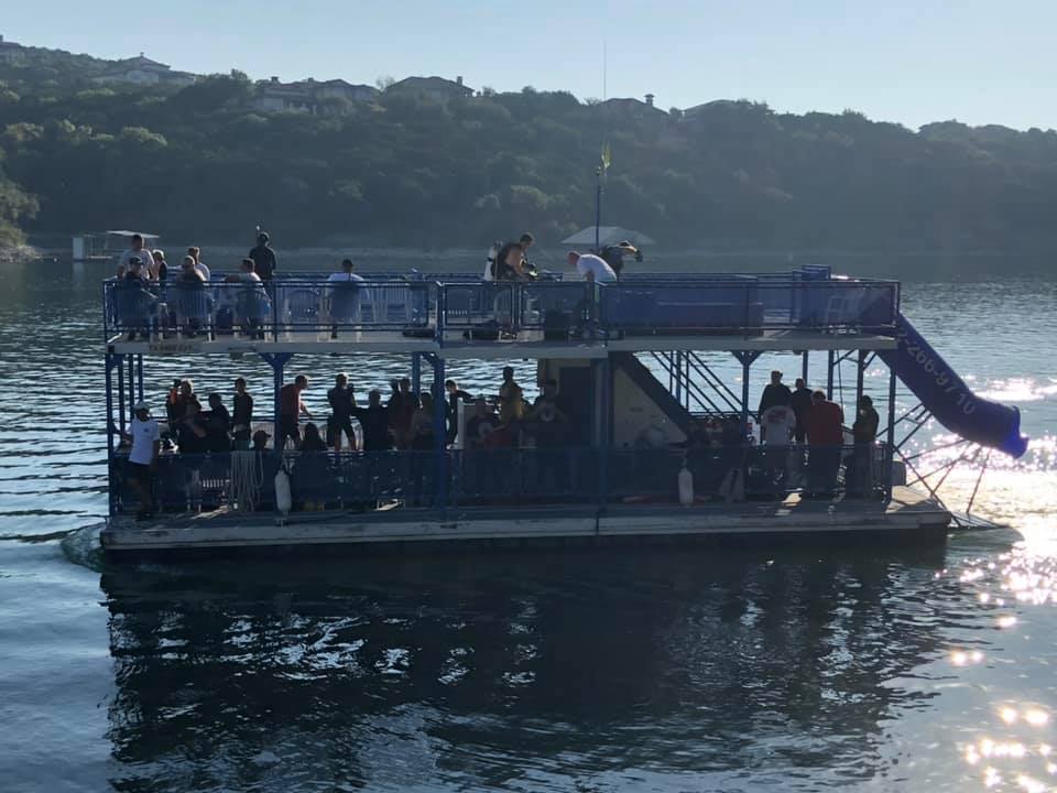
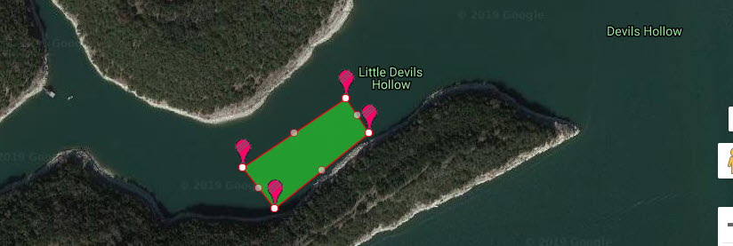
Bluff Island, Ung Kong Wan (甕缸灣)

22.325656, 114.354349
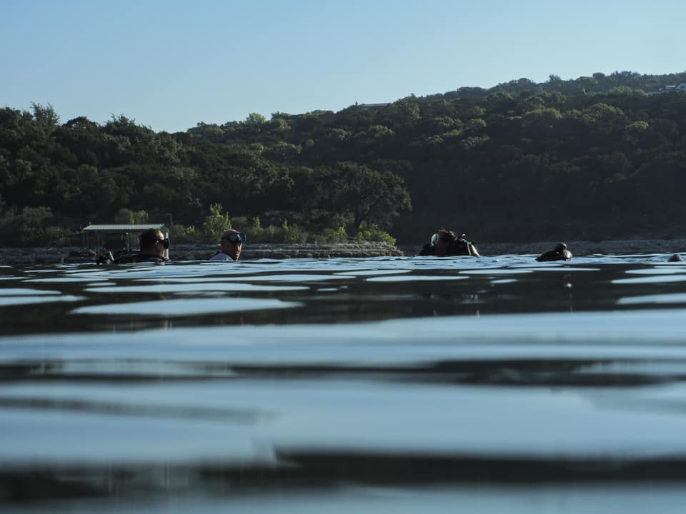
sand
Pleasure Boats
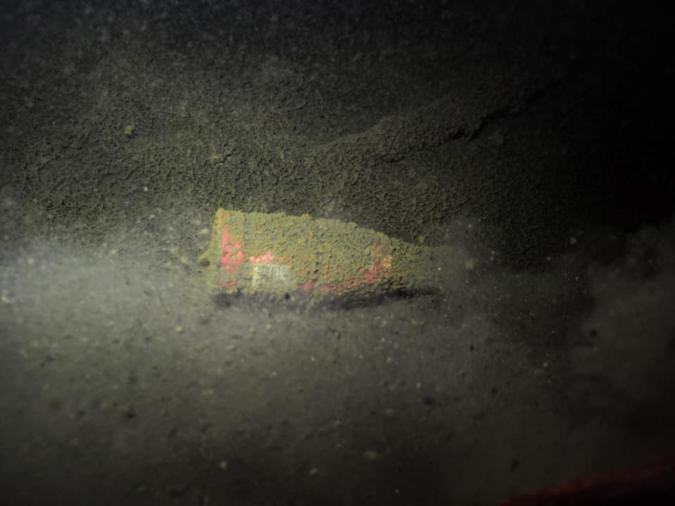
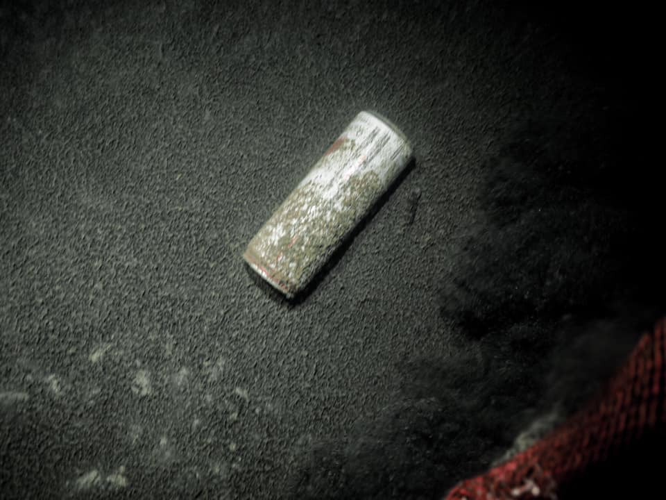
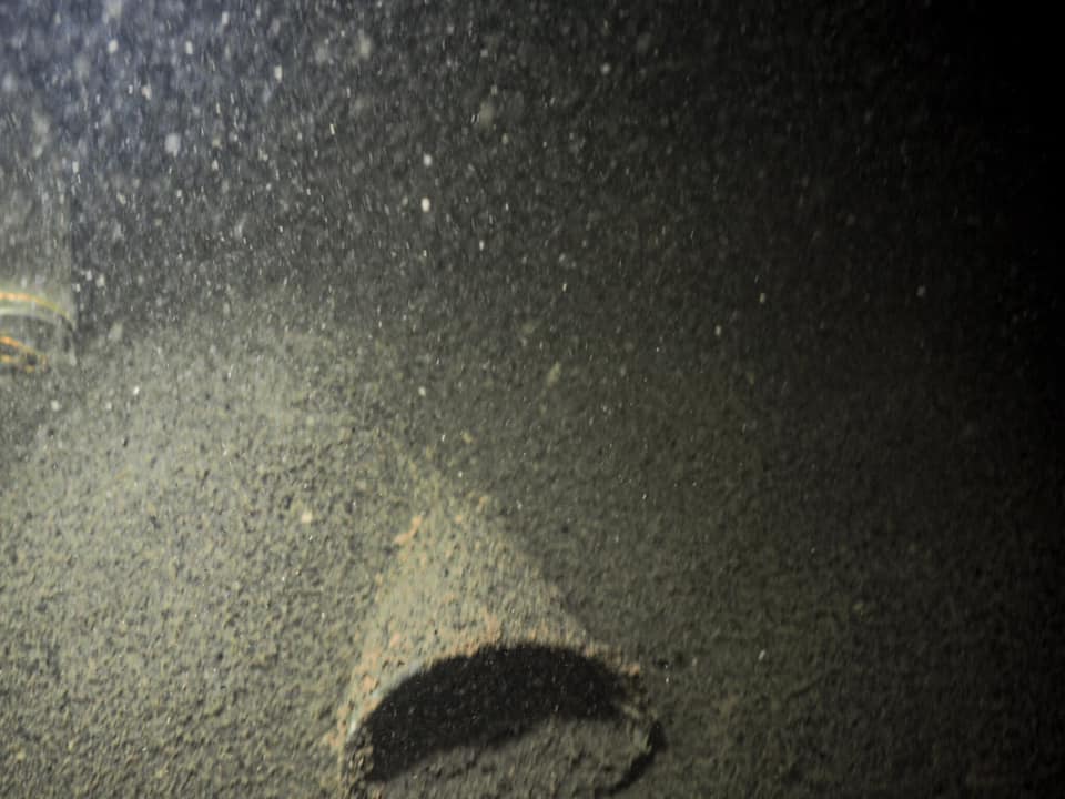
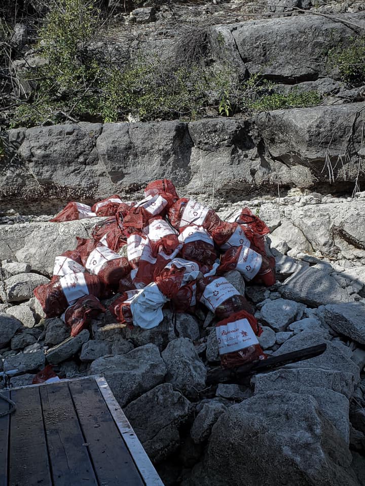
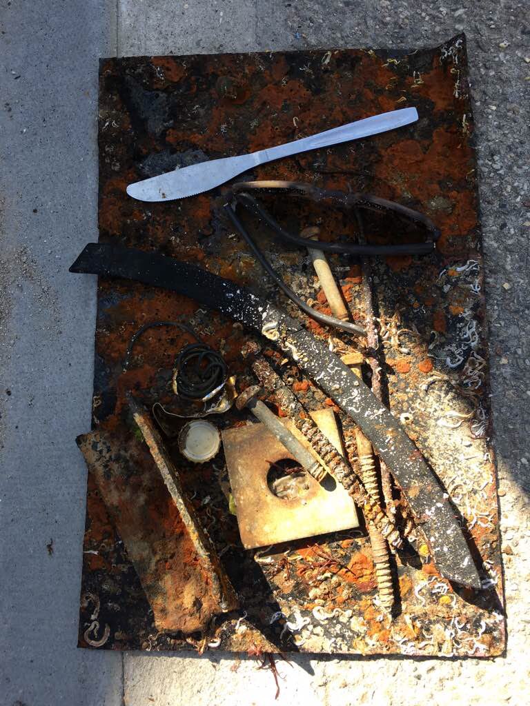
The dive site was largely free of debris.
Calm, Fair Skies
Living Seas Hong Kong 勃勃海洋
Jeffrey Lee
5
0.50
25
6.00
2.00
estimated
800.00
On
kilograms
I have debris data to report
Calm (glassy to rippled) for waves 0 – 0.1 meter high
1
0
m2
meters
coral reef
1
Hong Kong S.A.R., China
City
Hong Kong
Map Help


Dive Location

If you know your survey site coordinates, enter them manually in decimal degrees using WGS84 Map Datum. Use the minus sign for latitudes south of the equator and longitudes west of the Prime Meridian to 180 degrees.

If you do not know your survey site coordinates, click the “Map Location” tab to use the map to zoom into your survey site and drop the pin on the map to fall within your survey dive site in the water (not on land or the beach). Ensure you zoom in as much as possible to ensure data accuracy.

Entangled Help


Use the vertical tabs below to record any entangled animals you found of each type.

ADS73 - House Reef

0
0
0

2.5231384156514, 103.97383118059

0
0
0
coral
0
0
0
0
0
Sunny, light wind
0
0
0
0
0
0
0
0
0
0
0
0
0
0
0
0
0
0
0
0
OrcaNation
Lee
0
0
0
0
0
0
0
0
0
0
0
0
0
0
0
0
0
0
0
3
0
0
0
0
0
0
0
0
0
0
0
0
0
0
0.00
60
8.00
4.00
0
estimated
0
0
1000.00
0
0
0
0
0
0
On
kilograms
0
Our Survey Site was free of debris
0
0
0
Smooth (wavelets) for waves 0.1 - 0.5 meter high
0
0
0
0
0
0
0
m2
0
0
meters
coral reef
0
0
0
0
0
0
0
0
0
0
0
0
0
0
0
0
0
0
0
0
0
0
0
0
0
0
0
0
Malaysia
State\Province
Johor
City
Mersing
Map Help


Dive Location

If you know your survey site coordinates, enter them manually in decimal degrees using WGS84 Map Datum. Use the minus sign for latitudes south of the equator and longitudes west of the Prime Meridian to 180 degrees.

If you do not know your survey site coordinates, click the “Map Location” tab to use the map to zoom into your survey site and drop the pin on the map to fall within your survey dive site in the water (not on land or the beach). Ensure you zoom in as much as possible to ensure data accuracy.

Entangled Help


Use the vertical tabs below to record any entangled animals you found of each type.

ADS73 - House Reef

0
0
0

2.5231413663468, 103.97383035609

0
0
0
coral
0
1
0
0
0
No
Sunny, calm
0
0
0
0
0
0
0
0
0
0
0
0
0
0
0
0
0
0
0
0
OrcaNation
Lee
0
0
0
0
0
0
0
0
0
0
0
0
0
0
0
0
0
0
0
3
0
0
0
0
0
0
0
0
0
0
0
0
0
0
2.00
60
7.00
4.00
4
estimated
0
0
1000.00
0
0
0
1
0
1
On
kilograms
0
I have debris data to report
0
0
0
Smooth (wavelets) for waves 0.1 - 0.5 meter high
0
0
0
0
1
0
0
m2
0
0
meters
coral reef
0
0
0
0
0
0
0
0
0
0
0
0
0
0
0
0
0
0
0
0
0
0
0
0
0
0
0
0
Malaysia
State\Province
Johor
City
Mersing
Map Help


Dive Location

If you know your survey site coordinates, enter them manually in decimal degrees using WGS84 Map Datum. Use the minus sign for latitudes south of the equator and longitudes west of the Prime Meridian to 180 degrees.

If you do not know your survey site coordinates, click the “Map Location” tab to use the map to zoom into your survey site and drop the pin on the map to fall within your survey dive site in the water (not on land or the beach). Ensure you zoom in as much as possible to ensure data accuracy.

Entangled Help


Use the vertical tabs below to record any entangled animals you found of each type.

Aow Mao

0
0
0

10.092231179393, 99.852778968908

0
0
0
sand
0
0
0
0
0
Rainy/cloudy
0
0
0
0
0
0
0
0
0
0
0
0
0
0
0
0
0
0
0
0
Jamahkiri Diving
Macca
1
0
0
0
0
0
0
0
0
0
0
0
0
2
0
0
0
5
5
4
0
0
0
0
0
0
0
0
0
0
0
0
0
0
15.00
60
15.00
5.00
0
estimated
0
0
5442.30
0
0
0
0
0
0
On
kilograms
0
I have debris data to report
2
0
0
Calm (glassy to rippled) for waves 0 – 0.1 meter high
0
0
2
0
0
0
0
m2
0
0
meters
coral reef
0
0
0
0
0
3
0
0
2
0
0
0
0
0
0
0
0
0
0
0
0
0
0
0
0
1
0
0
Thailand
State\Province
Surat Thani
City
Koh Tao
Map Help


Dive Location

If you know your survey site coordinates, enter them manually in decimal degrees using WGS84 Map Datum. Use the minus sign for latitudes south of the equator and longitudes west of the Prime Meridian to 180 degrees.

If you do not know your survey site coordinates, click the “Map Location” tab to use the map to zoom into your survey site and drop the pin on the map to fall within your survey dive site in the water (not on land or the beach). Ensure you zoom in as much as possible to ensure data accuracy.

Entangled Help


Use the vertical tabs below to record any entangled animals you found of each type.

ADS571 - Saonek Monde

11
0
0

-0.449288, 130.800922

0
0
0
sand
0
4
0
25
1
Engine part
0
0
0
0
0
0
0
0
0
0
0
0
0
0
0
0
0
0
0
0
Meridian Adventure Dive Resort
JP Nathrass
0
1
1
8
0
0
0
1
0
1
0
0
28
0
1
0
0
0
0
8
0
0
0
0
0
0
0
0
0
0
0
0
0
0
14.00
60
15.00
3.00
2
measured
0
0
6000.00
0
0
0
0
0
Plastic
Metal
0
On
kilograms
0
I have debris data to report
5
2
0
Calm (glassy to rippled) for waves 0 – 0.1 meter high
0
0
1
0
0
0
0
m2
0
0
meters
coral reef
0
0
0
0
0
0
1
0
0
0
0
0
0
1
0
1
0
0
0
0
0
0
0
1
0
0
0
0
Indonesia
State\Province
West papua, Raja Ampat Regency
City
Waisai
Map Help


Dive Location

If you know your survey site coordinates, enter them manually in decimal degrees using WGS84 Map Datum. Use the minus sign for latitudes south of the equator and longitudes west of the Prime Meridian to 180 degrees.

If you do not know your survey site coordinates, click the “Map Location” tab to use the map to zoom into your survey site and drop the pin on the map to fall within your survey dive site in the water (not on land or the beach). Ensure you zoom in as much as possible to ensure data accuracy.

Entangled Help


Use the vertical tabs below to record any entangled animals you found of each type.

ADS583 - Poblacion 1

4
11
2

9.186609998984, 123.26561946674

0
0
0
coral
0
1
0
10
0
Typhoon
A lot of shoes
Typhoon
0
0
0
0
0
0
0
0
0
0
0
0
0
0
0
0
0
0
0
0
Bongobongo divers
Karina
0
0
0
2
9
0
0
0
1
0
0
0
0
0
1
0
0
14
0
8
0
0
0
0
0
0
0
0
0
0
0
0
0
0
8.00
60
20.00
1.50
2
estimated
0
0
415.00
0
0
1
13
0
Fishing line
Clothes
Rubber parts
2
On
kilograms
0
I have debris data to report
3
0
0
Slight for waves 0.5 -1.25 meter high
3
0
0
2
6
0
1
m2
2
4
meters
coral reef
0
0
0
0
0
0
0
0
0
0
0
0
0
0
0
0
0
0
0
0
0
0
0
0
0
0
1
0
Philippines
State\Province
Negros Oriental
City
Dauin
Map Help


Dive Location

If you know your survey site coordinates, enter them manually in decimal degrees using WGS84 Map Datum. Use the minus sign for latitudes south of the equator and longitudes west of the Prime Meridian to 180 degrees.

If you do not know your survey site coordinates, click the “Map Location” tab to use the map to zoom into your survey site and drop the pin on the map to fall within your survey dive site in the water (not on land or the beach). Ensure you zoom in as much as possible to ensure data accuracy.

Entangled Help


Use the vertical tabs below to record any entangled animals you found of each type.

Little Devil's Cove

30.4408736, -97.9490818

silt
Little Devil's Cove provides a sheltered area for boaters to tie up/anchor and swim. It's typical for these boaters to drop their bottles, cans, and solo cups in the water and let them sink rather than take their garbage with them. I do not have exact counts of each item (40 divers plus we're new at this), but we had an estimated 800 pounds of trash that we removed from this cove as part of the Lake Travis Underwater Cleanup (https://laketraviscleanup.org/). Dive World Austin would like to adopt this cove; our monthly totals will give us a better idea of ratio of cans, bottles, and cups.
Due to the huge amount of trash collected, I can't provide exact counts of bottles, cans, and cups. They're split fairly evenly among the three.
Abandoned boat anchors - they get caught in stumps at the bottom and the boaters cut the line. We surface them with lift bags.
Calm
Dive World Austin
Matt Jacobs
40
800.00
60
60.00
25.00
estimated
81975.00
Bottles
Cans
Solo cups
On
pounds
I have debris data to report
Calm (glassy to rippled) for waves 0 – 0.1 meter high
None
-1
None
ft2
feet
other
United States
State\Province
Texas
City
Austin
Map Help


Dive Location

If you know your survey site coordinates, enter them manually in decimal degrees using WGS84 Map Datum. Use the minus sign for latitudes south of the equator and longitudes west of the Prime Meridian to 180 degrees.

If you do not know your survey site coordinates, click the “Map Location” tab to use the map to zoom into your survey site and drop the pin on the map to fall within your survey dive site in the water (not on land or the beach). Ensure you zoom in as much as possible to ensure data accuracy.

Entangled Help


Use the vertical tabs below to record any entangled animals you found of each type.

Ecosystem Other
Lake

ADS475 - Cha Cha Cha Beach

31
sand
16
1

12.149187127382, -68.277932092142

no
Menstrual padding
calm
Dive friends bonaire
Roos
4
5
6
3.00
50
17.00
2.00
estimated
2
200.00
3
On
kilograms
I have debris data to report
2
Calm (glassy to rippled) for waves 0 – 0.1 meter high
1
1
11
m2
5
meters
coral reef
2
3
1
1
Netherlands Antilles
City
Kralendijk
Map Help


Dive Location

If you know your survey site coordinates, enter them manually in decimal degrees using WGS84 Map Datum. Use the minus sign for latitudes south of the equator and longitudes west of the Prime Meridian to 180 degrees.

If you do not know your survey site coordinates, click the “Map Location” tab to use the map to zoom into your survey site and drop the pin on the map to fall within your survey dive site in the water (not on land or the beach). Ensure you zoom in as much as possible to ensure data accuracy.

Entangled Help


Use the vertical tabs below to record any entangled animals you found of each type.

Marmora Ontario

rock

44.484673866448, -77.686918612113

Nothing besides vandalism
The Aluminum structure we recovered was a railing
Thunderstorms 1 day the 6 others sunny and warm
Dive Kawartha
Vernon Moore
2
25.00
32
21.00
8.00
estimated
1000.00
Tires
Aluminum Cans
Plastic
On
pounds
I have debris data to report
Calm (glassy to rippled) for waves 0 – 0.1 meter high ft2
feet
other
1
Canada
State\Province
Ontario
City
Lindsay
Map Help


Dive Location

If you know your survey site coordinates, enter them manually in decimal degrees using WGS84 Map Datum. Use the minus sign for latitudes south of the equator and longitudes west of the Prime Meridian to 180 degrees.

If you do not know your survey site coordinates, click the “Map Location” tab to use the map to zoom into your survey site and drop the pin on the map to fall within your survey dive site in the water (not on land or the beach). Ensure you zoom in as much as possible to ensure data accuracy.

Entangled Help


Use the vertical tabs below to record any entangled animals you found of each type.

Ecosystem Other
River

ADS165 - Swanage Pier

0
0
0

50.607406949261, -1.9528490433937

0
0
0
sand
0
0
0
0
0
Restoration of the Pier
Stainless steel cutlery knife
Calm sunny
1
1
0
0
0
0
0
0
0
0
0
0
0
0
0
0
0
0
0
0
Sunglasses
Ocean Turtle Diving
Stephan
0
0
0
0
0
0
0
0
0
0
0
0
0
0
0
0
0
0
0
2
0
0
0
0
0
0
0
0
0
0
0
0
0
0
3.00
40
6.00
1.00
0
estimated
0
0
235.48
0
0
0
1
0
0
On
kilograms
0
I have debris data to report
0
0
0
Smooth (wavelets) for waves 0.1 - 0.5 meter high
0
0
0
0
0
0
0
m2
0
0
meters
seagrass
10
0
0
0
1
0
0
0
0
0
0
0
0
0
0
0
0
0
0
0
0
0
0
0
0
0
0
0
United Kingdom
State\Province
Dorset
City
Swanage
Map Help


Dive Location

If you know your survey site coordinates, enter them manually in decimal degrees using WGS84 Map Datum. Use the minus sign for latitudes south of the equator and longitudes west of the Prime Meridian to 180 degrees.

If you do not know your survey site coordinates, click the “Map Location” tab to use the map to zoom into your survey site and drop the pin on the map to fall within your survey dive site in the water (not on land or the beach). Ensure you zoom in as much as possible to ensure data accuracy.

Entangled Help


Use the vertical tabs below to record any entangled animals you found of each type.

Subscribe to