Menu

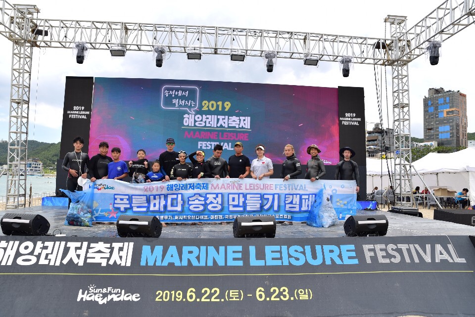
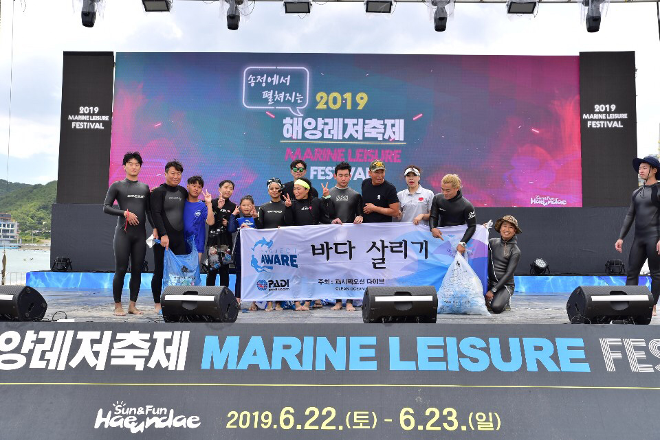
ADS586 - Lake Dlinnoe. The Island

0
0
0
0

60.299125381906, 29.297378745896

3
0
0
silt
0
5
0
1
0
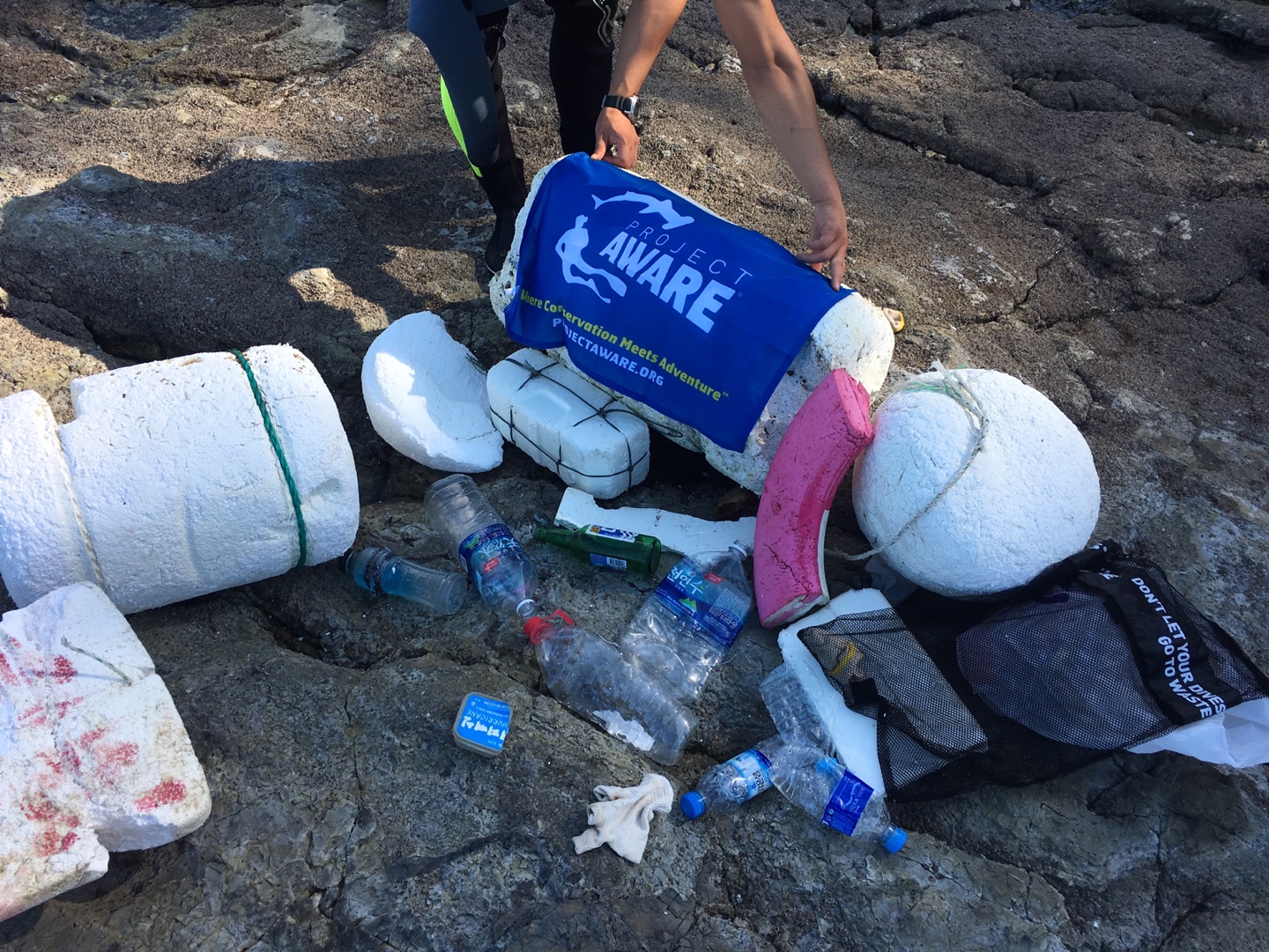
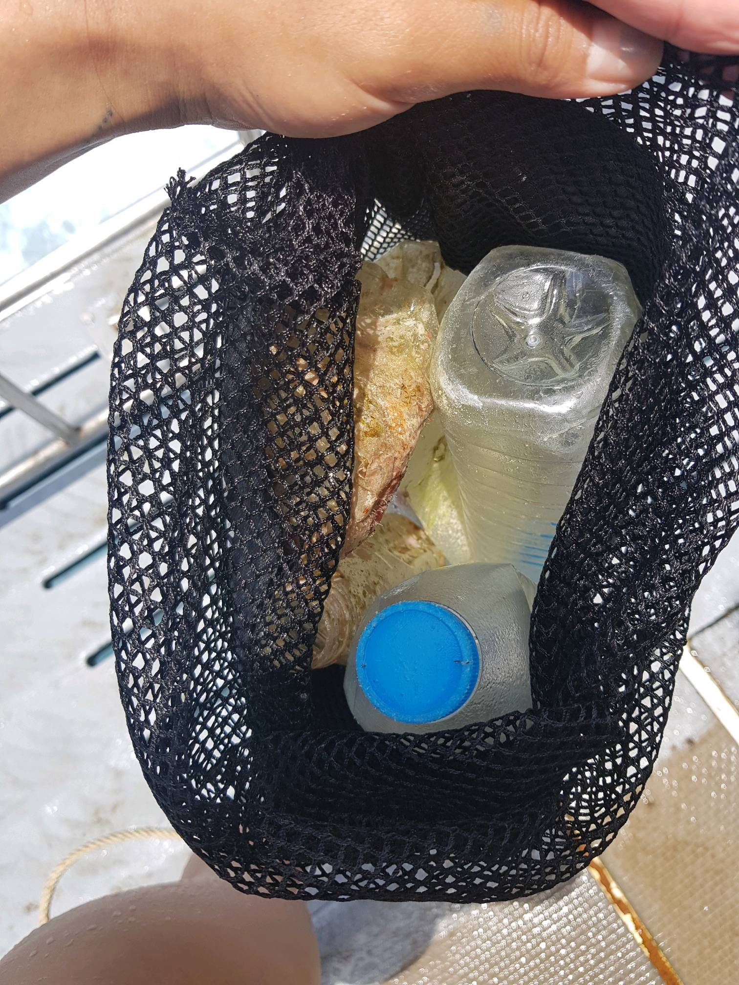
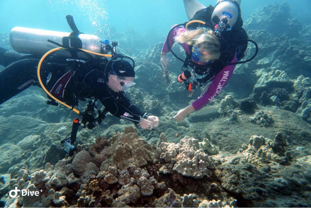
That was a planed dive against debris with our open water students and rescue students. They were happy to be a part of this activity.
We started with fishing line which tangle around my fin then continue with the collection of all other items.
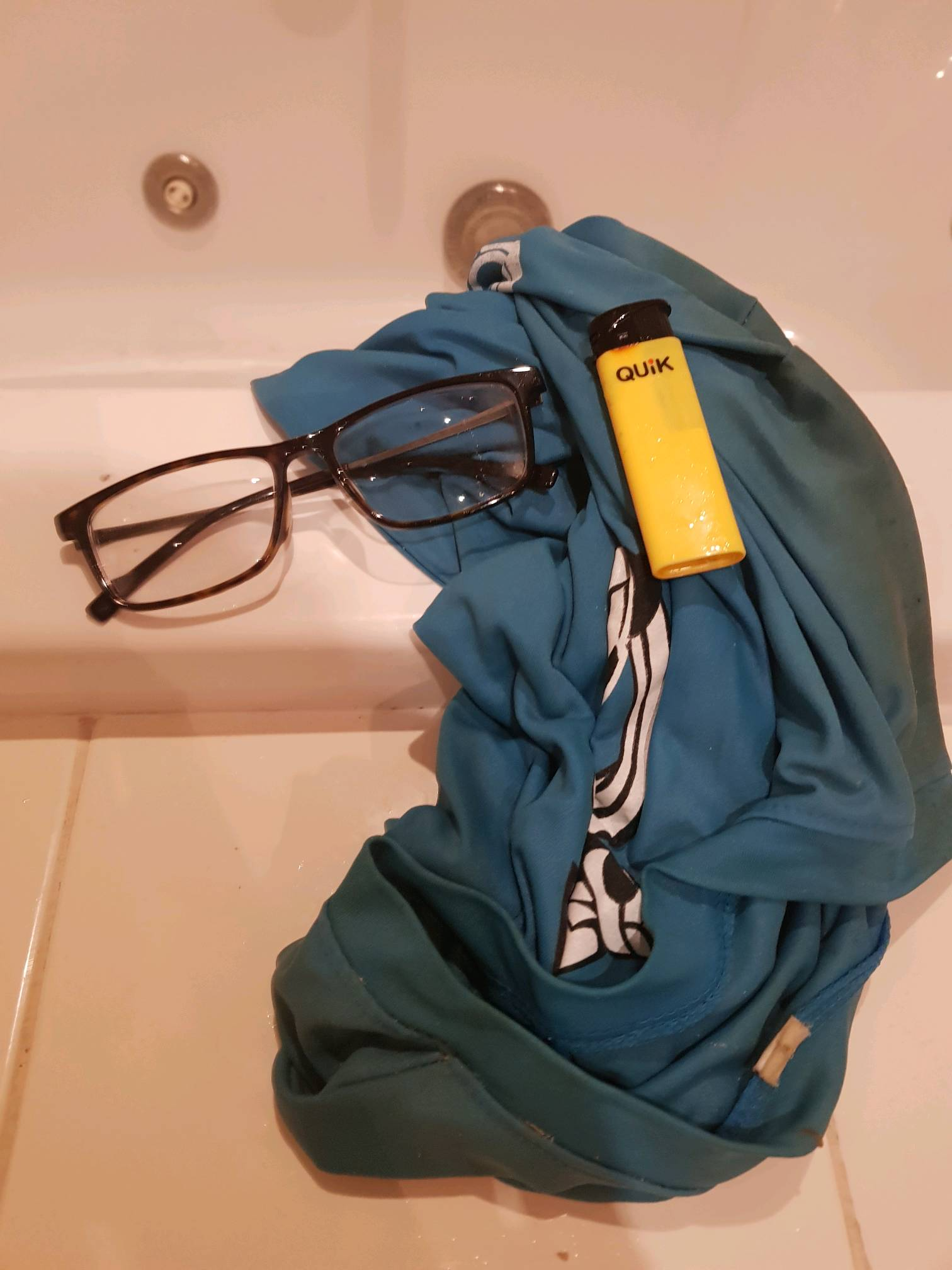
man underwear )))
cloudy, wind, rain
Tortuga s-21559
Elena Nayda
0
0
0
0
0
0
0
0
0
0
0
0
0
0
0
2
0
2
0
7
0
0
0
0
0
0
7
0
0
0
0
0
0
0
0
0
6.00
25
6.00
2.00
0
measured
0
0
0
0
42.00
0
0
0
0
0
fishing line
0
On
kilograms
0
I have debris data to report
3
0
1
Calm (glassy to rippled) for waves 0 – 0.1 meter high
2
0
0
no
1
Released Unharmed
perch
0
1
0
0
m2
0
1
meters
seagrass
0
0
1
0
0
2
0
0
0
1
0
0
0
0
0
2
0
0
0
0
0
0
5
0
0
0
0
0
0
Russia
City
St-Petersburg
Map Help


Dive Location

If you know your survey site coordinates, enter them manually in decimal degrees using WGS84 Map Datum. Use the minus sign for latitudes south of the equator and longitudes west of the Prime Meridian to 180 degrees.

If you do not know your survey site coordinates, click the “Map Location” tab to use the map to zoom into your survey site and drop the pin on the map to fall within your survey dive site in the water (not on land or the beach). Ensure you zoom in as much as possible to ensure data accuracy.

Entangled Help


Use the vertical tabs below to record any entangled animals you found of each type.

ADS442 - Alona Beach House Reef

coral
6
1
3

9.5484436650392, 123.77570690409

Fair weather
Tropical Divers
Aleksei Permiakov
1
4
3
3
2.00
60
21.00
4.00
estimated
1200.00
Plastic bags and sachets
On
kilograms
I have debris data to report
Smooth (wavelets) for waves 0.1 - 0.5 meter high
2
m2
meters
coral reef
4
1
Philippines
State\Province
Bohol
City
Panglao
Map Help


Dive Location

If you know your survey site coordinates, enter them manually in decimal degrees using WGS84 Map Datum. Use the minus sign for latitudes south of the equator and longitudes west of the Prime Meridian to 180 degrees.

If you do not know your survey site coordinates, click the “Map Location” tab to use the map to zoom into your survey site and drop the pin on the map to fall within your survey dive site in the water (not on land or the beach). Ensure you zoom in as much as possible to ensure data accuracy.

Entangled Help


Use the vertical tabs below to record any entangled animals you found of each type.

Songjung beach

5
0
2
sand
4
6

35.179477149948, 129.20387819669

it was beach festival at Songjung beach. A lot of people come and enjoy it.
we explain about protecting sea environment and animals.
25 degree .cloudy and windy
Pacific ocean dive center
Byungju Jung
7
25
18
10
7
9
23
17
8
3
14
22
8
50.00
40
5.00
3.00
4
measured
0
982.00
1
On
kilograms
I have debris data to report
7
Calm (glassy to rippled) for waves 0 – 0.1 meter high m2
7
meters
seagrass
9
13
5
6
3
2
3
South Korea
City
Busan
Map Help


Dive Location

If you know your survey site coordinates, enter them manually in decimal degrees using WGS84 Map Datum. Use the minus sign for latitudes south of the equator and longitudes west of the Prime Meridian to 180 degrees.

If you do not know your survey site coordinates, click the “Map Location” tab to use the map to zoom into your survey site and drop the pin on the map to fall within your survey dive site in the water (not on land or the beach). Ensure you zoom in as much as possible to ensure data accuracy.

Entangled Help


Use the vertical tabs below to record any entangled animals you found of each type.

Ecosystem Other
clean sand

Mae Island (south sea)

4
5
rock
2
3
7

34.716486931394, 128.04635662744

there is many old fishing traps and fishing nets.
i feel so sorry to dead fishes and ocean animals.
cloudy / 25 degree
Pacific ocean dive center
Byungju Jung
8
2
5
4
1
2
1
3
2
24.00
86
15.00
4.00
2
measured
3
2
2745.14
On
kilograms
I have debris data to report
2
1
Smooth (wavelets) for waves 0.1 - 0.5 meter high m2
meters
seagrass
1
1
3
1
1
South Korea
State\Province
Gyeongsangnam-do
City
Namhae-gun
Map Help


Dive Location

If you know your survey site coordinates, enter them manually in decimal degrees using WGS84 Map Datum. Use the minus sign for latitudes south of the equator and longitudes west of the Prime Meridian to 180 degrees.

If you do not know your survey site coordinates, click the “Map Location” tab to use the map to zoom into your survey site and drop the pin on the map to fall within your survey dive site in the water (not on land or the beach). Ensure you zoom in as much as possible to ensure data accuracy.

Entangled Help


Use the vertical tabs below to record any entangled animals you found of each type.

Racha Yai, Bay 3

0
0
0
0

7.498035, 98.324789

0
0
0
sand
0
0
1
0
0
Tourism
Tshirt
cloudy, big waves, strong current
2
Clothing: tshirt, shorts, underwear, glasses, hair accessories
Linda
0
0
0
0
0
0
0
0
0
0
0
0
0
0
0
0
0
0
0
2
0
0
0
0
0
0
0
0
0
0
0
0
0
0
0
0
3.00
40
12.00
5.00
0
estimated
0
0
0
0
3500.00
0
0
0
0
0
0
On
kilograms
0
I have debris data to report
0
0
0
Moderate to rough for waves greater than 1.25 meters
0
0
0
0
0
0
0
m2
0
0
meters
other
0
0
0
0
0
0
0
0
0
1
0
0
0
0
0
0
0
0
0
0
0
0
0
0
0
0
0
0
0
Thailand
State\Province
Phuket
City
Phuket
Map Help


Dive Location

If you know your survey site coordinates, enter them manually in decimal degrees using WGS84 Map Datum. Use the minus sign for latitudes south of the equator and longitudes west of the Prime Meridian to 180 degrees.

If you do not know your survey site coordinates, click the “Map Location” tab to use the map to zoom into your survey site and drop the pin on the map to fall within your survey dive site in the water (not on land or the beach). Ensure you zoom in as much as possible to ensure data accuracy.

Entangled Help


Use the vertical tabs below to record any entangled animals you found of each type.

Racha Noi

3
0
0
0

7.497926, 98.324958

0
0
0
sand
0
2
0
0
0
Tourism
Coffee wrapper
Calm, cloudy, slight rain and wind
All 4 Diving
Linda
0
0
0
0
0
0
0
0
0
0
0
0
0
0
0
0
0
0
0
4
0
0
0
0
0
0
6
0
0
0
0
0
0
0
0
0
4.00
30
15.00
5.00
0
estimated
0
0
0
0
3000.00
0
0
0
0
0
String
Broken plastic bottles
0
On
kilograms
0
I have debris data to report
0
0
0
Calm (glassy to rippled) for waves 0 – 0.1 meter high
0
0
0
0
0
0
0
m2
3
0
meters
coral reef
0
0
0
0
0
0
0
0
0
0
0
0
0
0
0
0
0
0
0
0
0
0
0
0
0
0
0
0
0
Thailand
State\Province
Phuket
City
Phuket
Map Help


Dive Location

If you know your survey site coordinates, enter them manually in decimal degrees using WGS84 Map Datum. Use the minus sign for latitudes south of the equator and longitudes west of the Prime Meridian to 180 degrees.

If you do not know your survey site coordinates, click the “Map Location” tab to use the map to zoom into your survey site and drop the pin on the map to fall within your survey dive site in the water (not on land or the beach). Ensure you zoom in as much as possible to ensure data accuracy.

Entangled Help


Use the vertical tabs below to record any entangled animals you found of each type.

Red Hill

0
0
0

20.632311489031, -156.4513

0
0
0
coral
0
0
0
5
0
Additional divers were John Blackburn and Kayla Kingston
Fishing
Mask strap
0
0
0
0
0
0
0
0
0
0
0
0
0
0
0
0
0
0
Prodiver Maui
Amy Blackburn
0
0
0
0
0
0
0
0
0
0
0
0
0
0
0
0
0
0
0
3
0
0
0
0
0
0
0
0
0
0
0
0
0
0
2.00
50
34.00
11.00
0
estimated
0
1
8979.73
0
0
0
0
0
Fishing hooks & lines
0
On
pounds
0
I have debris data to report
0
0
0
Calm (glassy to rippled) for waves 0 – 0.1 meter high
0
0
0
0
0
0
0
m2
0
0
meters
coral reef
0
0
0
0
0
0
0
0
0
0
0
0
0
0
0
0
0
0
0
0
0
0
0
0
0
0
0
0
United States
State\Province
Hawaii
City
Maui
Map Help


Dive Location

If you know your survey site coordinates, enter them manually in decimal degrees using WGS84 Map Datum. Use the minus sign for latitudes south of the equator and longitudes west of the Prime Meridian to 180 degrees.

If you do not know your survey site coordinates, click the “Map Location” tab to use the map to zoom into your survey site and drop the pin on the map to fall within your survey dive site in the water (not on land or the beach). Ensure you zoom in as much as possible to ensure data accuracy.

Entangled Help


Use the vertical tabs below to record any entangled animals you found of each type.

ADS584 - Holyrood Marina

47.389297, -53.126558

silt
Holyrood Marina is an Adopted Dive site. Today DB, PO and I did a dive against debris. We are hardy drysuit divers well versed in diving in the cold waters of the North Atlantic. But come on! We did not plan for -1 degree C at 35 feet on September 4. The average water temps are closer to 12 degrees C this time of year. The cold drove me out of there water. Poor glove selection!! Regardless we still made a good haul of debris. Left some behind for some future dives. Way to go guys, we did giver till we shivered.
Rainy. Windy
1
vinyl siding
Oceran Quest Adventures
Mark McGowan
2
3
3
2
50.00
25
35.00
20.00
estimated
2000.00
Glass beverage containers represented more than 75% of the debris removed today.
On
pounds
I have debris data to report
97
Calm (glassy to rippled) for waves 0 – 0.1 meter high ft2
feet
kelp
2
1
3
3
6
4
Canada
State\Province
NL
City
Holyrood
Map Help


Dive Location

If you know your survey site coordinates, enter them manually in decimal degrees using WGS84 Map Datum. Use the minus sign for latitudes south of the equator and longitudes west of the Prime Meridian to 180 degrees.

If you do not know your survey site coordinates, click the “Map Location” tab to use the map to zoom into your survey site and drop the pin on the map to fall within your survey dive site in the water (not on land or the beach). Ensure you zoom in as much as possible to ensure data accuracy.

Entangled Help


Use the vertical tabs below to record any entangled animals you found of each type.

Halfmoon Bay

11
5
0
0

16.306529, -86.593642

0
0
0
sand
0
11
1
1
0
Plastic car
Naturedivers
Tess
0
0
0
3
2
0
0
0
0
1
0
0
0
0
2
0
0
2
4
1
2
0
1
0
0
0
1
0
0
0
0
2
0
0
0
0
1.50
45
4.00
1.00
0
estimated
0
0
0
0
35904.00
0
0
0
0
0
Fishing line
0
On
pounds
0
I have debris data to report
1
0
0
Calm (glassy to rippled) for waves 0 – 0.1 meter high
0
0
0
0
0
0
0
m2
0
0
meters
coral reef
5
0
0
0
0
2
0
0
0
1
0
0
0
9
0
0
2
0
0
0
0
0
0
0
0
0
0
0
0
Honduras
State\Province
Honduras
City
Roatan
Map Help


Dive Location

If you know your survey site coordinates, enter them manually in decimal degrees using WGS84 Map Datum. Use the minus sign for latitudes south of the equator and longitudes west of the Prime Meridian to 180 degrees.

If you do not know your survey site coordinates, click the “Map Location” tab to use the map to zoom into your survey site and drop the pin on the map to fall within your survey dive site in the water (not on land or the beach). Ensure you zoom in as much as possible to ensure data accuracy.

Entangled Help


Use the vertical tabs below to record any entangled animals you found of each type.

ADS216 - USCG Duane

0
0
0
0

24.98966667, -80.382

0
0
0
sand
0
0
0
1
0
Fishing
Rainbow Reef Dive Center/FKNMS
Gage
0
0
0
0
0
0
0
0
0
0
0
0
0
0
0
0
0
0
0
1
0
0
0
0
0
0
0
0
0
0
0
0
0
0
0
0
0.50
30
100.00
70.00
0
estimated
0
0
0
3
2786.53
0
0
0
0
0
0
On
pounds
0
I have debris data to report
0
0
0
Calm (glassy to rippled) for waves 0 – 0.1 meter high
0
0
0
0
0
0
0
ft2
0
0
feet
coral reef
0
0
0
0
0
0
0
0
0
0
0
0
0
0
0
0
0
0
0
0
0
0
0
0
0
0
0
0
0
United States
State\Province
Florida
City
Key Largo
Map Help


Dive Location

If you know your survey site coordinates, enter them manually in decimal degrees using WGS84 Map Datum. Use the minus sign for latitudes south of the equator and longitudes west of the Prime Meridian to 180 degrees.

If you do not know your survey site coordinates, click the “Map Location” tab to use the map to zoom into your survey site and drop the pin on the map to fall within your survey dive site in the water (not on land or the beach). Ensure you zoom in as much as possible to ensure data accuracy.

Entangled Help


Use the vertical tabs below to record any entangled animals you found of each type.

Subscribe to