Niagara River Canada side
1
1
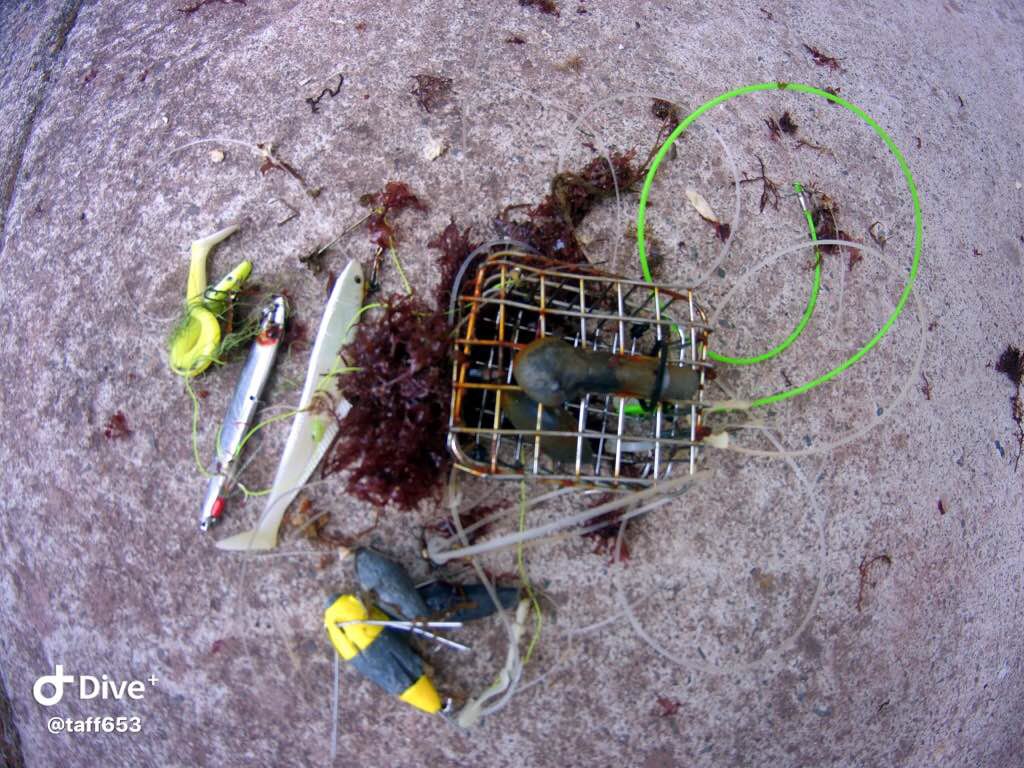
rock
1
42.92153127109, -78.910603528991
high boat traffic area with shore picnic areas along the length of the dive site
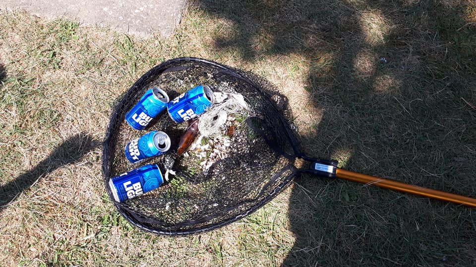
net shown in photo was also part of the debris recovered from the river bottom
Sunny and warm no rain
Float N Flag Dive Centre
Martin Smith
5
5.00
40
20.00
10.00
estimated
2572170.00
beverage cans
beverage bottles
On
pounds
I have debris data to report
4
Calm (glassy to rippled) for waves 0 – 0.1 meter high
ft2
feet
other
6
State\Province
On
City
Burlington
Map Help
Dive Location
If you know your survey site coordinates, enter them manually in decimal degrees using WGS84 Map Datum. Use the minus sign for latitudes south of the equator and longitudes west of the Prime Meridian to 180 degrees.
If you do not know your survey site coordinates, click the “Map Location” tab to use the map to zoom into your survey site and drop the pin on the map to fall within your survey dive site in the water (not on land or the beach). Ensure you zoom in as much as possible to ensure data accuracy.
Entangled Help
Use the vertical tabs below to record any entangled animals you found of each type.
Ecosystem Other
fresh water river