Menu

ADS584 - Holyrood Marina

5
4

47.389297, -53.126558

1
silt
2
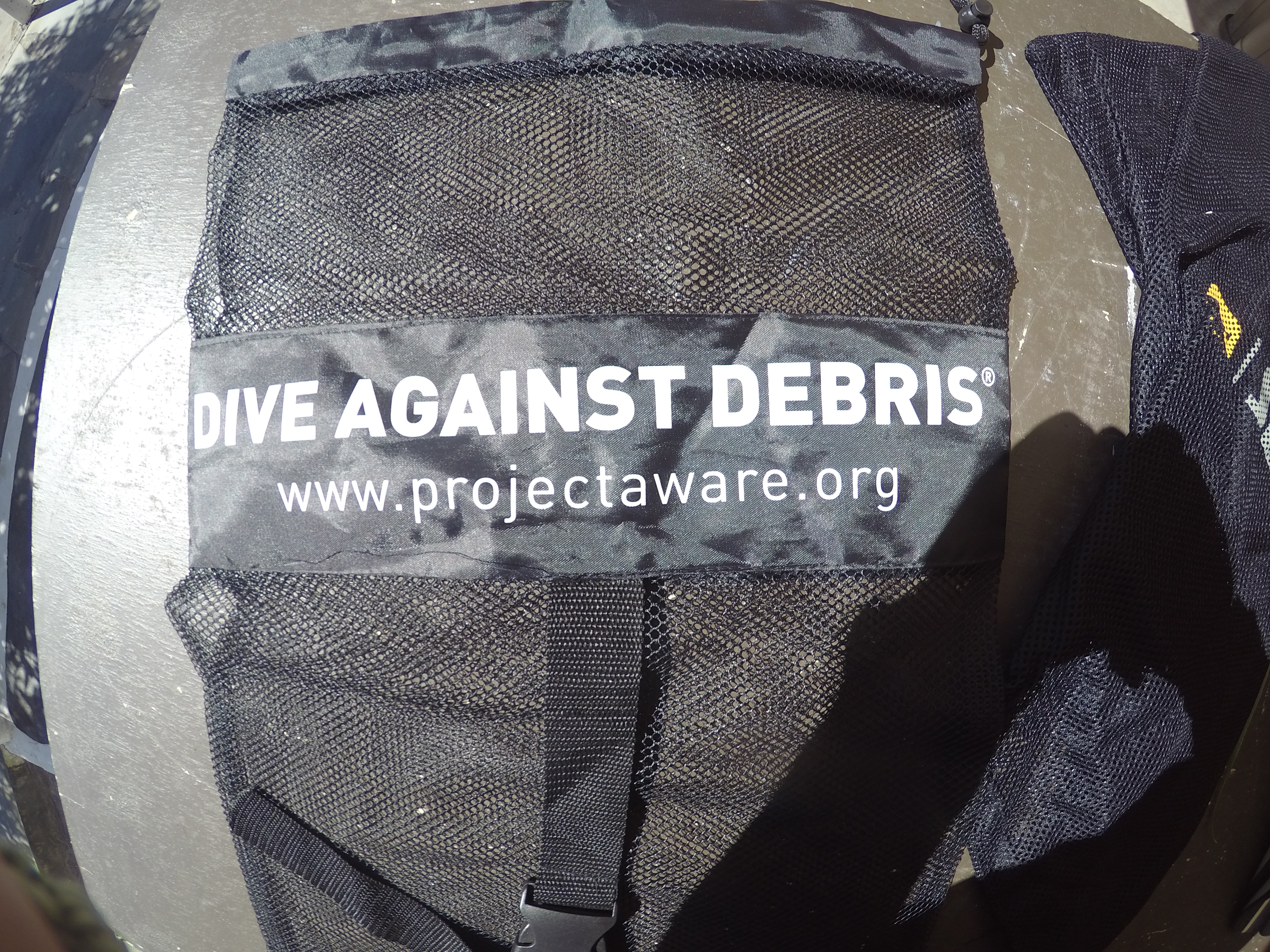
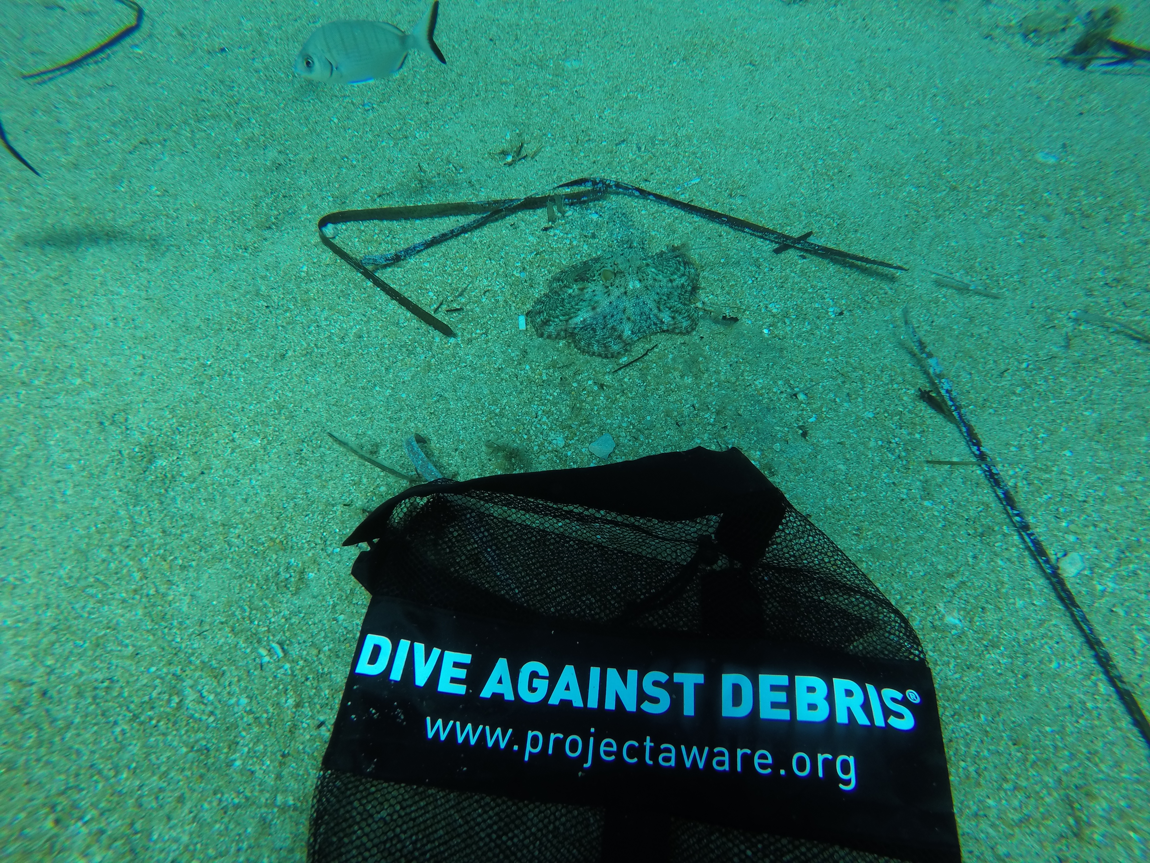
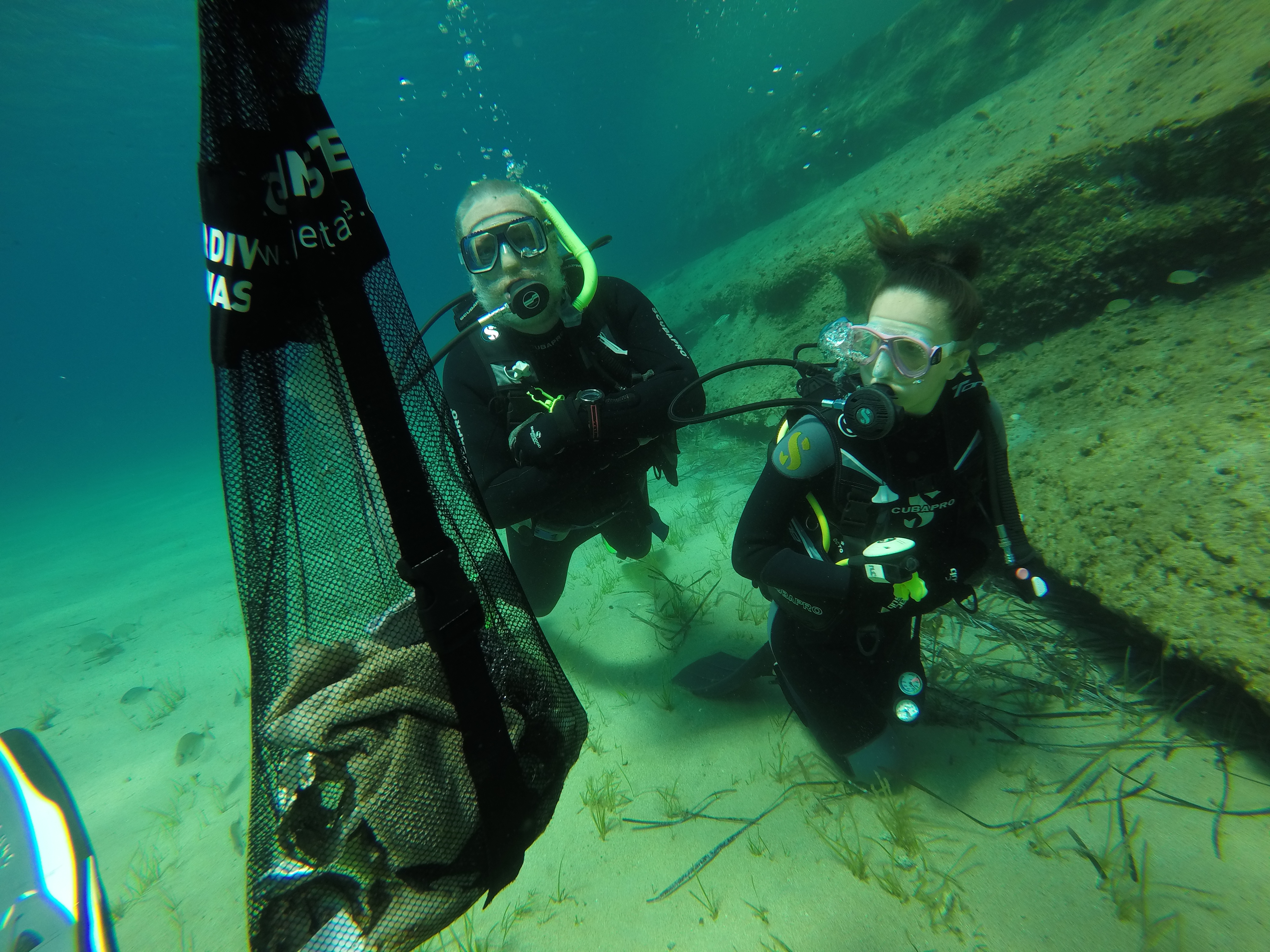
This dive agains debris was conducted in conjunction with Project AWARE training. The participants will be earning Project AWARE certifications. Team motivation was high!!
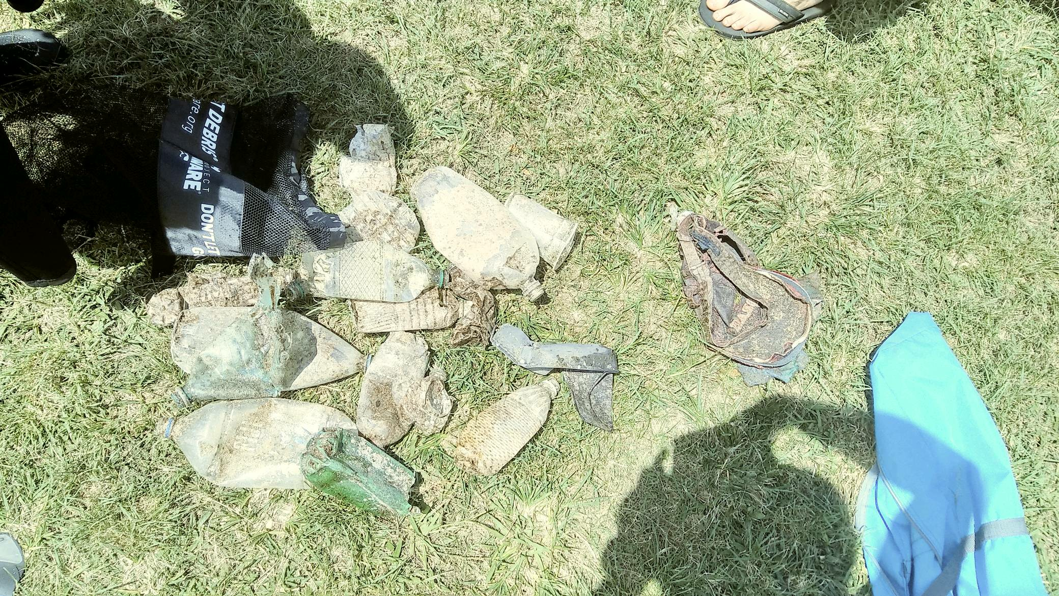
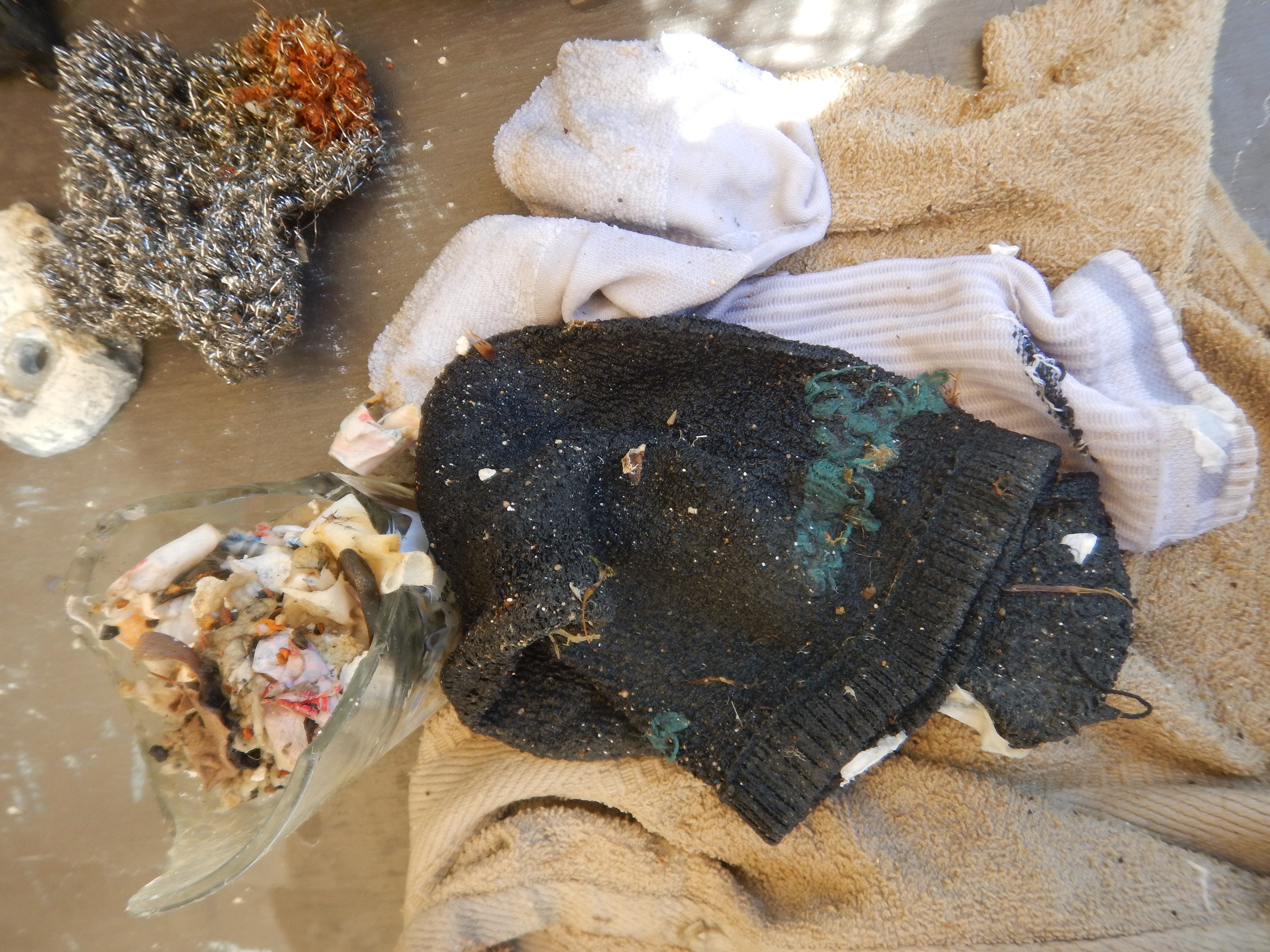
The site surveyed is adjacent to a private marina. Most of the debris was deposited in the ocean by persons aboard private yachts leaving and returning to the marina.
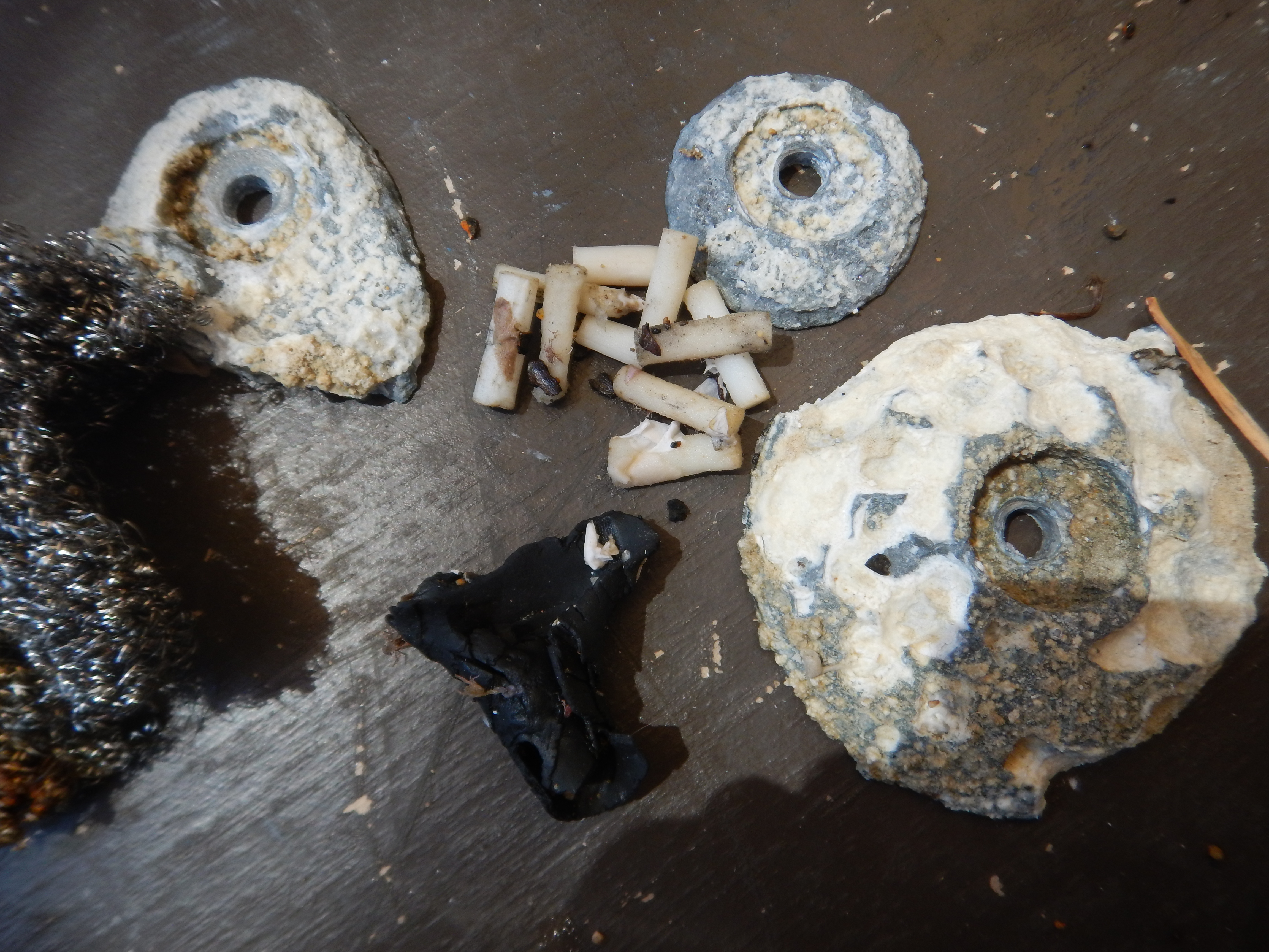
113 golf balls. There is a golf course about 1.68 miles away from the site surveyed.
Overcast, light rain, light winds, calm seas
1
1
1
1
1
1
5
auto parts, plastic/metal, distributor cap
auto parts, rubber, radiator hose
hose, rubber, garden
plastic, spool
paint roller
plastic, lighter, disposable
plastic/metal, shotgun shells, spent
Ocean Quesat Adventures
Mark McGowan
2
1
1
1
1
6
4
10
114
1
40.00
60
40.00
20.00
2
estimated
200.00
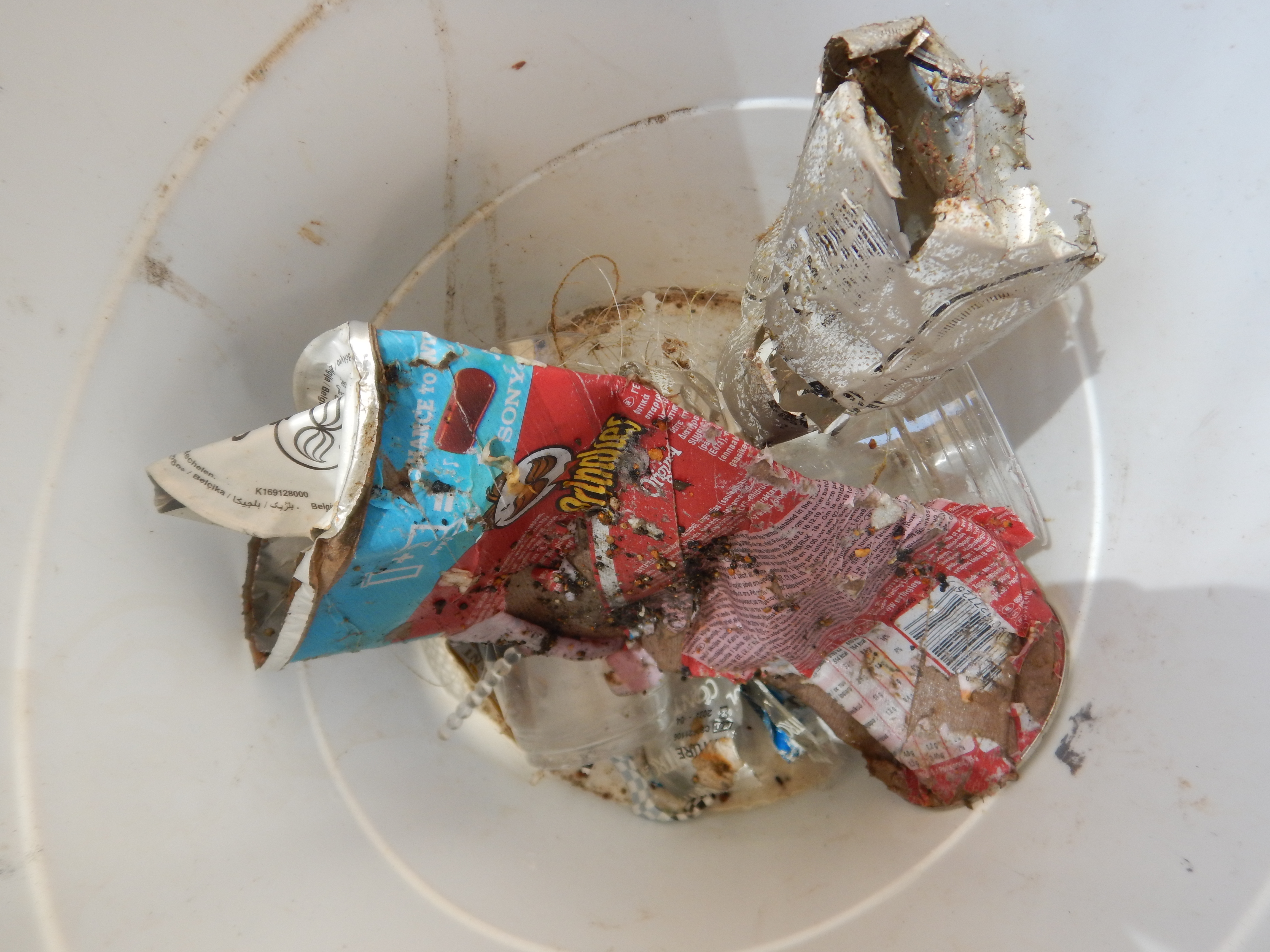
beverage containers: represented approximately 30% of the debris collected
On
pounds
I have debris data to report
23
Smooth (wavelets) for waves 0.1 - 0.5 meter high
1
ft2
feet
kelp
1
4
1
1
4
32
2
1
Canada
State\Province
NL
City
Conception Bay South
Map Help


Dive Location

If you know your survey site coordinates, enter them manually in decimal degrees using WGS84 Map Datum. Use the minus sign for latitudes south of the equator and longitudes west of the Prime Meridian to 180 degrees.

If you do not know your survey site coordinates, click the “Map Location” tab to use the map to zoom into your survey site and drop the pin on the map to fall within your survey dive site in the water (not on land or the beach). Ensure you zoom in as much as possible to ensure data accuracy.

Entangled Help


Use the vertical tabs below to record any entangled animals you found of each type.

Sunabe Beach

0
0
0

26.334996, 127.745014

0
0
0
coral
0
1
0
0
0
No
Good
0
0
0
0
0
0
0
0
0
0
0
0
0
0
0
0
0
0
0
0
1NfinitX
Nico
0
0
0
0
0
0
0
0
0
0
0
0
0
0
0
0
0
0
0
1
0
0
0
0
1
0
0
0
0
0
0
0
0
0
0.40
28
8.00
2.00
0
estimated
0
0
17783.30
0
0
0
0
0
0
On
kilograms
0
I have debris data to report
0
0
0
Smooth (wavelets) for waves 0.1 - 0.5 meter high
0
0
0
0
0
0
0
m2
0
0
meters
coral reef
0
0
0
0
0
0
0
4
0
0
0
0
0
0
0
2
2
0
0
0
0
0
0
0
0
0
0
0
Japan
State\Province
Sunabe
City
Okinawa
Map Help


Dive Location

If you know your survey site coordinates, enter them manually in decimal degrees using WGS84 Map Datum. Use the minus sign for latitudes south of the equator and longitudes west of the Prime Meridian to 180 degrees.

If you do not know your survey site coordinates, click the “Map Location” tab to use the map to zoom into your survey site and drop the pin on the map to fall within your survey dive site in the water (not on land or the beach). Ensure you zoom in as much as possible to ensure data accuracy.

Entangled Help


Use the vertical tabs below to record any entangled animals you found of each type.

Directors Bay

3
1
coral
200

12.06618831505, -68.860404270625

The Dive Bus
Collin
1
5
9
7.00
60
18.00
2.00
measured
47
50.00
Fishing Line
On
kilograms
I have debris data to report
1
Slight for waves 0.5 -1.25 meter high
4
m2
meters
coral reef
4
1
1
3
6
6
Netherlands Antilles
City
Willemstaad
Map Help


Dive Location

If you know your survey site coordinates, enter them manually in decimal degrees using WGS84 Map Datum. Use the minus sign for latitudes south of the equator and longitudes west of the Prime Meridian to 180 degrees.

If you do not know your survey site coordinates, click the “Map Location” tab to use the map to zoom into your survey site and drop the pin on the map to fall within your survey dive site in the water (not on land or the beach). Ensure you zoom in as much as possible to ensure data accuracy.

Entangled Help


Use the vertical tabs below to record any entangled animals you found of each type.

Magic Island

0
0
0
0

21.283525, -157.845834

0
0
0
coral
0
1
0
0
0
Boat debris
Hat
Good.
Dive Oahu
Laurel Knopf
0
0
0
1
0
0
0
0
0
0
0
0
0
0
0
0
0
0
0
3
0
0
0
0
0
0
16
0
0
0
0
0
0
0
0
0
3.50
30
33.00
10.00
0
estimated
0
0
0
0
16297.10
0
0
0
0
0
0
On
pounds
0
I have debris data to report
0
0
0
Slight for waves 0.5 -1.25 meter high
0
0
0
0
2
0
0
ft2
0
0
feet
rocky reef
0
0
0
0
0
0
0
0
0
0
0
0
0
0
0
0
0
0
0
0
0
0
0
0
0
0
0
0
0
United States
State\Province
Hawaii
City
Honolulu
Map Help


Dive Location

If you know your survey site coordinates, enter them manually in decimal degrees using WGS84 Map Datum. Use the minus sign for latitudes south of the equator and longitudes west of the Prime Meridian to 180 degrees.

If you do not know your survey site coordinates, click the “Map Location” tab to use the map to zoom into your survey site and drop the pin on the map to fall within your survey dive site in the water (not on land or the beach). Ensure you zoom in as much as possible to ensure data accuracy.

Entangled Help


Use the vertical tabs below to record any entangled animals you found of each type.

ADS500 - Tikila Beach

41

20.4832265, -86.9718085

sand
61
Good
Blue Magic Scuba
Javier Agudo
8
3.00
27
9.00
3.00
estimated
10000.00
Small plastic fragments
On
kilograms
I have debris data to report
Calm (glassy to rippled) for waves 0 – 0.1 meter high
5
2
m2
meters
coral reef
8
2
3
16
Mexico
State\Province
Quintana Roo
City
Cozumel
Map Help


Dive Location

If you know your survey site coordinates, enter them manually in decimal degrees using WGS84 Map Datum. Use the minus sign for latitudes south of the equator and longitudes west of the Prime Meridian to 180 degrees.

If you do not know your survey site coordinates, click the “Map Location” tab to use the map to zoom into your survey site and drop the pin on the map to fall within your survey dive site in the water (not on land or the beach). Ensure you zoom in as much as possible to ensure data accuracy.

Entangled Help


Use the vertical tabs below to record any entangled animals you found of each type.

Jose Cuervo Reef

0
0
0

25.768812413213, -80.125695908626

0
0
0
sand
0
0
0
0
0
N/A
The Plastic Bucket
Thunderstorms and scattered showers
0
0
0
0
0
0
0
0
0
0
0
0
0
0
0
0
0
0
0
0
N/A
Daniel Burgos
0
0
0
0
0
0
0
0
1
0
0
0
0
0
0
0
0
0
0
3
0
0
0
0
0
0
0
0
1
0
0
0
0
0
3.00
75
22.00
15.00
0
estimated
0
0
95653.30
0
0
0
0
0
Beer Can
Plastic bucket
0
On
pounds
0
I have debris data to report
0
0
0
Calm (glassy to rippled) for waves 0 – 0.1 meter high
0
0
0
0
0
0
0
ft2
0
0
feet
coral reef
0
0
0
0
0
0
0
0
0
0
0
0
0
0
0
0
1
0
0
0
0
2
0
0
0
0
0
0
United States
State\Province
Florida
City
Miami Beach
Map Help


Dive Location

If you know your survey site coordinates, enter them manually in decimal degrees using WGS84 Map Datum. Use the minus sign for latitudes south of the equator and longitudes west of the Prime Meridian to 180 degrees.

If you do not know your survey site coordinates, click the “Map Location” tab to use the map to zoom into your survey site and drop the pin on the map to fall within your survey dive site in the water (not on land or the beach). Ensure you zoom in as much as possible to ensure data accuracy.

Entangled Help


Use the vertical tabs below to record any entangled animals you found of each type.

ADS343 - Playa Lagun

3

12.31835, -69.150884

7
rock
18
Bahia Diving
Ana Kostadinova
10
11
3.00
59
8.00
2.00
estimated
50.00
1
On
kilograms
I have debris data to report
7
Calm (glassy to rippled) for waves 0 – 0.1 meter high m2
meters
rocky reef
Netherlands Antilles
State\Province
Lagun
City
Willemstad
Map Help


Dive Location

If you know your survey site coordinates, enter them manually in decimal degrees using WGS84 Map Datum. Use the minus sign for latitudes south of the equator and longitudes west of the Prime Meridian to 180 degrees.

If you do not know your survey site coordinates, click the “Map Location” tab to use the map to zoom into your survey site and drop the pin on the map to fall within your survey dive site in the water (not on land or the beach). Ensure you zoom in as much as possible to ensure data accuracy.

Entangled Help


Use the vertical tabs below to record any entangled animals you found of each type.

Home Reef

6
sand
1

37.409971050447, 25.356932403233

Nearby beach bar, everyday parties
Educate Tropicana beach about project aware and conservation
Very rusty long metal chain
1
metal chain
Mykonos diving center
Marita Frettun
5
10
1
17
3
1
10.00
53
6.30
1.00
estimated
200.00
1
plastic cups
paper (napkins, menus etc)
cigarette filters
On
kilograms
I have debris data to report
Calm (glassy to rippled) for waves 0 – 0.1 meter high
2
m2
1
meters
rocky reef
4
1
1
1
4
Greece
City
mykonos
Map Help


Dive Location

If you know your survey site coordinates, enter them manually in decimal degrees using WGS84 Map Datum. Use the minus sign for latitudes south of the equator and longitudes west of the Prime Meridian to 180 degrees.

If you do not know your survey site coordinates, click the “Map Location” tab to use the map to zoom into your survey site and drop the pin on the map to fall within your survey dive site in the water (not on land or the beach). Ensure you zoom in as much as possible to ensure data accuracy.

Entangled Help


Use the vertical tabs below to record any entangled animals you found of each type.

Chaloklum Bay

1
5
1

9.787592, 100.00698

0
0
0
sand
0
7
0
0
0
None general debis
Ignite for car lights
Stormy
0
0
0
0
0
0
0
0
0
0
0
0
0
0
0
0
0
0
0
0
Sail rock divers
Matt
0
0
0
1
0
0
0
0
0
0
0
0
0
0
0
0
0
0
2
3
0
0
0
0
0
0
0
1
0
0
0
0
0
0
3.00
22
8.50
3.00
1
estimated
0
0
4232.10
0
0
0
0
0
Plastic
Glass
0
On
kilograms
0
I have debris data to report
6
0
0
Calm (glassy to rippled) for waves 0 – 0.1 meter high
0
0
0
Fishing net (not in use)
Crab
Released Unharmed
2
0
0
1
0
m2
0
0
meters
coral reef
1
0
0
0
0
0
0
0
0
0
0
0
0
0
0
2
0
0
0
0
0
0
0
0
0
0
0
0
Thailand
Map Help


Dive Location

If you know your survey site coordinates, enter them manually in decimal degrees using WGS84 Map Datum. Use the minus sign for latitudes south of the equator and longitudes west of the Prime Meridian to 180 degrees.

If you do not know your survey site coordinates, click the “Map Location” tab to use the map to zoom into your survey site and drop the pin on the map to fall within your survey dive site in the water (not on land or the beach). Ensure you zoom in as much as possible to ensure data accuracy.

Entangled Help


Use the vertical tabs below to record any entangled animals you found of each type.

ADS506 - Chunzumbul

20.635179830818, -87.056891494155

sand
Scuba Revolution
Keila
4
0.00
41
9.80
6.00
estimated
2315.30
On
kilograms
Our Survey Site was free of debris
Calm (glassy to rippled) for waves 0 – 0.1 meter high m2
meters
coral reef
Mexico
State\Province
Quintana Roo
City
Playa del Carmen
Map Help


Dive Location

If you know your survey site coordinates, enter them manually in decimal degrees using WGS84 Map Datum. Use the minus sign for latitudes south of the equator and longitudes west of the Prime Meridian to 180 degrees.

If you do not know your survey site coordinates, click the “Map Location” tab to use the map to zoom into your survey site and drop the pin on the map to fall within your survey dive site in the water (not on land or the beach). Ensure you zoom in as much as possible to ensure data accuracy.

Entangled Help


Use the vertical tabs below to record any entangled animals you found of each type.

Subscribe to