Menu

Porth Ysgaden

3
rock
1

52.904196862754, -4.650186201387

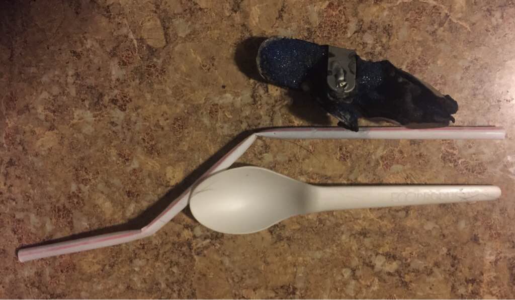
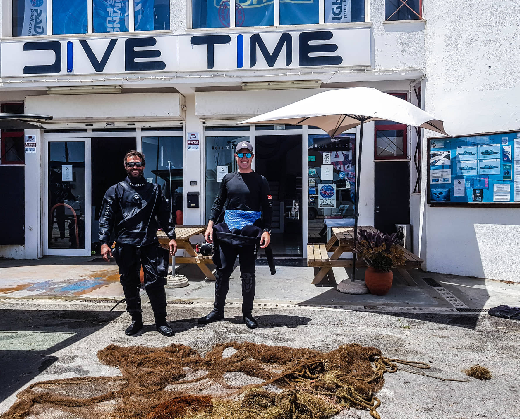
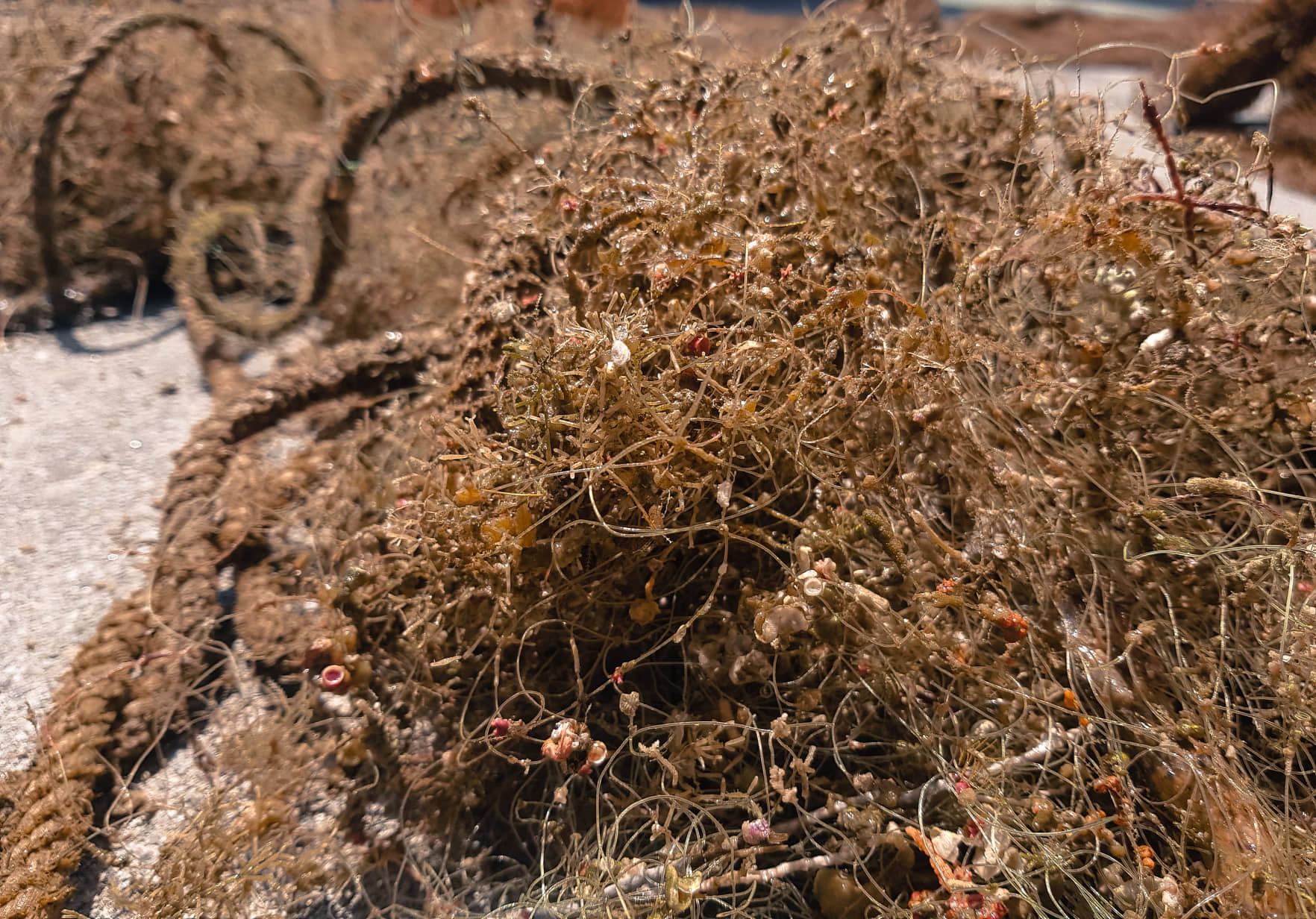
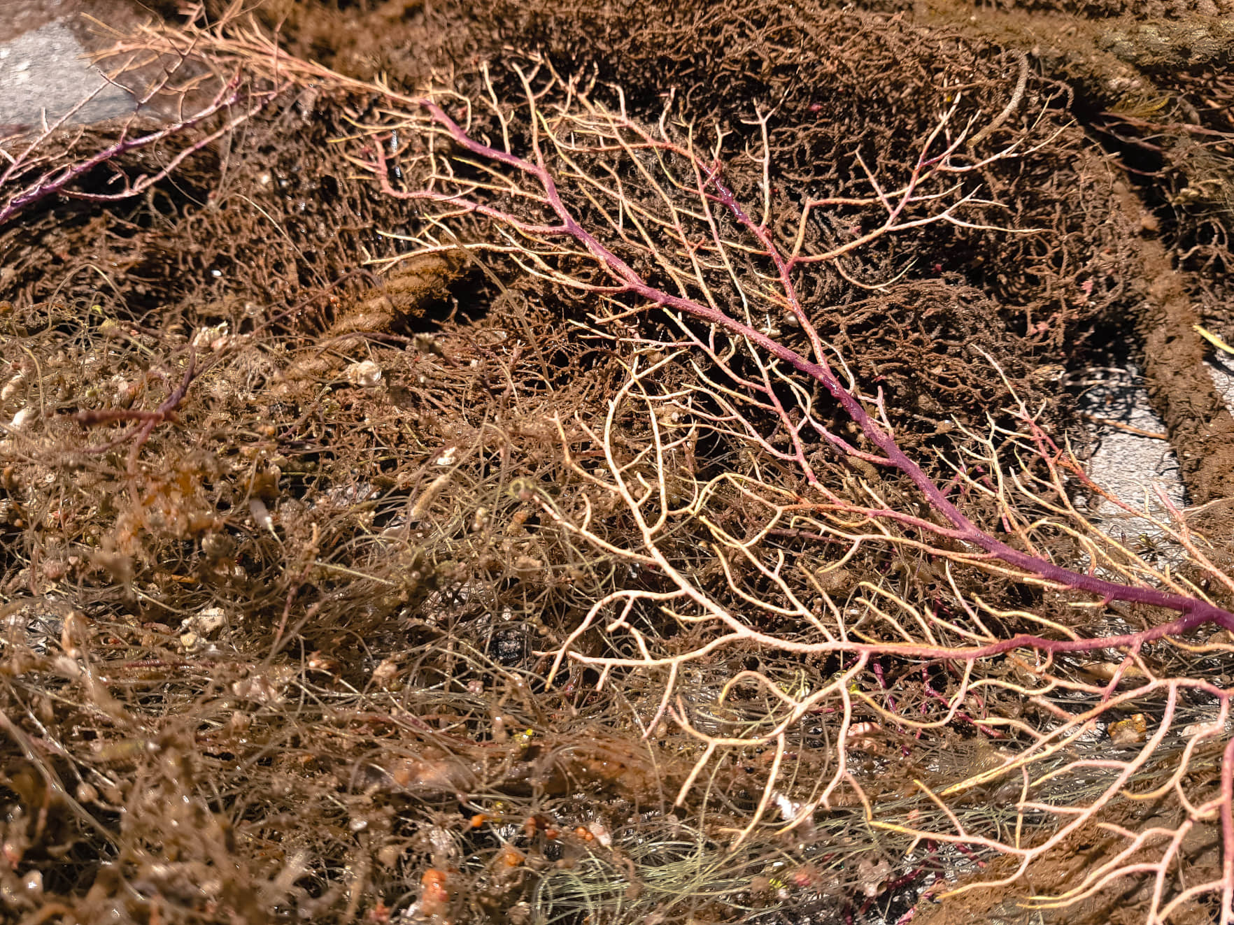
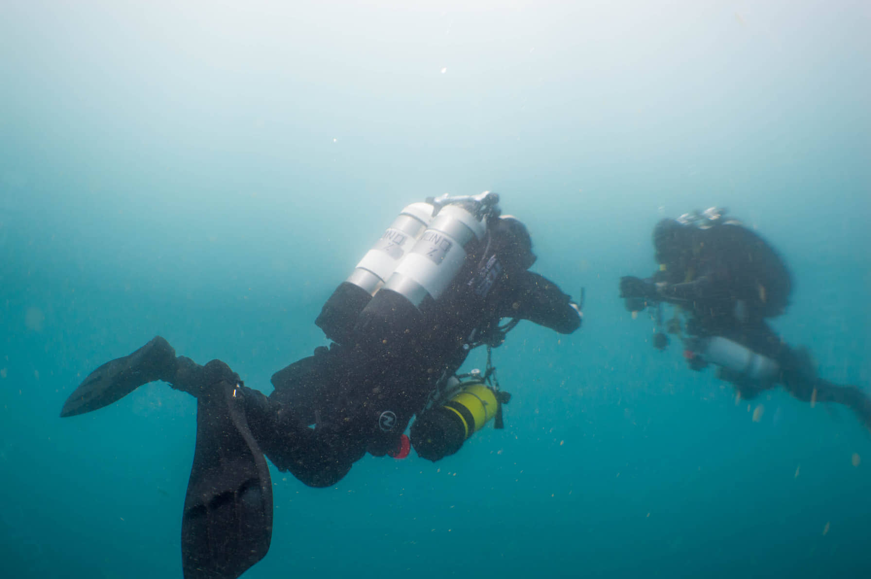
A new dive site for Scuba Leeds but a lovely one. Very sheltered spot, with parking very close to the water. A brilliant dive site. The debris we found here seemed to mostly be fishing activity, with some plastic, you had to really look to find the debris, but it was there. The biggest concern for debris here was fishing debris (we found wire entangled around kelp), and lots of small parts of rope. Lots of sea life was found, 2 Dogfish sightings and some very large Spider Crabs. We spotted Wrasse, Cod and Goby here. Would highly recommend this dive spot. We completed a beach clean up and found a lot of plastic on the beach so there is clearly an issue with debris here .
No events that we were aware of but interestingly the beach had a lot more debris then in the water. We found over 200 individual plastic fragments on the beach in 10 mins. I suspect a lot of the debris from the water is washed up onto the beach
Cloudy and slight winds
Scuba Leeds
Susannah Noble
2
1
0.50
74
7.00
1.00
measured
1
5948.00
4
Fishing line
Fishing rope
Plastic fragments
On
kilograms
I have debris data to report
Calm (glassy to rippled) for waves 0 – 0.1 meter high
2
m2
1
meters
kelp
1
2
United Kingdom
City
Tudweiliog
Map Help


Dive Location

If you know your survey site coordinates, enter them manually in decimal degrees using WGS84 Map Datum. Use the minus sign for latitudes south of the equator and longitudes west of the Prime Meridian to 180 degrees.

If you do not know your survey site coordinates, click the “Map Location” tab to use the map to zoom into your survey site and drop the pin on the map to fall within your survey dive site in the water (not on land or the beach). Ensure you zoom in as much as possible to ensure data accuracy.

Entangled Help


Use the vertical tabs below to record any entangled animals you found of each type.

ADS92 - Grand Anse Beach

1
1
0

12.02443310548, -61.761974394321

0
0
0
sand
0
1
0
0
0
Regular wash off and run off
Clothing fragment
Mild Surge
1
0
0
0
0
0
0
0
0
0
0
0
0
0
0
0
0
0
0
0
Kite Threading line
Eco Dive
Christine Finney
0
0
0
1
0
0
0
0
0
0
0
0
0
0
0
0
0
0
0
11
1
0
0
0
0
0
0
0
0
0
0
0
0
0
1.00
60
6.00
1.00
0
estimated
0
0
50.00
0
0
0
0
0
Plastic
0
On
kilograms
0
I have debris data to report
0
0
0
Smooth (wavelets) for waves 0.1 - 0.5 meter high
0
1
0
0
1
0
0
m2
0
0
meters
seagrass
1
0
0
0
0
0
0
0
0
0
0
0
0
0
0
0
0
0
0
0
0
0
0
0
0
0
0
0
Grenada
State\Province
Saint George’s
City
Saint George’s
Map Help


Dive Location

If you know your survey site coordinates, enter them manually in decimal degrees using WGS84 Map Datum. Use the minus sign for latitudes south of the equator and longitudes west of the Prime Meridian to 180 degrees.

If you do not know your survey site coordinates, click the “Map Location” tab to use the map to zoom into your survey site and drop the pin on the map to fall within your survey dive site in the water (not on land or the beach). Ensure you zoom in as much as possible to ensure data accuracy.

Entangled Help


Use the vertical tabs below to record any entangled animals you found of each type.

Virgin Island Point

1
2

9.3439, 123.424

coral
112
sunny
Keep Diving
Gost and Dao Heng Chen
10
1
3.20
52
24.00
2.80
9
measured
1
5000.00
some boat man fishing at the area
On
kilograms
Our Survey Site was free of debris
1
Calm (glassy to rippled) for waves 0 – 0.1 meter high
1
m2
meters
coral reef
2
Philippines
State\Province
Bohol
City
Panglao
Map Help


Dive Location

If you know your survey site coordinates, enter them manually in decimal degrees using WGS84 Map Datum. Use the minus sign for latitudes south of the equator and longitudes west of the Prime Meridian to 180 degrees.

If you do not know your survey site coordinates, click the “Map Location” tab to use the map to zoom into your survey site and drop the pin on the map to fall within your survey dive site in the water (not on land or the beach). Ensure you zoom in as much as possible to ensure data accuracy.

Entangled Help


Use the vertical tabs below to record any entangled animals you found of each type.

North Crescent

0
0
0

33.54612356527, -117.80325690272

0
0
0
sand
0
0
0
0
0
Surprising clean for all the poor weather the week prior.
No
Finger brace
Rainy
1
0
0
0
0
0
0
0
0
0
0
0
0
0
0
0
0
0
0
0
Finger Brace
Bubble of Divers
Khrystyna
0
0
0
1
0
0
0
0
0
0
1
0
0
0
0
0
0
0
0
8
0
0
0
0
0
0
0
0
0
0
0
0
0
0
0.10
60
35.00
15.00
0
estimated
0
0
2000.00
0
0
0
0
0
Plastic utensils
Straw
0
On
kilograms
0
I have debris data to report
0
0
0
Slight for waves 0.5 -1.25 meter high
0
0
0
0
0
0
0
ft2
0
0
feet
rocky reef
0
0
0
0
0
0
0
0
0
0
0
0
0
0
0
0
0
0
0
0
0
0
0
0
0
0
0
0
United States
State\Province
CA
City
Laguna Beach
Map Help


Dive Location

If you know your survey site coordinates, enter them manually in decimal degrees using WGS84 Map Datum. Use the minus sign for latitudes south of the equator and longitudes west of the Prime Meridian to 180 degrees.

If you do not know your survey site coordinates, click the “Map Location” tab to use the map to zoom into your survey site and drop the pin on the map to fall within your survey dive site in the water (not on land or the beach). Ensure you zoom in as much as possible to ensure data accuracy.

Entangled Help


Use the vertical tabs below to record any entangled animals you found of each type.

Shallow Turbo

1
0
0
0

-8.349002, 116.043572

0
2
0
sand
0
2
0
3
0
Sandal/flip flop
Swell, dry, strong current
1
2
Nasi bunkus wrapper
Sunglasses
Trawangan Dive
Sian
0
0
0
0
0
0
0
0
0
0
0
0
0
0
0
0
0
0
0
3
0
0
1
0
0
0
2
0
0
0
0
0
0
0
0
0
5.00
55
3.00
2.00
0
estimated
0
0
0
0
229.15
0
0
0
0
0
Straw
Cigarette butt
Nasi bungkus paper
1
On
kilograms
0
I have debris data to report
2
0
0
Slight for waves 0.5 -1.25 meter high
0
0
1
Plastic fragment
Crab
Released Unharmed
1
1
0
0
0
m2
0
0
meters
coral reef
0
0
0
0
0
1
0
0
0
0
0
0
0
0
0
0
0
0
0
0
0
0
7
0
0
0
0
1
0
Indonesia
State\Province
Lombok
City
Gili Trawangan
Map Help


Dive Location

If you know your survey site coordinates, enter them manually in decimal degrees using WGS84 Map Datum. Use the minus sign for latitudes south of the equator and longitudes west of the Prime Meridian to 180 degrees.

If you do not know your survey site coordinates, click the “Map Location” tab to use the map to zoom into your survey site and drop the pin on the map to fall within your survey dive site in the water (not on land or the beach). Ensure you zoom in as much as possible to ensure data accuracy.

Entangled Help


Use the vertical tabs below to record any entangled animals you found of each type.

Wilhelm Krag

4
other
1

37.052463175552, -8.7436280418084

Trawling nets that have been snagged and caught on the wreck over many years
Dive Time Portugal
Nuno Mendes
3
28.00
45
30.00
28.00
measured
50.00
This wreck has an amazing ecosystem of marine life and soft corals, unfortunately trawling nets have been snagged and caught on the wreck and has become an entanglement hazard for the variety of life on this wreck.
On
kilograms
I have debris data to report
Slight for waves 0.5 -1.25 meter high m2
meters
other
Portugal
State\Province
Faro
City
Lagos
Map Help


Dive Location

If you know your survey site coordinates, enter them manually in decimal degrees using WGS84 Map Datum. Use the minus sign for latitudes south of the equator and longitudes west of the Prime Meridian to 180 degrees.

If you do not know your survey site coordinates, click the “Map Location” tab to use the map to zoom into your survey site and drop the pin on the map to fall within your survey dive site in the water (not on land or the beach). Ensure you zoom in as much as possible to ensure data accuracy.

Entangled Help


Use the vertical tabs below to record any entangled animals you found of each type.

Ecosystem Other
Wreck
Dominant Substrate Other
Wreck and sand

ADS364 - Toucari Bay

2
0
0
0

15.608358, -61.46621

0
1
0
sand
0
8
0
0
0
Rebuilding the jetty and people
Flooring
Cloudy
SALT
Kayla
0
0
0
7
0
0
0
0
0
0
0
0
0
0
0
0
0
0
3
5
0
0
0
0
1
0
0
0
0
0
0
0
0
0
0
0
10.00
44
21.00
5.00
1
estimated
0
0
0
1
14929.00
0
0
0
0
0
Boat parts
Plastic cups
0
On
pounds
0
I have debris data to report
2
0
0
Calm (glassy to rippled) for waves 0 – 0.1 meter high
0
0
0
Burlap sac
Dead
Juvenile Fisheries
Crab
Dead
2
2
Burlap sac
0
0
1
3
ft2
0
1
feet
coral reef
0
0
0
0
0
0
0
0
0
1
0
0
0
0
0
1
1
0
0
0
0
0
0
0
0
0
0
0
0
Dominica
City
Toucari
Map Help


Dive Location

If you know your survey site coordinates, enter them manually in decimal degrees using WGS84 Map Datum. Use the minus sign for latitudes south of the equator and longitudes west of the Prime Meridian to 180 degrees.

If you do not know your survey site coordinates, click the “Map Location” tab to use the map to zoom into your survey site and drop the pin on the map to fall within your survey dive site in the water (not on land or the beach). Ensure you zoom in as much as possible to ensure data accuracy.

Entangled Help


Use the vertical tabs below to record any entangled animals you found of each type.

Octopus Rock

1

12.171103439769, 109.31296048494

rock
Probably lost by a fishing boat
Net on a metal structure, quite unusual at sea here...
Very hot and sunny, some thunderstorm in afternoon/evening
Sailing Club Divers
Nicolas Martin
3
30.00
22
8.00
5.00
estimated
180.00
On
kilograms
I have debris data to report
Calm (glassy to rippled) for waves 0 – 0.1 meter high m2
meters
coral reef
Vietnam
State\Province
Khanh Hoa
City
Nha Trang
Map Help


Dive Location

If you know your survey site coordinates, enter them manually in decimal degrees using WGS84 Map Datum. Use the minus sign for latitudes south of the equator and longitudes west of the Prime Meridian to 180 degrees.

If you do not know your survey site coordinates, click the “Map Location” tab to use the map to zoom into your survey site and drop the pin on the map to fall within your survey dive site in the water (not on land or the beach). Ensure you zoom in as much as possible to ensure data accuracy.

Entangled Help


Use the vertical tabs below to record any entangled animals you found of each type.

ADS367 - PADI Beach

2
4

12.169492, 109.307799

coral
14
Very hot and sunny, with thunderstorm in afternoon/evening
Sailing Club Divers
Nicolas Martin
4
1
3
7.00
63
15.00
4.00
49
estimated
450.00
1
On
kilograms
I have debris data to report
1
Calm (glassy to rippled) for waves 0 – 0.1 meter high
3
m2
meters
coral reef
1
1
Vietnam
State\Province
Khanh Hoa
City
Nha Trang
Map Help


Dive Location

If you know your survey site coordinates, enter them manually in decimal degrees using WGS84 Map Datum. Use the minus sign for latitudes south of the equator and longitudes west of the Prime Meridian to 180 degrees.

If you do not know your survey site coordinates, click the “Map Location” tab to use the map to zoom into your survey site and drop the pin on the map to fall within your survey dive site in the water (not on land or the beach). Ensure you zoom in as much as possible to ensure data accuracy.

Entangled Help


Use the vertical tabs below to record any entangled animals you found of each type.

Alagadi Beach 3

0
0
0

35.337672843245, 33.496905588074

0
0
0
sand
0
0
0
0
0
Locals continually clearing the beach too
Strong winds from the N/E
This area collect rubbish as it’s a natural cove
Fishing flight
Blowy and easterly current
0
0
0
0
0
0
0
0
0
0
0
0
0
0
0
0
0
0
0
0
North Cyprus British Scuba
Jewells Hobley
0
0
0
0
0
0
0
0
0
0
0
0
0
0
0
0
0
0
24
5
0
0
2
0
0
0
0
0
0
0
0
0
0
0
3.50
55
6.00
1.00
0
estimated
0
7
25.00
0
0
0
0
0
Bottles
Cans
0
On
kilograms
0
I have debris data to report
5
0
0
Smooth (wavelets) for waves 0.1 - 0.5 meter high
8
0
7
1
0
0
0
m2
0
2
meters
rocky reef
0
0
0
0
2
0
0
1
0
2
0
4
5
0
0
0
7
0
0
0
0
19
0
0
0
2
0
2
Cyprus
State\Province
Esentepe
City
Kyrenia
Map Help


Dive Location

If you know your survey site coordinates, enter them manually in decimal degrees using WGS84 Map Datum. Use the minus sign for latitudes south of the equator and longitudes west of the Prime Meridian to 180 degrees.

If you do not know your survey site coordinates, click the “Map Location” tab to use the map to zoom into your survey site and drop the pin on the map to fall within your survey dive site in the water (not on land or the beach). Ensure you zoom in as much as possible to ensure data accuracy.

Entangled Help


Use the vertical tabs below to record any entangled animals you found of each type.

Subscribe to