Menu

ADS474 - Yellow Submarine

coral
3

12.160188814231, -68.282122809089

1
Tag (plastic)
Dive Friends Bonaire
Luiz Cesar Savi
1
1
2
2
0.50
55
23.00
1.00
estimated
3
3047.28
fishing line
On
kilograms
I have debris data to report
Calm (glassy to rippled) for waves 0 – 0.1 meter high m2
meters
coral reef
Netherlands Antilles
City
Kralendijk
Map Help


Dive Location

If you know your survey site coordinates, enter them manually in decimal degrees using WGS84 Map Datum. Use the minus sign for latitudes south of the equator and longitudes west of the Prime Meridian to 180 degrees.

If you do not know your survey site coordinates, click the “Map Location” tab to use the map to zoom into your survey site and drop the pin on the map to fall within your survey dive site in the water (not on land or the beach). Ensure you zoom in as much as possible to ensure data accuracy.

Entangled Help


Use the vertical tabs below to record any entangled animals you found of each type.

ADS409 - St. George's Bay

0
4
0
0

35.926326, 14.489571

0
1
0
sand
0
0
0
0
0
Green grass carpet
Cresta Dive Centre
Nicholas Martens
0
1
0
0
0
0
0
0
0
0
0
0
0
0
0
0
1
0
0
5
0
0
0
0
0
0
3
0
0
6
0
0
0
0
0
0
25.00
45
6.00
5.00
0
estimated
0
0
0
0
2126.76
0
4
0
5
0
Cans
Bottles
Tyres
0
On
kilograms
0
I have debris data to report
16
0
0
Calm (glassy to rippled) for waves 0 – 0.1 meter high
2
0
0
0
0
0
0
m2
0
4
meters
seagrass
2
0
1
0
0
0
0
0
0
0
0
0
0
0
0
0
0
4
0
0
0
0
0
0
0
0
0
0
0
Malta
City
St. Julian's
Map Help


Dive Location

If you know your survey site coordinates, enter them manually in decimal degrees using WGS84 Map Datum. Use the minus sign for latitudes south of the equator and longitudes west of the Prime Meridian to 180 degrees.

If you do not know your survey site coordinates, click the “Map Location” tab to use the map to zoom into your survey site and drop the pin on the map to fall within your survey dive site in the water (not on land or the beach). Ensure you zoom in as much as possible to ensure data accuracy.

Entangled Help


Use the vertical tabs below to record any entangled animals you found of each type.

ADS211 - Anse Chastanet Reef

3
coral
10
2

13.863930711873, -61.078630836556

Good.
Anse Chastanet Scuba St Lucia
Georgiana Merlusca
1
3
1.00
45
18.00
5.00
measured
30.00
Fishing line
On
kilograms
I have debris data to report
Calm (glassy to rippled) for waves 0 – 0.1 meter high
1
m2
meters
coral reef
Saint Lucia
City
Soufriere
Map Help


Dive Location

If you know your survey site coordinates, enter them manually in decimal degrees using WGS84 Map Datum. Use the minus sign for latitudes south of the equator and longitudes west of the Prime Meridian to 180 degrees.

If you do not know your survey site coordinates, click the “Map Location” tab to use the map to zoom into your survey site and drop the pin on the map to fall within your survey dive site in the water (not on land or the beach). Ensure you zoom in as much as possible to ensure data accuracy.

Entangled Help


Use the vertical tabs below to record any entangled animals you found of each type.

ADS382 - Dibba Rock

0
0
1

25.603427, 56.351174

0
0
0
sand
0
0
0
0
0
No
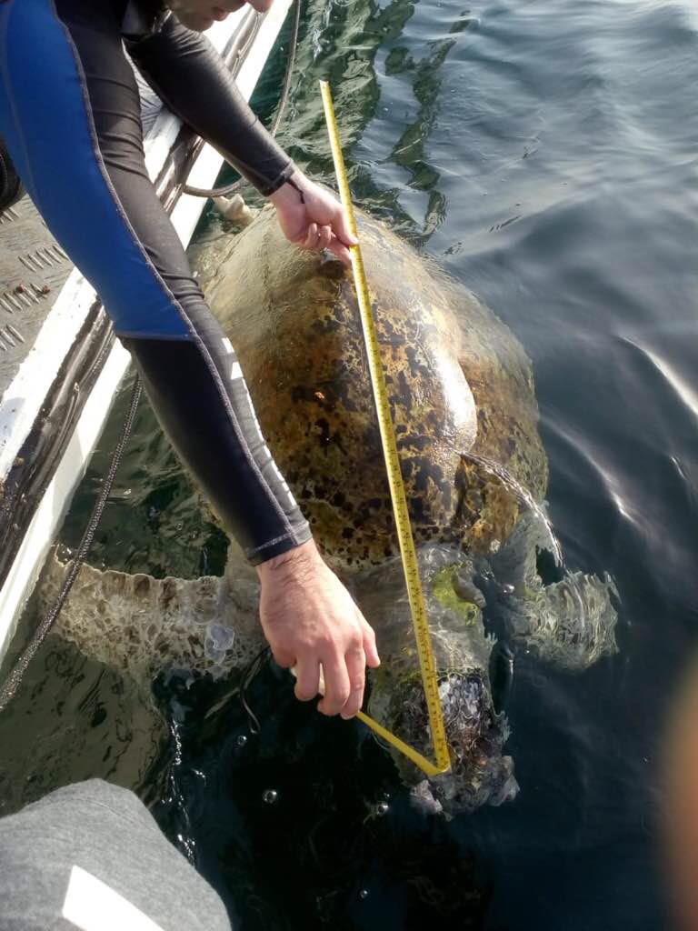
Hawksbill Turtle
Dead turtle
calm
0
0
0
0
0
0
0
0
0
0
0
0
0
0
0
0
0
0
0
Freestyle Divers
Mathieu
0
0
0
0
0
0
0
0
0
0
0
0
0
0
0
0
0
0
0
4
0
0
0
0
0
0
0
0
0
0
0
0
0
0
18.00
30
15.00
2.00
0
estimated
0
0
2261.02
0
0
0
0
0
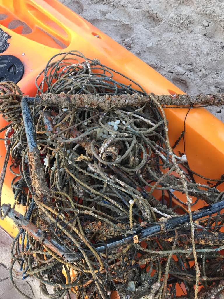
Ghost fishing net
Metal bars
0
On
kilograms
0
I have debris data to report
0
0
0
Smooth (wavelets) for waves 0.1 - 0.5 meter high
0
0
0
0
0
0
0
m2
0
0
meters
coral reef
1
0
0
6
0
0
0
0
0
0
0
0
0
0
0
0
0
0
0
0
0
Fish net
Dead
Hawksbill Turtle
0
0
0
0
0
0
0
0
United Arab Emirates
State\Province
Fujairah
City
Dibba
Map Help


Dive Location

If you know your survey site coordinates, enter them manually in decimal degrees using WGS84 Map Datum. Use the minus sign for latitudes south of the equator and longitudes west of the Prime Meridian to 180 degrees.

If you do not know your survey site coordinates, click the “Map Location” tab to use the map to zoom into your survey site and drop the pin on the map to fall within your survey dive site in the water (not on land or the beach). Ensure you zoom in as much as possible to ensure data accuracy.
Entangled Help


Use the vertical tabs below to record any entangled animals you found of each type.

Rasfushi House Reef

0
0
0

4.1992559389299, 73.413728571269

0
0
0
sand
0
0
0
0
0
Calm and medium to strong current
0
0
0
0
0
0
0
0
0
0
0
0
0
0
0
0
0
0
0
0
Best Dives Maldives
Ismail Samooh
0
0
0
0
0
0
0
0
0
0
0
0
0
0
0
0
0
0
0
3
0
0
0
0
0
0
0
0
0
0
0
0
0
0
7.00
47
20.00
5.00
0
estimated
0
0
50.00
0
0
0
0
0
0
On
kilograms
0
I have debris data to report
1
0
0
Calm (glassy to rippled) for waves 0 – 0.1 meter high
0
0
0
0
0
0
0
m2
0
0
meters
coral reef
0
0
0
0
0
0
0
0
0
0
0
0
0
0
54
0
0
0
0
0
0
0
0
0
0
0
0
0
Maldives
State\Province
North Male atoll
City
Giraavaru
Map Help


Dive Location

If you know your survey site coordinates, enter them manually in decimal degrees using WGS84 Map Datum. Use the minus sign for latitudes south of the equator and longitudes west of the Prime Meridian to 180 degrees.

If you do not know your survey site coordinates, click the “Map Location” tab to use the map to zoom into your survey site and drop the pin on the map to fall within your survey dive site in the water (not on land or the beach). Ensure you zoom in as much as possible to ensure data accuracy.
Entangled Help


Use the vertical tabs below to record any entangled animals you found of each type.

Dibba Rock

0
1
0
0

25.602906, 56.351124

0
0
0
sand
0
12
0
0
0
Divers Down UAE
Talih
0
0
0
1
0
0
0
0
0
0
0
0
0
0
0
0
0
1
0
4
0
0
0
0
5
0
0
0
0
0
0
0
0
0
0
0
2.00
50
16.00
2.00
0
estimated
0
0
0
0
1000.00
0
0
0
0
0
0
On
kilograms
0
I have debris data to report
0
0
0
Calm (glassy to rippled) for waves 0 – 0.1 meter high
0
0
0
0
0
0
0
m2
0
0
meters
rocky reef
0
0
0
0
0
0
0
0
0
0
0
0
0
0
0
0
0
0
0
0
0
0
0
0
0
0
0
0
0
United Arab Emirates
City
Fujairah
Map Help


Dive Location

If you know your survey site coordinates, enter them manually in decimal degrees using WGS84 Map Datum. Use the minus sign for latitudes south of the equator and longitudes west of the Prime Meridian to 180 degrees.

If you do not know your survey site coordinates, click the “Map Location” tab to use the map to zoom into your survey site and drop the pin on the map to fall within your survey dive site in the water (not on land or the beach). Ensure you zoom in as much as possible to ensure data accuracy.

Entangled Help


Use the vertical tabs below to record any entangled animals you found of each type.

ADS368 - South Bay

1
4

12.165496, 109.30875

sand
1
4
Mostly sunny, high temperatures, thunderstorm since yesterday afternoon
Sailing Club Divers
Vu Lam
1
1
4
1
3
1.00
45
16.00
4.00
estimated
600.00
1
On
kilograms
I have debris data to report
Slight for waves 0.5 -1.25 meter high m2
meters
coral reef
Vietnam
State\Province
Khanh Hoa
City
Nha Trang
Map Help


Dive Location

If you know your survey site coordinates, enter them manually in decimal degrees using WGS84 Map Datum. Use the minus sign for latitudes south of the equator and longitudes west of the Prime Meridian to 180 degrees.

If you do not know your survey site coordinates, click the “Map Location” tab to use the map to zoom into your survey site and drop the pin on the map to fall within your survey dive site in the water (not on land or the beach). Ensure you zoom in as much as possible to ensure data accuracy.

Entangled Help


Use the vertical tabs below to record any entangled animals you found of each type.

ADS367 - PADI Beach

3
4

12.169492, 109.307799

coral
19
3
3
Sunny, very hot and thunderstorm since yesterday afternoon
Sailing Club Divers
Pieter Van Wyk
2
1
4
4
6.00
50
6.00
2.00
4
estimated
900.00
On
kilograms
I have debris data to report
Calm (glassy to rippled) for waves 0 – 0.1 meter high
4
1
2
m2
meters
coral reef
1
3
Vietnam
State\Province
Khanh Hoa
City
Nha Trang
Map Help


Dive Location

If you know your survey site coordinates, enter them manually in decimal degrees using WGS84 Map Datum. Use the minus sign for latitudes south of the equator and longitudes west of the Prime Meridian to 180 degrees.

If you do not know your survey site coordinates, click the “Map Location” tab to use the map to zoom into your survey site and drop the pin on the map to fall within your survey dive site in the water (not on land or the beach). Ensure you zoom in as much as possible to ensure data accuracy.

Entangled Help


Use the vertical tabs below to record any entangled animals you found of each type.

ADS513 - Horseshoe

26.504645856914, 127.84525929079

coral
20
Most of the debris founded is trash from fishing or tourism industry.
Moderate to flat sea, no swell or current.
Piranha Divers Okinawa
Jan C. Weirauch
3
1
2
4
5.00
70
22.00
5.00
estimated
102
414.22
Fishing equipment
plastic debris in general
bottles
On
kilograms
I have debris data to report
Smooth (wavelets) for waves 0.1 - 0.5 meter high m2
meters
rocky reef
5
3
Japan
State\Province
Okinawa Prefecture
City
Onna Village
Map Help


Dive Location

If you know your survey site coordinates, enter them manually in decimal degrees using WGS84 Map Datum. Use the minus sign for latitudes south of the equator and longitudes west of the Prime Meridian to 180 degrees.

If you do not know your survey site coordinates, click the “Map Location” tab to use the map to zoom into your survey site and drop the pin on the map to fall within your survey dive site in the water (not on land or the beach). Ensure you zoom in as much as possible to ensure data accuracy.

Entangled Help


Use the vertical tabs below to record any entangled animals you found of each type.

ADS502 - South Steps Sunabe Sea Wall

73
105
29

26.321735, 127.748128

22
2
1
coral
5
2
73
2
none
Amazing group of divers dedicated to being part of the solution. We appreciate each and everyone of them.
cell phone
Stormy with choppy seas
Mermaid Island Diving
April Dahn
2
25
23
2
1
1
1
7
72
3
4
9
2
2
1
28
6
120.00
65
55.00
10.00
3
measured
118
5000.00
2
1
2
5
plastics
fishing lines
lures
1
On
pounds
I have debris data to report
5
5
Calm (glassy to rippled) for waves 0 – 0.1 meter high
1
1
ft2
3
1
feet
coral reef
31
11
2
1
3
7
1
56
4
6
99
3
3
11
1
Japan
State\Province
AP
City
FPO
Map Help


Dive Location

If you know your survey site coordinates, enter them manually in decimal degrees using WGS84 Map Datum. Use the minus sign for latitudes south of the equator and longitudes west of the Prime Meridian to 180 degrees.

If you do not know your survey site coordinates, click the “Map Location” tab to use the map to zoom into your survey site and drop the pin on the map to fall within your survey dive site in the water (not on land or the beach). Ensure you zoom in as much as possible to ensure data accuracy.

Entangled Help


Use the vertical tabs below to record any entangled animals you found of each type.

Subscribe to