Menu

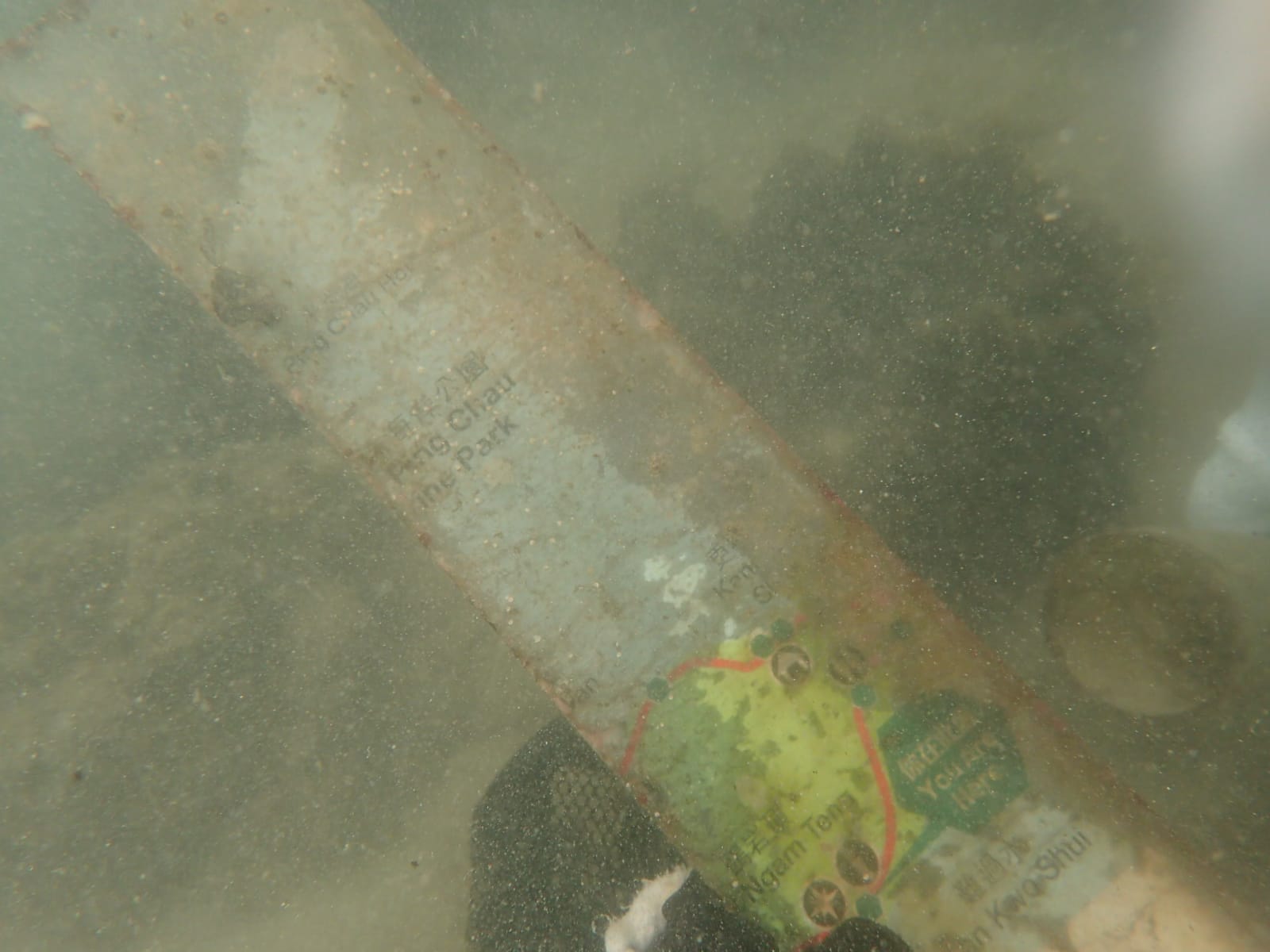
ADS323 - Tung Ping Chau

35
88
1
2

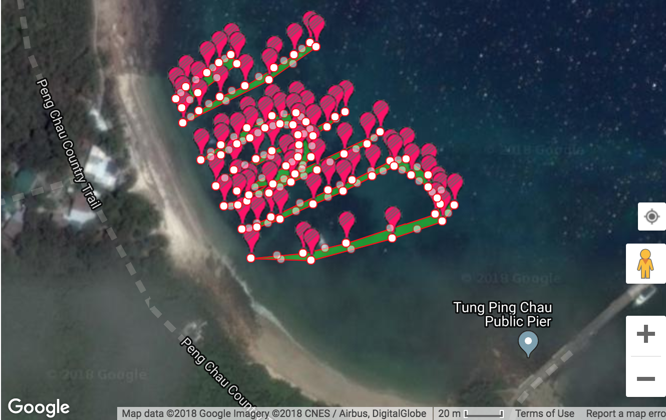
22.545909, 114.431823

1
sand
7
3
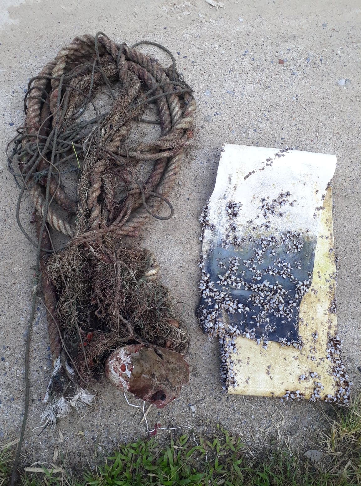
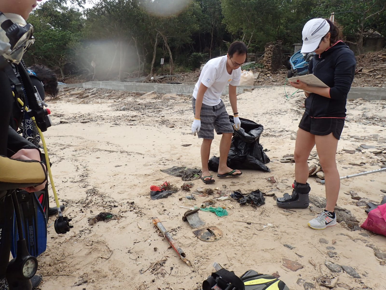
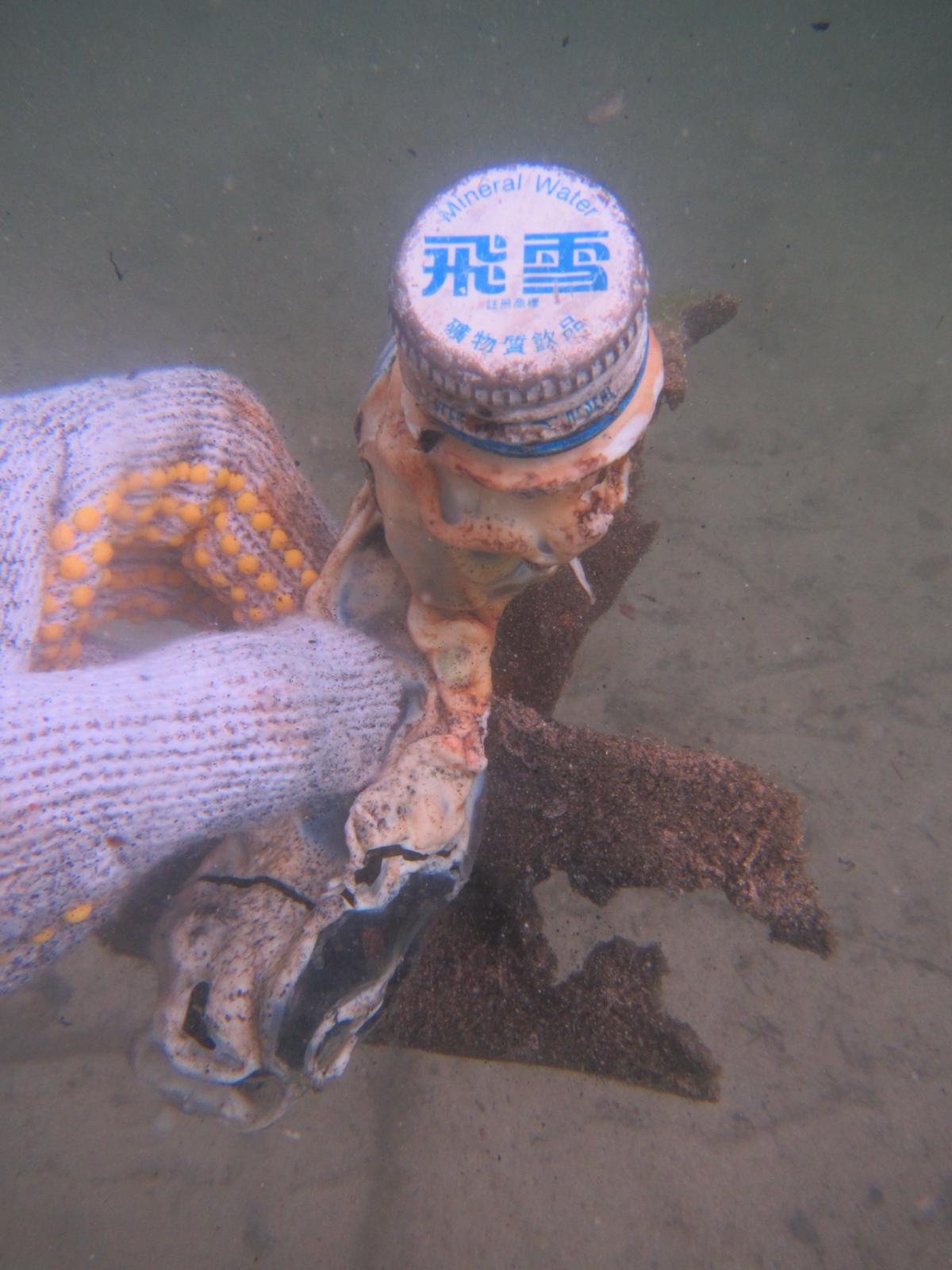
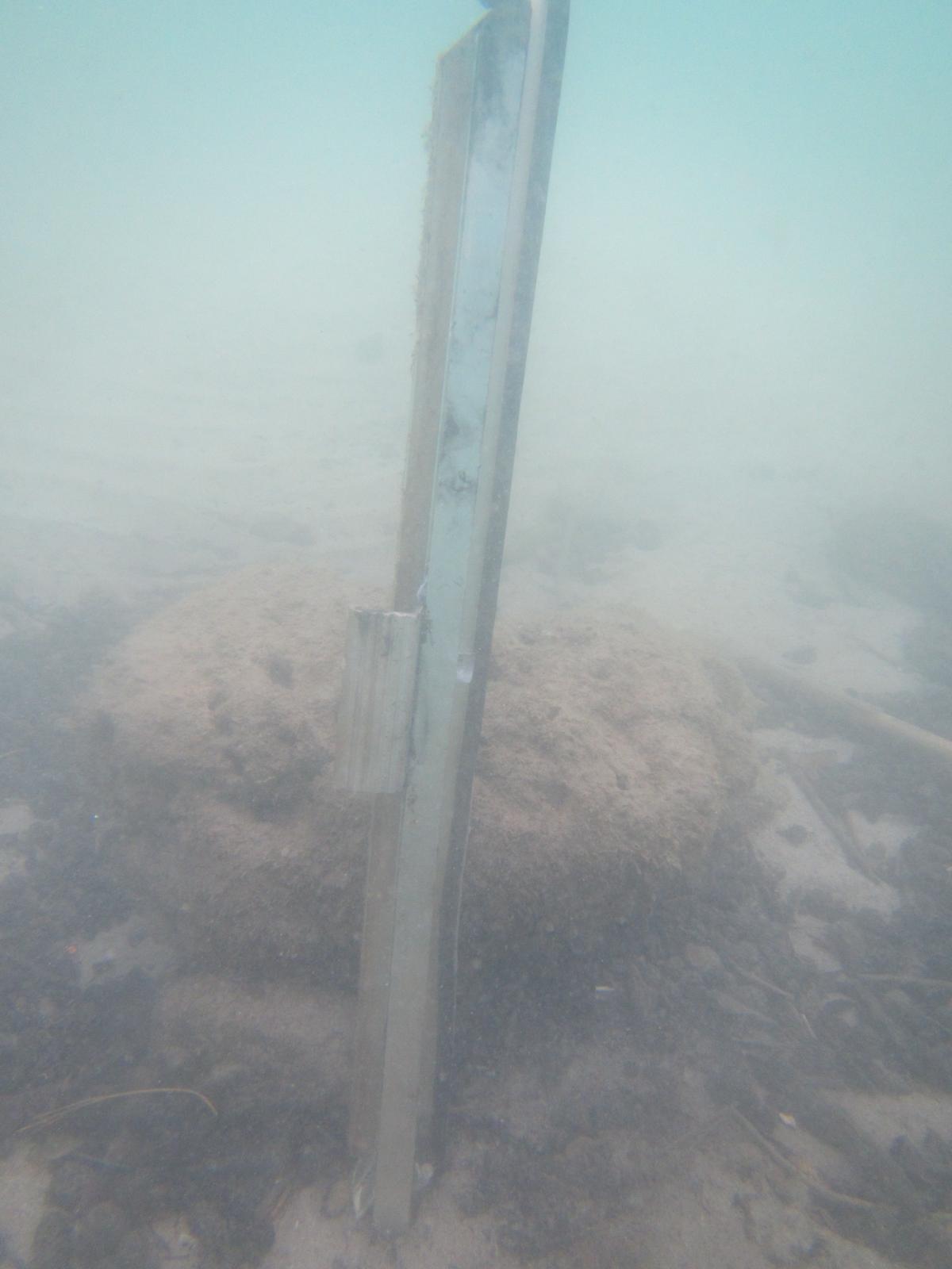
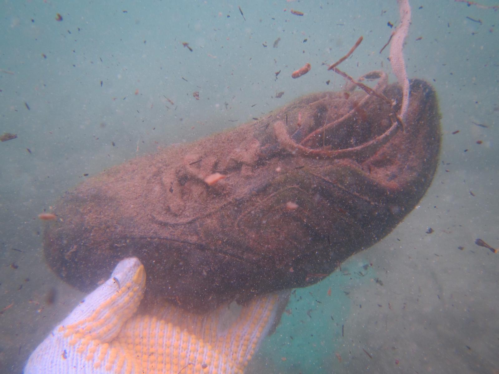
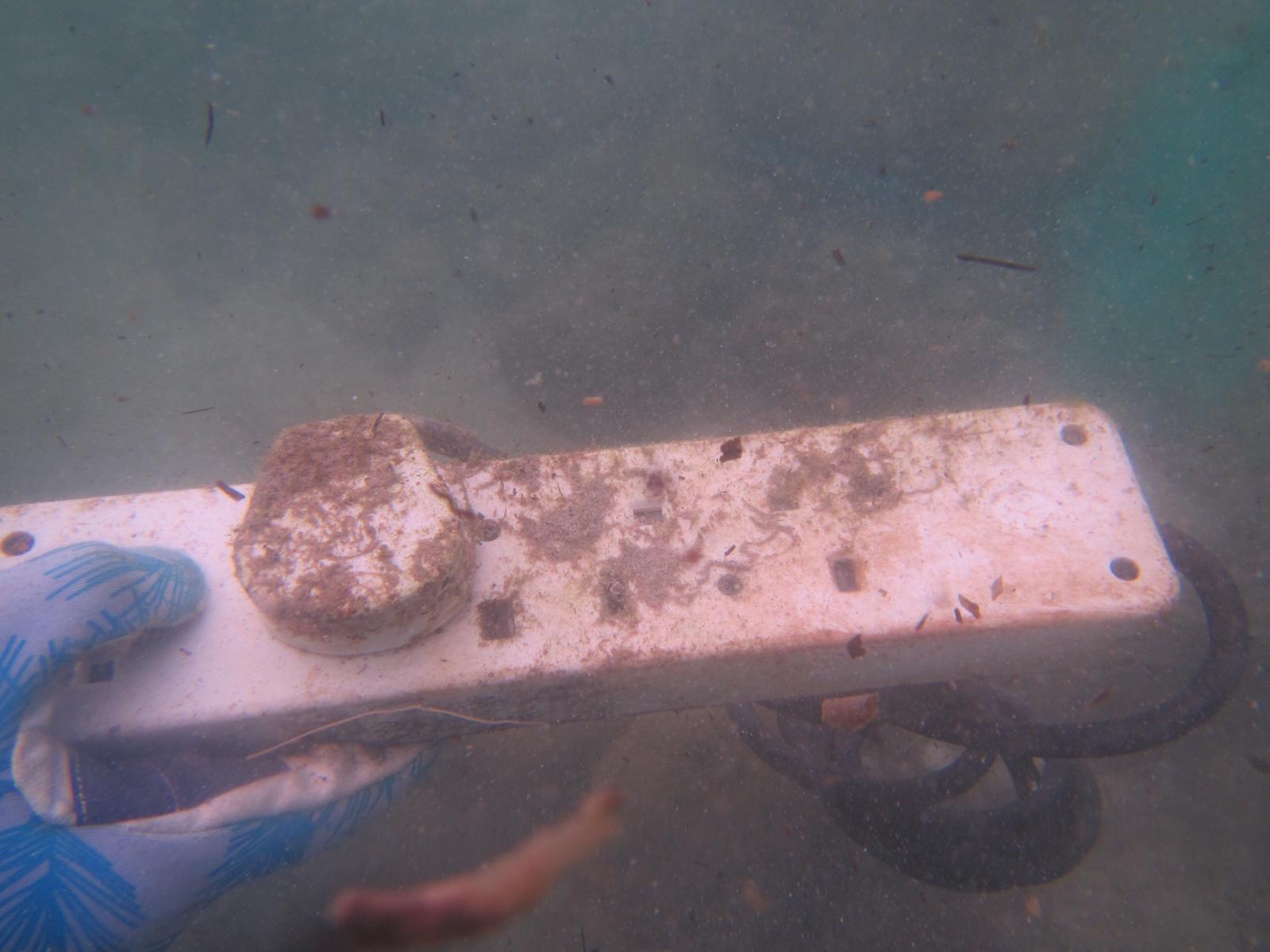
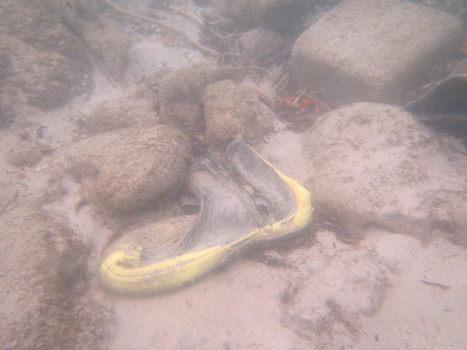
window frame, belt buckle, extension cord, AFCD sign, mahjong tiles, neon light cover
Sunny and cloudy periods
2
3
2
4
1
1
1
2
Bubble wrap
Tarp bag
Mahjong tiles
Fiberglass fragment
Metal belt buckle
Plastic cover of a neon light
Sponge
Plastic plates (one if an AFCD sign)
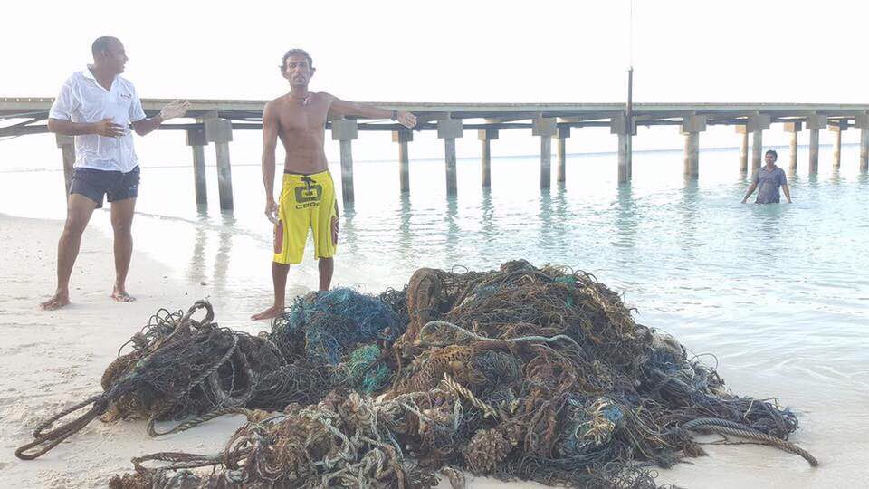
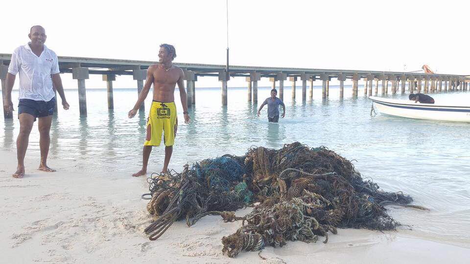
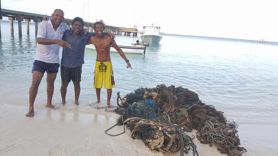
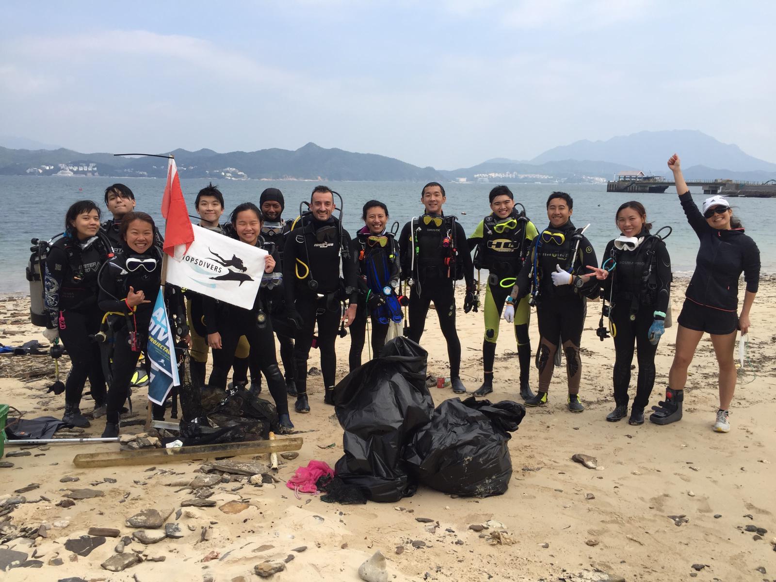
Tursiopsdivers
1
13
6
1
12
4
1
12
2
1
2
9
1
1
34.37
47
6.10
1.20
2
measured
929.32
2
1
Plastic fragment
Household items
On
kilograms
I have debris data to report
9
Smooth (wavelets) for waves 0.1 - 0.5 meter high
1
2
14
6
m2
2
meters
coral reef
6
2
1
1
20
5
1
1
1
Hong Kong S.A.R., China
Map Help


Dive Location

If you know your survey site coordinates, enter them manually in decimal degrees using WGS84 Map Datum. Use the minus sign for latitudes south of the equator and longitudes west of the Prime Meridian to 180 degrees.

If you do not know your survey site coordinates, click the “Map Location” tab to use the map to zoom into your survey site and drop the pin on the map to fall within your survey dive site in the water (not on land or the beach). Ensure you zoom in as much as possible to ensure data accuracy.

Entangled Help


Use the vertical tabs below to record any entangled animals you found of each type.

ADS415 - Adotta La Zotta

35
415
4
0

38.199626814118, 13.275791918859

2
0
0
sand
3
13
0
1
0
Fast Food Kiosks along the bellevue are the origin of such single-use plastic debris.
Calm and Sunny25
MARE NOSTRUM DIVING PALERMO
Tatiana Geloso
0
0
0
57
0
0
0
0
0
0
3
0
0
0
2
0
0
8
0
6
0
0
111
0
0
0
2
1
0
5
0
0
0
0
0
0
9.00
25
3.50
1.50
0
estimated
0
0
0
0
98.00
0
0
0
0
0
0
On
kilograms
0
I have debris data to report
10
0
0
Calm (glassy to rippled) for waves 0 – 0.1 meter high
0
4
0
26
0
0
m2
0
0
meters
seagrass
2
0
0
0
0
0
0
0
0
0
0
0
0
2
0
0
0
1
0
0
1
0
0
0
1
0
0
0
0
Italy
State\Province
PALERMO
City
PALERMO (Sferracavallo)
Map Help


Dive Location

If you know your survey site coordinates, enter them manually in decimal degrees using WGS84 Map Datum. Use the minus sign for latitudes south of the equator and longitudes west of the Prime Meridian to 180 degrees.

If you do not know your survey site coordinates, click the “Map Location” tab to use the map to zoom into your survey site and drop the pin on the map to fall within your survey dive site in the water (not on land or the beach). Ensure you zoom in as much as possible to ensure data accuracy.

Entangled Help


Use the vertical tabs below to record any entangled animals you found of each type.

ADS461 - Lighthouse Reef

0
0
0
0

9.758, 99.953229

0
0
0
sand
0
0
0
0
0
No
Mild
Reefers Dive Resort
Ryan
0
0
0
0
0
0
0
0
0
0
0
0
0
0
0
0
0
0
0
4
0
0
0
0
0
0
0
0
0
0
0
0
0
0
0
0
10.00
50
12.00
5.00
0
estimated
0
0
0
0
19387.50
0
0
0
0
0
Fishing nets
Rope
Fishing line
0
On
kilograms
0
I have debris data to report
0
0
0
Smooth (wavelets) for waves 0.1 - 0.5 meter high
0
0
0
0
0
0
0
m2
5
0
meters
coral reef
0
0
0
0
0
0
0
0
0
0
0
0
0
0
0
0
0
0
0
0
0
0
0
0
0
0
0
0
0
Thailand
State\Province
Surat Thani
City
Koh Phangan
Map Help


Dive Location

If you know your survey site coordinates, enter them manually in decimal degrees using WGS84 Map Datum. Use the minus sign for latitudes south of the equator and longitudes west of the Prime Meridian to 180 degrees.

If you do not know your survey site coordinates, click the “Map Location” tab to use the map to zoom into your survey site and drop the pin on the map to fall within your survey dive site in the water (not on land or the beach). Ensure you zoom in as much as possible to ensure data accuracy.

Entangled Help


Use the vertical tabs below to record any entangled animals you found of each type.

FKCC Lagoon

0
0
0

24.584172, -81.745232

0
0
0
silt
0
0
0
0
0
Lots of debris on shore and in mangroves. Collected separately. Not included in this report.
Debris from hurricane Irma, construction site nearby, student dorms nearby
Spoon
Moderately windy
0
0
0
0
0
0
0
0
0
0
0
0
0
0
0
0
0
0
0
0
Fkcc
Lucja Rice
0
0
0
0
0
0
0
0
0
0
0
0
0
0
0
0
0
0
0
1
0
0
0
0
0
0
0
0
0
0
0
0
0
0
1.00
45
35.00
15.00
0
measured
0
0
3975.13
0
0
0
0
0
0
On
pounds
0
I have debris data to report
0
0
0
Calm (glassy to rippled) for waves 0 – 0.1 meter high
0
0
0
0
1
0
0
m2
0
0
feet
other
0
0
0
0
1
1
0
0
0
0
0
0
0
0
0
0
2
0
0
0
0
0
0
0
0
0
0
0
United States
State\Province
FL
City
Key West
Map Help


Dive Location

If you know your survey site coordinates, enter them manually in decimal degrees using WGS84 Map Datum. Use the minus sign for latitudes south of the equator and longitudes west of the Prime Meridian to 180 degrees.

If you do not know your survey site coordinates, click the “Map Location” tab to use the map to zoom into your survey site and drop the pin on the map to fall within your survey dive site in the water (not on land or the beach). Ensure you zoom in as much as possible to ensure data accuracy.

Entangled Help


Use the vertical tabs below to record any entangled animals you found of each type.

The Bridge

28.496488, 34.517223

4
seagrass
0

28.5091355, 34.5136344

Project Azraq
Nouran El Sawy
2
3
205
6
34
235
2
4
3
-33
5.00
60
15.00
5.00
estimated
25.00
On
kilograms
I have debris data to report
3
Smooth (wavelets) for waves 0.1 - 0.5 meter high m2
meters
seagrass
2
55
3
6
Egypt
Map Help


Dive Location

If you know your survey site coordinates, enter them manually in decimal degrees using WGS84 Map Datum. Use the minus sign for latitudes south of the equator and longitudes west of the Prime Meridian to 180 degrees.

If you do not know your survey site coordinates, click the “Map Location” tab to use the map to zoom into your survey site and drop the pin on the map to fall within your survey dive site in the water (not on land or the beach). Ensure you zoom in as much as possible to ensure data accuracy.

Entangled Help


Use the vertical tabs below to record any entangled animals you found of each type.

House Reef

5
30
coral
4

19.286074934747, -81.391230026677

Huge storm came through
Dentures
Rough, not diveable.
1
Dentures
Sunset Divers
LizMelGrace
10
3
1
4
2
3
3
1
7.00
80
16.70
3.00
estimated
3
200.00
Fishing line
On
kilograms
I have debris data to report
Smooth (wavelets) for waves 0.1 - 0.5 meter high
1
m2
meters
coral reef
5
4
3
Cayman Islands
State\Province
Grand Cayman
City
Georgetown
Map Help


Dive Location

If you know your survey site coordinates, enter them manually in decimal degrees using WGS84 Map Datum. Use the minus sign for latitudes south of the equator and longitudes west of the Prime Meridian to 180 degrees.

If you do not know your survey site coordinates, click the “Map Location” tab to use the map to zoom into your survey site and drop the pin on the map to fall within your survey dive site in the water (not on land or the beach). Ensure you zoom in as much as possible to ensure data accuracy.

Entangled Help


Use the vertical tabs below to record any entangled animals you found of each type.

ADS461 - Lighthouse Reef

sand

9.7578436495405, 99.953030995865

Reefers Dive Resort
Matt
2
30.00
45
16.00
8.00
estimated
500.00
1
On
kilograms
I have debris data to report
Slight for waves 0.5 -1.25 meter high m2
2
meters
rocky reef
Thailand
State\Province
Surat Thani
City
Koh Phangan
Map Help


Dive Location

If you know your survey site coordinates, enter them manually in decimal degrees using WGS84 Map Datum. Use the minus sign for latitudes south of the equator and longitudes west of the Prime Meridian to 180 degrees.

If you do not know your survey site coordinates, click the “Map Location” tab to use the map to zoom into your survey site and drop the pin on the map to fall within your survey dive site in the water (not on land or the beach). Ensure you zoom in as much as possible to ensure data accuracy.

Entangled Help


Use the vertical tabs below to record any entangled animals you found of each type.

Junkyard

1
sand

10.090172716028, 99.817915293709

1
Matress
Master Divers
Haley Pearce
5
4.00
25
7.00
5.00
estimated
100.00
On
kilograms
I have debris data to report
6
Smooth (wavelets) for waves 0.1 - 0.5 meter high m2
meters
other
Thailand
State\Province
Surat Thani
City
Koh Tao
Map Help


Dive Location

If you know your survey site coordinates, enter them manually in decimal degrees using WGS84 Map Datum. Use the minus sign for latitudes south of the equator and longitudes west of the Prime Meridian to 180 degrees.

If you do not know your survey site coordinates, click the “Map Location” tab to use the map to zoom into your survey site and drop the pin on the map to fall within your survey dive site in the water (not on land or the beach). Ensure you zoom in as much as possible to ensure data accuracy.

Entangled Help


Use the vertical tabs below to record any entangled animals you found of each type.

Ecosystem Other
artificial reef

Buddah Point

coral

10.058825465613, 99.826905727386

Master Divers
Tom Innet
3
6
1
0.40
60
8.00
5.00
estimated
100.00
On
kilograms
I have debris data to report
Calm (glassy to rippled) for waves 0 – 0.1 meter high m2
meters
coral reef
Thailand
State\Province
Surat Thani
City
Koh Tao
Map Help


Dive Location

If you know your survey site coordinates, enter them manually in decimal degrees using WGS84 Map Datum. Use the minus sign for latitudes south of the equator and longitudes west of the Prime Meridian to 180 degrees.

If you do not know your survey site coordinates, click the “Map Location” tab to use the map to zoom into your survey site and drop the pin on the map to fall within your survey dive site in the water (not on land or the beach). Ensure you zoom in as much as possible to ensure data accuracy.

Entangled Help


Use the vertical tabs below to record any entangled animals you found of each type.

Amari

14
2
300

0.49999999999996, 73.3

8
0
1
other
0
20
2
80
9
There was lots of crabs while we collect it and we have to leave those junks in a shore fo few hours to let them go
All unusual items
Calm and clear -Low tide
0
0
0
0
0
0
0
0
0
0
0
0
0
0
0
0
0
0
0
0
Euro Divers
Riyaaz
14
0
1
0
0
0
0
0
0
0
0
0
0
0
0
0
0
12
0
3
0
0
0
0
24
0
69
11
3
0
0
1
0
0
350.00
180
16.40
9.84
200
estimated
0
0
2.00
0
0
0
0
0
0
On
kilograms
0
I have debris data to report
0
0
0
Calm (glassy to rippled) for waves 0 – 0.1 meter high
0
0
0
Crab
Lot Like Million Crabs
Injured
1000
Deep sea crabs
1000
Released Unharmed
Crabs
0
0
0
0
m2
0
0
feet
coral reef
0
0
0
0
0
0
0
0
0
0
0
0
0
0
0
0
0
0
0
0
0
0
0
0
0
0
0
0
0
Maldives
State\Province
G,Dh. Atoll
City
Amari havodda
Map Help


Dive Location

If you know your survey site coordinates, enter them manually in decimal degrees using WGS84 Map Datum. Use the minus sign for latitudes south of the equator and longitudes west of the Prime Meridian to 180 degrees.

If you do not know your survey site coordinates, click the “Map Location” tab to use the map to zoom into your survey site and drop the pin on the map to fall within your survey dive site in the water (not on land or the beach). Ensure you zoom in as much as possible to ensure data accuracy.

Entangled Help


Use the vertical tabs below to record any entangled animals you found of each type.

Subscribe to