Menu

ADS471 - Aow Leuk

75
3
0

10.069569, 99.841918

0
0
1
coral
0
1
1
0
1
Some strong currents recently
Toothpaste
Moderate winds
0
0
0
0
0
0
0
0
0
0
0
0
0
0
0
0
0
0
0
0
Buddha View
Julian Pirie
4
13
0
82
0
0
0
0
2
0
14
0
0
0
0
0
1
12
0
5
0
0
0
0
140
1
0
0
0
0
0
0
0
0
18.00
53
12.00
3.00
5
estimated
0
0
497.14
0
0
0
5
0
Plastic bags
Food wrappers
Drink bottles
0
On
kilograms
0
I have debris data to report
28
0
0
Calm (glassy to rippled) for waves 0 – 0.1 meter high
1
0
1
1
0
2
8
m2
0
0
meters
coral reef
24
0
0
0
0
0
3
0
0
1
0
0
0
0
0
3
0
0
0
0
1
0
0
0
0
1
0
0
Thailand
State\Province
Suratthani
City
Koh Tao
Map Help


Dive Location

If you know your survey site coordinates, enter them manually in decimal degrees using WGS84 Map Datum. Use the minus sign for latitudes south of the equator and longitudes west of the Prime Meridian to 180 degrees.

If you do not know your survey site coordinates, click the “Map Location” tab to use the map to zoom into your survey site and drop the pin on the map to fall within your survey dive site in the water (not on land or the beach). Ensure you zoom in as much as possible to ensure data accuracy.

Entangled Help


Use the vertical tabs below to record any entangled animals you found of each type.

ADS114 - Kingman Wash Lake Mead

0
2
1
0

36.036301005269, -114.71089158207

2
0
0
silt
0
2
0
3
0
Underwear
Sin City Scuba
Curtis Snaper
0
0
0
4
0
0
0
0
0
1
0
0
0
0
0
0
0
3
0
6
0
0
0
0
0
2
9
0
0
0
0
0
0
0
0
0
17.00
27
55.00
10.00
0
measured
0
0
0
3
24968.00
0
0
0
0
0
Fishing line
Fishing lures
0
On
pounds
0
I have debris data to report
16
0
0
Calm (glassy to rippled) for waves 0 – 0.1 meter high
0
0
2
0
2
0
0
ft2
0
1
feet
other
3
0
1
0
0
2
0
0
2
1
0
0
0
0
0
0
0
18
0
0
0
0
0
0
0
0
0
1
0
United States
State\Province
Nevada
City
Las Vegas
Map Help


Dive Location

If you know your survey site coordinates, enter them manually in decimal degrees using WGS84 Map Datum. Use the minus sign for latitudes south of the equator and longitudes west of the Prime Meridian to 180 degrees.

If you do not know your survey site coordinates, click the “Map Location” tab to use the map to zoom into your survey site and drop the pin on the map to fall within your survey dive site in the water (not on land or the beach). Ensure you zoom in as much as possible to ensure data accuracy.

Entangled Help


Use the vertical tabs below to record any entangled animals you found of each type.

ADS114 - Kingman Wash Lake Mead

0
0
0
0

36.036301005269, -114.71089158207

0
0
0
silt
0
0
0
2
0
Sin City Scuba
Curtis Snaper
0
0
0
0
0
0
0
0
0
0
0
0
0
0
0
0
0
0
0
5
0
0
0
0
0
0
3
0
0
0
0
0
0
0
0
0
1.50
32
40.00
10.00
0
measured
0
0
0
0
9107.06
0
0
0
0
0
Fishing line
0
On
pounds
0
I have debris data to report
2
0
0
Calm (glassy to rippled) for waves 0 – 0.1 meter high
0
0
0
0
0
0
0
ft2
0
0
feet
other
0
0
0
0
0
0
0
0
0
0
0
0
0
0
0
0
0
0
0
0
0
0
0
0
0
0
0
0
0
United States
State\Province
Nevada
City
Las Vegas
Map Help


Dive Location

If you know your survey site coordinates, enter them manually in decimal degrees using WGS84 Map Datum. Use the minus sign for latitudes south of the equator and longitudes west of the Prime Meridian to 180 degrees.

If you do not know your survey site coordinates, click the “Map Location” tab to use the map to zoom into your survey site and drop the pin on the map to fall within your survey dive site in the water (not on land or the beach). Ensure you zoom in as much as possible to ensure data accuracy.

Entangled Help


Use the vertical tabs below to record any entangled animals you found of each type.

UMISORA park NAHA

1

26.220311, 127.664944

1
coral
2

26.220631494691, 127.66519128855

Honu Honu Divers
Tetsuro NAGASAKA
4
9
4.00
30
5.00
1.00
estimated
2000.00
On
kilograms
I have debris data to report
Calm (glassy to rippled) for waves 0 – 0.1 meter high m2
meters
coral reef
2
1
Japan
State\Province
OKINAWA
City
NAHA
Map Help


Dive Location

If you know your survey site coordinates, enter them manually in decimal degrees using WGS84 Map Datum. Use the minus sign for latitudes south of the equator and longitudes west of the Prime Meridian to 180 degrees.

If you do not know your survey site coordinates, click the “Map Location” tab to use the map to zoom into your survey site and drop the pin on the map to fall within your survey dive site in the water (not on land or the beach). Ensure you zoom in as much as possible to ensure data accuracy.

Entangled Help


Use the vertical tabs below to record any entangled animals you found of each type.

Padang bay

0
0
0

-8.5185529716832, 115.52782049282

0
0
0
coral
0
1
0
0
0
Rainy
1
1
0
0
0
0
0
0
0
0
0
0
0
0
0
0
0
0
0
0
Fishing line
lead for fishing
Planet Bali Dive
Katut
0
0
0
0
0
0
0
0
0
0
0
0
0
0
0
0
0
0
0
5
0
0
0
0
0
0
0
0
0
0
0
0
0
0
2.00
40
11.60
3.00
0
estimated
0
0
7511290.00
0
0
0
0
0
0
On
kilograms
0
I have debris data to report
0
0
0
Smooth (wavelets) for waves 0.1 - 0.5 meter high
0
0
0
0
0
0
0
m2
0
0
meters
coral reef
0
0
0
0
0
0
0
0
0
0
0
0
0
0
0
0
0
0
0
0
0
0
0
0
0
0
0
0
Indonesia
State\Province
Bali
City
Denpasar
Map Help


Dive Location

If you know your survey site coordinates, enter them manually in decimal degrees using WGS84 Map Datum. Use the minus sign for latitudes south of the equator and longitudes west of the Prime Meridian to 180 degrees.

If you do not know your survey site coordinates, click the “Map Location” tab to use the map to zoom into your survey site and drop the pin on the map to fall within your survey dive site in the water (not on land or the beach). Ensure you zoom in as much as possible to ensure data accuracy.
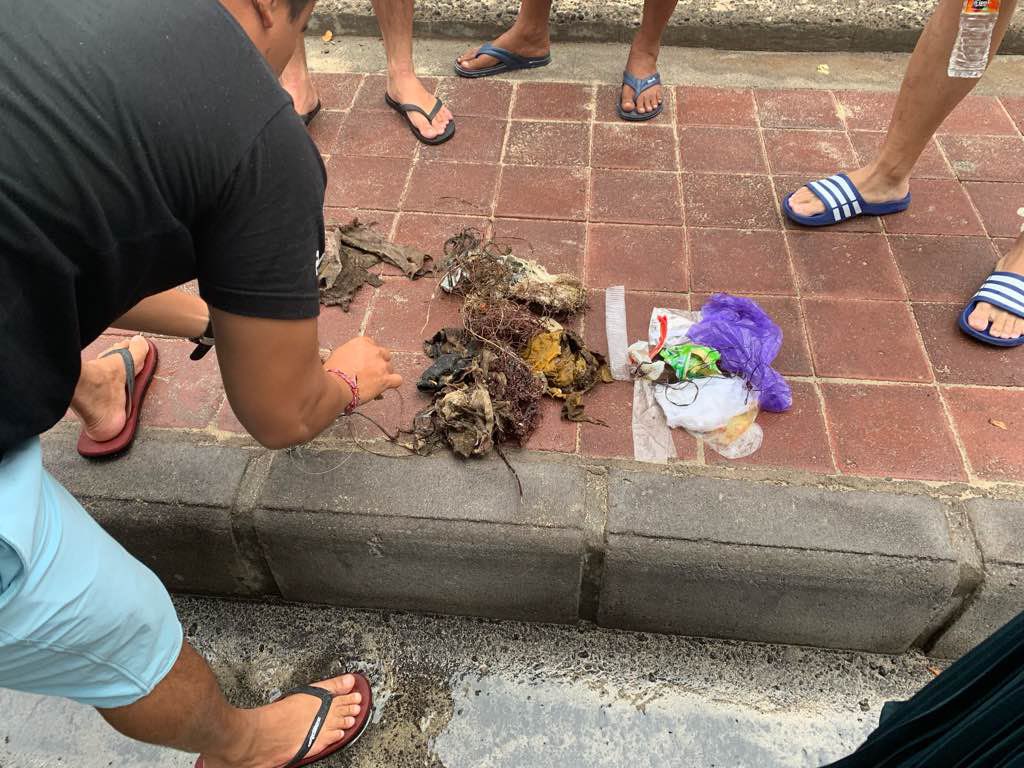
Entangled Help


Use the vertical tabs below to record any entangled animals you found of each type.

Padang bai

0
0
0

-1.886739, 118.070274

0
0
0
sand
0
0
0
0
0
No
Yes
No
Yes
Rain
0
0
0
0
0
0
0
0
0
0
0
0
0
0
0
0
0
0
0
0
Planet Bali Dive
Jacky Lau
0
0
0
0
0
0
0
0
0
0
0
0
0
0
0
0
0
0
0
2
0
0
0
0
0
0
0
0
0
0
0
0
0
0
0.00
41
10.00
3.00
0
estimated
0
0
9702.84
0
0
0
0
0
Beach
0
On
kilograms
0
Our Survey Site was free of debris
0
0
0
Smooth (wavelets) for waves 0.1 - 0.5 meter high
0
0
0
0
0
0
0
m2
0
0
meters
coral reef
0
0
0
0
0
0
0
0
0
0
0
0
0
0
0
0
0
0
0
0
0
0
0
0
0
0
0
0
Indonesia
State\Province
Denpasar
City
Bali
Map Help


Dive Location

If you know your survey site coordinates, enter them manually in decimal degrees using WGS84 Map Datum. Use the minus sign for latitudes south of the equator and longitudes west of the Prime Meridian to 180 degrees.

If you do not know your survey site coordinates, click the “Map Location” tab to use the map to zoom into your survey site and drop the pin on the map to fall within your survey dive site in the water (not on land or the beach). Ensure you zoom in as much as possible to ensure data accuracy.
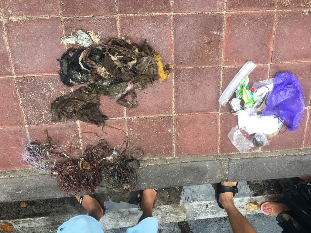
Entangled Help


Use the vertical tabs below to record any entangled animals you found of each type.

ADS401 - Giraavaru Kuda Haa

0
0
0

4.200849957722, 73.412144242739

0
0
0
coral
0
0
0
0
0
Rough and small to medium current
0
0
0
0
0
0
0
0
0
0
0
0
0
0
0
0
0
0
0
0
Best dives maldives
Ismail samooh
0
0
0
0
0
0
0
0
0
0
0
0
0
0
0
0
0
0
0
3
0
0
0
0
0
0
0
0
0
0
0
0
0
0
1.00
50
20.00
7.00
0
estimated
0
0
50.00
0
0
0
0
0
0
On
kilograms
0
I have debris data to report
0
0
0
Calm (glassy to rippled) for waves 0 – 0.1 meter high
0
0
0
1
0
0
1
m2
0
0
meters
coral reef
0
0
0
0
0
0
0
0
0
0
0
0
0
0
2
0
0
0
0
0
0
0
0
0
0
0
0
0
Maldives
State\Province
North male’ atoll
City
Giraavaru
Map Help


Dive Location

If you know your survey site coordinates, enter them manually in decimal degrees using WGS84 Map Datum. Use the minus sign for latitudes south of the equator and longitudes west of the Prime Meridian to 180 degrees.

If you do not know your survey site coordinates, click the “Map Location” tab to use the map to zoom into your survey site and drop the pin on the map to fall within your survey dive site in the water (not on land or the beach). Ensure you zoom in as much as possible to ensure data accuracy.
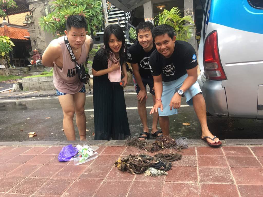
Entangled Help


Use the vertical tabs below to record any entangled animals you found of each type.

Tao Tong, Koh Tao

1
3
2
sand
7

10.068135312111, 99.816702734104

Visibility was low
Plastic Filter/Pump piece
Sunny and mild winds
1
1
Fan belt
Plastic Filter/Pump Piece
Eco Koh Tao - Crystal Dive
Jennifer Downling
1
7
1
1
4.70
57
15.00
8.00
measured
5
150.00
Fishing line
Rope and String
Fishing sinkers
1
On
kilograms
I have debris data to report
Smooth (wavelets) for waves 0.1 - 0.5 meter high m2
6
meters
coral reef
4
1
1
Thailand
State\Province
Surat Thani
City
Koh Tao
Map Help


Dive Location

If you know your survey site coordinates, enter them manually in decimal degrees using WGS84 Map Datum. Use the minus sign for latitudes south of the equator and longitudes west of the Prime Meridian to 180 degrees.

If you do not know your survey site coordinates, click the “Map Location” tab to use the map to zoom into your survey site and drop the pin on the map to fall within your survey dive site in the water (not on land or the beach). Ensure you zoom in as much as possible to ensure data accuracy.

Entangled Help


Use the vertical tabs below to record any entangled animals you found of each type.

Tao Tong, Koh Tao

1
1
1
sand
1
3

10.068065498252, 99.816331344588

Visibility - 4m
3 groups
Metal Valve
Sunny
1
Metal Tap/Valve
Eco Koh Tao - Crystal Dive
Jennifer Dowling
2
1
1
7
5.50
53
12.00
5.00
measured
2
100.00
Rope and string
PVC Pipe
Fishing Lines and electronic cables
On
kilograms
I have debris data to report
Smooth (wavelets) for waves 0.1 - 0.5 meter high
1
1
m2
4
meters
coral reef
1
1
1
2
11
Thailand
State\Province
Surat Thani
City
Koh Tao
Map Help


Dive Location

If you know your survey site coordinates, enter them manually in decimal degrees using WGS84 Map Datum. Use the minus sign for latitudes south of the equator and longitudes west of the Prime Meridian to 180 degrees.

If you do not know your survey site coordinates, click the “Map Location” tab to use the map to zoom into your survey site and drop the pin on the map to fall within your survey dive site in the water (not on land or the beach). Ensure you zoom in as much as possible to ensure data accuracy.

Entangled Help


Use the vertical tabs below to record any entangled animals you found of each type.

ADS457 - Farallon's Rock

0
0
0
0

8.35337, -80.110231

0
0
0
rock
0
0
0
0
0
Tourism
None
Sunny
Scuba Caribe Playa Blanca
Maria Henriquez
0
0
0
0
0
0
0
0
0
0
0
0
0
0
0
0
0
0
0
2
0
0
0
0
1
0
0
0
0
0
0
0
0
0
0
0
0.20
40
25.00
15.00
0
estimated
0
0
0
0
20.00
0
0
0
0
0
0
On
pounds
0
I have debris data to report
0
0
0
Slight for waves 0.5 -1.25 meter high
0
0
0
0
1
0
0
m2
0
0
feet
rocky reef
0
0
0
0
0
0
0
0
0
0
0
0
0
0
0
0
0
2
0
0
0
0
0
0
0
0
0
0
0
Panama
State\Province
Cocle
City
Farallon
Map Help


Dive Location

If you know your survey site coordinates, enter them manually in decimal degrees using WGS84 Map Datum. Use the minus sign for latitudes south of the equator and longitudes west of the Prime Meridian to 180 degrees.

If you do not know your survey site coordinates, click the “Map Location” tab to use the map to zoom into your survey site and drop the pin on the map to fall within your survey dive site in the water (not on land or the beach). Ensure you zoom in as much as possible to ensure data accuracy.

Entangled Help


Use the vertical tabs below to record any entangled animals you found of each type.

Subscribe to