Cais dos Pescadores
silt


 Portugal
38.697332541408, -9.4180589369542
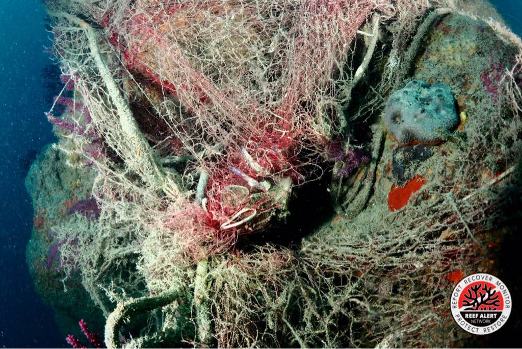
One of the items we collected during this cleanup was a big pile of entangled fishing line. We were unable to count how many fishing lines there were so we decided to weight it and the result was 2kg!!
In addition to the divers we had the help of shore volunteers that helped:
- Carry out a record of the weight, quantity and type of debris collected (a specific sheet is provided for this purpose);
- Remove the debris from the water and place it on the pier;
- Pull cables with debris into the pier, if necessary;
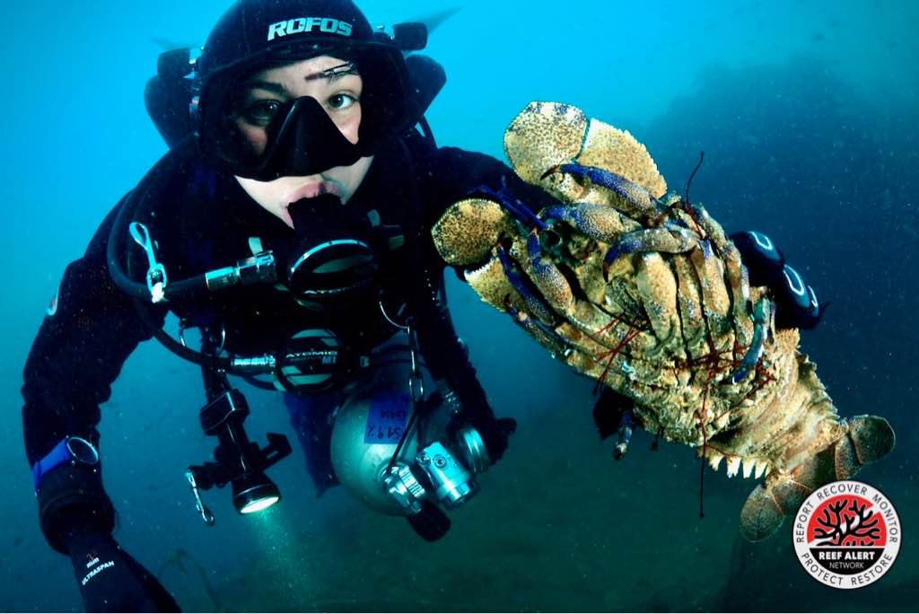
- To check if the garbage collected had any marine animals (octopus, starfish, sea urchins, anemones, etc.) trapped in it and return them to the sea;
- Separate and count collected marine litter.
We also had the support of Stand Up Paddle board volunteers that helped:
- Accompany the pairs of divers, marking their position to protect them from boats and others;
- Delimit cleaning area;
- Warn vessels to keep a safe distance from divers;
- Collect the debris that the divers brought from the bottom and delivered it to the shore volunteers positioned on the pier;
- Bring equipment from divers to the vessels and vice versa;
- Collect debris that was on the surface of the ocean.
We also had the help of the local fisherman community who helped transport the divers to the cleaning area.
In addition to the divers we had the help of shore volunteers that helped:
- Carry out a record of the weight, quantity and type of debris collected (a specific sheet is provided for this purpose);
- Remove the debris from the water and place it on the pier;
- Pull cables with debris into the pier, if necessary;
- To check if the garbage collected had any marine animals (octopus, starfish, sea urchins, anemones, etc.) trapped in it and return them to the sea;
- Separate and count collected marine litter.
We also had the support of Stand Up Paddle board volunteers that helped:
- Accompany the pairs of divers, marking their position to protect them from boats and others;
- Delimit cleaning area;
- Warn vessels to keep a safe distance from divers;
- Collect the debris that the divers brought from the bottom and delivered it to the shore volunteers positioned on the pier;
- Bring equipment from divers to the vessels and vice versa;
- Collect debris that was on the surface of the ocean.
We also had the help of the local fisherman community who helped transport the divers to the cleaning area.
Fishing
Cargo Cart
1
1
1
1
39
Cargo Cart
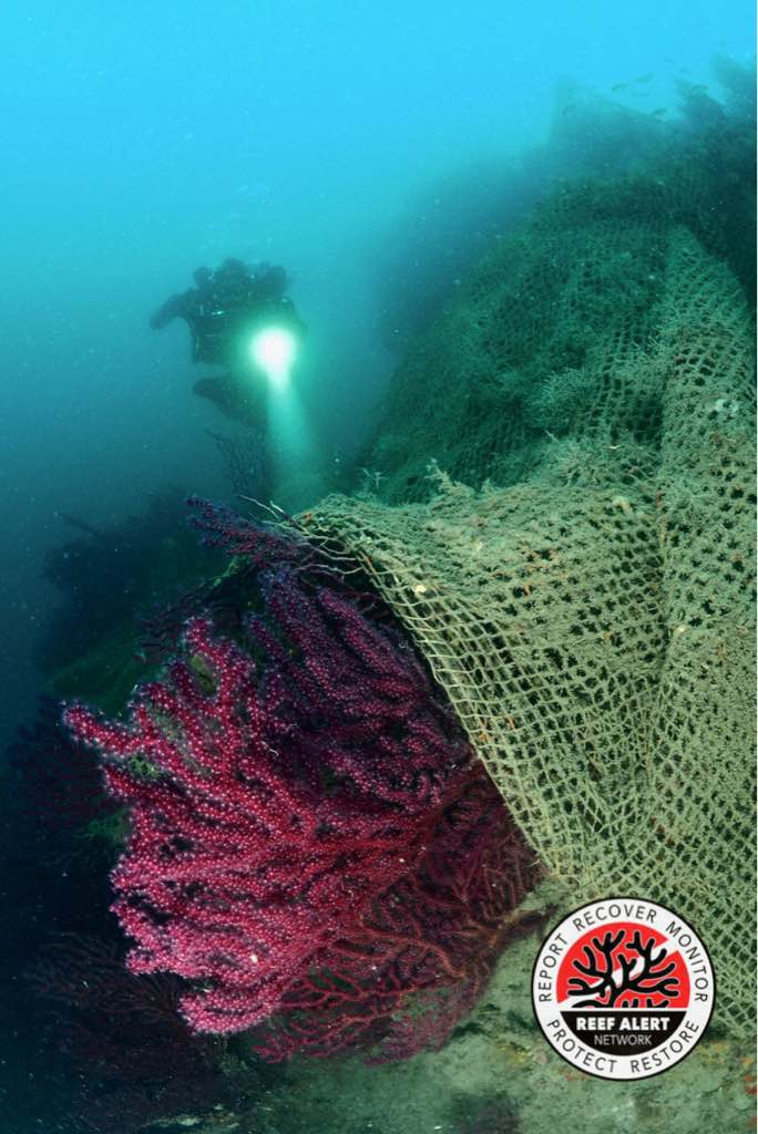
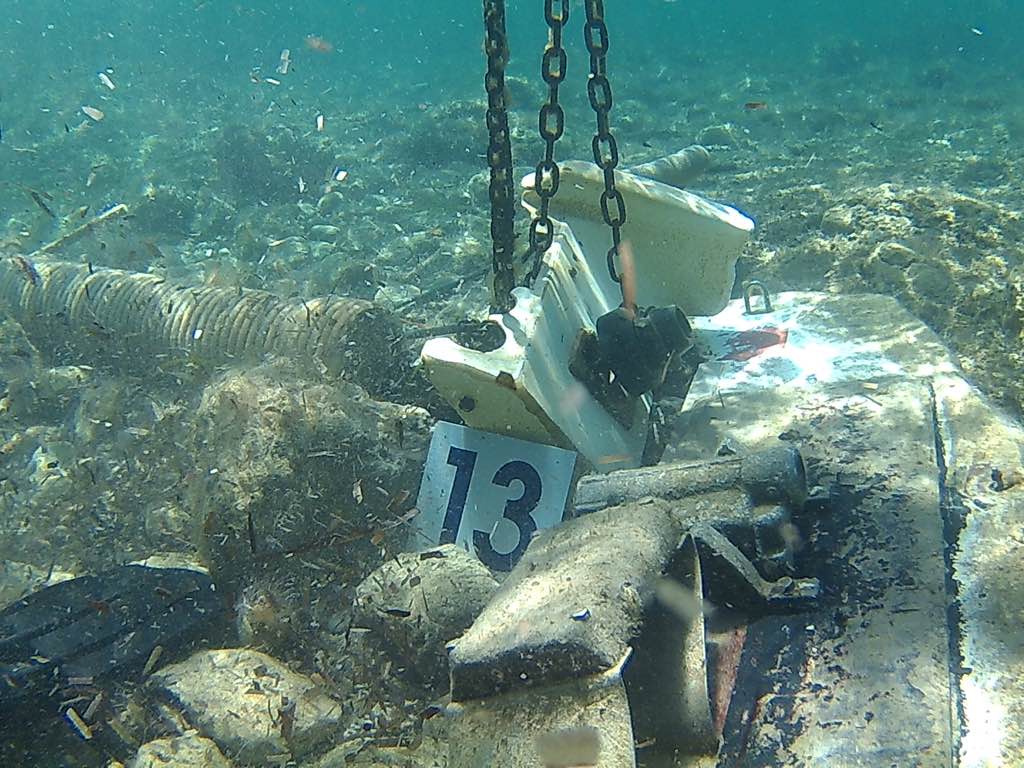
Pile of entangled fishing line
Glasses
Anchor
Fishing: Traps & Pots
Associação Juvenil Claro/Clube Naval de Cascais
Carolina Gonçalves & Teresa Vale
16
200.00
47
4.00
1.00
estimated
39
613.70
4
Fishing Traps
Tires
On
kilograms
I have debris data to report
Calm (glassy to rippled) for waves 0 – 0.1 meter high
Released Unharmed
European conger
1
Tire
small-spotted catshark eggs
2
m2
2
Fishing traps (pots)
Octopus
Released Unharmed
meters
other
Fishing traps
2
1
5
1
4
City
Cascais
Map Help
Dive Location
If you know your survey site coordinates, enter them manually in decimal degrees using WGS84 Map Datum. Use the minus sign for latitudes south of the equator and longitudes west of the Prime Meridian to 180 degrees.
If you do not know your survey site coordinates, click the “Map Location” tab to use the map to zoom into your survey site and drop the pin on the map to fall within your survey dive site in the water (not on land or the beach). Ensure you zoom in as much as possible to ensure data accuracy.
Entangled Help