Menu

Local Action Beach #311104

0
0
0
0

33.54507220677, -117.79997372904

0
0
0
sand
0
1
0
0
0
Some fishing activity
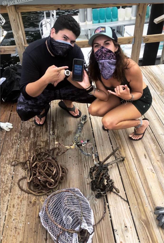
Lobster trap
Some waves
PADI AWARE
PADI AWARE
0
0
0
0
0
0
0
0
0
0
0
0
0
0
0
0
0
0
0
4
1
1
0
1
1
1
2
0
0
1
1
1
1
0
0
0
4.00
44
14.00
4.00
0
estimated
1
0
4720.54
0
0
0
0
0
0
On
pounds
0
I have debris data to report
0
0
1
Slight for waves 0.5 -1.25 meter high
0
0
0
1
0
1
1
ft2
1
0
feet
rocky reef
0
0
0
0
0
0
0
0
0
0
0
0
0
0
0
0
0
0
0
0
0
0
0
0
0
0
0
0
0
United States
State\Province
California
City
Laguna Beach
Map Help


Dive Location

If you know your survey site coordinates, enter them manually in decimal degrees using WGS84 Map Datum. Use the minus sign for latitudes south of the equator and longitudes west of the Prime Meridian to 180 degrees.

If you do not know your survey site coordinates, click the “Map Location” tab to use the map to zoom into your survey site and drop the pin on the map to fall within your survey dive site in the water (not on land or the beach). Ensure you zoom in as much as possible to ensure data accuracy.

Entangled Help


Use the vertical tabs below to record any entangled animals you found of each type.

Global Action Bay #311104

1
1
1
1

33.383547095346, -118.4745873626

1
1
1
sand
1
1
1
1
1
Local action, global impact
Anchor
Calm
PADI AWARE
PADI AWARE
1
1
1
1
1
1
1
1
1
1
1
1
1
1
1
1
1
1
0
4
0
0
0
0
1
1
1
1
1
1
1
1
1
1
1
0
44.00
44
44.00
4.00
1
estimated
0
0
12406.50
1
0
0
0
0
0
On
pounds
0
I have debris data to report
1
0
0
Calm (glassy to rippled) for waves 0 – 0.1 meter high
0
0
0
0
0
0
0
ft2
0
0
feet
kelp
0
0
0
0
0
0
0
0
0
1
0
0
1
0
0
0
0
0
1
0
1
0
0
0
1
1
1
0
0
United States
State\Province
California
City
Catalina
Map Help


Dive Location

If you know your survey site coordinates, enter them manually in decimal degrees using WGS84 Map Datum. Use the minus sign for latitudes south of the equator and longitudes west of the Prime Meridian to 180 degrees.

If you do not know your survey site coordinates, click the “Map Location” tab to use the map to zoom into your survey site and drop the pin on the map to fall within your survey dive site in the water (not on land or the beach). Ensure you zoom in as much as possible to ensure data accuracy.
Entangled Help


Use the vertical tabs below to record any entangled animals you found of each type.

Aow Leuk

3
11
0
10

10.070921, 99.84079

0
0
0
sand
0
3
0
0
0
Raining
1
1
1
1
4 ppe masks
1 pencil
Metal ring
1 coat hanget
The Coral Tribe
Jennifer Dowling
0
1
0
1
0
0
0
0
1
0
3
0
0
0
1
0
0
0
0
3
0
0
0
0
1
0
8
0
0
0
0
0
0
0
0
0
3.20
65
10.00
5.00
12
measured
0
0
0
2
548.02
0
0
0
2
0
1
On
kilograms
0
I have debris data to report
1
0
0
Smooth (wavelets) for waves 0.1 - 0.5 meter high
0
0
0
0
1
1
2
m2
3
0
meters
other
2
0
0
0
0
2
0
0
0
1
2
0
0
2
0
4
0
0
0
0
0
0
1
0
0
0
0
0
0
Thailand
State\Province
Surat Thani
City
Koh Tao
Map Help


Dive Location

If you know your survey site coordinates, enter them manually in decimal degrees using WGS84 Map Datum. Use the minus sign for latitudes south of the equator and longitudes west of the Prime Meridian to 180 degrees.

If you do not know your survey site coordinates, click the “Map Location” tab to use the map to zoom into your survey site and drop the pin on the map to fall within your survey dive site in the water (not on land or the beach). Ensure you zoom in as much as possible to ensure data accuracy.

Entangled Help


Use the vertical tabs below to record any entangled animals you found of each type.

Ecosystem Other
sand

Aow Leuk

1
4
0
6

10.069935, 99.840328

0
0
0
sand
0
0
0
5
0
Plug socket
Rainy
The Coral Tribe
Jennifer Dowling
0
0
0
0
0
0
0
0
0
0
0
0
0
0
0
0
0
0
0
3
0
0
0
0
0
0
2
0
0
0
0
0
0
0
0
0
2.00
63
13.00
5.00
9
measured
0
0
0
0
407.46
0
0
0
1
0
Fishing line
0
On
kilograms
0
I have debris data to report
0
0
0
Slight for waves 0.5 -1.25 meter high
0
0
0
0
2
0
1
m2
0
0
meters
coral reef
0
0
0
0
0
0
0
0
0
0
1
0
0
0
0
3
0
0
0
0
0
0
0
0
0
0
0
0
0
Thailand
State\Province
Surat Thani
City
Koh Tao
Map Help


Dive Location

If you know your survey site coordinates, enter them manually in decimal degrees using WGS84 Map Datum. Use the minus sign for latitudes south of the equator and longitudes west of the Prime Meridian to 180 degrees.

If you do not know your survey site coordinates, click the “Map Location” tab to use the map to zoom into your survey site and drop the pin on the map to fall within your survey dive site in the water (not on land or the beach). Ensure you zoom in as much as possible to ensure data accuracy.

Entangled Help


Use the vertical tabs below to record any entangled animals you found of each type.

DROC - Canyon

1

19.75718, -70.52068

coral
1
Regular?
5
Paper Napkins
Divecenter Merlin
Christian Harder
2
0.15
70
12.00
6.00
estimated
1
6800.00
1
On
kilograms
I have debris data to report
Calm (glassy to rippled) for waves 0 – 0.1 meter high m2
meters
coral reef
1
Dominican Republic
State\Province
Puerto Plata
City
Sosua
Map Help


Dive Location

If you know your survey site coordinates, enter them manually in decimal degrees using WGS84 Map Datum. Use the minus sign for latitudes south of the equator and longitudes west of the Prime Meridian to 180 degrees.

If you do not know your survey site coordinates, click the “Map Location” tab to use the map to zoom into your survey site and drop the pin on the map to fall within your survey dive site in the water (not on land or the beach). Ensure you zoom in as much as possible to ensure data accuracy.

Entangled Help


Use the vertical tabs below to record any entangled animals you found of each type.

DROC - The Charamicos Wall

2
1
1

19.75565, -70.52336

coral
1
Regular?
Divecenter Merlin
Christian Harder
2
1
3
0.20
48
18.00
7.00
estimated
6000.00
On
kilograms
I have debris data to report
Calm (glassy to rippled) for waves 0 – 0.1 meter high m2
meters
coral reef
Dominican Republic
State\Province
Puerto Plata
City
Sosua
Map Help


Dive Location

If you know your survey site coordinates, enter them manually in decimal degrees using WGS84 Map Datum. Use the minus sign for latitudes south of the equator and longitudes west of the Prime Meridian to 180 degrees.

If you do not know your survey site coordinates, click the “Map Location” tab to use the map to zoom into your survey site and drop the pin on the map to fall within your survey dive site in the water (not on land or the beach). Ensure you zoom in as much as possible to ensure data accuracy.

Entangled Help


Use the vertical tabs below to record any entangled animals you found of each type.

Edmonds Underwater Park #444074

0
0
0
0

47.81435, -122.381549

0
0
0
sand
0
0
0
0
0
The tide was soooo so low. It was a struggle bringing all our trash in up the beach (so much walking!)
Old boat debris
Brass Posts
Rainy and windy
Tro Ota
0
0
0
0
0
0
0
0
0
0
0
0
0
0
0
0
0
0
0
2
0
0
0
0
0
0
0
0
0
0
0
0
0
0
0
0
162.80
39
28.00
24.00
0
measured
0
0
0
0
3901.75
0
0
0
0
0
Metal fragments
Bottles
Wire
0
On
pounds
0
I have debris data to report
3
0
0
Smooth (wavelets) for waves 0.1 - 0.5 meter high
0
0
0
0
0
0
0
ft2
2
0
feet
rocky reef
33
0
8
0
0
0
0
0
0
0
0
0
1
0
0
3
0
0
0
0
0
0
0
0
0
0
0
0
0
United States
State\Province
Washington
City
Edmonds
Map Help


Dive Location

If you know your survey site coordinates, enter them manually in decimal degrees using WGS84 Map Datum. Use the minus sign for latitudes south of the equator and longitudes west of the Prime Meridian to 180 degrees.

If you do not know your survey site coordinates, click the “Map Location” tab to use the map to zoom into your survey site and drop the pin on the map to fall within your survey dive site in the water (not on land or the beach). Ensure you zoom in as much as possible to ensure data accuracy.

Entangled Help


Use the vertical tabs below to record any entangled animals you found of each type.

Morada

24.53614, -80.34664

coral
Islamorada Dive Center
Matt
4
0.00
45
30.00
20.00
estimated
350.00
On
pounds
Our Survey Site was free of debris
Calm (glassy to rippled) for waves 0 – 0.1 meter high ft2
feet
coral reef
United States
Map Help


Dive Location

If you know your survey site coordinates, enter them manually in decimal degrees using WGS84 Map Datum. Use the minus sign for latitudes south of the equator and longitudes west of the Prime Meridian to 180 degrees.

If you do not know your survey site coordinates, click the “Map Location” tab to use the map to zoom into your survey site and drop the pin on the map to fall within your survey dive site in the water (not on land or the beach). Ensure you zoom in as much as possible to ensure data accuracy.

Entangled Help


Use the vertical tabs below to record any entangled animals you found of each type.

Arnos

24.5271, -80.3421

coral
Islamorada Dive Center
Matt
5
2
0.00
45
40.00
20.00
estimated
300.00
On
pounds
I have debris data to report
Smooth (wavelets) for waves 0.1 - 0.5 meter high ft2
feet
coral reef
United States
Map Help


Dive Location

If you know your survey site coordinates, enter them manually in decimal degrees using WGS84 Map Datum. Use the minus sign for latitudes south of the equator and longitudes west of the Prime Meridian to 180 degrees.

If you do not know your survey site coordinates, click the “Map Location” tab to use the map to zoom into your survey site and drop the pin on the map to fall within your survey dive site in the water (not on land or the beach). Ensure you zoom in as much as possible to ensure data accuracy.

Entangled Help


Use the vertical tabs below to record any entangled animals you found of each type.

Carys Fort Reef South

2

25.165117260866, -80.380304618466

coral
No, the netting was pretty old!
We went through the netting and took out all pod the baby lobsters and released them back to the ocean!
Flat calm seas, no current and 80ft of visibility
Horizon Divers
Dan Dawson
4
265.00
180
30.00
6.00
estimated
2
100.00
On
pounds
I have debris data to report
Calm (glassy to rippled) for waves 0 – 0.1 meter high
0
Ghost Net
Baby Lobsters
Released Unharmed
20
ft2
feet
coral reef
United States
State\Province
Florida
City
Key Largo
Map Help


Dive Location

If you know your survey site coordinates, enter them manually in decimal degrees using WGS84 Map Datum. Use the minus sign for latitudes south of the equator and longitudes west of the Prime Meridian to 180 degrees.

If you do not know your survey site coordinates, click the “Map Location” tab to use the map to zoom into your survey site and drop the pin on the map to fall within your survey dive site in the water (not on land or the beach). Ensure you zoom in as much as possible to ensure data accuracy.

Entangled Help


Use the vertical tabs below to record any entangled animals you found of each type.

Subscribe to