Menu

jeju

gravel

33.227530069692, 126.56739093512

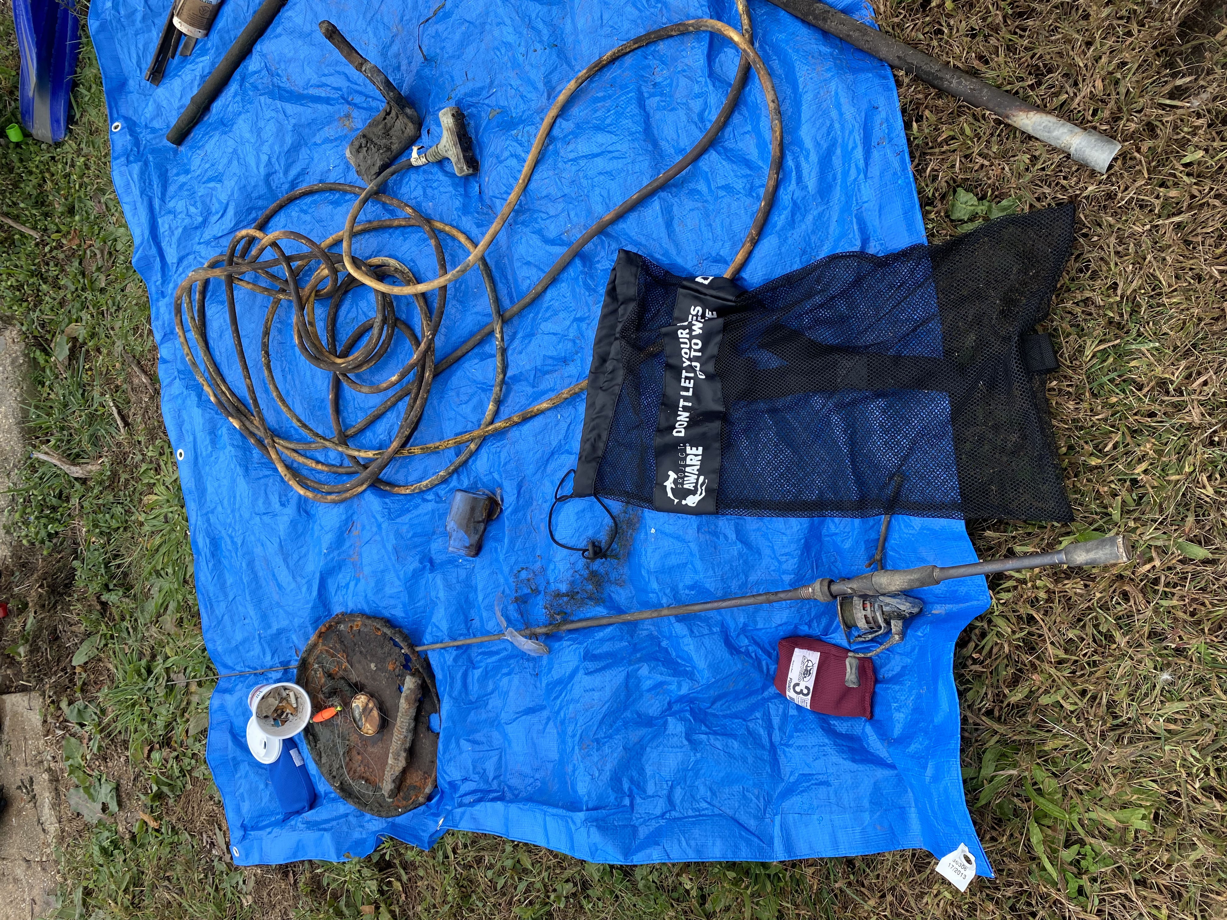
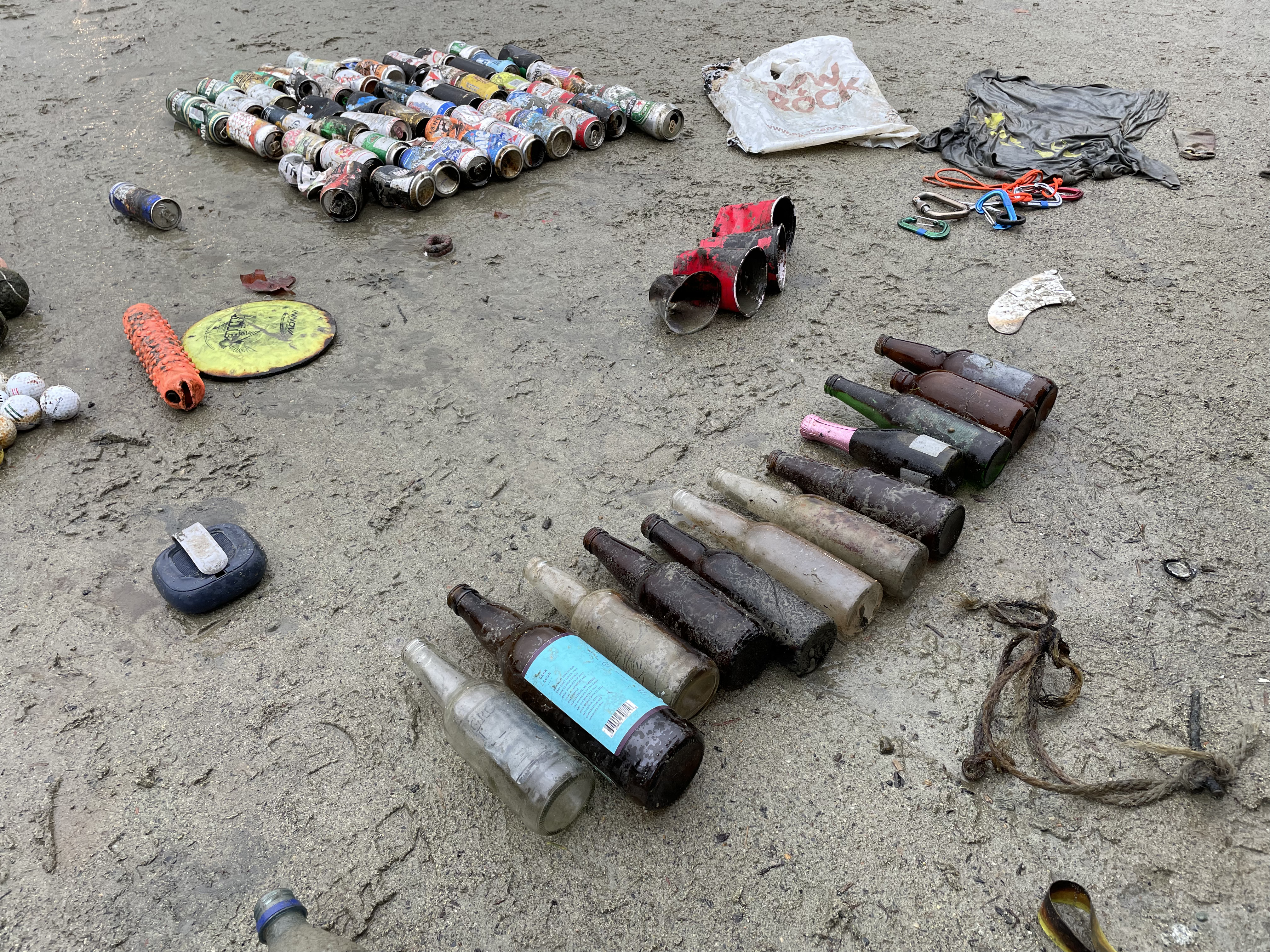
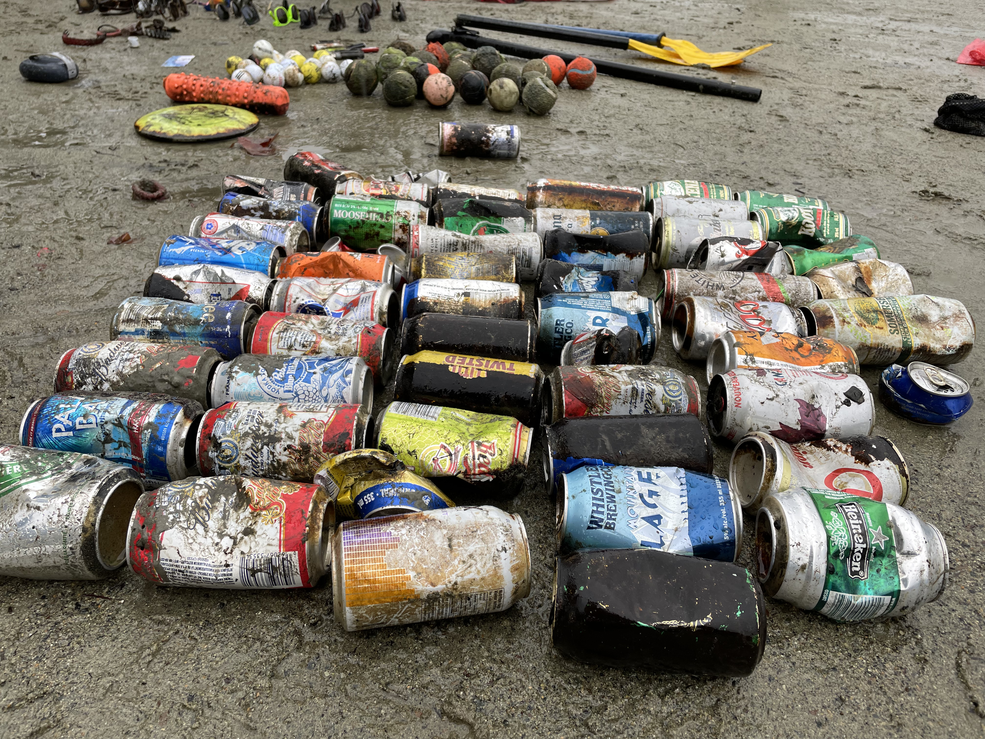
문섬주변 다이버들은 눈에 보이는 캔, 낚시 어구를 잘 확인하고 줍는다.
다이버의 장비와 호흡기 핀에 걸림현상을 일으킬수 있습니다.
낚시꾼들이 가지고 간 물건은 반드시 돌아와서 확인하는 절차가 필요
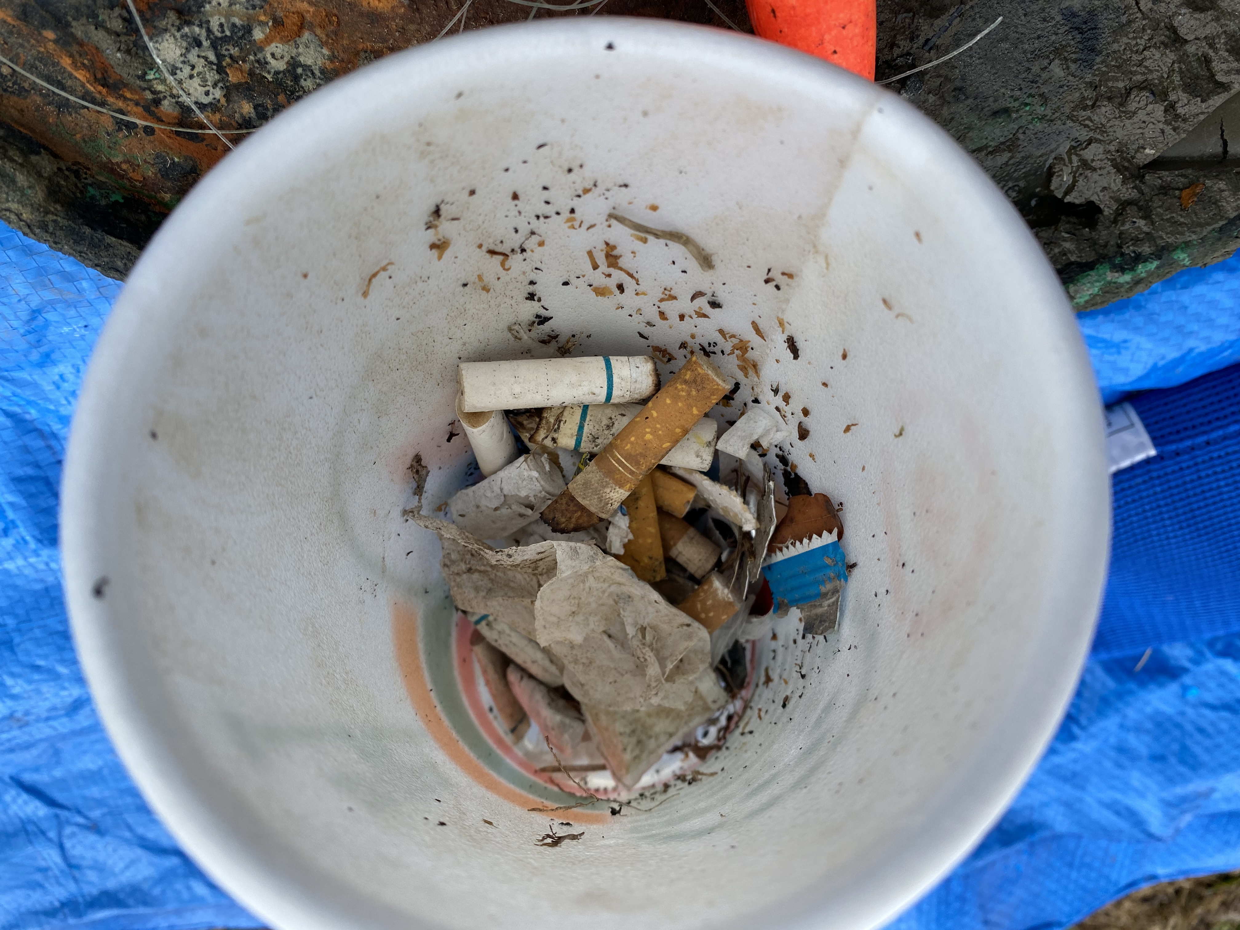
수중속에 낚시꾼들이 버린 낚시 관련 줄, 봉돌등이 많았습니다.
매우 양호했습니다
enjoycebudiving
kim sungkuk
5
1
1.00
20
30.00
12.00
estimated
500.00
낚시어구
낚시줄
On
kilograms
I have debris data to report
Calm (glassy to rippled) for waves 0 – 0.1 meter high m2
meters
coral reef
South Korea
State\Province
서귀포시
City
서귀포시
Map Help


Dive Location

If you know your survey site coordinates, enter them manually in decimal degrees using WGS84 Map Datum. Use the minus sign for latitudes south of the equator and longitudes west of the Prime Meridian to 180 degrees.

If you do not know your survey site coordinates, click the “Map Location” tab to use the map to zoom into your survey site and drop the pin on the map to fall within your survey dive site in the water (not on land or the beach). Ensure you zoom in as much as possible to ensure data accuracy.

Entangled Help


Use the vertical tabs below to record any entangled animals you found of each type.

Playa Blanca

9
4
1

11.2193, -74.2397

coral
1

11.219357709379, -74.239702638487

Atlantida bucea
Angie Arandia
1
10
2
2
19
1
12.00
57
12.00
4.00
measured
100.00
1
On
kilograms
I have debris data to report
2
Smooth (wavelets) for waves 0.1 - 0.5 meter high
1
19
3
m2
meters
rocky reef
21
1
Colombia
State\Province
Magdalena
City
Santa marta
Map Help


Dive Location

If you know your survey site coordinates, enter them manually in decimal degrees using WGS84 Map Datum. Use the minus sign for latitudes south of the equator and longitudes west of the Prime Meridian to 180 degrees.

If you do not know your survey site coordinates, click the “Map Location” tab to use the map to zoom into your survey site and drop the pin on the map to fall within your survey dive site in the water (not on land or the beach). Ensure you zoom in as much as possible to ensure data accuracy.

Entangled Help


Use the vertical tabs below to record any entangled animals you found of each type.

Rappahannock Quarry

1
silt

38.325346280327, -77.503802776337

Patriot Scuba
Charles Martin
1
2
24.20
30
25.00
10.00
measured
2000.00
On
pounds
I have debris data to report
Calm (glassy to rippled) for waves 0 – 0.1 meter high ft2
feet
other
2
1
2
1
United States
State\Province
VA
City
Occoquan
Map Help


Dive Location

If you know your survey site coordinates, enter them manually in decimal degrees using WGS84 Map Datum. Use the minus sign for latitudes south of the equator and longitudes west of the Prime Meridian to 180 degrees.

If you do not know your survey site coordinates, click the “Map Location” tab to use the map to zoom into your survey site and drop the pin on the map to fall within your survey dive site in the water (not on land or the beach). Ensure you zoom in as much as possible to ensure data accuracy.

Entangled Help


Use the vertical tabs below to record any entangled animals you found of each type.

Ecosystem Other
quarry

Water Street, Havre de Grace

5
1
1
2
silt
1
3
1

39.554127846882, -76.093395754817

No
Metal lid to a large can
Sunny, Cold
One Ocean Scuba
J. Elizabeth Clark
3
27
4
1
1
5.90
75
12.00
5.00
measured
2
10.00
Fishing line
On
pounds
I have debris data to report
Calm (glassy to rippled) for waves 0 – 0.1 meter high ft2
feet
other
2
1
1
United States
State\Province
MD
City
Silver Spring
Map Help


Dive Location

If you know your survey site coordinates, enter them manually in decimal degrees using WGS84 Map Datum. Use the minus sign for latitudes south of the equator and longitudes west of the Prime Meridian to 180 degrees.

If you do not know your survey site coordinates, click the “Map Location” tab to use the map to zoom into your survey site and drop the pin on the map to fall within your survey dive site in the water (not on land or the beach). Ensure you zoom in as much as possible to ensure data accuracy.

Entangled Help


Use the vertical tabs below to record any entangled animals you found of each type.

Ecosystem Other
River

Marmora Scuba Park

rock

44.482947, -77.682106

Shirt
Dive Kawartha
Nolan Oliver
3
2
4.00
22
20.00
25.00
estimated
50.00
On
pounds
I have debris data to report
1
Calm (glassy to rippled) for waves 0 – 0.1 meter high
1
ft2
feet
other
15
Canada
State\Province
Ontario
City
Marmora
Map Help


Dive Location

If you know your survey site coordinates, enter them manually in decimal degrees using WGS84 Map Datum. Use the minus sign for latitudes south of the equator and longitudes west of the Prime Meridian to 180 degrees.

If you do not know your survey site coordinates, click the “Map Location” tab to use the map to zoom into your survey site and drop the pin on the map to fall within your survey dive site in the water (not on land or the beach). Ensure you zoom in as much as possible to ensure data accuracy.

Entangled Help


Use the vertical tabs below to record any entangled animals you found of each type.

Ecosystem Other
Rock bottom

Churchill Barrier 1

3
2
1
silt
10

58.894597355988, -2.9000095155362

Trying to use cans as homes
Kraken Diving
Rob Slight
1
3
4
2
10.00
45
10.00
4.00
2
estimated
200.00
On
kilograms
I have debris data to report
Slight for waves 0.5 -1.25 meter high
Drinks cans
Crabs
Released Unharmed
2
1
1
m2
2
meters
kelp
1
3
United Kingdom
State\Province
Orkney
Map Help


Dive Location

If you know your survey site coordinates, enter them manually in decimal degrees using WGS84 Map Datum. Use the minus sign for latitudes south of the equator and longitudes west of the Prime Meridian to 180 degrees.

If you do not know your survey site coordinates, click the “Map Location” tab to use the map to zoom into your survey site and drop the pin on the map to fall within your survey dive site in the water (not on land or the beach). Ensure you zoom in as much as possible to ensure data accuracy.

Entangled Help


Use the vertical tabs below to record any entangled animals you found of each type.

Maiko beach

34.6276661, 135.0388223

0
sand
1
1
NORIS KOBEMAIKO
Noriko Tanaka
1
2
2
1
0.50
32
1200.00
3.00
estimated
4
0.00
On
kilograms
I have debris data to report
2
Smooth (wavelets) for waves 0.1 - 0.5 meter high m2
1
meters
seagrass
Japan
State\Province
HYOGO
City
KOBE
Map Help


Dive Location

If you know your survey site coordinates, enter them manually in decimal degrees using WGS84 Map Datum. Use the minus sign for latitudes south of the equator and longitudes west of the Prime Meridian to 180 degrees.

If you do not know your survey site coordinates, click the “Map Location” tab to use the map to zoom into your survey site and drop the pin on the map to fall within your survey dive site in the water (not on land or the beach). Ensure you zoom in as much as possible to ensure data accuracy.

Entangled Help


Use the vertical tabs below to record any entangled animals you found of each type.

Lost Lake

4
1
silt
1
8

50.127030041361, -122.93644927596

no
mixed
23
3
5
2
sunglasses
boat paddles
hair elastic
plastic hair clips
Divers for Cleaner Lakes and Oceans
Henry Wang
4
5
1
1
3
2
2
44
39.40
38
34.00
5.00
3
measured
1623.00
sunglasses
beer cans
On
pounds
I have debris data to report
12
Calm (glassy to rippled) for waves 0 – 0.1 meter high ft2
feet
other
3
1
56
Canada
State\Province
British Columbia
City
North Vancouver
Map Help


Dive Location

If you know your survey site coordinates, enter them manually in decimal degrees using WGS84 Map Datum. Use the minus sign for latitudes south of the equator and longitudes west of the Prime Meridian to 180 degrees.

If you do not know your survey site coordinates, click the “Map Location” tab to use the map to zoom into your survey site and drop the pin on the map to fall within your survey dive site in the water (not on land or the beach). Ensure you zoom in as much as possible to ensure data accuracy.

Entangled Help


Use the vertical tabs below to record any entangled animals you found of each type.

Ecosystem Other
silt

ADS644 - Point Panic

2
7
1
5
1
rock
2
76

21.290275494809, -157.86007328665

Light winds, rain
1
1
Recreational Dive Planner
7/16 in socket
Nudi Wear
Christy Johnson
1
2
12
1
15
2
3
131.00
50
25.00
4.00
measured
60
300.00
3
On
pounds
I have debris data to report
68
Smooth (wavelets) for waves 0.1 - 0.5 meter high
4
8
ft2
1
11
feet
rocky reef
5
2
2
3
2
1
8
32
1
United States
State\Province
HI
City
Honolulu
Map Help


Dive Location

If you know your survey site coordinates, enter them manually in decimal degrees using WGS84 Map Datum. Use the minus sign for latitudes south of the equator and longitudes west of the Prime Meridian to 180 degrees.

If you do not know your survey site coordinates, click the “Map Location” tab to use the map to zoom into your survey site and drop the pin on the map to fall within your survey dive site in the water (not on land or the beach). Ensure you zoom in as much as possible to ensure data accuracy.

Entangled Help


Use the vertical tabs below to record any entangled animals you found of each type.

Sebastian's Reef

5

12.141126107616, -68.276729534261

coral
3

12.1590861, -68.2777649

Cleaning brush and sponge
Rainy
1
1
Plastic brush
Sponge
VIP Diving/STINAPA
Pascal van Empelen
1
1
1
10
1
2.00
55
18.00
3.00
1
estimated
466.17
1
fishing line
plastic fragments
glass
On
kilograms
I have debris data to report
2
1
Calm (glassy to rippled) for waves 0 – 0.1 meter high m2
meters
coral reef
2
1
1
Netherlands Antilles
City
Kralendijk
Map Help


Dive Location

If you know your survey site coordinates, enter them manually in decimal degrees using WGS84 Map Datum. Use the minus sign for latitudes south of the equator and longitudes west of the Prime Meridian to 180 degrees.

If you do not know your survey site coordinates, click the “Map Location” tab to use the map to zoom into your survey site and drop the pin on the map to fall within your survey dive site in the water (not on land or the beach). Ensure you zoom in as much as possible to ensure data accuracy.

Entangled Help


Use the vertical tabs below to record any entangled animals you found of each type.

Subscribe to