Menu

Blue Heron Bridge

0
4
0

26.784871036472, -80.045983023448

1
0
0
sand
0
0
0
2
0
Scissors
Sunny
1
1
1
1
1
1
0
0
0
0
0
0
0
0
0
0
0
0
0
0
Pen
Plastic Dart
Metal belt buckle
Scissors
Electrical cord (rubber insulation)
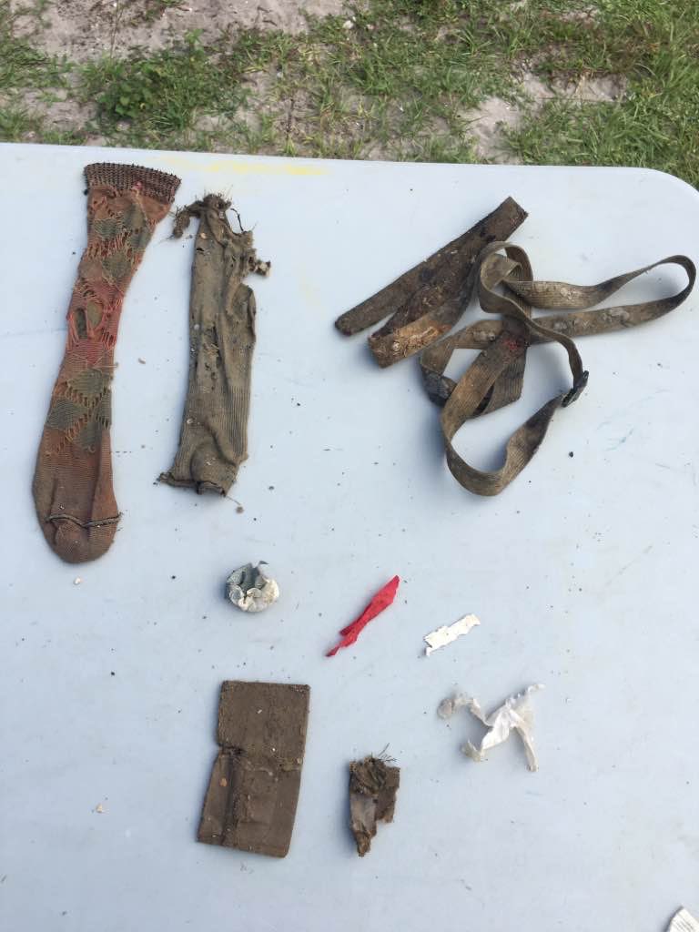
Cloth strap/belt
Cecilia Aragon
0
0
0
0
0
0
0
0
0
0
1
0
1
0
0
0
0
1
6
2
0
0
0
0
0
0
0
0
0
0
0
0
0
0
10.00
123
20.00
7.00
0
estimated
0
6
141129.00
0
1
0
6
0
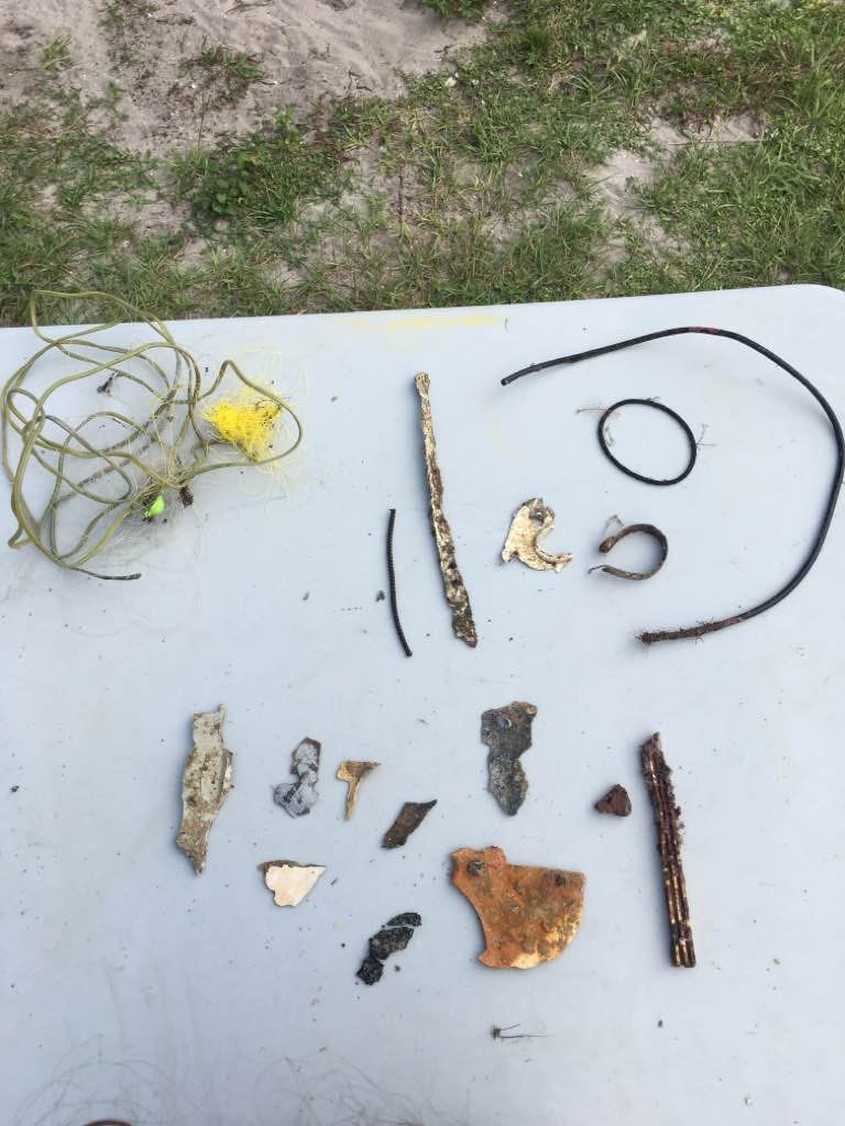
Fishing line/hooks
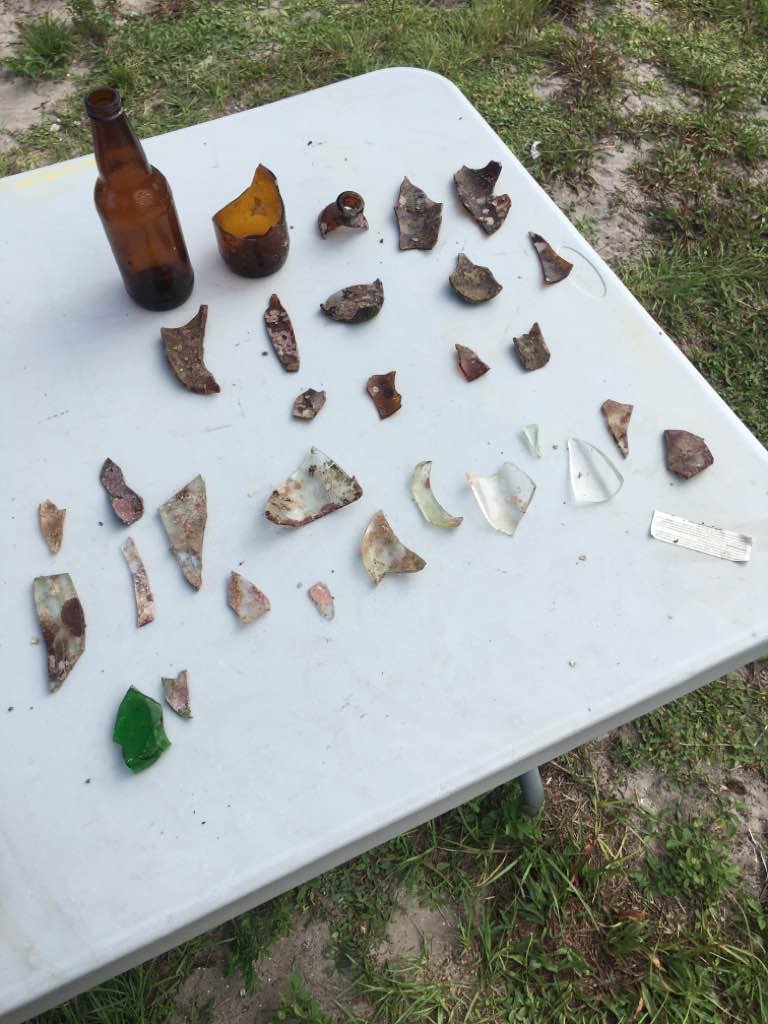
Glass fragments
0
On
pounds
0
I have debris data to report
1
0
0
Smooth (wavelets) for waves 0.1 - 0.5 meter high
0
0
0
0
0
0
0
ft2
0
0
feet
rocky reef
1
0
0
0
0
2
0
2
0
2
0
0
1
0
1
0
3
0
0
0
0
40
2
0
0
0
0
0
United States
State\Province
Florida
City
Riviera Beach
Map Help


Dive Location

If you know your survey site coordinates, enter them manually in decimal degrees using WGS84 Map Datum. Use the minus sign for latitudes south of the equator and longitudes west of the Prime Meridian to 180 degrees.

If you do not know your survey site coordinates, click the “Map Location” tab to use the map to zoom into your survey site and drop the pin on the map to fall within your survey dive site in the water (not on land or the beach). Ensure you zoom in as much as possible to ensure data accuracy.

Entangled Help


Use the vertical tabs below to record any entangled animals you found of each type.

Blue Heron Bridge

0
5
0

26.78346548671, -80.045570274918

1
0
0
sand
0
0
0
2
0
Shirt
Sunny
1
0
0
0
0
0
0
0
0
0
0
0
0
0
0
0
0
0
0
0
Plastic safety cone
Cecilia Aragon
0
0
0
0
0
0
0
0
0
0
0
0
0
4
0
0
0
1
0
4
0
0
0
0
1
0
0
0
0
0
0
0
0
0
6.00
120
20.00
7.00
2
estimated
0
2
94482.00
0
0
0
4
0
Fishing line
Hooks
Bunjee cords w/ hooks
0
On
pounds
0
I have debris data to report
2
0
0
Calm (glassy to rippled) for waves 0 – 0.1 meter high
0
0
0
0
0
0
0
ft2
0
0
feet
rocky reef
0
0
0
0
0
1
0
1
0
1
0
0
1
0
0
0
5
0
0
0
0
7
0
0
0
0
0
0
United States
State\Province
Florida
City
Riviera Beach
Map Help


Dive Location

If you know your survey site coordinates, enter them manually in decimal degrees using WGS84 Map Datum. Use the minus sign for latitudes south of the equator and longitudes west of the Prime Meridian to 180 degrees.

If you do not know your survey site coordinates, click the “Map Location” tab to use the map to zoom into your survey site and drop the pin on the map to fall within your survey dive site in the water (not on land or the beach). Ensure you zoom in as much as possible to ensure data accuracy.

Entangled Help


Use the vertical tabs below to record any entangled animals you found of each type.

Liberty Ship

0
0
0

30.349671643703, -86.480079824093

0
0
0
sand
0
0
0
0
0
Anchor
0
0
0
0
0
0
0
0
0
0
0
0
0
0
0
0
0
0
0
0
ScubaTech
David Sundberg
0
0
0
0
0
0
0
0
0
0
0
0
0
0
0
0
0
0
0
4
0
0
0
0
0
0
0
0
0
0
0
0
0
0
0.00
25
90.00
75.00
0
estimated
0
0
61719.70
0
0
0
0
0
None
0
On
kilograms
0
Our Survey Site was free of debris
0
0
0
Smooth (wavelets) for waves 0.1 - 0.5 meter high
0
0
0
0
0
0
0
m2
0
0
feet
other
0
0
0
0
0
0
0
0
0
0
0
0
0
0
0
0
0
0
0
0
0
0
0
0
0
0
0
0
United States
State\Province
Florida
City
Destin
Map Help


Dive Location

If you know your survey site coordinates, enter them manually in decimal degrees using WGS84 Map Datum. Use the minus sign for latitudes south of the equator and longitudes west of the Prime Meridian to 180 degrees.

If you do not know your survey site coordinates, click the “Map Location” tab to use the map to zoom into your survey site and drop the pin on the map to fall within your survey dive site in the water (not on land or the beach). Ensure you zoom in as much as possible to ensure data accuracy.

Entangled Help


Use the vertical tabs below to record any entangled animals you found of each type.

ADS88 - Dive Bus House Reef

0
18
2
0

12.088975, -68.905175

0
0
0
coral
0
0
0
28
0
No
1
Purse
The Dive Bus
Adam
0
0
0
4
0
0
0
0
0
0
0
0
0
0
0
0
0
0
0
18
0
0
0
0
2
0
3
0
0
0
0
0
0
0
0
0
23.00
60
12.00
1.00
0
measured
0
0
0
50
214.00
0
1
0
0
0
Fishing line
Fishing lures
Plastic bottles
0
On
kilograms
0
I have debris data to report
26
0
0
Smooth (wavelets) for waves 0.1 - 0.5 meter high
2
0
0
0
10
0
0
m2
10
0
meters
coral reef
2
0
3
0
0
0
0
0
0
1
0
0
0
0
0
0
18
0
0
0
0
0
0
0
0
0
0
0
0
Netherlands Antilles
City
Willemstad
Map Help


Dive Location

If you know your survey site coordinates, enter them manually in decimal degrees using WGS84 Map Datum. Use the minus sign for latitudes south of the equator and longitudes west of the Prime Meridian to 180 degrees.

If you do not know your survey site coordinates, click the “Map Location” tab to use the map to zoom into your survey site and drop the pin on the map to fall within your survey dive site in the water (not on land or the beach). Ensure you zoom in as much as possible to ensure data accuracy.

Entangled Help


Use the vertical tabs below to record any entangled animals you found of each type.

ADS25 - Rappahannock Quarry

0
0
0
0

38.325333, -77.503782

1
0
0
silt
0
0
0
0
0
Fishing
Fish toy
Raining
1
Dive octo holder
Patriot Scuba
Dessie
0
0
0
0
0
0
0
0
1
0
0
0
0
0
0
0
0
0
0
2
0
0
0
0
0
0
0
0
1
0
0
0
0
0
0
0
2.00
30
25.00
3.00
0
estimated
0
0
0
0
3122.78
0
0
0
0
0
Beer cans
Fishing lures
Dive equipment
1
On
pounds
0
I have debris data to report
1
0
0
Calm (glassy to rippled) for waves 0 – 0.1 meter high
0
0
0
0
0
0
0
m2
0
0
feet
other
1
0
0
0
0
0
0
0
0
0
0
0
0
1
0
0
2
0
0
0
0
0
0
0
0
0
0
0
0
United States
State\Province
VA
City
Fredericksburg
Map Help


Dive Location

If you know your survey site coordinates, enter them manually in decimal degrees using WGS84 Map Datum. Use the minus sign for latitudes south of the equator and longitudes west of the Prime Meridian to 180 degrees.

If you do not know your survey site coordinates, click the “Map Location” tab to use the map to zoom into your survey site and drop the pin on the map to fall within your survey dive site in the water (not on land or the beach). Ensure you zoom in as much as possible to ensure data accuracy.

Entangled Help


Use the vertical tabs below to record any entangled animals you found of each type.

Macro jetty Pemuteran

35
13
sand
100
1

-8.1436331592815, 114.66090993643

Good
phocéa bali
Maxime
2
1
3
9
2
6
2
4
2
10
7
3
5
26.00
60
10.00
2.00
measured
2
100.00
On
kilograms
I have debris data to report
7
Calm (glassy to rippled) for waves 0 – 0.1 meter high
2
m2
2
meters
other
2
Indonesia
State\Province
Bali
City
Pemuteran
Map Help


Dive Location

If you know your survey site coordinates, enter them manually in decimal degrees using WGS84 Map Datum. Use the minus sign for latitudes south of the equator and longitudes west of the Prime Meridian to 180 degrees.

If you do not know your survey site coordinates, click the “Map Location” tab to use the map to zoom into your survey site and drop the pin on the map to fall within your survey dive site in the water (not on land or the beach). Ensure you zoom in as much as possible to ensure data accuracy.

Entangled Help


Use the vertical tabs below to record any entangled animals you found of each type.

ADS314 - Shark Island

2
0
1
1

25.353533, 56.376133

0
0
0
coral
0
2
1
0
0
N/A
Hassan NK Khayal
0
0
0
0
3
0
0
0
0
0
0
0
0
0
0
0
0
0
0
2
0
0
0
0
0
0
0
0
0
0
0
0
0
0
0
0
0.10
60
8.00
3.00
0
estimated
0
0
0
0
50.00
0
0
0
0
0
0
On
kilograms
0
I have debris data to report
0
0
0
Moderate to rough for waves greater than 1.25 meters
0
0
0
0
0
0
0
m2
0
0
meters
coral reef
0
0
0
0
0
0
0
0
0
0
0
0
0
0
0
0
0
0
0
0
0
0
0
0
0
0
0
0
0
United Arab Emirates
Map Help


Dive Location

If you know your survey site coordinates, enter them manually in decimal degrees using WGS84 Map Datum. Use the minus sign for latitudes south of the equator and longitudes west of the Prime Meridian to 180 degrees.

If you do not know your survey site coordinates, click the “Map Location” tab to use the map to zoom into your survey site and drop the pin on the map to fall within your survey dive site in the water (not on land or the beach). Ensure you zoom in as much as possible to ensure data accuracy.

Entangled Help


Use the vertical tabs below to record any entangled animals you found of each type.

ADS268 - Dibba Rock

0
0
0
0

25.6025977, 56.351134

0
0
0
coral
0
0
0
0
0
N/A
Hassan NK Khayal
0
0
0
0
0
0
0
0
0
0
0
0
0
0
0
0
0
0
0
2
0
0
0
0
0
0
0
0
0
0
0
0
0
0
0
0
0.00
60
14.00
4.00
0
estimated
0
0
0
0
50.00
0
0
0
0
0
0
On
kilograms
0
Our Survey Site was free of debris
0
0
0
Slight for waves 0.5 -1.25 meter high
0
0
0
0
0
0
0
m2
0
0
meters
coral reef
0
0
0
0
0
0
0
0
0
0
0
0
0
0
0
0
0
0
0
0
0
0
0
0
0
0
0
0
0
United Arab Emirates
Map Help


Dive Location

If you know your survey site coordinates, enter them manually in decimal degrees using WGS84 Map Datum. Use the minus sign for latitudes south of the equator and longitudes west of the Prime Meridian to 180 degrees.

If you do not know your survey site coordinates, click the “Map Location” tab to use the map to zoom into your survey site and drop the pin on the map to fall within your survey dive site in the water (not on land or the beach). Ensure you zoom in as much as possible to ensure data accuracy.
Entangled Help


Use the vertical tabs below to record any entangled animals you found of each type.

AAA dive site Key Largo FL

sand

25.073470865816, -80.363227075336

Hurricane Irma
Scuba Center
Shaina Michael
2
8.00
60
26.00
16.00
estimated
2
10000.00
On
pounds
I have debris data to report
Smooth (wavelets) for waves 0.1 - 0.5 meter high
1
ft2
1
feet
coral reef
1
United States
State\Province
MN
City
Minneapolis
Map Help


Dive Location

If you know your survey site coordinates, enter them manually in decimal degrees using WGS84 Map Datum. Use the minus sign for latitudes south of the equator and longitudes west of the Prime Meridian to 180 degrees.

If you do not know your survey site coordinates, click the “Map Location” tab to use the map to zoom into your survey site and drop the pin on the map to fall within your survey dive site in the water (not on land or the beach). Ensure you zoom in as much as possible to ensure data accuracy.

Entangled Help


Use the vertical tabs below to record any entangled animals you found of each type.

Ispra Fornaci

1

45.820109582623, 8.6079425726613

rock
Rubinetto, porta zavorra sub
Sereno
Arlete Tamai
1
1
1
3.25
50
20.00
5.00
measured
300.00
Vetro
Ceramica
Plastica
On
kilograms
I have debris data to report
4
Calm (glassy to rippled) for waves 0 – 0.1 meter high m2
meters
other
1
1
1
1
6
1
Italy
State\Province
Varese
City
Ispra
Map Help


Dive Location

If you know your survey site coordinates, enter them manually in decimal degrees using WGS84 Map Datum. Use the minus sign for latitudes south of the equator and longitudes west of the Prime Meridian to 180 degrees.

If you do not know your survey site coordinates, click the “Map Location” tab to use the map to zoom into your survey site and drop the pin on the map to fall within your survey dive site in the water (not on land or the beach). Ensure you zoom in as much as possible to ensure data accuracy.

Entangled Help


Use the vertical tabs below to record any entangled animals you found of each type.

Ecosystem Other
Lake
Subscribe to