Menu

Blairgowrie Pier

1
2
4

-38.357383, 144.773235

1
0
0
sand
0
0
0
0
0
Would love for this to be our adopted site
Spider crabs migration
Even though the spider crabs were mostly at rye this year it was said to see Blairgowrie still in a mess
Not the first time we have seen this and not just at this site
Found in a crab net
Overcast
3
1
0
0
0
0
0
0
0
0
0
0
0
0
0
0
0
0
0
0
Wipes
Cleaning Chucks
Melbourne Mermaids
Jourdane
0
1
0
0
1
0
0
0
0
0
0
0
0
0
0
0
0
0
0
7
0
0
0
0
0
0
0
0
0
0
0
0
0
0
2.00
60
4.00
2.00
0
estimated
0
0
2309.26
0
0
0
0
0
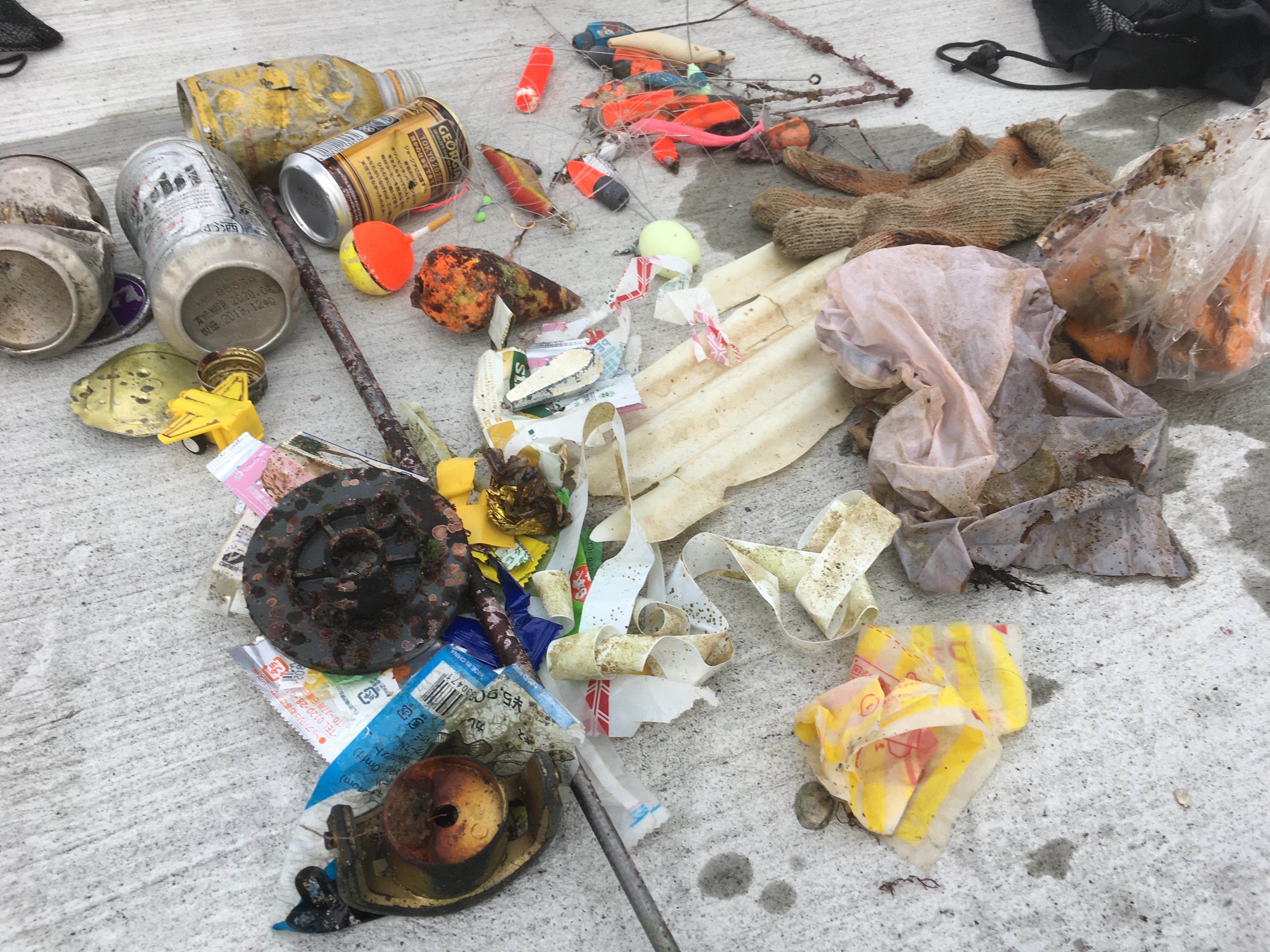
Left over debris from fishermen
0
On
kilograms
0
I have debris data to report
2
0
0
Slight for waves 0.5 -1.25 meter high
0
0
0
Released Unharmed
Yellow belly seahorse
1
Crab fishing net
Dead
Banjo Shark
1
0
0
0
0
m2
0
4
meters
other
Stab wound
0
0
0
0
0
0
0
0
0
0
0
0
0
0
0
0
1
0
0
0
0
0
0
0
0
0
0
0
Australia
State\Province
Victoria
City
Blairgowrie
Map Help


Dive Location

If you know your survey site coordinates, enter them manually in decimal degrees using WGS84 Map Datum. Use the minus sign for latitudes south of the equator and longitudes west of the Prime Meridian to 180 degrees.

If you do not know your survey site coordinates, click the “Map Location” tab to use the map to zoom into your survey site and drop the pin on the map to fall within your survey dive site in the water (not on land or the beach). Ensure you zoom in as much as possible to ensure data accuracy.

Entangled Help


Use the vertical tabs below to record any entangled animals you found of each type.

ADS571 - Saonek Monde

20
1
0

-0.44928799999999, 130.800923

0
0
0
sand
0
1
0
10
0
Visibility 15m+ and LOADS of fish.
Less debris than than previous months.
Big Metal pump for a boat
Raining
0
0
0
0
0
0
0
0
0
0
0
0
0
0
0
0
0
0
0
0
Meridian Adventure Dive Resort
Joane Esterhuizen
0
2
0
3
0
0
0
0
0
0
1
0
0
0
1
0
0
0
0
10
0
0
0
0
0
0
0
0
0
0
0
0
0
0
35.00
30
12.00
3.00
0
estimated
0
0
4239.00
0
0
0
0
0
Plastic water bottles
Fishing line
0
On
kilograms
0
I have debris data to report
7
0
0
Calm (glassy to rippled) for waves 0 – 0.1 meter high
0
0
0
0
0
0
0
m2
0
0
meters
coral reef
1
0
13
0
0
0
0
0
0
0
0
0
0
0
0
0
5
0
0
0
0
0
0
0
0
0
0
0
Indonesia
State\Province
Raja Ampat, West Papua
City
Waisai
Map Help


Dive Location

If you know your survey site coordinates, enter them manually in decimal degrees using WGS84 Map Datum. Use the minus sign for latitudes south of the equator and longitudes west of the Prime Meridian to 180 degrees.

If you do not know your survey site coordinates, click the “Map Location” tab to use the map to zoom into your survey site and drop the pin on the map to fall within your survey dive site in the water (not on land or the beach). Ensure you zoom in as much as possible to ensure data accuracy.

Entangled Help


Use the vertical tabs below to record any entangled animals you found of each type.

ADS474 - Yellow Submarine

1
11
0

12.16016285382, -68.282103860617

0
0
0
coral
0
2
0
31
0
Public harbour
Clothespin
Good
3
0
0
0
0
0
0
0
0
0
0
0
0
0
0
0
0
0
0
0
Fiberglass
Dive Friends
Pieter
0
1
0
5
0
0
0
0
0
0
0
0
0
0
0
0
0
0
0
3
0
0
0
0
0
0
0
1
0
0
0
0
0
0
12.00
60
18.00
1.00
0
estimated
0
0
3999.29
0
0
0
3
0
Plastic fragments
Fishing line
1
On
kilograms
0
I have debris data to report
0
0
0
Calm (glassy to rippled) for waves 0 – 0.1 meter high
1
0
0
0
13
0
0
m2
2
1
meters
coral reef
0
0
0
0
0
0
0
0
0
0
0
0
1
0
4
0
0
0
0
0
0
4
0
0
0
0
0
0
Netherlands Antilles
State\Province
Bonaire
City
Kralendijk
Map Help


Dive Location

If you know your survey site coordinates, enter them manually in decimal degrees using WGS84 Map Datum. Use the minus sign for latitudes south of the equator and longitudes west of the Prime Meridian to 180 degrees.

If you do not know your survey site coordinates, click the “Map Location” tab to use the map to zoom into your survey site and drop the pin on the map to fall within your survey dive site in the water (not on land or the beach). Ensure you zoom in as much as possible to ensure data accuracy.

Entangled Help


Use the vertical tabs below to record any entangled animals you found of each type.

Clean-Up and Marine Debris Survey in Panormos bay, Skopelos island, Greece

5
1
2

39.110028, 23.662981

sand
3
2

39.110882537652, 23.663606643677

The most volimunous and heavy item was a platform (like a pontoon) constructed with an aluminium-metal frame and wooden plank (with dimensions circa 2X5m. and weight 250-300kg). It might have been part of the infrastructure from an old water sport station that was operating years before and probably the platform was drifted and sunk close to the coast. Note that this particular water area was declared as archaeological site (prehistoric settlement) and only a couple years ago in 2018, they excluded a part of that bay and allowed us to scuba dive for recreational reasons. The reason was mainly that 200 meters from the shore an 80m cargo ship was sunk at -40m depth in '83, so they gave us the permission to visit it.
canopy cover made from asbestos fibers probably drifted to the sea and smashed form wind gusts during a storm. It might have been part of a land structure (small ηθτ) or part (roof cover for shade) from a fishing boat.
Skopelos Dive Center
Kostas Danis
3
1
2
2
1
2
2
6
2
350.00
65
15.00
5.00
3
estimated
1
300.00
5
1
2
canopy cover made from asbestos fibers
On
kilograms
1
I have debris data to report
3
1
Calm (glassy to rippled) for waves 0 – 0.1 meter high
5
m2
meters
other
1
2
Greece
State\Province
Thessaly
City
Skopelos
Map Help


Dive Location

If you know your survey site coordinates, enter them manually in decimal degrees using WGS84 Map Datum. Use the minus sign for latitudes south of the equator and longitudes west of the Prime Meridian to 180 degrees.

If you do not know your survey site coordinates, click the “Map Location” tab to use the map to zoom into your survey site and drop the pin on the map to fall within your survey dive site in the water (not on land or the beach). Ensure you zoom in as much as possible to ensure data accuracy.

Entangled Help


Use the vertical tabs below to record any entangled animals you found of each type.

Ecosystem Other
sandy (pebbles) seafloor with micro flora & fauna

jogashima

30

35.137121781071, 139.61188668822

21
sand
1
2

35.137121781071, 139.61188668822

jogashima diving center
nene fukizawa
10
1
1
1
4
1
1
1.80
80
8.00
2.00
measured
2
4800.00
On
kilograms
I have debris data to report
Calm (glassy to rippled) for waves 0 – 0.1 meter high
1
m2
meters
other
1
3
4
Japan
Map Help


Dive Location

If you know your survey site coordinates, enter them manually in decimal degrees using WGS84 Map Datum. Use the minus sign for latitudes south of the equator and longitudes west of the Prime Meridian to 180 degrees.

If you do not know your survey site coordinates, click the “Map Location” tab to use the map to zoom into your survey site and drop the pin on the map to fall within your survey dive site in the water (not on land or the beach). Ensure you zoom in as much as possible to ensure data accuracy.

Entangled Help


Use the vertical tabs below to record any entangled animals you found of each type.

Ecosystem Other
sandy bottom

ADS126 - Chilpo Beach Northern Rocky outcrop

1
64
7

36.136072, 129.398292

1
29
sand
3
34
Because of fishermen on the rocks and rather poor vis, I didn't try to take my normal northerly route for fear of not seeing their fishing line and be able to avoid it. I stayed fairly close to the entry point in shallower water which had enough trash to keep me busy for a long shallow dive.

Video of the entire dive here - https://youtu.be/3PFG0xMu33U
Clear.
Dive Against Debris Korea (Daegu)
William Henderson
2
1
3
4
1
1
1
1
1
1
20.00
79
4.00
1.00
27
estimated
1
14
60.00
3
burlap sacks
rags/clothing/some type of cloth
masses of twisted nylonrope/fishing.ine/cloth
On
kilograms
I have debris data to report
1
Smooth (wavelets) for waves 0.1 - 0.5 meter high
1
86
2
12
m2
9
7
meters
rocky reef
1
1
1
South Korea
State\Province
Gyeongbukdo
City
Pohang
Map Help


Dive Location

If you know your survey site coordinates, enter them manually in decimal degrees using WGS84 Map Datum. Use the minus sign for latitudes south of the equator and longitudes west of the Prime Meridian to 180 degrees.

If you do not know your survey site coordinates, click the “Map Location” tab to use the map to zoom into your survey site and drop the pin on the map to fall within your survey dive site in the water (not on land or the beach). Ensure you zoom in as much as possible to ensure data accuracy.

Entangled Help


Use the vertical tabs below to record any entangled animals you found of each type.

ADS364 - Toucari Bay

15.608358, -61.46621

coral
sunny
Salt
Kayla
2
0.00
50
68.00
7.00
measured
14929.00
On
kilograms
Our Survey Site was free of debris
Calm (glassy to rippled) for waves 0 – 0.1 meter high ft2
feet
coral reef
Dominica
City
Toucari
Map Help


Dive Location

If you know your survey site coordinates, enter them manually in decimal degrees using WGS84 Map Datum. Use the minus sign for latitudes south of the equator and longitudes west of the Prime Meridian to 180 degrees.

If you do not know your survey site coordinates, click the “Map Location” tab to use the map to zoom into your survey site and drop the pin on the map to fall within your survey dive site in the water (not on land or the beach). Ensure you zoom in as much as possible to ensure data accuracy.

Entangled Help


Use the vertical tabs below to record any entangled animals you found of each type.

ADS364 - Toucari Bay

15.608358, -61.46621

coral
sunny
Salt
Kayla
2
0.00
26
21.00
7.00
measured
14929.00
On
kilograms
Our Survey Site was free of debris
Calm (glassy to rippled) for waves 0 – 0.1 meter high ft2
feet
coral reef
Dominica
City
Toucari
Map Help


Dive Location

If you know your survey site coordinates, enter them manually in decimal degrees using WGS84 Map Datum. Use the minus sign for latitudes south of the equator and longitudes west of the Prime Meridian to 180 degrees.

If you do not know your survey site coordinates, click the “Map Location” tab to use the map to zoom into your survey site and drop the pin on the map to fall within your survey dive site in the water (not on land or the beach). Ensure you zoom in as much as possible to ensure data accuracy.

Entangled Help


Use the vertical tabs below to record any entangled animals you found of each type.

ADS364 - Toucari Bay

15.608358, -61.46621

coral
sunny
Salt
Kayla
2
0.00
26
36.00
7.00
measured
14929.00
On
kilograms
Our Survey Site was free of debris
Calm (glassy to rippled) for waves 0 – 0.1 meter high ft2
feet
coral reef
Dominica
City
Toucari
Map Help


Dive Location

If you know your survey site coordinates, enter them manually in decimal degrees using WGS84 Map Datum. Use the minus sign for latitudes south of the equator and longitudes west of the Prime Meridian to 180 degrees.

If you do not know your survey site coordinates, click the “Map Location” tab to use the map to zoom into your survey site and drop the pin on the map to fall within your survey dive site in the water (not on land or the beach). Ensure you zoom in as much as possible to ensure data accuracy.

Entangled Help


Use the vertical tabs below to record any entangled animals you found of each type.

ADS364 - Toucari Bay

15.608358, -61.46621

coral
sunny
Salt
Kayla
5
0.00
47
33.00
7.00
measured
14929.00
On
kilograms
Our Survey Site was free of debris
Calm (glassy to rippled) for waves 0 – 0.1 meter high ft2
feet
coral reef
Dominica
City
Toucari
Map Help


Dive Location

If you know your survey site coordinates, enter them manually in decimal degrees using WGS84 Map Datum. Use the minus sign for latitudes south of the equator and longitudes west of the Prime Meridian to 180 degrees.

If you do not know your survey site coordinates, click the “Map Location” tab to use the map to zoom into your survey site and drop the pin on the map to fall within your survey dive site in the water (not on land or the beach). Ensure you zoom in as much as possible to ensure data accuracy.

Entangled Help


Use the vertical tabs below to record any entangled animals you found of each type.

Subscribe to