Menu

Jack Neal Beach

16.07599, -86.93811
sand
1
stormy weather
top sunshine - pouring rain
Utila Dive Center
7
2
1
0.62
44
11.50
1.00
measured
1
725.00
fishing line
fishing hook
plastic bottles
On
kilograms
I have debris data to report
1
1
Calm (glassy to rippled) for waves 0 – 0.1 meter high
1
m2
meters
coral reef
2
Honduras
State\Province
Bay Islands
City
Utila
Map Help


Dive Location

If you know your survey site coordinates, enter them manually in decimal degrees using WGS84 Map Datum. Use the minus sign for latitudes south of the equator and longitudes west of the Prime Meridian to 180 degrees.

If you do not know your survey site coordinates, click the “Map Location” tab to use the map to zoom into your survey site and drop the pin on the map to fall within your survey dive site in the water (not on land or the beach). Ensure you zoom in as much as possible to ensure data accuracy.

Entangled Help


Use the vertical tabs below to record any entangled animals you found of each type.

Taganga bay

sand

11.270675537723, -74.196818768978

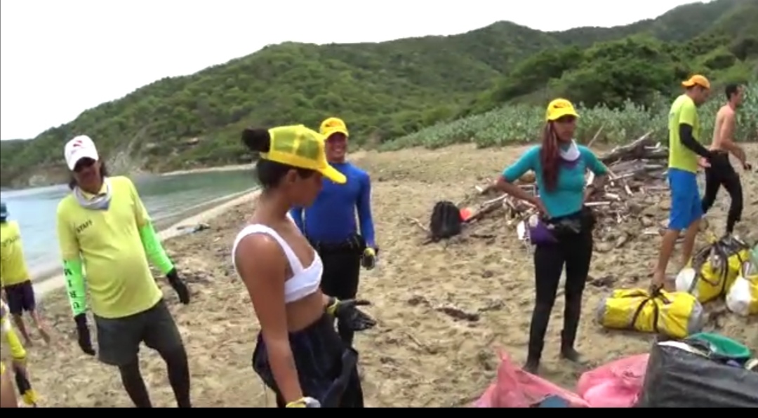
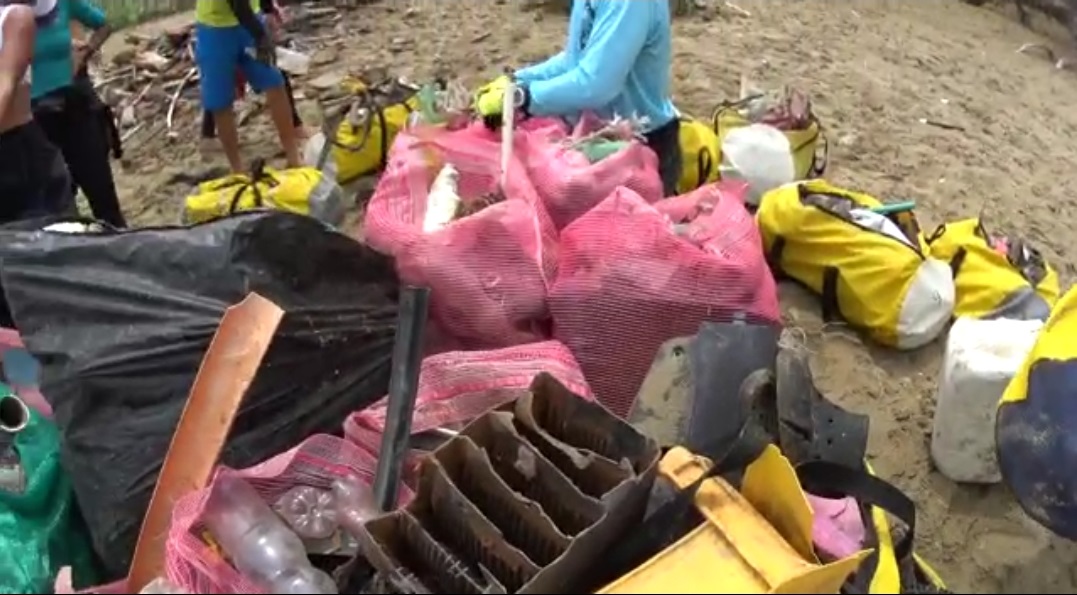
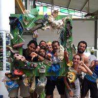
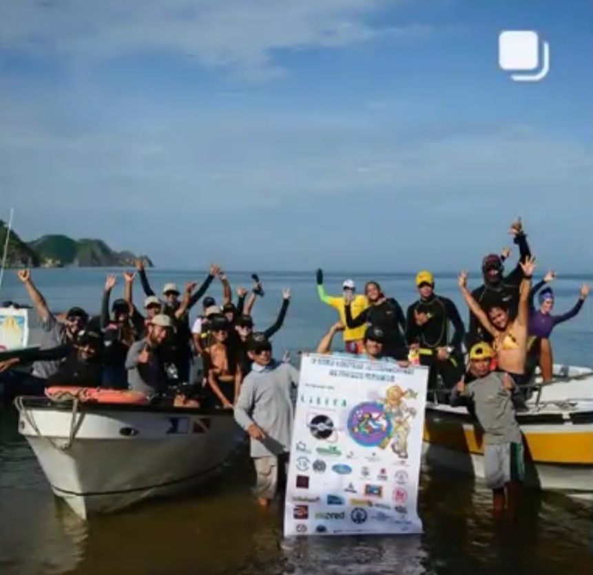
We are a group of people who was accepted for La Red de Vigilantes Marinos to be their leaders in Colombia, Thes cleanup was part of it.
Plastic
rainy, cloudy. calm waters.
Red de Vigilantes Marinos
Hernando Bonilla
18
1500.00
60
6.00
0.50
estimated
3000.00
On
kilograms
I have debris data to report
Smooth (wavelets) for waves 0.1 - 0.5 meter high m2
meters
coral reef
Colombia
State\Province
Magdalena
City
Santa Marta
Map Help


Dive Location

If you know your survey site coordinates, enter them manually in decimal degrees using WGS84 Map Datum. Use the minus sign for latitudes south of the equator and longitudes west of the Prime Meridian to 180 degrees.

If you do not know your survey site coordinates, click the “Map Location” tab to use the map to zoom into your survey site and drop the pin on the map to fall within your survey dive site in the water (not on land or the beach). Ensure you zoom in as much as possible to ensure data accuracy.
Entangled Help


Use the vertical tabs below to record any entangled animals you found of each type.

ADS557 - Muravandhoo House Reef

7
rock
11

5.6060130991471, 72.951954603195

the site corresponds to the supply jetty in Joali
tyres, rubber pumber
Cloudy, sporadic rains during morning
2
6
Electric cable
Rubber bumper
Best Dives
Aura Torres
3
10
2
2
330.00
40
6.50
4.50
estimated
1
45.00
2
1
7
rubber pumber
tyre
garbage bags
On
kilograms
I have debris data to report
1
Calm (glassy to rippled) for waves 0 – 0.1 meter high
11
2
8
m2
meters
rocky reef
7
4
5
1
1
1
1
Maldives
Map Help


Dive Location

If you know your survey site coordinates, enter them manually in decimal degrees using WGS84 Map Datum. Use the minus sign for latitudes south of the equator and longitudes west of the Prime Meridian to 180 degrees.

If you do not know your survey site coordinates, click the “Map Location” tab to use the map to zoom into your survey site and drop the pin on the map to fall within your survey dive site in the water (not on land or the beach). Ensure you zoom in as much as possible to ensure data accuracy.
Entangled Help


Use the vertical tabs below to record any entangled animals you found of each type.

ADS529 - Manafaru House Reef

rock
2
15

6.9989101270045, 72.943761752215

carm sea ,good weather sunshine
BEST DIVES MANAFARU
Mari Kawagoe
1
2
1
5
1
3
1
1
65.00
60
8.00
2.00
1
measured
2500.00
1
On
kilograms
I have debris data to report
2
Calm (glassy to rippled) for waves 0 – 0.1 meter high
15
1
1
1
m2
15
2
meters
coral reef
10
30
1
2
15
6
3
1
5
Maldives
State\Province
HA.
City
JA Manafaru
Map Help


Dive Location

If you know your survey site coordinates, enter them manually in decimal degrees using WGS84 Map Datum. Use the minus sign for latitudes south of the equator and longitudes west of the Prime Meridian to 180 degrees.

If you do not know your survey site coordinates, click the “Map Location” tab to use the map to zoom into your survey site and drop the pin on the map to fall within your survey dive site in the water (not on land or the beach). Ensure you zoom in as much as possible to ensure data accuracy.

Entangled Help


Use the vertical tabs below to record any entangled animals you found of each type.

ADS490 - Namae Beach

1
28
34
rock
1
8

37.939174746724, 128.7889186386

Oceankind / Namae Scuba Resort
Yongkyu Kim
2
44
3
1
2.00
40
5.00
2.00
estimated
37
1000.00
On
kilograms
I have debris data to report
Smooth (wavelets) for waves 0.1 - 0.5 meter high
1
m2
meters
rocky reef
5
1
South Korea
State\Province
Gangwon-do
City
Yangyang
Map Help


Dive Location

If you know your survey site coordinates, enter them manually in decimal degrees using WGS84 Map Datum. Use the minus sign for latitudes south of the equator and longitudes west of the Prime Meridian to 180 degrees.

If you do not know your survey site coordinates, click the “Map Location” tab to use the map to zoom into your survey site and drop the pin on the map to fall within your survey dive site in the water (not on land or the beach). Ensure you zoom in as much as possible to ensure data accuracy.

Entangled Help


Use the vertical tabs below to record any entangled animals you found of each type.

Shallow Turbo

2
2
0

-8.3476477951746, 116.04402087794

0
0
0
coral
0
0
0
3
0
No
Towel
Sunny and calm
0
0
0
0
0
0
0
0
0
0
0
0
0
0
0
0
0
0
0
0
Trawangan Dive Center
Holly
0
0
0
0
0
0
0
0
0
0
0
0
0
0
0
0
0
0
0
10
0
0
0
0
0
0
0
0
0
0
0
0
0
0
1.00
41
20.00
3.00
1
estimated
0
0
8786.76
0
0
0
1
0
Fishing lines and hooks
Plastic wrappers
Glass bottles
0
On
kilograms
0
I have debris data to report
1
0
0
Smooth (wavelets) for waves 0.1 - 0.5 meter high
0
0
0
0
0
0
0
m2
0
1
meters
coral reef
0
0
0
0
0
0
0
0
0
0
0
0
0
0
0
0
0
0
0
0
0
0
0
0
0
0
0
0
Indonesia
State\Province
Lombok
City
Gili Trawangan
Map Help


Dive Location

If you know your survey site coordinates, enter them manually in decimal degrees using WGS84 Map Datum. Use the minus sign for latitudes south of the equator and longitudes west of the Prime Meridian to 180 degrees.

If you do not know your survey site coordinates, click the “Map Location” tab to use the map to zoom into your survey site and drop the pin on the map to fall within your survey dive site in the water (not on land or the beach). Ensure you zoom in as much as possible to ensure data accuracy.

Entangled Help


Use the vertical tabs below to record any entangled animals you found of each type.

Shallow Turbo

2
2
0

-8.3480604671787, 116.04337157102

0
0
0
coral
0
1
0
3
0
Calm
0
0
0
0
0
0
0
0
0
0
0
0
0
0
0
0
0
0
0
0
0
0
0
0
0
0
0
0
0
0
0
0
0
0
0
0
0
0
0
10
0
0
0
0
0
0
0
0
0
0
0
0
0
0
1.00
40
22.00
4.00
1
estimated
0
0
4193.46
0
0
0
1
0
Fishing lines
Glass bottles
Plastic bags
1
On
kilograms
0
I have debris data to report
1
0
0
Smooth (wavelets) for waves 0.1 - 0.5 meter high
0
0
0
0
0
0
0
m2
0
1
meters
coral reef
0
0
0
0
0
0
0
0
0
0
0
0
0
0
0
0
0
0
0
0
0
0
0
0
0
0
0
0
Indonesia
City
Gili Trawangan
Map Help


Dive Location

If you know your survey site coordinates, enter them manually in decimal degrees using WGS84 Map Datum. Use the minus sign for latitudes south of the equator and longitudes west of the Prime Meridian to 180 degrees.

If you do not know your survey site coordinates, click the “Map Location” tab to use the map to zoom into your survey site and drop the pin on the map to fall within your survey dive site in the water (not on land or the beach). Ensure you zoom in as much as possible to ensure data accuracy.

Entangled Help


Use the vertical tabs below to record any entangled animals you found of each type.

Bonito Gordo/Parque Tayrona

sand

11.295219267475, -74.167614296931

A lot of people met with one goal, for free, we were joining th World Cleanup day.
Plastic
Cloudy and rainy, 30 to 34 celsius.
World Cleanup day
Hernando Bonilla
32
2950.00
120
5.00
0.50
measured
25000.00
On
kilograms
I have debris data to report
Calm (glassy to rippled) for waves 0 – 0.1 meter high m2
meters
seagrass
Colombia
State\Province
Magdalena
City
Santa Marta
Map Help


Dive Location

If you know your survey site coordinates, enter them manually in decimal degrees using WGS84 Map Datum. Use the minus sign for latitudes south of the equator and longitudes west of the Prime Meridian to 180 degrees.

If you do not know your survey site coordinates, click the “Map Location” tab to use the map to zoom into your survey site and drop the pin on the map to fall within your survey dive site in the water (not on land or the beach). Ensure you zoom in as much as possible to ensure data accuracy.

Entangled Help


Use the vertical tabs below to record any entangled animals you found of each type.

Koloa landing

20
4
0

21.878784329159, -159.46860484715

5
0
0
coral
0
0
1
20
0
Painted toenail
Calm
1
0
0
0
0
0
0
0
0
0
0
0
0
0
0
0
0
0
0
0
Shotgun shell
Scott
0
0
0
0
0
0
0
0
0
0
1
0
0
2
0
0
0
3
0
7
0
0
0
0
0
0
1
0
0
0
7
0
0
0
10.00
55
45.00
5.00
0
estimated
0
20
3511.62
0
0
0
0
0
Fishing line
Plastic fragments
Golf balls
0
On
pounds
0
I have debris data to report
0
0
0
Calm (glassy to rippled) for waves 0 – 0.1 meter high
0
0
0
0
0
0
0
m2
0
0
feet
coral reef
0
0
0
0
0
0
0
0
0
2
0
0
0
0
0
5
0
0
0
0
0
0
0
0
0
0
0
0
United States
State\Province
Hawaii
City
Koloa
Map Help


Dive Location

If you know your survey site coordinates, enter them manually in decimal degrees using WGS84 Map Datum. Use the minus sign for latitudes south of the equator and longitudes west of the Prime Meridian to 180 degrees.

If you do not know your survey site coordinates, click the “Map Location” tab to use the map to zoom into your survey site and drop the pin on the map to fall within your survey dive site in the water (not on land or the beach). Ensure you zoom in as much as possible to ensure data accuracy.

Entangled Help


Use the vertical tabs below to record any entangled animals you found of each type.

ADS561 - Shark Point

0
1
0

-8.3448043952198, 116.0257609354

0
0
0
coral
0
1
0
13
0
Fishing
Kitchen knife
Clear
1
0
0
0
0
0
0
0
0
0
0
0
0
0
0
0
0
0
0
0
Concrete sack
Trawangan Dive Center
Chelsey
0
0
0
0
0
0
0
0
0
1
0
0
0
0
0
0
0
0
0
3
0
0
0
0
0
0
0
0
0
0
0
0
0
0
2.00
60
30.00
5.00
0
estimated
0
30
108475.00
0
0
0
0
0
Fishing line
Fishing hooks
Concrete bags
0
On
kilograms
0
I have debris data to report
0
0
0
Calm (glassy to rippled) for waves 0 – 0.1 meter high
0
0
0
0
0
1
0
m2
0
0
meters
coral reef
0
0
0
0
1
1
0
0
0
0
0
0
0
0
0
0
0
0
0
0
0
0
0
0
0
0
0
0
Indonesia
State\Province
Lombok
City
Gili Trawangan
Map Help


Dive Location

If you know your survey site coordinates, enter them manually in decimal degrees using WGS84 Map Datum. Use the minus sign for latitudes south of the equator and longitudes west of the Prime Meridian to 180 degrees.

If you do not know your survey site coordinates, click the “Map Location” tab to use the map to zoom into your survey site and drop the pin on the map to fall within your survey dive site in the water (not on land or the beach). Ensure you zoom in as much as possible to ensure data accuracy.
Entangled Help


Use the vertical tabs below to record any entangled animals you found of each type.

Subscribe to