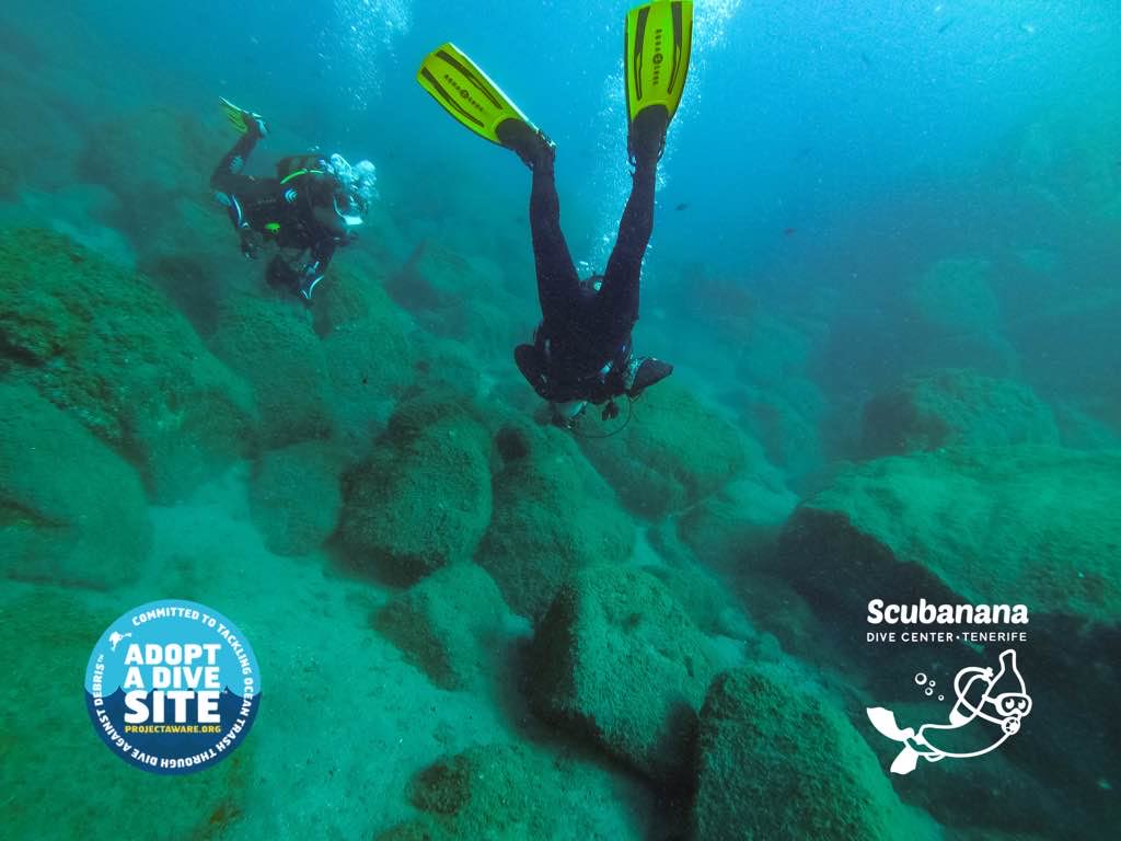
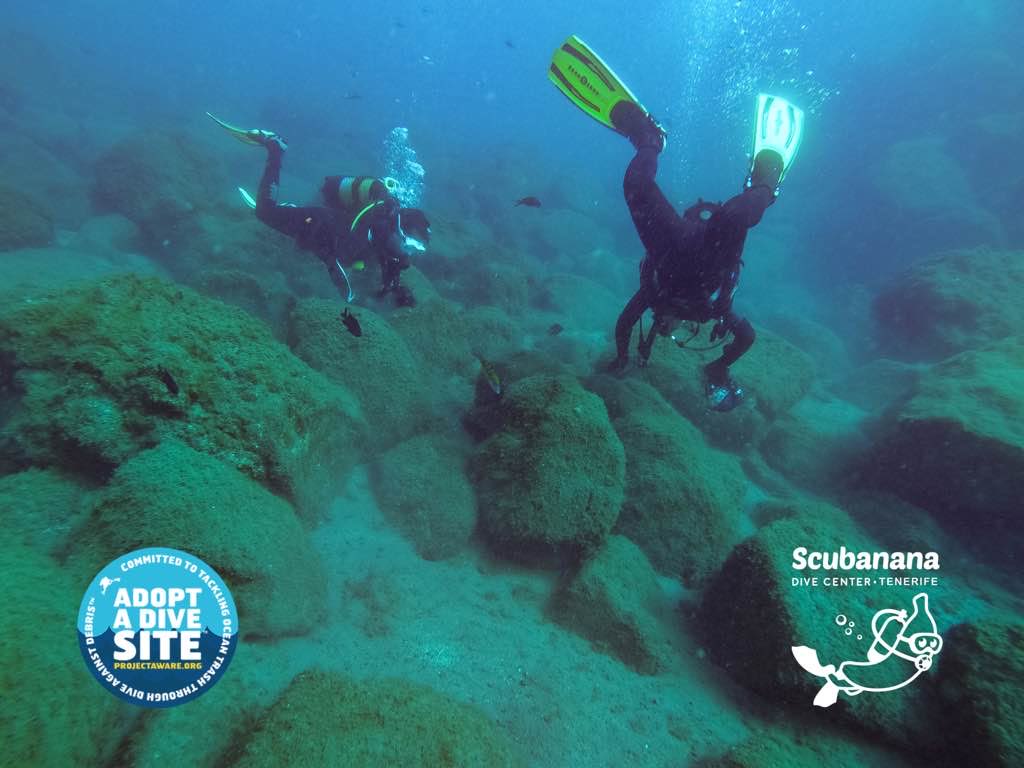
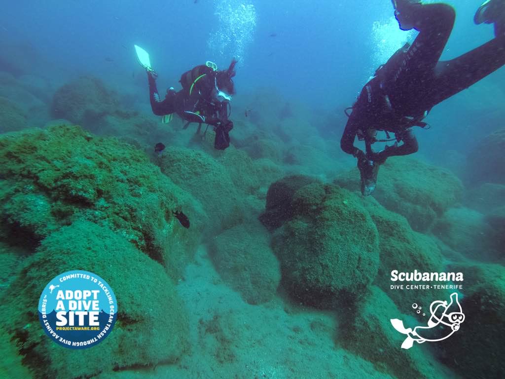
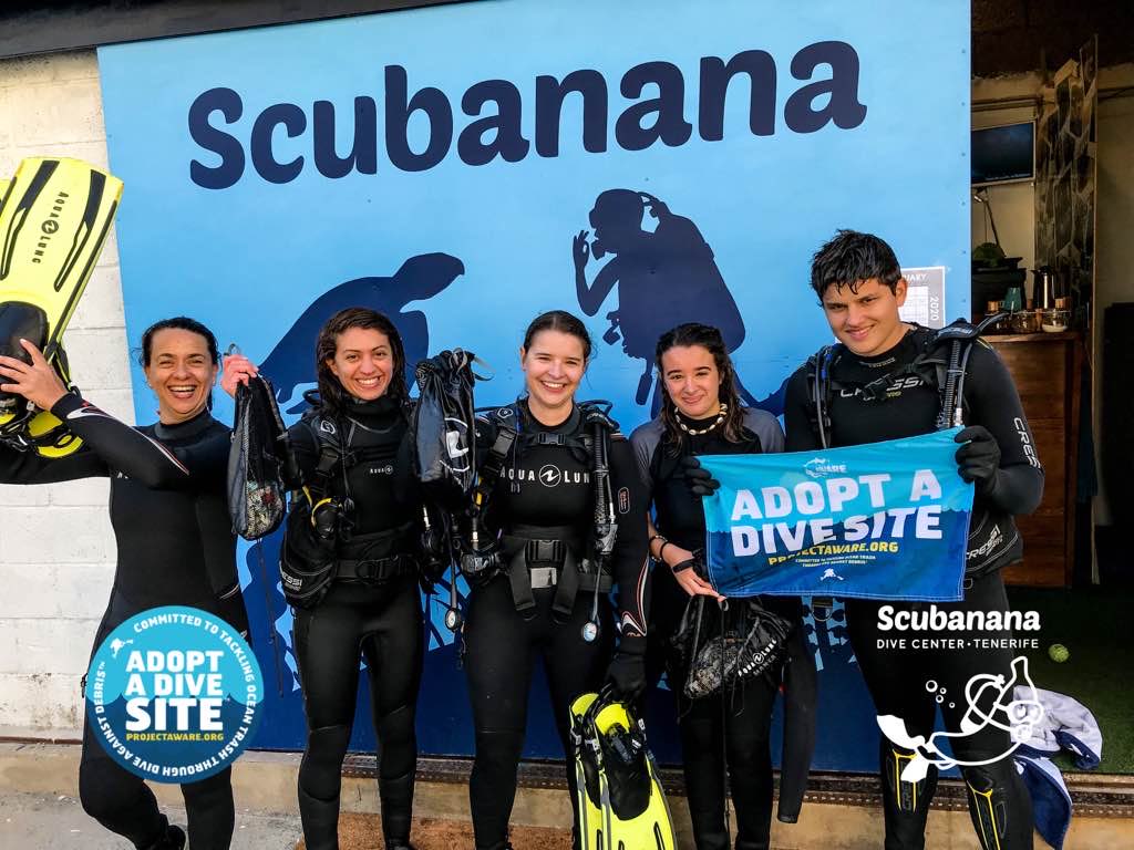
Menu

ADS528 - Radazul

20
268
0

28.401225187871, -16.323759965791

0
0
0
sand
0
0
0
14
1
9
3
1
0
0
0
0
0
0
0
0
0
0
0
0
0
0
0
0
0
Sticking plaster
Hair tie
Hair lock
Scubanana Dive Center
Zuleyka Lara Biceño
0
9
0
6
0
0
0
0
2
0
0
0
0
1
16
0
0
1
0
6
0
0
0
0
1
0
0
0
0
0
0
0
0
0
3.20
45
14.00
10.00
0
measured
0
1
7814.00
0
0
0
0
0
Plastic fragments (micro plastic)
Sanitary towels
Fishing lines
0
On
kilograms
0
I have debris data to report
0
1
0
Calm (glassy to rippled) for waves 0 – 0.1 meter high
4
0
0
0
0
0
0
m2
12
0
meters
rocky reef
0
0
1
0
0
0
0
0
0
0
0
0
0
4
0
0
4
0
0
0
0
4
0
0
0
0
0
0
Spain
State\Province
Canary Islands
City
Radazul
Map Help


Dive Location

If you know your survey site coordinates, enter them manually in decimal degrees using WGS84 Map Datum. Use the minus sign for latitudes south of the equator and longitudes west of the Prime Meridian to 180 degrees.

If you do not know your survey site coordinates, click the “Map Location” tab to use the map to zoom into your survey site and drop the pin on the map to fall within your survey dive site in the water (not on land or the beach). Ensure you zoom in as much as possible to ensure data accuracy.

Entangled Help


Use the vertical tabs below to record any entangled animals you found of each type.

Clownfish

0
0
0
0

-23.840543, 35.546702

0
0
0
rock
0
0
0
0
0
Fishing
Bottle cap
Medium swell, light winds
Liquid Dive Adventures
Maria
0
0
0
0
0
0
0
0
0
0
0
0
0
0
0
0
0
1
0
3
0
0
0
0
0
0
0
0
0
0
0
0
0
0
0
0
0.05
62
9.00
5.00
0
estimated
0
0
0
0
3769.51
0
0
0
0
0
Fishing net
Plastic bottles
0
On
kilograms
0
I have debris data to report
0
0
0
Moderate to rough for waves greater than 1.25 meters
0
0
0
0
0
0
0
m2
1
0
meters
coral reef
0
0
0
0
0
0
0
0
0
0
0
0
0
0
0
0
0
0
0
0
0
0
0
0
0
0
0
0
0
Mozambique
State\Province
Inhambane
City
Tofo
Map Help


Dive Location

If you know your survey site coordinates, enter them manually in decimal degrees using WGS84 Map Datum. Use the minus sign for latitudes south of the equator and longitudes west of the Prime Meridian to 180 degrees.

If you do not know your survey site coordinates, click the “Map Location” tab to use the map to zoom into your survey site and drop the pin on the map to fall within your survey dive site in the water (not on land or the beach). Ensure you zoom in as much as possible to ensure data accuracy.

Entangled Help


Use the vertical tabs below to record any entangled animals you found of each type.

ADS521 - Mirette Reef

40

27.249011086595, 33.847801618413

coral
1
This time there is much less garbage, I think-this is due to the season and weather
stormy, sometimes rain
Crazy Dolphins
Stanislav Yurchenko
6
2
3
4
4
3.00
40
13.00
2.00
estimated
30.00
On
kilograms
I have debris data to report
Slight for waves 0.5 -1.25 meter high m2
meters
coral reef
Egypt
State\Province
Hurghada
City
Hurghada
Map Help


Dive Location

If you know your survey site coordinates, enter them manually in decimal degrees using WGS84 Map Datum. Use the minus sign for latitudes south of the equator and longitudes west of the Prime Meridian to 180 degrees.

If you do not know your survey site coordinates, click the “Map Location” tab to use the map to zoom into your survey site and drop the pin on the map to fall within your survey dive site in the water (not on land or the beach). Ensure you zoom in as much as possible to ensure data accuracy.

Entangled Help


Use the vertical tabs below to record any entangled animals you found of each type.

Santa Rita Beach

0
0
0
0

1.692503, 7.404081

0
0
0
sand
0
353
0
20
0
Yes
Spear Gun
Strong current
Bom Bom Dive Center
Flávio Quina
0
0
0
6
0
0
0
0
0
0
0
0
5
0
0
0
1
0
0
12
0
0
0
0
48
3
15
0
0
0
0
0
0
0
0
0
20.00
60
8.00
2.00
10
measured
0
0
0
0
5559.10
2
1
0
0
0
Fresh water bags
0
On
kilograms
0
I have debris data to report
4
0
0
Calm (glassy to rippled) for waves 0 – 0.1 meter high
0
0
4
0
0
2
9
m2
5
5
meters
rocky reef
0
0
2
1
0
0
0
2
0
3
0
0
0
3
0
5
0
10
0
0
0
0
0
0
1
0
0
0
0
Sao Tome and Principe
Map Help


Dive Location

If you know your survey site coordinates, enter them manually in decimal degrees using WGS84 Map Datum. Use the minus sign for latitudes south of the equator and longitudes west of the Prime Meridian to 180 degrees.

If you do not know your survey site coordinates, click the “Map Location” tab to use the map to zoom into your survey site and drop the pin on the map to fall within your survey dive site in the water (not on land or the beach). Ensure you zoom in as much as possible to ensure data accuracy.

Entangled Help


Use the vertical tabs below to record any entangled animals you found of each type.

Test update after submit

51.483520181592, -3.1907764172462

sand
James
1
0.00
20
15.00
10.00
measured
100.00
On
kilograms
Our Survey Site was free of debris
Calm (glassy to rippled) for waves 0 – 0.1 meter high m2
meters
coral reef
Afghanistan
Map Help


Dive Location

If you know your survey site coordinates, enter them manually in decimal degrees using WGS84 Map Datum. Use the minus sign for latitudes south of the equator and longitudes west of the Prime Meridian to 180 degrees.

If you do not know your survey site coordinates, click the “Map Location” tab to use the map to zoom into your survey site and drop the pin on the map to fall within your survey dive site in the water (not on land or the beach). Ensure you zoom in as much as possible to ensure data accuracy.

Entangled Help


Use the vertical tabs below to record any entangled animals you found of each type.

Alung Banua (Alban)

0
4
0
0

1.617456, 124.751878

0
0
0
other
0
0
0
8
0
Steep dive site, maybe trash falls in deeper area
No
Quite clean a dive site
Snorkel
Rain, wind, waves from north east and current
Two Fish Divers Bunaken
Yolanda
0
1
0
0
0
0
0
0
1
0
0
0
1
0
1
0
0
0
0
4
0
0
0
0
0
0
0
0
0
0
0
0
0
0
0
0
2.50
60
20.00
5.00
5
estimated
0
0
0
0
10287.30
0
0
0
0
0
Fishing lines
Cloth
Plastic
0
On
kilograms
0
I have debris data to report
0
0
0
Calm (glassy to rippled) for waves 0 – 0.1 meter high
1
0
0
Fishing line
Crab
Released Unharmed
1
0
5
0
0
m2
1
0
1
Clothing
Brittle Star
Released Unharmed
meters
coral reef
0
0
0
0
0
0
0
0
0
0
0
0
0
0
0
0
0
0
0
0
0
0
0
0
0
0
0
0
0
Indonesia
City
Bunaken
Map Help


Dive Location

If you know your survey site coordinates, enter them manually in decimal degrees using WGS84 Map Datum. Use the minus sign for latitudes south of the equator and longitudes west of the Prime Meridian to 180 degrees.

If you do not know your survey site coordinates, click the “Map Location” tab to use the map to zoom into your survey site and drop the pin on the map to fall within your survey dive site in the water (not on land or the beach). Ensure you zoom in as much as possible to ensure data accuracy.

Entangled Help


Use the vertical tabs below to record any entangled animals you found of each type.

ADS43 - House Reef of Kontiki Mactan

0
0
0

10.281504704746, 123.99890542167

0
0
0
coral
0
3
0
7
0
Windy and drizzling
0
0
0
0
0
0
0
0
0
0
0
0
0
0
0
0
0
0
0
0
Dive Funatics
Kae Estampador
0
0
0
3
0
0
0
0
0
0
0
0
0
0
0
0
0
0
0
12
1
0
0
0
0
0
0
0
0
0
0
0
0
0
4.00
43
17.30
1.50
0
estimated
0
0
1442.01
0
0
0
0
0
0
On
kilograms
0
I have debris data to report
3
0
0
Calm (glassy to rippled) for waves 0 – 0.1 meter high
0
0
0
0
5
0
0
m2
0
3
meters
coral reef
0
0
0
0
0
1
0
0
0
0
0
0
2
0
0
1
1
0
0
0
0
0
0
0
0
0
0
0
Philippines
State\Province
Cebu
City
Lapulapu
Map Help


Dive Location

If you know your survey site coordinates, enter them manually in decimal degrees using WGS84 Map Datum. Use the minus sign for latitudes south of the equator and longitudes west of the Prime Meridian to 180 degrees.

If you do not know your survey site coordinates, click the “Map Location” tab to use the map to zoom into your survey site and drop the pin on the map to fall within your survey dive site in the water (not on land or the beach). Ensure you zoom in as much as possible to ensure data accuracy.

Entangled Help


Use the vertical tabs below to record any entangled animals you found of each type.

House Reef

sand

-17.7873557, 178.7306635

Sunny, Calm
GVI
Ines
3
0.10
45
3.00
0.00
estimated
50.00
On
kilograms
I have debris data to report
Calm (glassy to rippled) for waves 0 – 0.1 meter high m2
meters
coral reef
1
Fiji
State\Province
Lomaiviti
City
Caqalai
Map Help


Dive Location

If you know your survey site coordinates, enter them manually in decimal degrees using WGS84 Map Datum. Use the minus sign for latitudes south of the equator and longitudes west of the Prime Meridian to 180 degrees.

If you do not know your survey site coordinates, click the “Map Location” tab to use the map to zoom into your survey site and drop the pin on the map to fall within your survey dive site in the water (not on land or the beach). Ensure you zoom in as much as possible to ensure data accuracy.

Entangled Help


Use the vertical tabs below to record any entangled animals you found of each type.

French Reef Deep test site test site

25.041868046331, -80.412771312137

sand
This is a test
This was a test
Great test!
This is a test
Test
Rainbow Reef Dive Center/FKNMS
Jack fishman test
1
0.00
45
35.00
10.00
measured
122.03
On
kilograms
Our Survey Site was free of debris
Calm (glassy to rippled) for waves 0 – 0.1 meter high
Fishing gear but this is a test
1
Released Unharmed
Shark species of some sort
m2
meters
coral reef
United States
State\Province
Florida
City
Key Largo
Map Help


Dive Location

If you know your survey site coordinates, enter them manually in decimal degrees using WGS84 Map Datum. Use the minus sign for latitudes south of the equator and longitudes west of the Prime Meridian to 180 degrees.

If you do not know your survey site coordinates, click the “Map Location” tab to use the map to zoom into your survey site and drop the pin on the map to fall within your survey dive site in the water (not on land or the beach). Ensure you zoom in as much as possible to ensure data accuracy.

Entangled Help


Use the vertical tabs below to record any entangled animals you found of each type.

French Reef Deep

25.041868046331, -80.412771312137

sand
This is a test
This was a test
Great test!
This is a test
Test
Rainbow Reef Dive Center/FKNMS
Luke Durso
1
0.00
45
35.00
10.00
measured
122.03
On
kilograms
Our Survey Site was free of debris
Calm (glassy to rippled) for waves 0 – 0.1 meter high
Fishing gear but this is a test
1
Released Unharmed
Shark species of some sort
m2
meters
coral reef
United States
State\Province
Florida
City
Key Largo
Map Help


Dive Location

If you know your survey site coordinates, enter them manually in decimal degrees using WGS84 Map Datum. Use the minus sign for latitudes south of the equator and longitudes west of the Prime Meridian to 180 degrees.

If you do not know your survey site coordinates, click the “Map Location” tab to use the map to zoom into your survey site and drop the pin on the map to fall within your survey dive site in the water (not on land or the beach). Ensure you zoom in as much as possible to ensure data accuracy.

Entangled Help


Use the vertical tabs below to record any entangled animals you found of each type.

Subscribe to