Menu

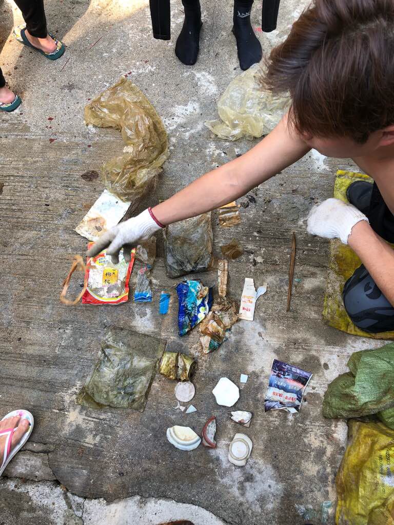
ADS323 - Tung Ping Chau

15
14
0

22.545909, 114.431823

0
0
0
sand
1
21
0
1
0
Sunny
3
0
0
0
0
0
0
0
0
0
0
0
0
0
0
0
0
0
0
0
Tarp bags
Tursiopsdivers
Eszter
0
0
0
5
1
0
0
0
2
0
7
0
0
3
0
0
0
0
0
13
0
0
0
0
0
0
0
0
0
0
0
0
0
0
8.40
28
6.00
1.20
2
measured
0
0
2983.89
0
0
0
0
0
Plastic fragments
0
On
kilograms
0
I have debris data to report
2
0
0
Calm (glassy to rippled) for waves 0 – 0.1 meter high
0
0
0
0
0
0
0
m2
2
0
meters
coral reef
0
0
0
0
0
0
0
0
0
1
0
0
0
0
0
0
5
0
0
0
0
7
0
0
0
0
0
0
Hong Kong S.A.R., China
Map Help


Dive Location

If you know your survey site coordinates, enter them manually in decimal degrees using WGS84 Map Datum. Use the minus sign for latitudes south of the equator and longitudes west of the Prime Meridian to 180 degrees.

If you do not know your survey site coordinates, click the “Map Location” tab to use the map to zoom into your survey site and drop the pin on the map to fall within your survey dive site in the water (not on land or the beach). Ensure you zoom in as much as possible to ensure data accuracy.

Entangled Help


Use the vertical tabs below to record any entangled animals you found of each type.

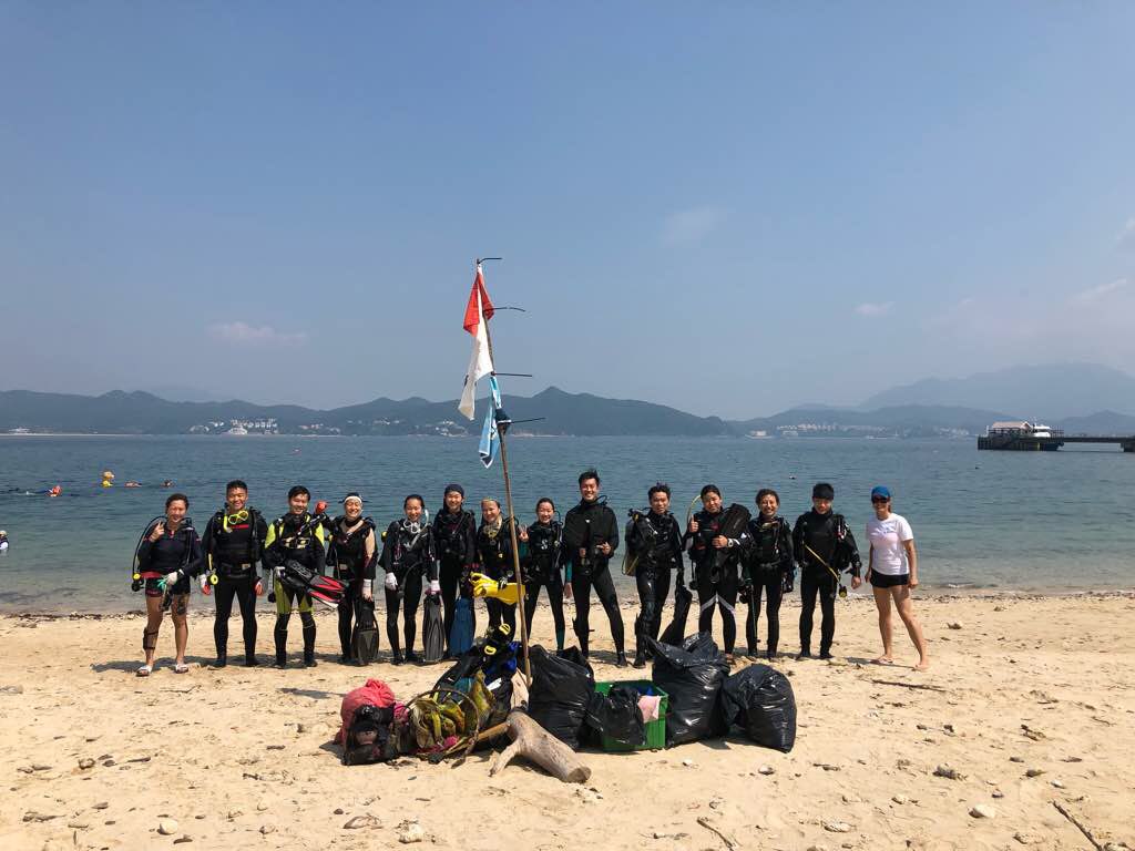
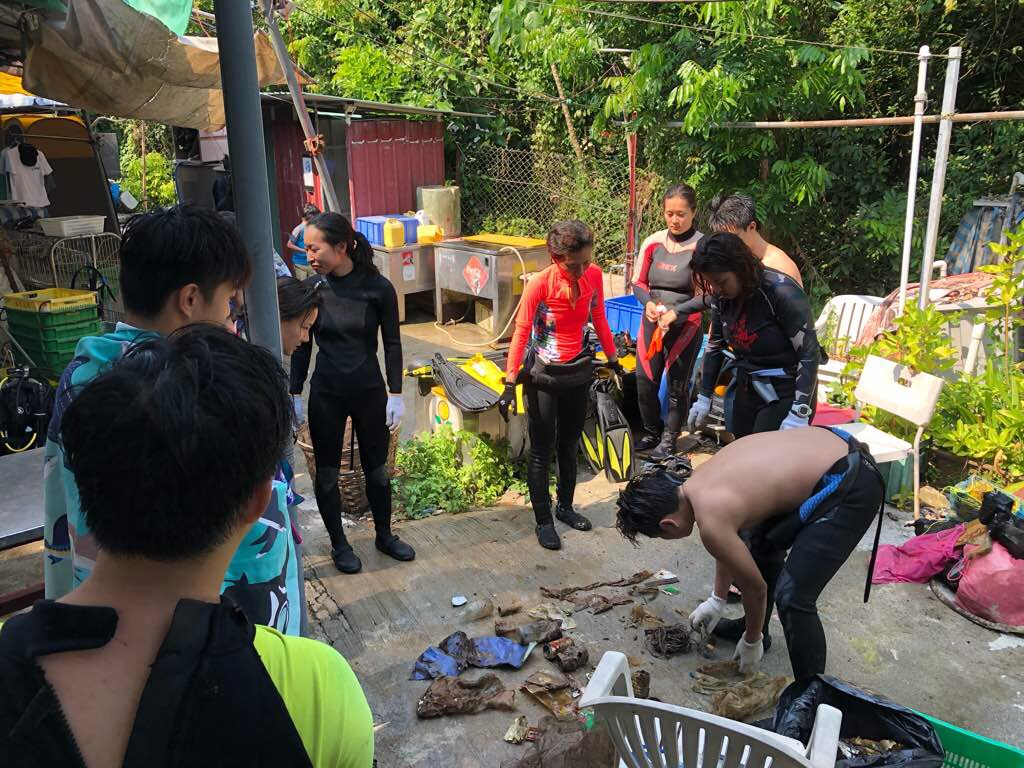
ADS323 - Tung Ping Chau

59
101
13

22.545909, 114.431823

0
0
0
sand
4
40
0
4
0
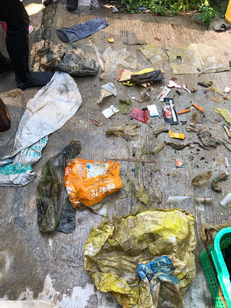
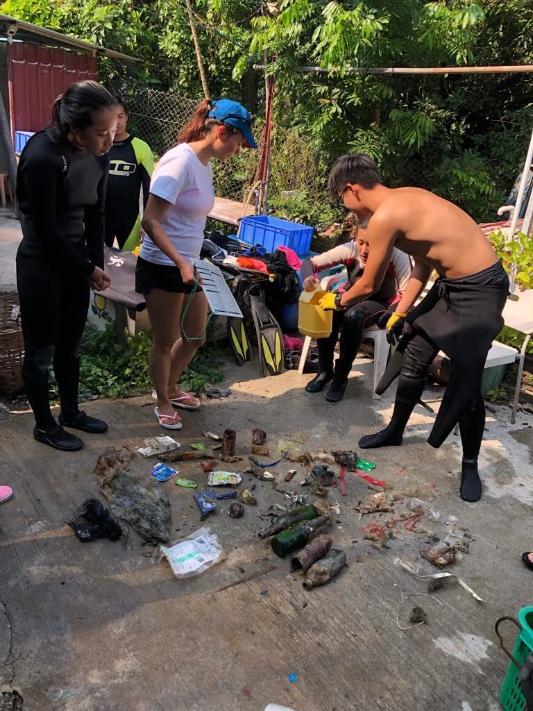
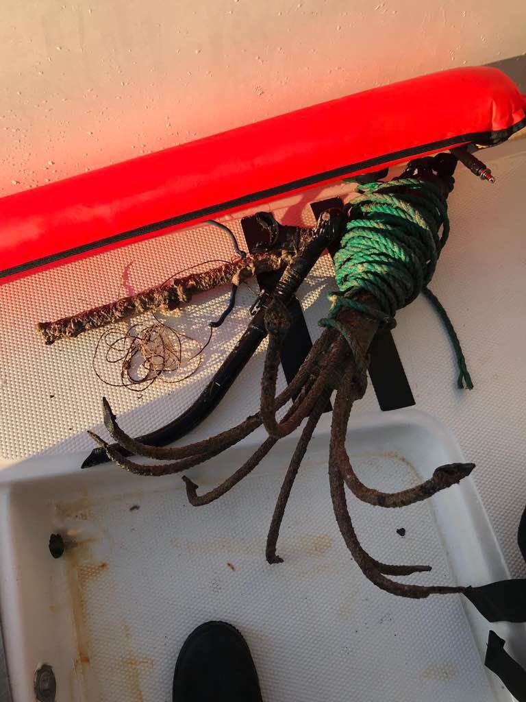
Screw diver, water pump
Sunny
1
1
10
1
2
0
0
0
0
0
0
0
0
0
0
0
0
0
0
0
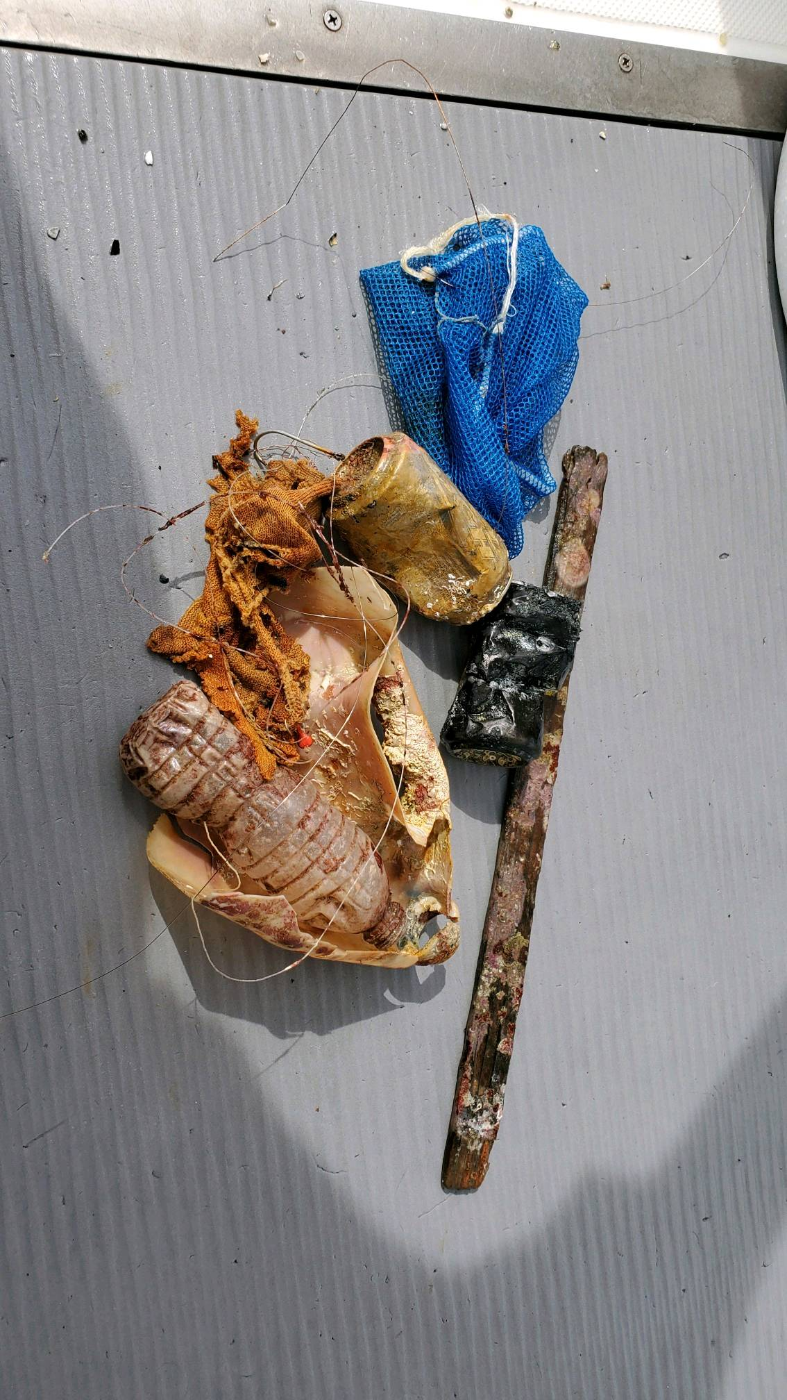
Medication packing
Water pump
Tarp bags
Screw driver
Wooden chopsticks
Tursiopsdivers
Eszter
0
1
0
18
0
0
0
0
1
0
12
0
0
12
0
0
0
0
0
13
0
0
5
0
0
0
0
0
0
0
0
0
0
0
21.56
44
7.10
1.20
3
measured
0
0
6214.02
3
0
0
0
0
Plastic wraps and bags
0
On
kilograms
0
I have debris data to report
7
0
0
Calm (glassy to rippled) for waves 0 – 0.1 meter high
1
0
2
Trapped in the bags
Crabs
Released Unharmed
4
0
5
1
0
m2
3
0
meters
coral reef
0
0
0
0
0
2
0
1
0
3
0
0
5
0
1
0
7
0
0
1
0
8
0
1
0
0
0
0
Hong Kong S.A.R., China
City
Hong Kong
Map Help


Dive Location

If you know your survey site coordinates, enter them manually in decimal degrees using WGS84 Map Datum. Use the minus sign for latitudes south of the equator and longitudes west of the Prime Meridian to 180 degrees.

If you do not know your survey site coordinates, click the “Map Location” tab to use the map to zoom into your survey site and drop the pin on the map to fall within your survey dive site in the water (not on land or the beach). Ensure you zoom in as much as possible to ensure data accuracy.
Entangled Help


Use the vertical tabs below to record any entangled animals you found of each type.

ADS493 - Two Fish House Reef

1
18
1
sand
4

-8.3330020561861, 115.64119952424

Balinese beach celebrations- there were quite a few the week before our clean-up
Clear weather conditions, sunny, 28 degrees temperatures
Two Fish Divers
Melissa Martin
1
8
3
7
10.00
45
29.00
1.50
estimated
5000.00
1
food wrappers
plastic pieces
fabric pieces
On
kilograms
I have debris data to report
2
Calm (glassy to rippled) for waves 0 – 0.1 meter high
7
2
1
1
m2
6
meters
other
12
1
1
10
2
1
2
5
Indonesia
State\Province
Bali
City
Amed
Map Help


Dive Location

If you know your survey site coordinates, enter them manually in decimal degrees using WGS84 Map Datum. Use the minus sign for latitudes south of the equator and longitudes west of the Prime Meridian to 180 degrees.

If you do not know your survey site coordinates, click the “Map Location” tab to use the map to zoom into your survey site and drop the pin on the map to fall within your survey dive site in the water (not on land or the beach). Ensure you zoom in as much as possible to ensure data accuracy.
Entangled Help


Use the vertical tabs below to record any entangled animals you found of each type.

Ecosystem Other
sand

ADS535 - Bigth Reef

1
3

21.786222, -72.212212085724

coral
1
Mark Healey
12
1
1
2
3
1
1
2
3.00
90
22.00
5.00
estimated
40.00
On
pounds
I have debris data to report
Calm (glassy to rippled) for waves 0 – 0.1 meter high ft2
feet
coral reef
Turks and Caicos Islands
Map Help


Dive Location

If you know your survey site coordinates, enter them manually in decimal degrees using WGS84 Map Datum. Use the minus sign for latitudes south of the equator and longitudes west of the Prime Meridian to 180 degrees.

If you do not know your survey site coordinates, click the “Map Location” tab to use the map to zoom into your survey site and drop the pin on the map to fall within your survey dive site in the water (not on land or the beach). Ensure you zoom in as much as possible to ensure data accuracy.
Entangled Help


Use the vertical tabs below to record any entangled animals you found of each type.

ADS372 - Cas Abao Beach

0
15
0

12.221522, -69.09345

0
0
0
coral
0
0
0
1
0
Normal
0
0
0
0
0
0
0
0
0
0
0
0
0
0
0
0
0
0
0
0
B Diving And Watersports Curacao
Brigitte
0
0
0
4
0
0
0
0
0
0
0
0
0
0
0
0
0
0
0
3
0
0
0
0
0
0
0
0
0
0
0
0
0
0
0.50
50
16.00
5.00
0
estimated
0
1
1110.20
0
0
0
0
0
Plastic cups
Fishing lines
0
On
kilograms
0
I have debris data to report
0
0
0
Calm (glassy to rippled) for waves 0 – 0.1 meter high
0
0
0
0
0
0
0
m2
0
0
meters
coral reef
0
0
0
0
0
0
0
0
0
0
0
0
0
0
0
0
0
0
0
0
0
0
0
0
0
0
0
0
Netherlands Antilles
State\Province
Curacao
City
Willemstad
Map Help


Dive Location

If you know your survey site coordinates, enter them manually in decimal degrees using WGS84 Map Datum. Use the minus sign for latitudes south of the equator and longitudes west of the Prime Meridian to 180 degrees.

If you do not know your survey site coordinates, click the “Map Location” tab to use the map to zoom into your survey site and drop the pin on the map to fall within your survey dive site in the water (not on land or the beach). Ensure you zoom in as much as possible to ensure data accuracy.

Entangled Help


Use the vertical tabs below to record any entangled animals you found of each type.

The Caves

0
0
0
0

26.101754, -80.101408

0
0
0
sand
0
0
0
0
0
None
None
Bleach container
Good
Squalo Divers
Joseph Kagan
0
0
0
0
0
0
0
0
0
0
0
0
0
0
0
0
0
0
0
3
0
0
0
0
0
0
1
1
0
0
0
0
0
0
0
0
3.00
47
34.00
25.00
0
estimated
0
0
0
5
100.00
0
0
0
0
0
Plastic
Fishing line
Sinkers
0
On
pounds
0
I have debris data to report
0
1
0
Calm (glassy to rippled) for waves 0 – 0.1 meter high
0
0
0
0
0
0
0
ft2
0
0
feet
coral reef
0
0
0
0
0
0
0
0
0
0
0
0
0
0
0
0
0
2
0
0
0
0
0
0
0
0
0
0
0
United States
State\Province
Florida
City
Fort Lauderdale
Map Help


Dive Location

If you know your survey site coordinates, enter them manually in decimal degrees using WGS84 Map Datum. Use the minus sign for latitudes south of the equator and longitudes west of the Prime Meridian to 180 degrees.

If you do not know your survey site coordinates, click the “Map Location” tab to use the map to zoom into your survey site and drop the pin on the map to fall within your survey dive site in the water (not on land or the beach). Ensure you zoom in as much as possible to ensure data accuracy.

Entangled Help


Use the vertical tabs below to record any entangled animals you found of each type.

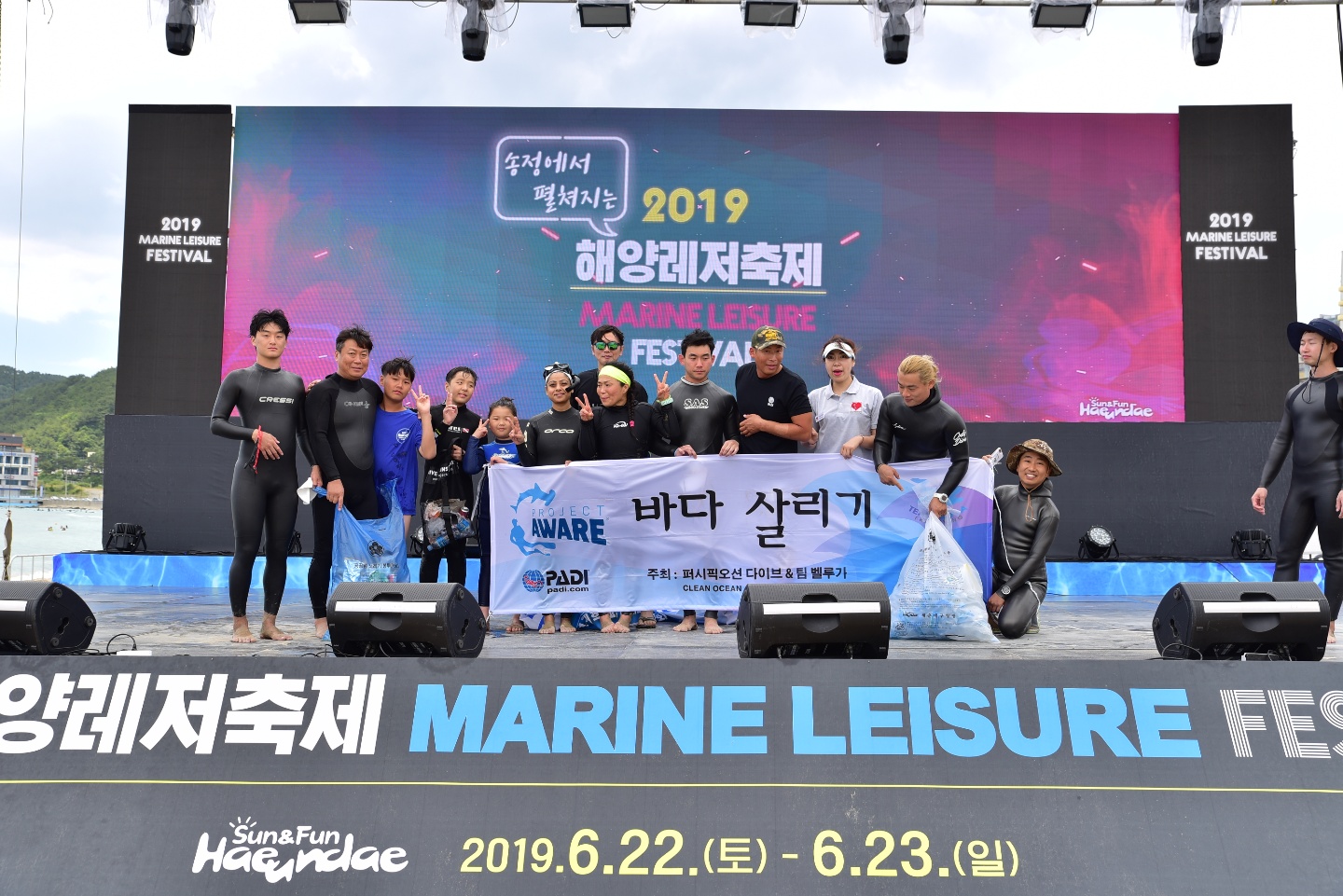
SONGJEONG BEACH

2
6
3
1
3
sand
3
4

35.178472518844, 129.2006345348

There were so many pieces of glass in the sand that it was dangerous and there were more harmful things in the sea than I thought.
23 degree. cloudy and windy
PACIFIC OCEAN DIVE
JAE HYEON IM
4
22
12
6
9
20
15
10
2
10
2
27
6
1
47.00
46
10.00
3.00
5
estimated
80.93
1
On
kilograms
I have debris data to report
4
Smooth (wavelets) for waves 0.1 - 0.5 meter high
1
m2
1
meters
kelp
11
5
7
3
2
3
South Korea
City
BUSAN
Map Help


Dive Location

If you know your survey site coordinates, enter them manually in decimal degrees using WGS84 Map Datum. Use the minus sign for latitudes south of the equator and longitudes west of the Prime Meridian to 180 degrees.

If you do not know your survey site coordinates, click the “Map Location” tab to use the map to zoom into your survey site and drop the pin on the map to fall within your survey dive site in the water (not on land or the beach). Ensure you zoom in as much as possible to ensure data accuracy.
Entangled Help


Use the vertical tabs below to record any entangled animals you found of each type.

ADS352 - Meno Slope

6
0
0
0

-8.35026, 116.0511

0
0
0
coral
0
0
0
0
0
Windy
Gili Shark Conservation
Katon
0
0
0
0
0
0
0
0
2
0
1
0
0
0
0
0
0
0
0
9
1
0
0
0
0
0
0
0
0
0
0
0
0
0
0
0
1.00
39
25.00
17.00
0
estimated
0
0
0
0
2686.00
0
0
0
0
0
0
On
kilograms
0
I have debris data to report
0
0
0
Calm (glassy to rippled) for waves 0 – 0.1 meter high
0
0
0
0
1
0
0
m2
0
0
meters
coral reef
0
0
0
0
0
0
0
0
0
2
0
0
0
0
0
0
0
0
0
0
0
0
0
3
0
0
0
0
0
Indonesia
State\Province
Lombok
City
Gili Meno
Map Help


Dive Location

If you know your survey site coordinates, enter them manually in decimal degrees using WGS84 Map Datum. Use the minus sign for latitudes south of the equator and longitudes west of the Prime Meridian to 180 degrees.

If you do not know your survey site coordinates, click the “Map Location” tab to use the map to zoom into your survey site and drop the pin on the map to fall within your survey dive site in the water (not on land or the beach). Ensure you zoom in as much as possible to ensure data accuracy.

Entangled Help


Use the vertical tabs below to record any entangled animals you found of each type.

ADS475 - Cha Cha Cha Beach

9
1
sand
9

12.145625115769, -68.276306916278

No
Some rain the last few days
Dive Friends Bonaire
Nienke van Houten
2
1
0.50
51
16.00
2.00
estimated
1000.00
1
fishing line
plastic
On
kilograms
I have debris data to report
Calm (glassy to rippled) for waves 0 – 0.1 meter high m2
2
meters
coral reef
2
1
Netherlands Antilles
State\Province
Bonaire
City
Kralendijk
Map Help


Dive Location

If you know your survey site coordinates, enter them manually in decimal degrees using WGS84 Map Datum. Use the minus sign for latitudes south of the equator and longitudes west of the Prime Meridian to 180 degrees.

If you do not know your survey site coordinates, click the “Map Location” tab to use the map to zoom into your survey site and drop the pin on the map to fall within your survey dive site in the water (not on land or the beach). Ensure you zoom in as much as possible to ensure data accuracy.
Entangled Help


Use the vertical tabs below to record any entangled animals you found of each type.

Qarouh island

0
0
0

29.06873244304, 48.492701400127

0
0
0
coral
0
0
0
0
0
Good
0
0
0
0
0
0
0
0
0
0
0
0
0
0
0
0
0
0
0
0
Nautilus diving kuwait
Saleh alsaleh
0
0
0
0
0
0
0
0
0
0
0
0
0
0
0
0
0
0
0
3
0
0
0
0
0
0
0
0
0
0
0
0
0
0
0.00
30
15.00
4.00
0
measured
0
0
3090.88
0
0
0
0
0
0
On
kilograms
0
Our Survey Site was free of debris
0
0
0
Smooth (wavelets) for waves 0.1 - 0.5 meter high
0
0
0
0
0
0
0
m2
0
0
meters
coral reef
0
0
0
0
0
0
0
0
0
0
0
0
0
0
0
0
0
0
0
0
0
0
0
0
0
0
0
0
Kuwait
City
Kuwait
Map Help


Dive Location

If you know your survey site coordinates, enter them manually in decimal degrees using WGS84 Map Datum. Use the minus sign for latitudes south of the equator and longitudes west of the Prime Meridian to 180 degrees.

If you do not know your survey site coordinates, click the “Map Location” tab to use the map to zoom into your survey site and drop the pin on the map to fall within your survey dive site in the water (not on land or the beach). Ensure you zoom in as much as possible to ensure data accuracy.
Entangled Help


Use the vertical tabs below to record any entangled animals you found of each type.

Subscribe to