Menu

Zero Gravity

200
4
sand
40

25.088539774441, 55.136655640466

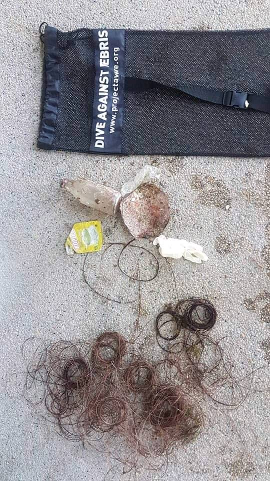
The 2nd December was U.A.E National day. Around the U.A.E there was a huge celebrations of balloon releases and fireworks. In the surrounding waters, there is also a huge development in water which will become Dubai Harbour. Visibility has gone from 7/8m to 2m.
Onshore wind in the afternoons.
28
1
1
1
Plastic Sheesha Pipe Mouthpiece
Sunglasses
Pacifier
Plastic Traffic Cone
Divers Down
Nicola Liddell
4
200
1
5
1
5
2
150
6
2
19
14.30
39
5.00
3.00
80
measured
2078.63
On
kilograms
I have debris data to report
Smooth (wavelets) for waves 0.1 - 0.5 meter high
9
1
m2
6
meters
coral reef
1
4
United Arab Emirates
State\Province
Dubai
City
Dubai
Map Help


Dive Location

If you know your survey site coordinates, enter them manually in decimal degrees using WGS84 Map Datum. Use the minus sign for latitudes south of the equator and longitudes west of the Prime Meridian to 180 degrees.

If you do not know your survey site coordinates, click the “Map Location” tab to use the map to zoom into your survey site and drop the pin on the map to fall within your survey dive site in the water (not on land or the beach). Ensure you zoom in as much as possible to ensure data accuracy.

Entangled Help


Use the vertical tabs below to record any entangled animals you found of each type.

Guillano 2

1
1
0
0

11.348419, 124.114755

0
0
1
coral
0
0
0
1
0
Fishing
Piece of metal
Exotic Island Dive Resort
Bas
0
0
0
0
0
0
0
0
0
0
0
0
0
0
0
0
0
0
0
2
0
0
0
0
0
0
0
0
0
0
0
0
0
0
0
0
2.00
60
20.00
11.00
0
estimated
0
0
0
0
172.77
0
0
0
0
0
Fishing lines
0
On
kilograms
0
I have debris data to report
1
0
0
Calm (glassy to rippled) for waves 0 – 0.1 meter high
0
0
0
0
0
0
0
m2
0
0
meters
coral reef
1
0
0
0
0
0
0
0
0
0
0
0
0
0
0
0
0
0
0
0
0
0
0
0
0
0
0
0
0
Philippines
State\Province
Cebu
City
Malapascua
Map Help


Dive Location

If you know your survey site coordinates, enter them manually in decimal degrees using WGS84 Map Datum. Use the minus sign for latitudes south of the equator and longitudes west of the Prime Meridian to 180 degrees.

If you do not know your survey site coordinates, click the “Map Location” tab to use the map to zoom into your survey site and drop the pin on the map to fall within your survey dive site in the water (not on land or the beach). Ensure you zoom in as much as possible to ensure data accuracy.

Entangled Help


Use the vertical tabs below to record any entangled animals you found of each type.

Hoyse Reef

4
0
1
0

3.924182, 73.456207

1
0
0
gravel
0
5
0
2
0
Ferry boat
Deodorant can
Windy
Biyadhoo Ressort
Mr Baguette
0
0
0
2
0
0
0
0
0
0
5
0
0
0
1
0
0
13
0
2
0
0
0
0
0
2
3
0
0
0
0
0
0
0
0
0
3.00
45
12.00
1.00
0
estimated
0
0
0
1
2230.87
0
0
0
0
0
0
On
kilograms
0
I have debris data to report
0
2
0
Smooth (wavelets) for waves 0.1 - 0.5 meter high
0
0
0
0
0
0
0
m2
0
0
meters
rocky reef
0
0
0
0
0
0
0
0
0
0
0
0
0
0
0
0
0
0
0
0
0
0
0
0
0
0
2
0
0
Maldives
State\Province
South Male Atoll
City
Biyadhoo
Map Help


Dive Location

If you know your survey site coordinates, enter them manually in decimal degrees using WGS84 Map Datum. Use the minus sign for latitudes south of the equator and longitudes west of the Prime Meridian to 180 degrees.

If you do not know your survey site coordinates, click the “Map Location” tab to use the map to zoom into your survey site and drop the pin on the map to fall within your survey dive site in the water (not on land or the beach). Ensure you zoom in as much as possible to ensure data accuracy.

Entangled Help


Use the vertical tabs below to record any entangled animals you found of each type.

Kontiki Marin

1

10.282222, 123.99914

coral
occasional rain
3
wet tissues
Dive Funatics
Rikka
1
1
1
1
1
1
0.50
33
33.00
0.00
estimated
190.00
On
pounds
I have debris data to report
Calm (glassy to rippled) for waves 0 – 0.1 meter high m2
1
meters
coral reef
Philippines
State\Province
Mactan, Cebu
City
Lapulapu
Map Help


Dive Location

If you know your survey site coordinates, enter them manually in decimal degrees using WGS84 Map Datum. Use the minus sign for latitudes south of the equator and longitudes west of the Prime Meridian to 180 degrees.

If you do not know your survey site coordinates, click the “Map Location” tab to use the map to zoom into your survey site and drop the pin on the map to fall within your survey dive site in the water (not on land or the beach). Ensure you zoom in as much as possible to ensure data accuracy.

Entangled Help


Use the vertical tabs below to record any entangled animals you found of each type.

Kontiki Marina

10.282194, 123.999058

coral
1
occasional rain
Dive Funatics
Rikka
1
0.50
42
20.00
0.00
estimated
196.00
On
pounds
I have debris data to report
1
Calm (glassy to rippled) for waves 0 – 0.1 meter high m2
meters
coral reef
Philippines
State\Province
Cebu
City
Lapulapu
Map Help


Dive Location

If you know your survey site coordinates, enter them manually in decimal degrees using WGS84 Map Datum. Use the minus sign for latitudes south of the equator and longitudes west of the Prime Meridian to 180 degrees.

If you do not know your survey site coordinates, click the “Map Location” tab to use the map to zoom into your survey site and drop the pin on the map to fall within your survey dive site in the water (not on land or the beach). Ensure you zoom in as much as possible to ensure data accuracy.

Entangled Help


Use the vertical tabs below to record any entangled animals you found of each type.

Rapid Bay

0
0
0

-35.523407108319, 138.18654893172

0
0
0
rock
0
0
0
0
0
Raining day before
High use by fishermen on Jetty
Please help us keep Rapid Bay a protected site. It’s one of the only places in the world leafy seadragons are present and if not protected and abused I worry about their and other beautiful sea life’s fate here
Squid jig which couldn’t remove as too sharp and couldn’t safely stow
Choppy
0
0
0
0
0
0
0
0
0
0
0
0
0
0
0
0
0
0
0
0
Adelaide Scuba
Erika Sullivan
0
0
0
0
0
0
0
0
0
0
0
0
0
0
0
0
0
0
0
7
0
0
0
0
0
0
0
0
0
0
0
0
0
0
0.50
60
6.60
5.50
0
estimated
0
0
411.89
0
0
0
0
0
High use of Jetty by fishermen
Nearby caravan park
Boats coming in
0
On
kilograms
0
I have debris data to report
0
0
0
Calm (glassy to rippled) for waves 0 – 0.1 meter high
0
0
0
0
0
0
0
m2
0
2
meters
seagrass
0
0
0
0
0
0
0
0
0
0
0
0
0
0
0
0
0
0
0
0
0
0
0
0
0
0
0
0
Australia
State\Province
South Australia
City
Adelaide
Map Help


Dive Location

If you know your survey site coordinates, enter them manually in decimal degrees using WGS84 Map Datum. Use the minus sign for latitudes south of the equator and longitudes west of the Prime Meridian to 180 degrees.

If you do not know your survey site coordinates, click the “Map Location” tab to use the map to zoom into your survey site and drop the pin on the map to fall within your survey dive site in the water (not on land or the beach). Ensure you zoom in as much as possible to ensure data accuracy.

Entangled Help


Use the vertical tabs below to record any entangled animals you found of each type.

ADS336 - Shaws Cove

0
4
0
0

33.545163, -117.799209

0
0
0
sand
0
0
0
0
0
Heavy Rai
Beach Cities Scuba
Brendan De Grim
0
0
0
0
0
0
0
0
0
0
1
0
0
0
0
0
0
0
0
5
0
0
0
0
0
0
0
0
0
0
0
0
0
0
0
0
0.10
26
26.00
5.00
0
estimated
0
0
0
0
2228.16
0
0
0
0
0
0
On
pounds
0
I have debris data to report
0
0
0
Smooth (wavelets) for waves 0.1 - 0.5 meter high
0
0
0
0
0
0
0
ft2
0
0
feet
rocky reef
0
0
0
0
0
0
0
0
0
0
0
0
0
0
0
0
0
0
0
0
0
0
0
0
0
0
0
0
0
United States
State\Province
CA
City
Laguna Beach
Map Help


Dive Location

If you know your survey site coordinates, enter them manually in decimal degrees using WGS84 Map Datum. Use the minus sign for latitudes south of the equator and longitudes west of the Prime Meridian to 180 degrees.

If you do not know your survey site coordinates, click the “Map Location” tab to use the map to zoom into your survey site and drop the pin on the map to fall within your survey dive site in the water (not on land or the beach). Ensure you zoom in as much as possible to ensure data accuracy.

Entangled Help


Use the vertical tabs below to record any entangled animals you found of each type.

Tug Boat

16
76
0
0

12.069913, -68.861908

0
0
0
coral
0
0
0
501
0
Party's
The aware scale broke we need a new one
Mask
1
1
Price list drinks
Mask
The Dive Bus
Bor
0
0
0
71
0
0
0
0
0
0
0
0
0
0
0
0
0
0
0
10
0
0
0
0
0
0
14
0
0
0
0
0
0
0
0
0
62.00
50
16.00
5.00
0
measured
0
0
0
0
3377.00
0
0
0
2
0
0
On
kilograms
0
I have debris data to report
73
0
0
Calm (glassy to rippled) for waves 0 – 0.1 meter high
0
0
4
0
5
0
0
m2
0
0
meters
coral reef
0
0
0
0
0
0
0
0
0
0
0
0
0
0
0
0
51
0
0
0
1
0
58
0
0
0
0
0
0
Netherlands Antilles
City
Wilamstaad
Map Help


Dive Location

If you know your survey site coordinates, enter them manually in decimal degrees using WGS84 Map Datum. Use the minus sign for latitudes south of the equator and longitudes west of the Prime Meridian to 180 degrees.

If you do not know your survey site coordinates, click the “Map Location” tab to use the map to zoom into your survey site and drop the pin on the map to fall within your survey dive site in the water (not on land or the beach). Ensure you zoom in as much as possible to ensure data accuracy.

Entangled Help


Use the vertical tabs below to record any entangled animals you found of each type.

Dry Rocks Dec 2018 /FKNMS

25.1240569297, -80.298687737

coral
Pocket knife
Seas 2ft - 3ft
Island Ventures
Michael
1
8
7.00
60
20.00
8.00
measured
3434.00
Line
Rope
Plastic
On
pounds
I have debris data to report
Slight for waves 0.5 -1.25 meter high m2
30
feet
coral reef
1
1
United States
State\Province
Florida
City
Key Largo
Map Help


Dive Location

If you know your survey site coordinates, enter them manually in decimal degrees using WGS84 Map Datum. Use the minus sign for latitudes south of the equator and longitudes west of the Prime Meridian to 180 degrees.

If you do not know your survey site coordinates, click the “Map Location” tab to use the map to zoom into your survey site and drop the pin on the map to fall within your survey dive site in the water (not on land or the beach). Ensure you zoom in as much as possible to ensure data accuracy.

Entangled Help


Use the vertical tabs below to record any entangled animals you found of each type.

Breakwater

0
0
0

36.609602475979, -121.89410401246

0
0
0
sand
0
0
0
0
0
No
Can
Windy rainy
7
0
0
0
0
0
0
0
0
0
0
0
0
0
0
0
0
0
0
0
Monofilament
Independent
Weitzenhoffer
0
0
0
0
0
0
0
0
0
0
0
0
0
0
0
0
0
0
0
4
0
0
0
0
0
0
0
0
0
0
0
0
0
0
2.00
45
12.00
3.00
0
estimated
0
0
2107.93
0
0
0
0
0
0
On
kilograms
0
I have debris data to report
0
0
0
Slight for waves 0.5 -1.25 meter high
0
0
0
0
0
0
0
m2
0
0
meters
kelp
0
0
0
0
0
0
0
0
0
0
0
0
0
0
0
0
8
0
0
0
0
0
0
0
0
0
0
0
United States
State\Province
Ca
City
Monterey
Map Help


Dive Location

If you know your survey site coordinates, enter them manually in decimal degrees using WGS84 Map Datum. Use the minus sign for latitudes south of the equator and longitudes west of the Prime Meridian to 180 degrees.

If you do not know your survey site coordinates, click the “Map Location” tab to use the map to zoom into your survey site and drop the pin on the map to fall within your survey dive site in the water (not on land or the beach). Ensure you zoom in as much as possible to ensure data accuracy.

Entangled Help


Use the vertical tabs below to record any entangled animals you found of each type.

Subscribe to