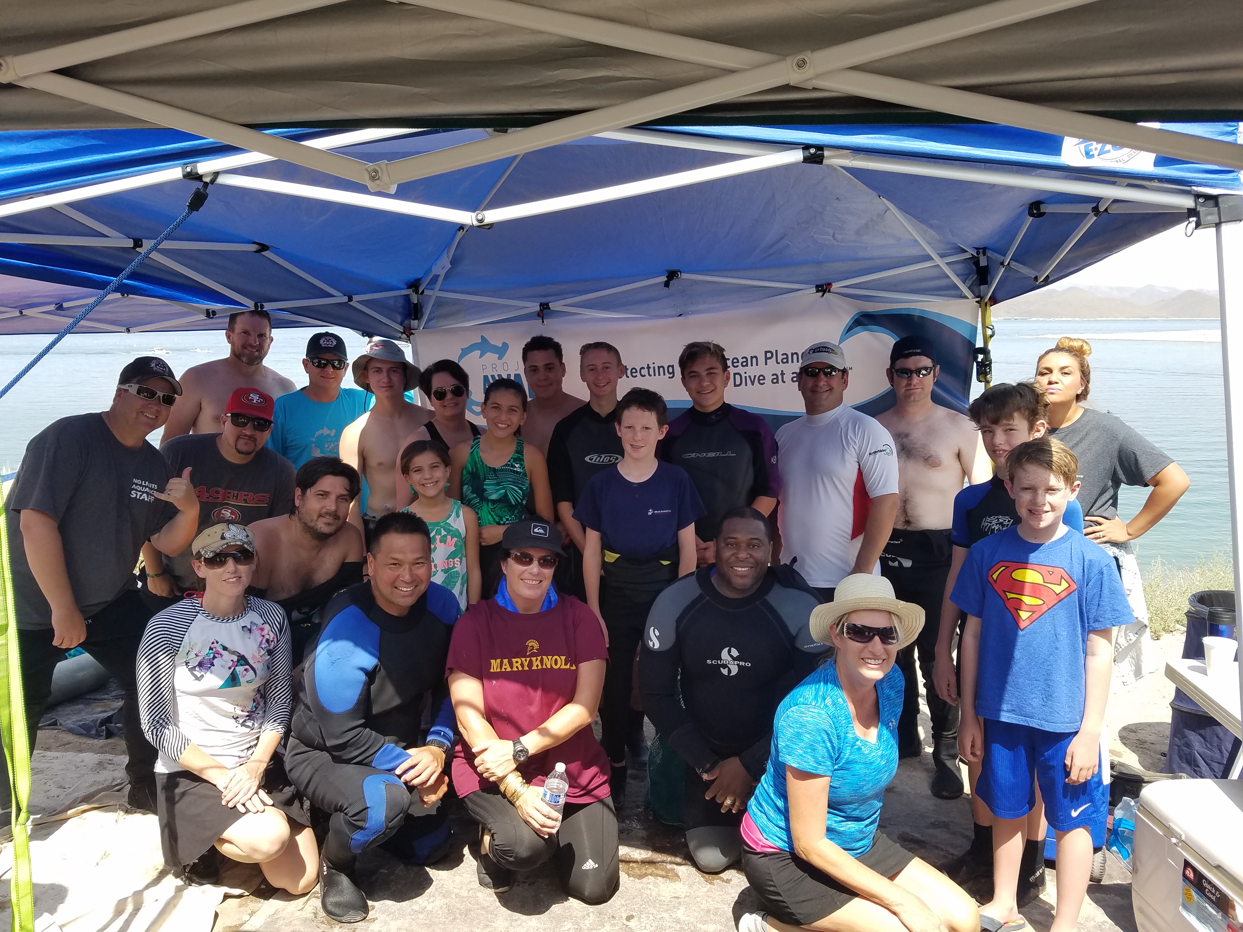
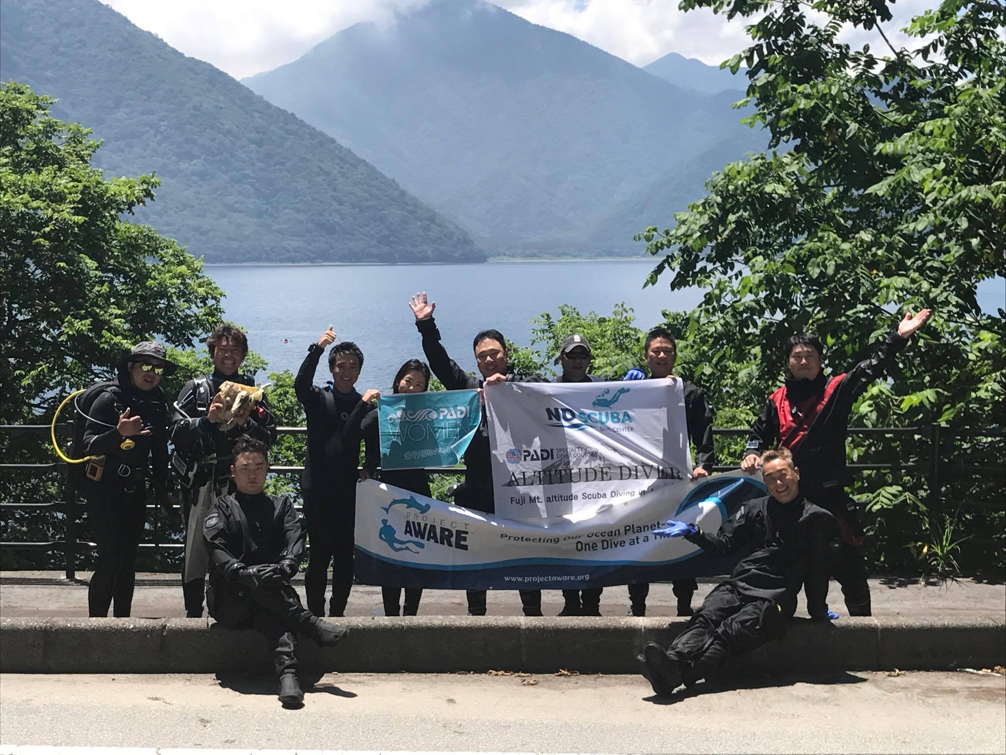
I thought the lake also was as precious as the ocean.
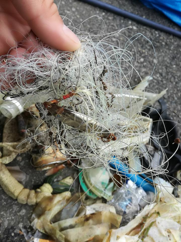
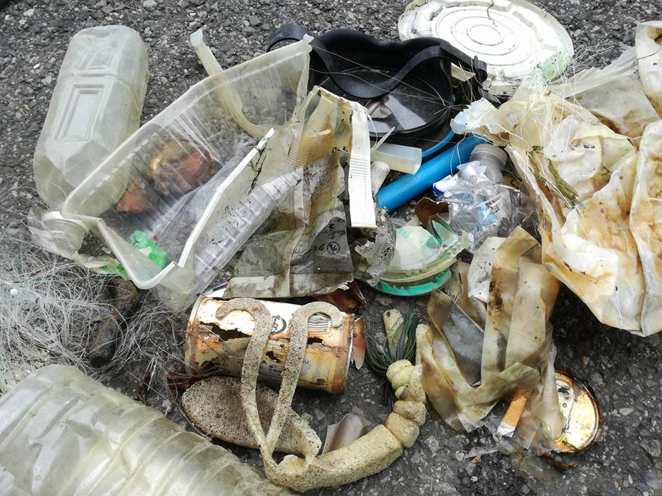
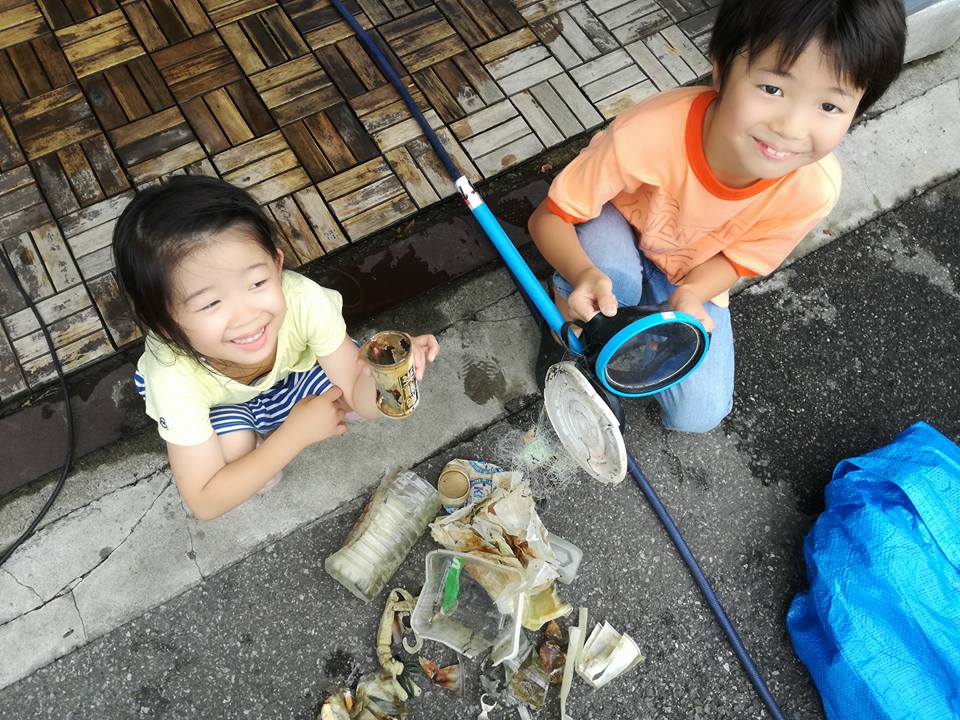
We found beer cans 30 years old.
I also found a very old diving mask.
It was very clear and the lake was calm.
ND Scuba
SUNG SU CHO
2
8
11
3
2
1
1
3.00
53
11.00
2.00
estimated
4
30
1300.00
On
kilograms
Our Survey Site was free of debris
1
Calm (glassy to rippled) for waves 0 – 0.1 meter high
m2
meters
other
2
6
South Korea
State\Province
Seoul
City
Songpa-gu
Map Help
Dive Location
If you know your survey site coordinates, enter them manually in decimal degrees using WGS84 Map Datum. Use the minus sign for latitudes south of the equator and longitudes west of the Prime Meridian to 180 degrees.
If you do not know your survey site coordinates, click the “Map Location” tab to use the map to zoom into your survey site and drop the pin on the map to fall within your survey dive site in the water (not on land or the beach). Ensure you zoom in as much as possible to ensure data accuracy.
Entangled Help
Use the vertical tabs below to record any entangled animals you found of each type.
Moderate to rough for waves greater than 1.25 meters
m2
meters
coral reef
Language
English
United Arab Emirates
Map Help
Dive Location
If you know your survey site coordinates, enter them manually in decimal degrees using WGS84 Map Datum. Use the minus sign for latitudes south of the equator and longitudes west of the Prime Meridian to 180 degrees.
If you do not know your survey site coordinates, click the “Map Location” tab to use the map to zoom into your survey site and drop the pin on the map to fall within your survey dive site in the water (not on land or the beach). Ensure you zoom in as much as possible to ensure data accuracy.
Entangled Help
Use the vertical tabs below to record any entangled animals you found of each type.
Moderate to rough for waves greater than 1.25 meters
1
m2
meters
coral reef
Language
English
United Arab Emirates
Map Help
Dive Location
If you know your survey site coordinates, enter them manually in decimal degrees using WGS84 Map Datum. Use the minus sign for latitudes south of the equator and longitudes west of the Prime Meridian to 180 degrees.
If you do not know your survey site coordinates, click the “Map Location” tab to use the map to zoom into your survey site and drop the pin on the map to fall within your survey dive site in the water (not on land or the beach). Ensure you zoom in as much as possible to ensure data accuracy.
Entangled Help
Use the vertical tabs below to record any entangled animals you found of each type.
I'd also like to add that with our shore support helpers we were able to gather about another ~40 pounds of debris from the shore putting our estimated total around 115-120 pounds of trash and over 430 pieces of debris recovered. Also, several volunteers, both non-diver and diver, let me know they went home that day and looked up Project AWARE for more info and loved what we are doing. Also, we have decided to make this an annual event to keep bring Scouts and Project AWARE together to fight for our water and oceans!
Tuesday of that week was 4th of July. However, this area is heavily used by jet-ski users, boaters, and party goers on the shore.
Thank you for helping and allowing me to support you as my beneficiary!
Crayfish had gotten themselves tangled up in the cloth. We didn't notice them till brought to shore. They began to crawl out. Once we saw them, we safely returned them to the lake.
Kitchen Knife
Clear and calm for most of the week. Some afternoon wind at unknown speed the two days before the event.
Individual - Eagle Scout Project
Tyler Swencki
8
9
14
9
15
69
1
75.00
49
18.00
2.00
estimated
4300.00
Plastic bags and sheets that have become caught under rocks and silted over. Hard to see and remove once found.
Plastic bottles - blow in from shore and fall off boats.
Beer cans - left on shore and thrown from boats.
On
pounds
I have debris data to report
10
2
Calm (glassy to rippled) for waves 0 – 0.1 meter high
1
16
Cloth
Crayfish
Released Unharmed
3
2
ft2
20
feet
other
1
1
3
60
Language
English
United States
State\Province
AZ
City
Queen Creek
Map Help
Dive Location
If you know your survey site coordinates, enter them manually in decimal degrees using WGS84 Map Datum. Use the minus sign for latitudes south of the equator and longitudes west of the Prime Meridian to 180 degrees.
If you do not know your survey site coordinates, click the “Map Location” tab to use the map to zoom into your survey site and drop the pin on the map to fall within your survey dive site in the water (not on land or the beach). Ensure you zoom in as much as possible to ensure data accuracy.
Entangled Help
Use the vertical tabs below to record any entangled animals you found of each type.
Ecosystem Other
Lake bottom with sand, mud, and rock bottom for area covered