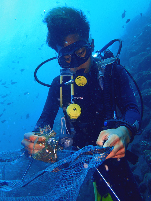
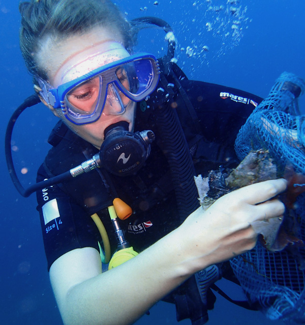
Current, surf and surge had been building up over the past week. Participants found more debris in the deeper depths of the reef, possibly caused by some down-welling current experienced in the week too.
Comments: "I never thought picking up trash in the ocean could be so much fun!" (stated by a member of our volunteers)
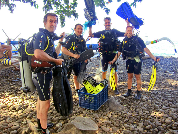
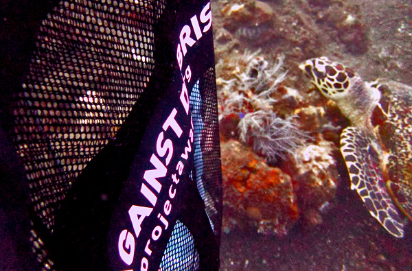
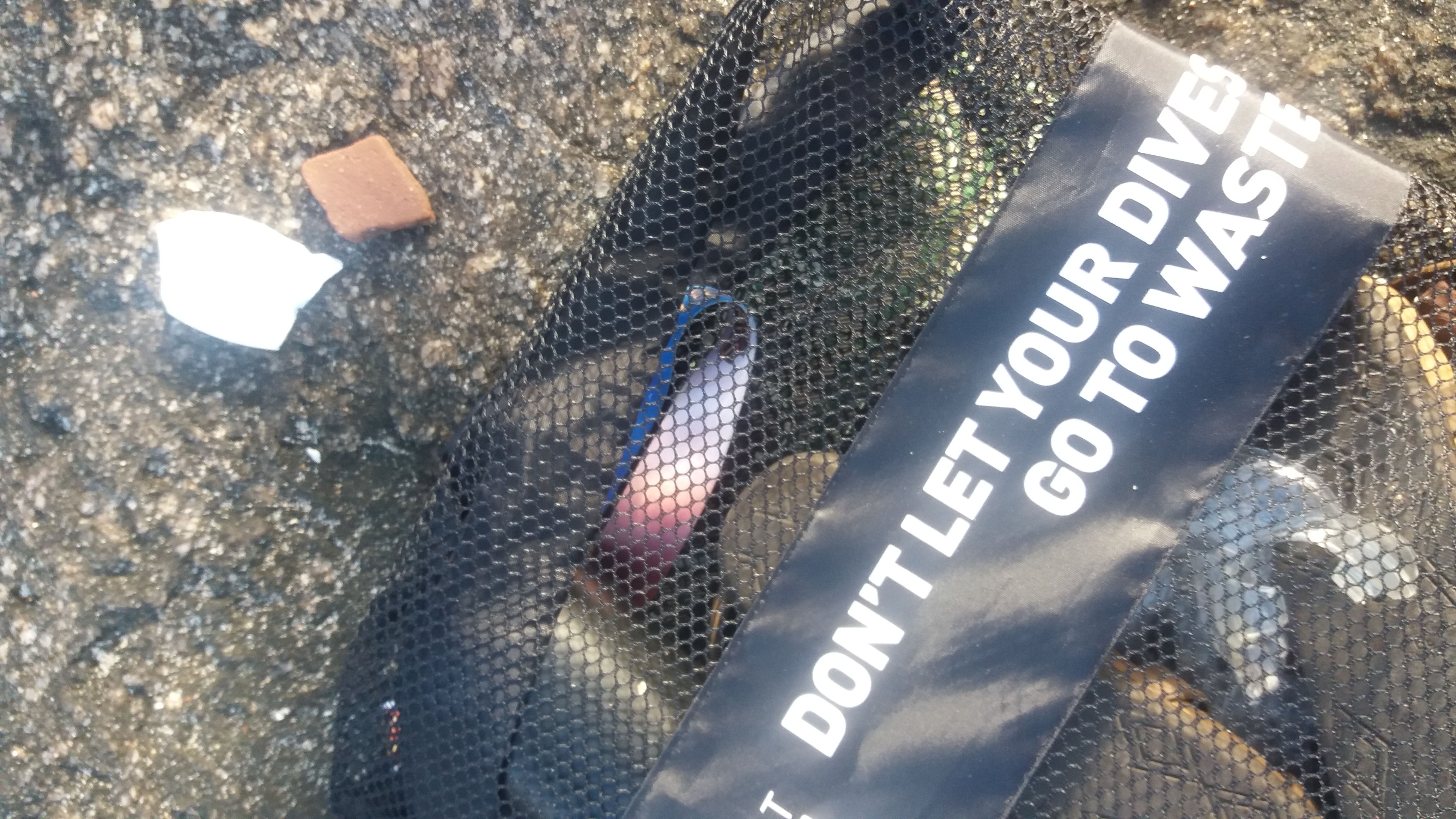
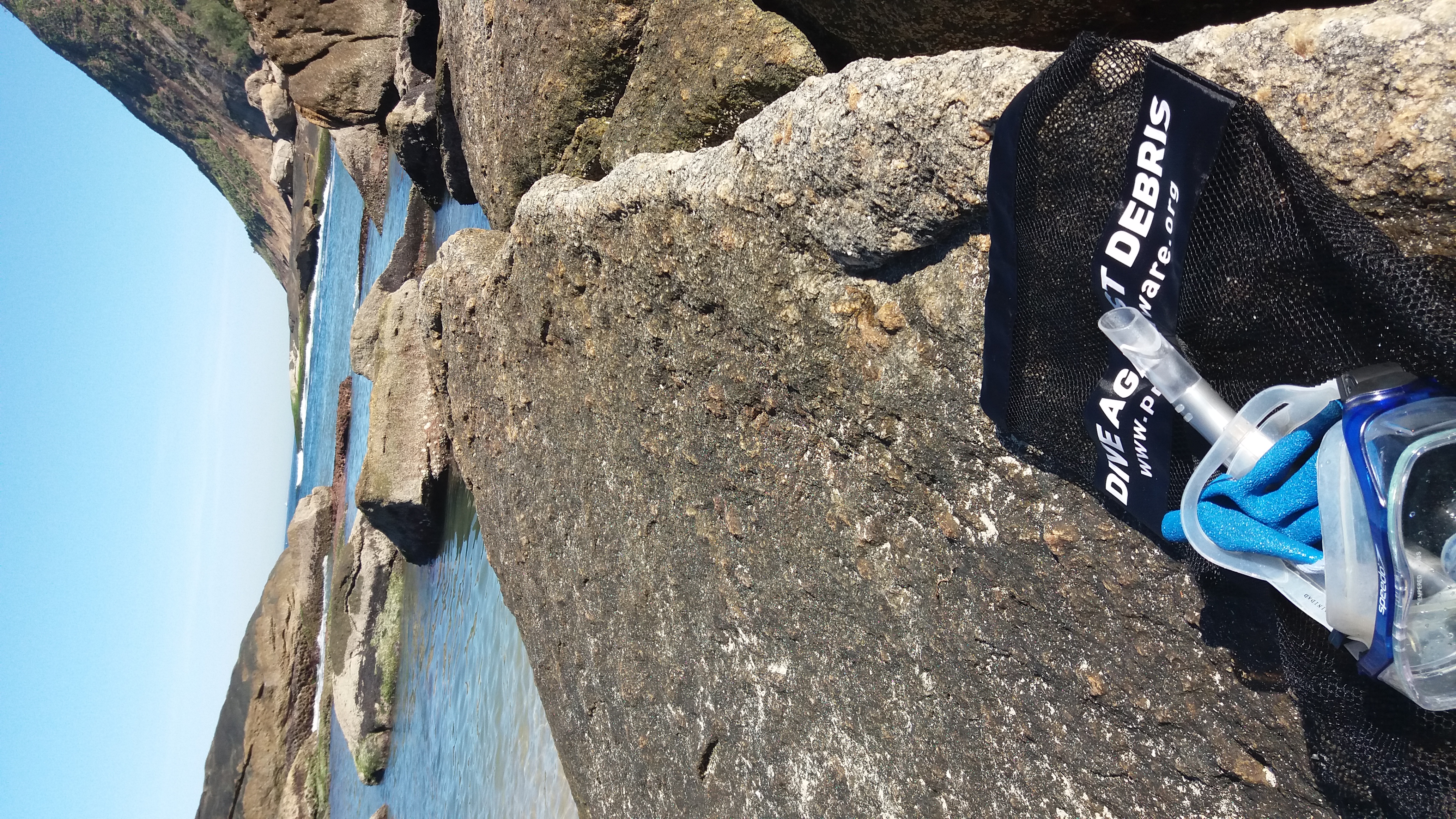
Feedback: Our Dive Against Debris tool kit arrived one day before the event... Couldn't have been better timing! The extra mesh bags and a printed version of the Marine Debris guide and slate made things so much easier!
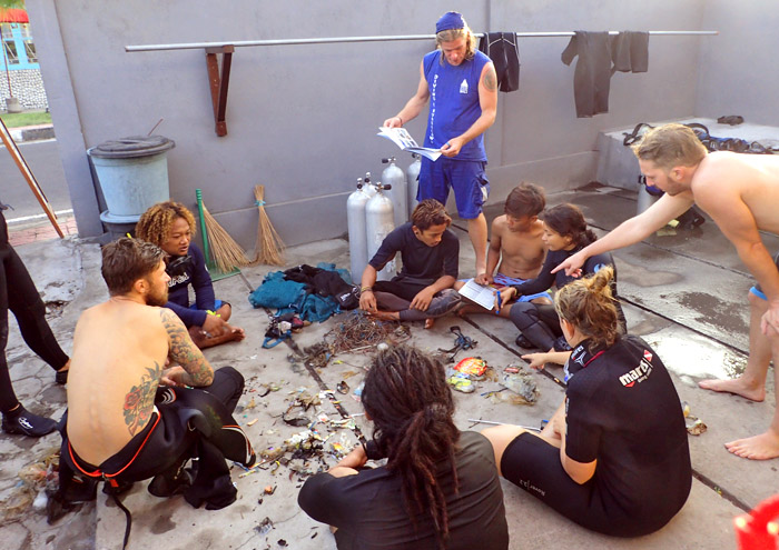
We also learned a few things that we will give greater emphasis on in future pre-dive briefings to be more effective in our efforts to be the best AWARE divers we can be!
Handle of a skipping rope.
Above the water: Frequent strong winds.
Underwater: Current, surf and surge (moderate).
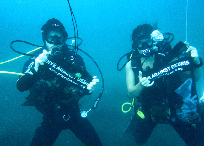
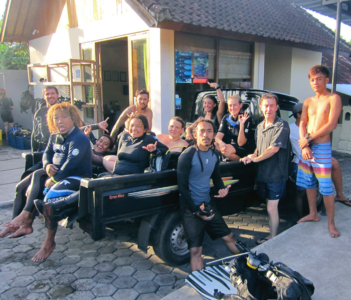
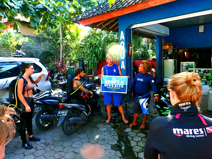
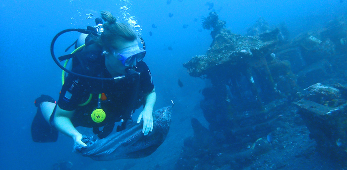
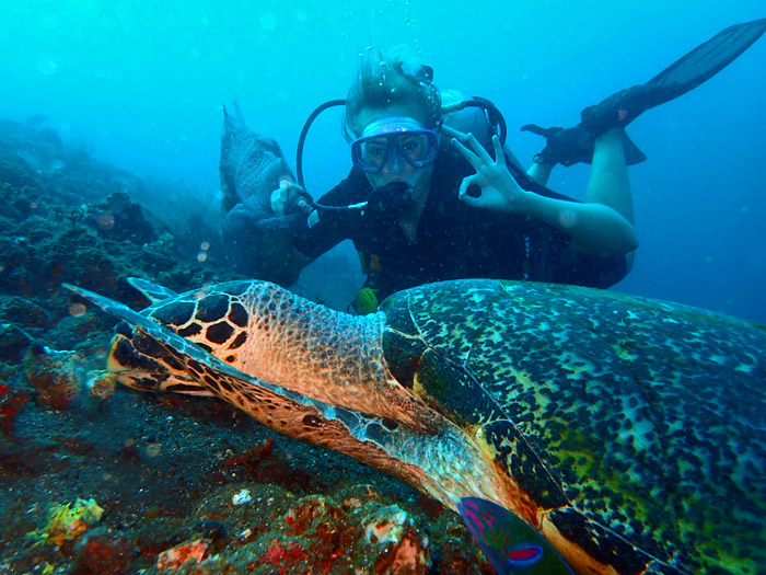
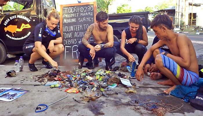
Aqua Dive Paradise
Made
2
1
1
3
5
1
1
3
14
1
1
1
5.00
50
29.00
5.00
3
estimated
24
22343.80
Metal fishing lures.
Nylon fishing lines.
Plastic food packets.
On
kilograms
I have debris data to report
Moderate to rough for waves greater than 1.25 meters
6
m2
meters
rocky reef
2
11
1
2
1
Indonesia
State\Province
Bali
City
Tulamben
Map Help
Dive Location
If you know your survey site coordinates, enter them manually in decimal degrees using WGS84 Map Datum. Use the minus sign for latitudes south of the equator and longitudes west of the Prime Meridian to 180 degrees.
If you do not know your survey site coordinates, click the “Map Location” tab to use the map to zoom into your survey site and drop the pin on the map to fall within your survey dive site in the water (not on land or the beach). Ensure you zoom in as much as possible to ensure data accuracy.
Entangled Help
Use the vertical tabs below to record any entangled animals you found of each type.
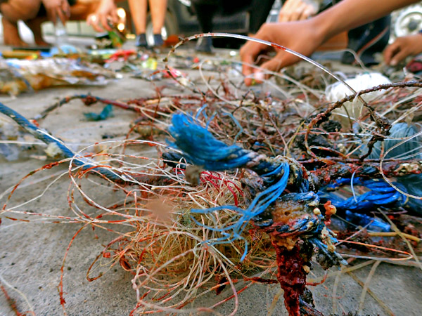
#96 electric cables.
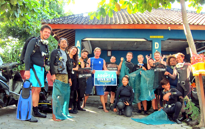
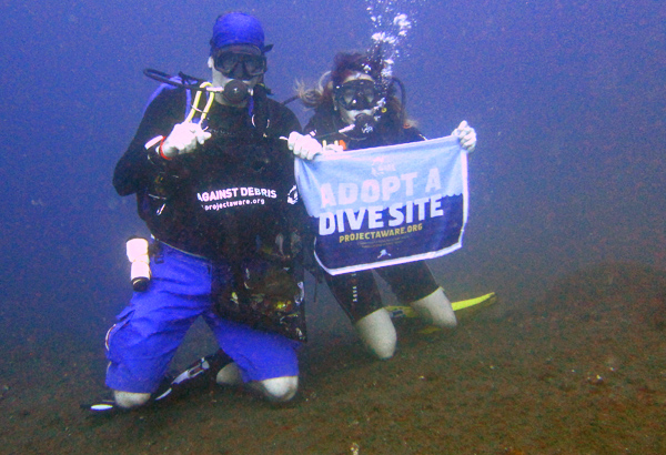
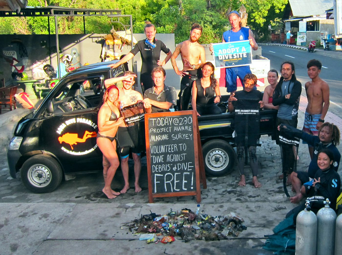
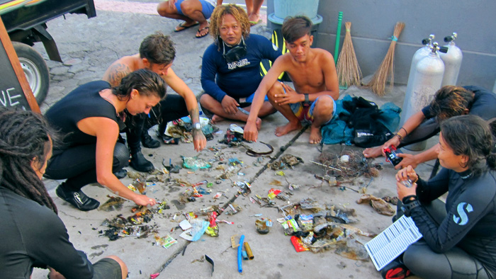
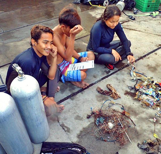
Great Dive Against Debris as well as 2017 Women's Dive Day with 9 participants on a "trashure hunt" for debris on our adopted dive site. The Dive Against Debris is organized as integral part of the eIDC - PADI Instructor Development Course. Thank you very much to all participants !!
none
Please enter a category for electric cables and "other boat spare parts" - so we can better trace such - as these items are important to specifically report - the local community can perhaps train their boat crew not to throw engine parts like transmission belts into the sea.
Plastic Flowerpot
sunny with afternoon/ evening showers
1
1
3
4
Large Sponge
Large Plastic Flowerpot
Large Rubber Pipes
Boat Engine Transmission Belts
Asia Divers
Sabine Henkel
6
1
5
4
3
4
9
3
1
12
20.50
55
16.00
5.00
measured
300.00
6
4
Fishing lines
Plastic items of all sizes, especially plastic bottles and fragments
Boat replacement parts - like rubber transmission belts
On
kilograms
I have debris data to report
11
1
Calm (glassy to rippled) for waves 0 – 0.1 meter high
4
2
2
m2
20
6
meters
coral reef
14
4
19
1
8
2
1
14
1
3
Philippines
City
Puerto Galera
Map Help
Dive Location
If you know your survey site coordinates, enter them manually in decimal degrees using WGS84 Map Datum. Use the minus sign for latitudes south of the equator and longitudes west of the Prime Meridian to 180 degrees.
If you do not know your survey site coordinates, click the “Map Location” tab to use the map to zoom into your survey site and drop the pin on the map to fall within your survey dive site in the water (not on land or the beach). Ensure you zoom in as much as possible to ensure data accuracy.
Entangled Help
Use the vertical tabs below to record any entangled animals you found of each type.
As noticed before there is an old house that's falling apart so probably again this debris came from it .
the debris colletcted on this day.
a bit windy and rainy
Michelle Mayumi Tizuka
1
0.30
15
2.00
2.00
estimated
40.00
On
kilograms
I have debris data to report
Calm (glassy to rippled) for waves 0 – 0.1 meter high
m2
meters
rocky reef
2
Brazil
Map Help
Dive Location
If you know your survey site coordinates, enter them manually in decimal degrees using WGS84 Map Datum. Use the minus sign for latitudes south of the equator and longitudes west of the Prime Meridian to 180 degrees.
If you do not know your survey site coordinates, click the “Map Location” tab to use the map to zoom into your survey site and drop the pin on the map to fall within your survey dive site in the water (not on land or the beach). Ensure you zoom in as much as possible to ensure data accuracy.
Entangled Help
Use the vertical tabs below to record any entangled animals you found of each type.
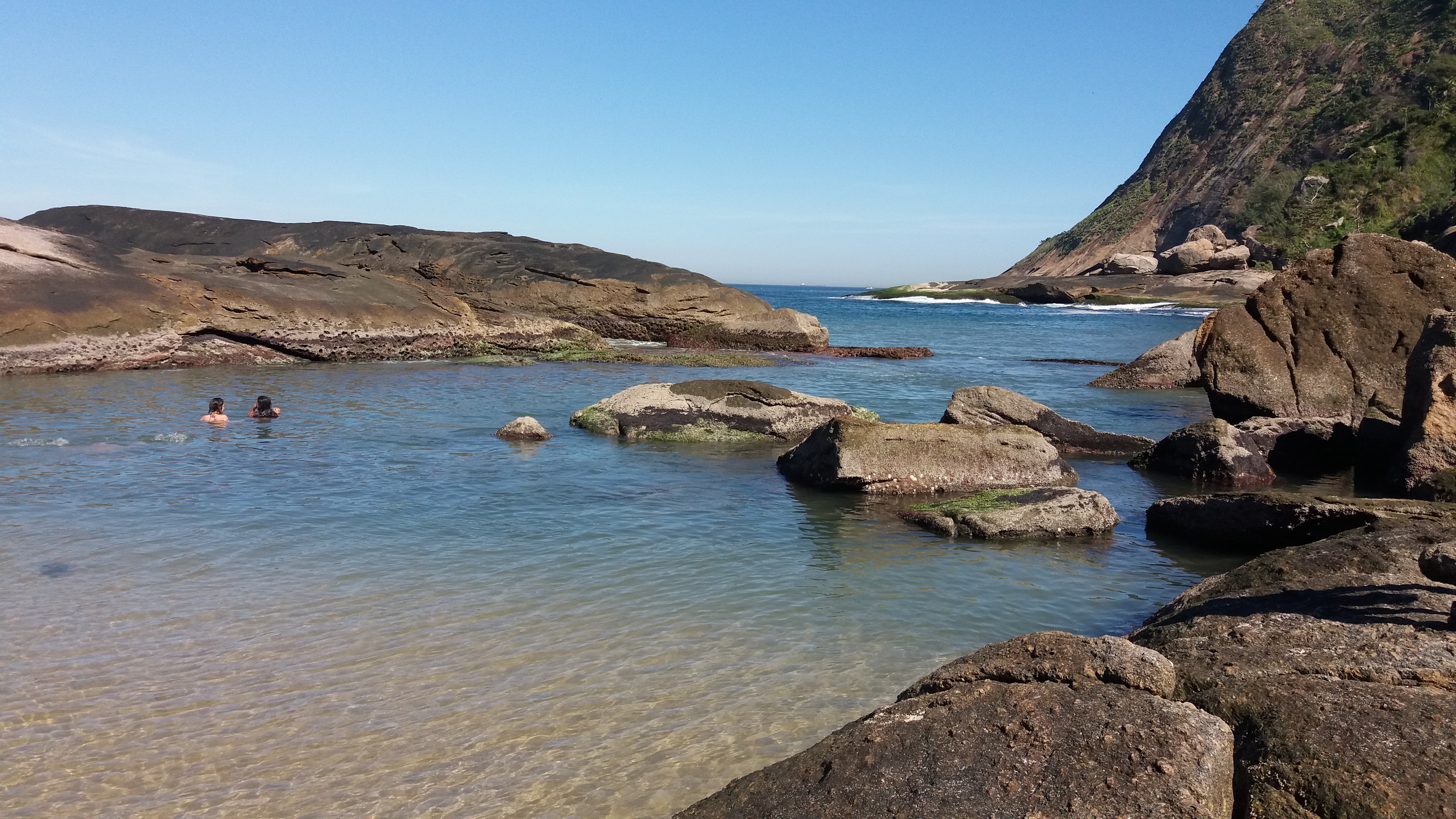
The visibility was not good for a long diving, we tried 2 times on the same day, but no worth to continue. On the shor time we dived, there were no debris on the sea, not even on the beach. It was a good day!
good
Michelle Mayumi Tizuka
2
0.00
20
2.00
2.00
measured
3.00
On
kilograms
Our Survey Site was free of debris
Calm (glassy to rippled) for waves 0 – 0.1 meter high
m2
meters
rocky reef
Brazil
Map Help
Dive Location
If you know your survey site coordinates, enter them manually in decimal degrees using WGS84 Map Datum. Use the minus sign for latitudes south of the equator and longitudes west of the Prime Meridian to 180 degrees.
If you do not know your survey site coordinates, click the “Map Location” tab to use the map to zoom into your survey site and drop the pin on the map to fall within your survey dive site in the water (not on land or the beach). Ensure you zoom in as much as possible to ensure data accuracy.
Entangled Help
Use the vertical tabs below to record any entangled animals you found of each type.
There is an old house about 20m above the sea level that's falling apart, so probably the ciments are due to that house.
a bit rainy
Michelle Mayumi Tizuka
1
0.40
25
2.00
2.00
estimated
40.00
On
kilograms
I have debris data to report
Calm (glassy to rippled) for waves 0 – 0.1 meter high
m2
meters
rocky reef
4
Brazil
Map Help
Dive Location
If you know your survey site coordinates, enter them manually in decimal degrees using WGS84 Map Datum. Use the minus sign for latitudes south of the equator and longitudes west of the Prime Meridian to 180 degrees.
If you do not know your survey site coordinates, click the “Map Location” tab to use the map to zoom into your survey site and drop the pin on the map to fall within your survey dive site in the water (not on land or the beach). Ensure you zoom in as much as possible to ensure data accuracy.
Entangled Help
Use the vertical tabs below to record any entangled animals you found of each type.
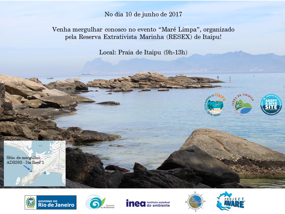
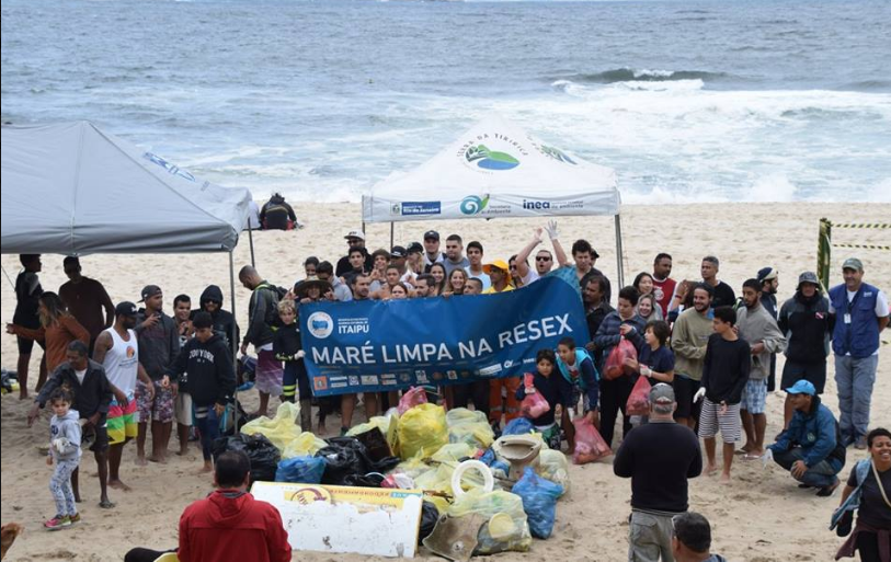
We had an event created together with the RESEX Marinha de Itaipu but the weather was awful on the day, so we had to cancelled the dive part. On the other hand we made a great action on cleaning the beach with more than 50 people helping out.
good
Michelle Mayumi Tizuka
4
0.00
0
0.00
0.00
measured
0.00
On
kilograms
Our Survey Site was free of debris
Slight for waves 0.5 -1.25 meter high
m2
meters
rocky reef
Brazil
Map Help
Dive Location
If you know your survey site coordinates, enter them manually in decimal degrees using WGS84 Map Datum. Use the minus sign for latitudes south of the equator and longitudes west of the Prime Meridian to 180 degrees.
If you do not know your survey site coordinates, click the “Map Location” tab to use the map to zoom into your survey site and drop the pin on the map to fall within your survey dive site in the water (not on land or the beach). Ensure you zoom in as much as possible to ensure data accuracy.
Entangled Help
Use the vertical tabs below to record any entangled animals you found of each type.
Some debris on the rocks near the dive site (plastic bags) - collected and discarded.
good
Michelle Mayumi Tizuka
1
0.00
20
2.00
2.00
measured
4.00
On
kilograms
Our Survey Site was free of debris
Smooth (wavelets) for waves 0.1 - 0.5 meter high
m2
meters
rocky reef
Brazil
Map Help
Dive Location
If you know your survey site coordinates, enter them manually in decimal degrees using WGS84 Map Datum. Use the minus sign for latitudes south of the equator and longitudes west of the Prime Meridian to 180 degrees.
If you do not know your survey site coordinates, click the “Map Location” tab to use the map to zoom into your survey site and drop the pin on the map to fall within your survey dive site in the water (not on land or the beach). Ensure you zoom in as much as possible to ensure data accuracy.
Entangled Help
Use the vertical tabs below to record any entangled animals you found of each type.
Calm (glassy to rippled) for waves 0 – 0.1 meter high
m2
meters
rocky reef
Brazil
Map Help
Dive Location
If you know your survey site coordinates, enter them manually in decimal degrees using WGS84 Map Datum. Use the minus sign for latitudes south of the equator and longitudes west of the Prime Meridian to 180 degrees.
If you do not know your survey site coordinates, click the “Map Location” tab to use the map to zoom into your survey site and drop the pin on the map to fall within your survey dive site in the water (not on land or the beach). Ensure you zoom in as much as possible to ensure data accuracy.
Entangled Help
Use the vertical tabs below to record any entangled animals you found of each type.