Smooth (wavelets) for waves 0.1 - 0.5 meter high
m2
meters
coral reef
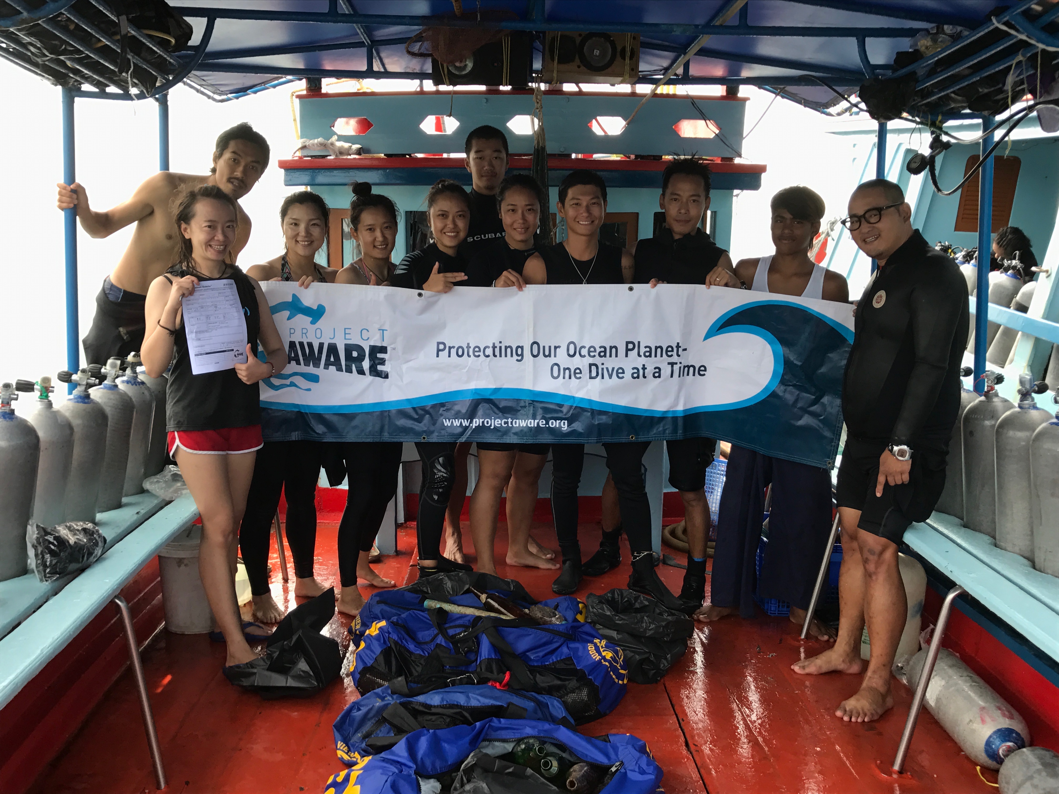
Thailand
State\Province
Suratthani
City
Koh Tao
Map Help
Dive Location
If you know your survey site coordinates, enter them manually in decimal degrees using WGS84 Map Datum. Use the minus sign for latitudes south of the equator and longitudes west of the Prime Meridian to 180 degrees.
If you do not know your survey site coordinates, click the “Map Location” tab to use the map to zoom into your survey site and drop the pin on the map to fall within your survey dive site in the water (not on land or the beach). Ensure you zoom in as much as possible to ensure data accuracy.
Entangled Help
Use the vertical tabs below to record any entangled animals you found of each type.
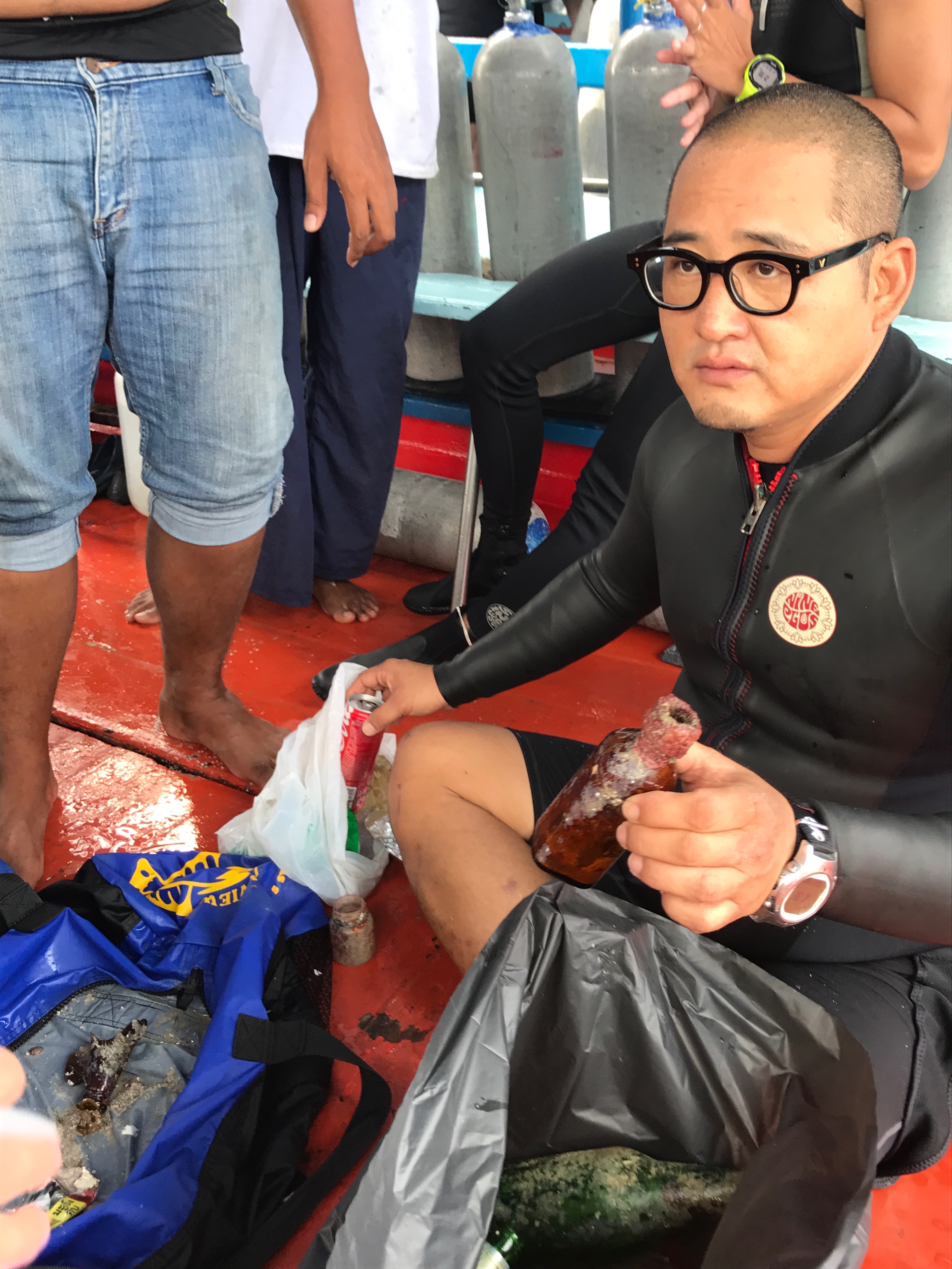
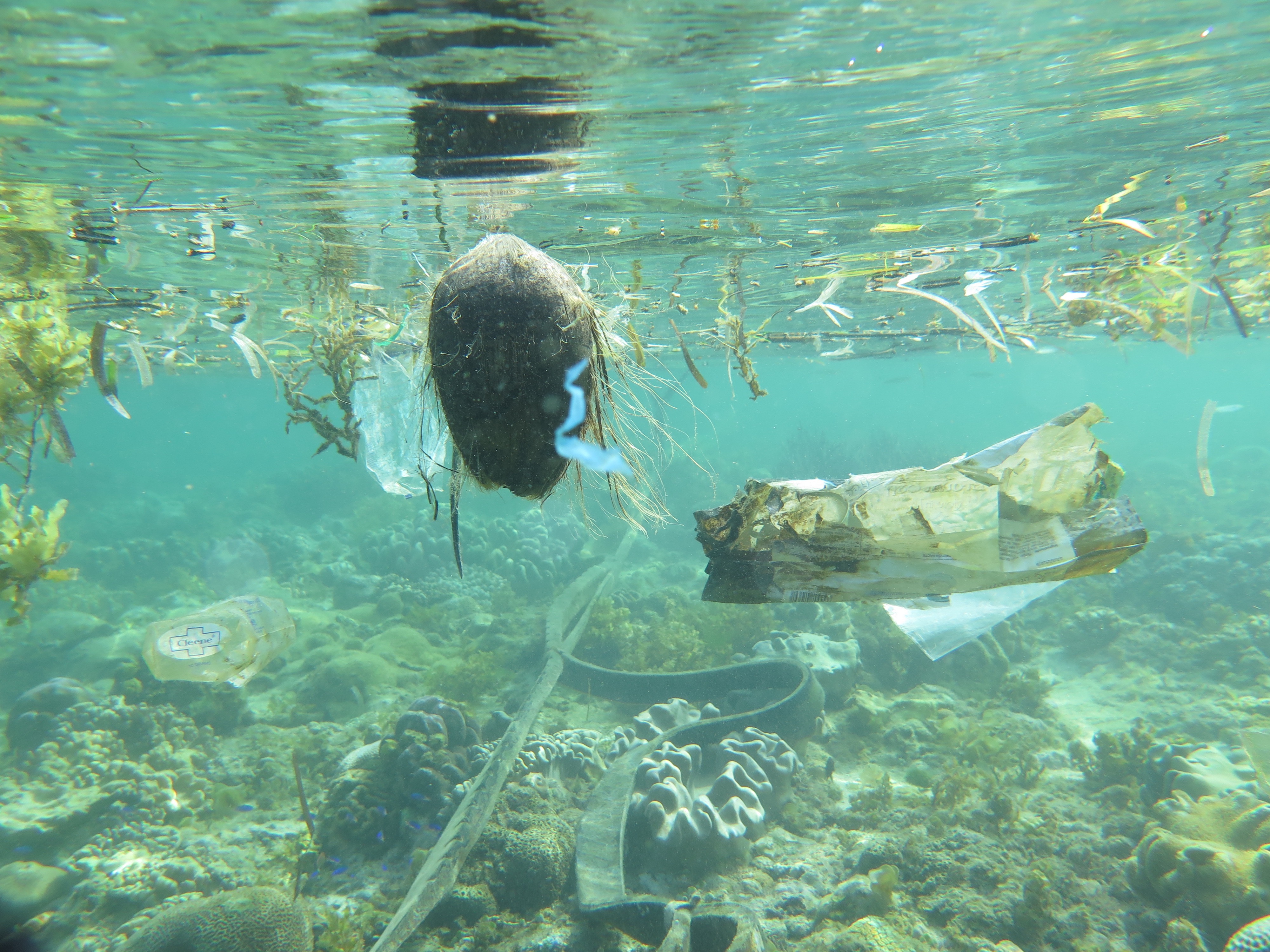
That beer bottles estimated from fishing boats, diving boats, snorkeling boats, and small commercial boats
NO
BEER BOTTLES
GOOD
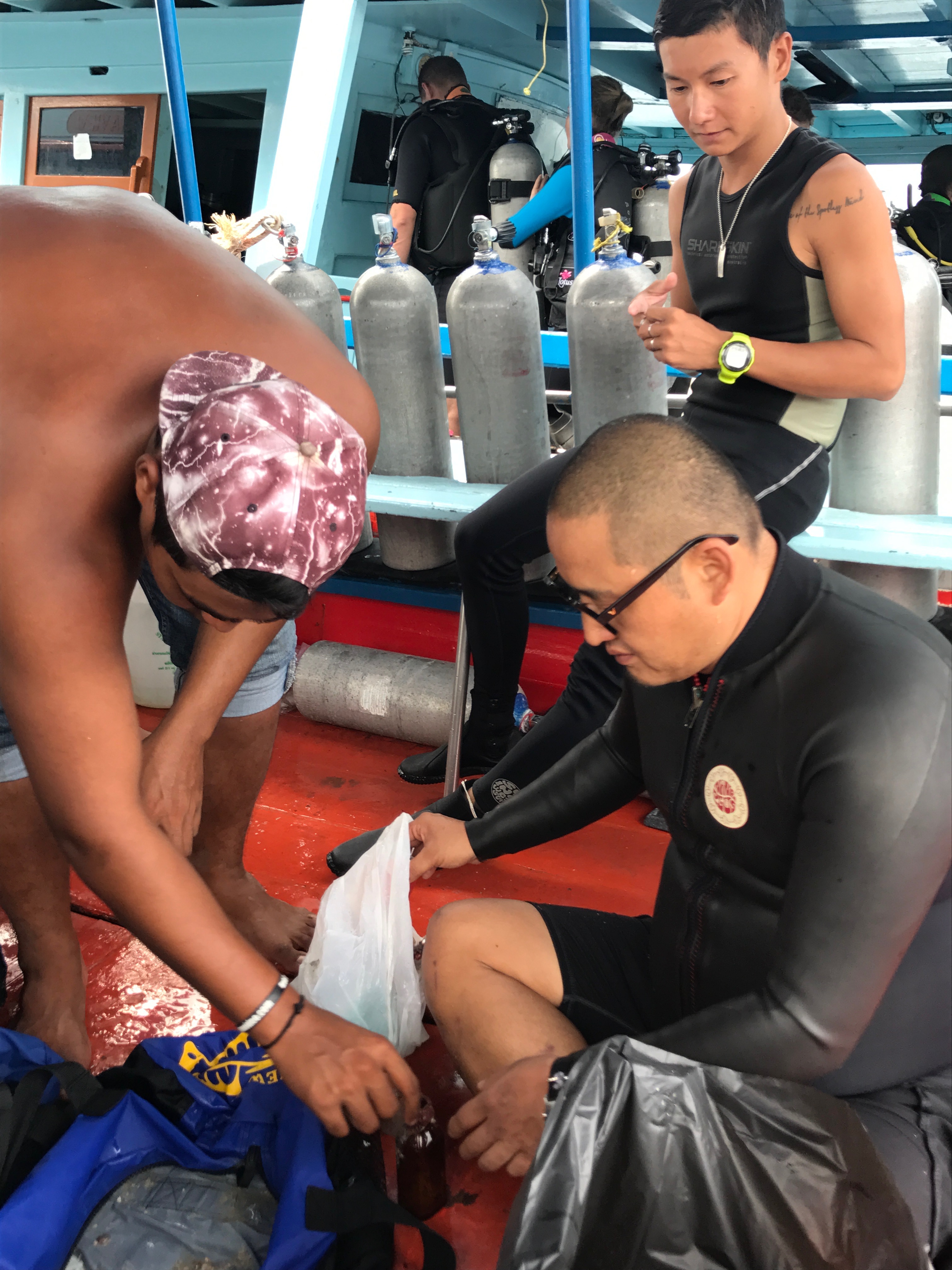
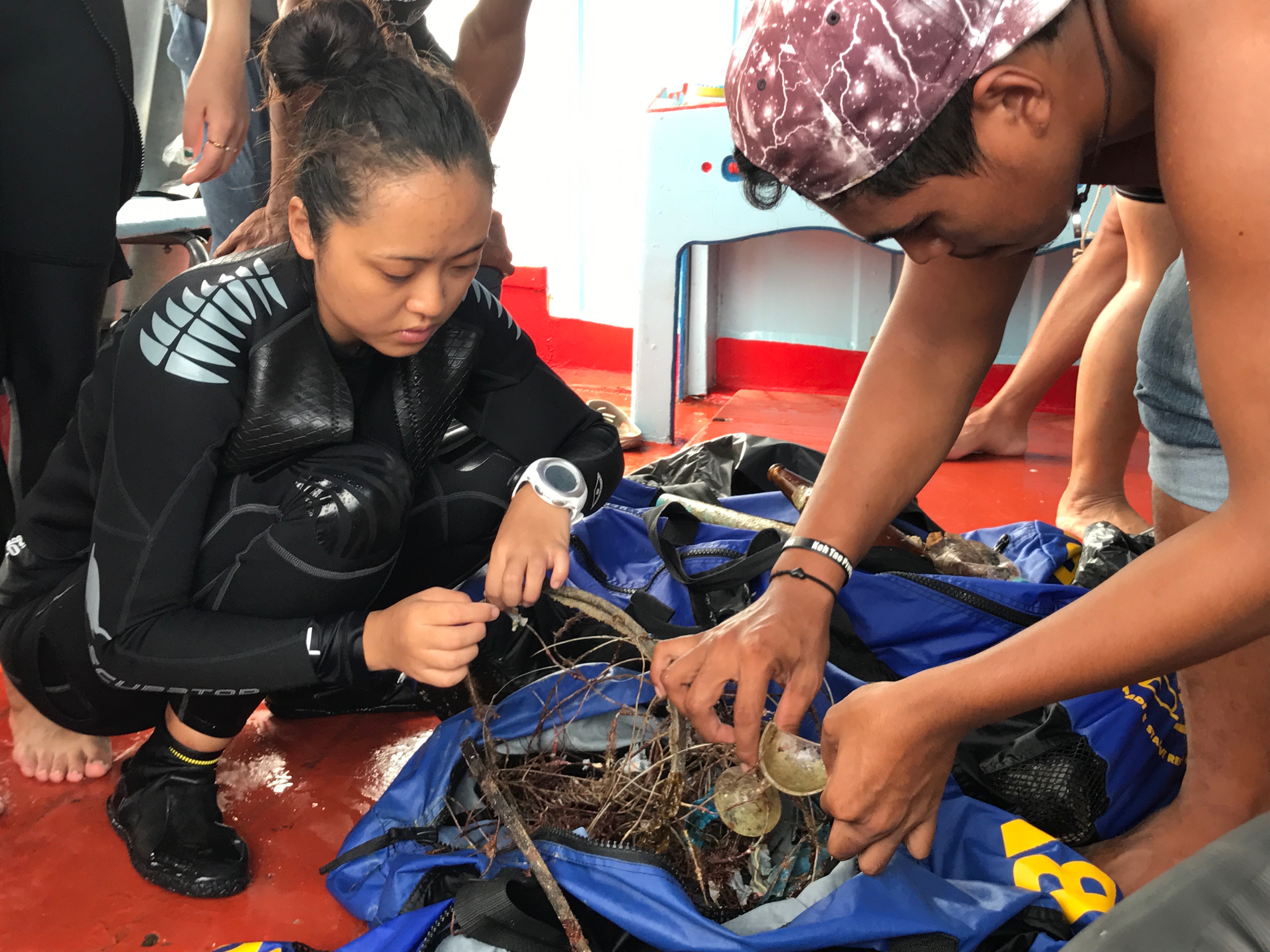
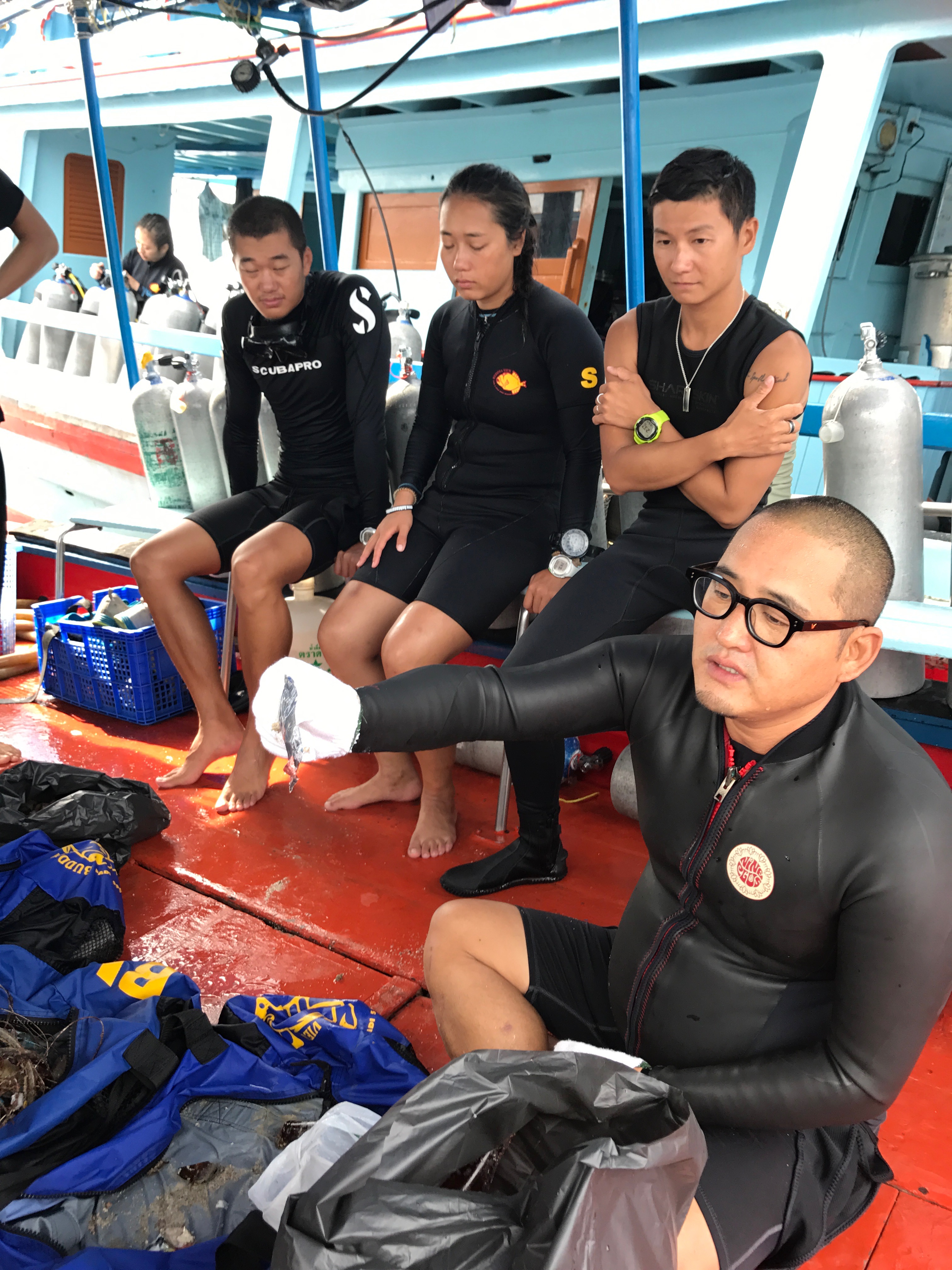
BUDDHAVIEW DIVE RESORT
SEUNGHAN OH
1
4
14.80
40
10.00
5.00
1
measured
108.00
2
BEER BOTTLES
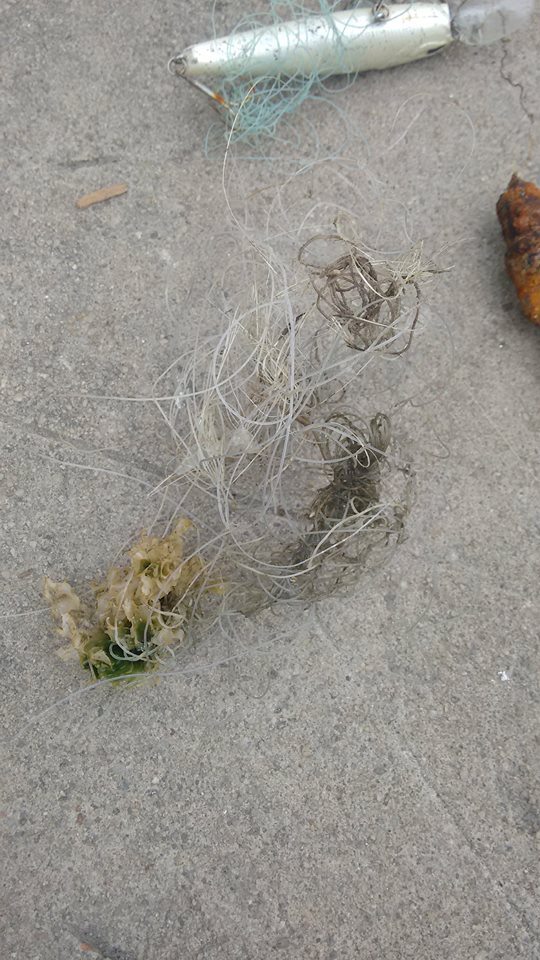
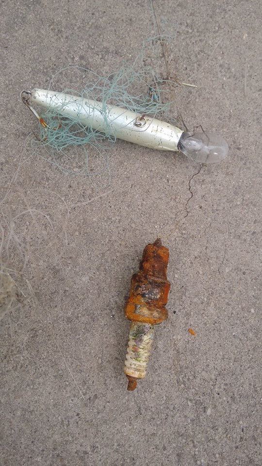
FISHING LINE
On
kilograms
I have debris data to report
23
Smooth (wavelets) for waves 0.1 - 0.5 meter high
1
1
m2
meters
coral reef
1
1
1
1
Thailand
State\Province
SURATTANI
City
KOH TAO
Map Help
Dive Location
If you know your survey site coordinates, enter them manually in decimal degrees using WGS84 Map Datum. Use the minus sign for latitudes south of the equator and longitudes west of the Prime Meridian to 180 degrees.
If you do not know your survey site coordinates, click the “Map Location” tab to use the map to zoom into your survey site and drop the pin on the map to fall within your survey dive site in the water (not on land or the beach). Ensure you zoom in as much as possible to ensure data accuracy.
Entangled Help
Use the vertical tabs below to record any entangled animals you found of each type.
Here are 2 sources where all trash coming from- one is Cebu city and nearest White beach every Saturday and Sunday .
Calm, no waves
40
50
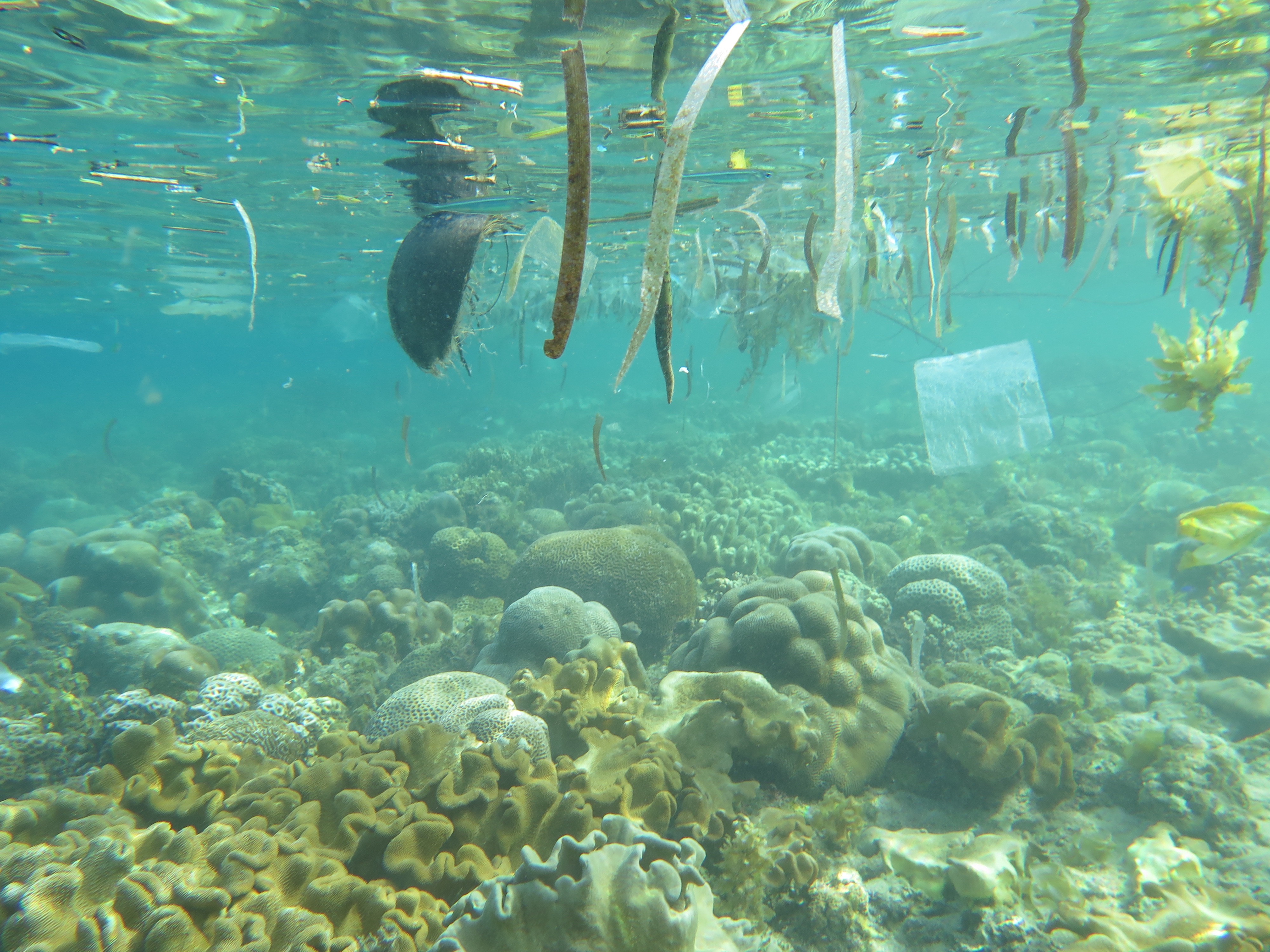
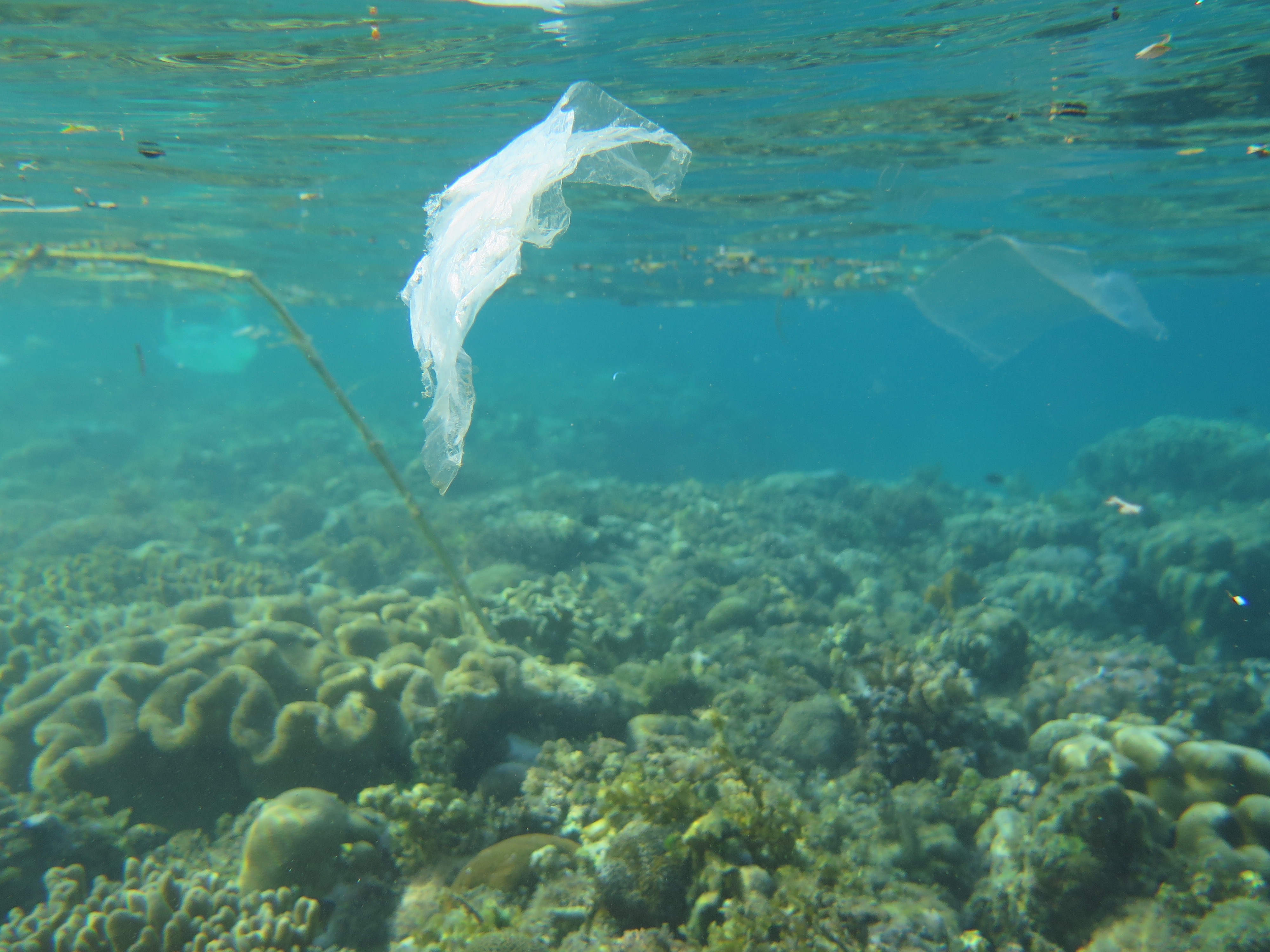
lot of chips packs
small plastic bags used for water
Savedra dive center
Martins Slisans
7
3
40
10
20.00
57
15.00
2.00
measured
150.00
On
kilograms
I have debris data to report
Calm (glassy to rippled) for waves 0 – 0.1 meter high
m2
1
meters
coral reef
Philippines
State\Province
Cebu
City
Moalboal
Map Help
Dive Location
If you know your survey site coordinates, enter them manually in decimal degrees using WGS84 Map Datum. Use the minus sign for latitudes south of the equator and longitudes west of the Prime Meridian to 180 degrees.
If you do not know your survey site coordinates, click the “Map Location” tab to use the map to zoom into your survey site and drop the pin on the map to fall within your survey dive site in the water (not on land or the beach). Ensure you zoom in as much as possible to ensure data accuracy.
Entangled Help
Use the vertical tabs below to record any entangled animals you found of each type.
Calm (glassy to rippled) for waves 0 – 0.1 meter high
m2
meters
coral reef
Singapore
Map Help
Dive Location
If you know your survey site coordinates, enter them manually in decimal degrees using WGS84 Map Datum. Use the minus sign for latitudes south of the equator and longitudes west of the Prime Meridian to 180 degrees.
If you do not know your survey site coordinates, click the “Map Location” tab to use the map to zoom into your survey site and drop the pin on the map to fall within your survey dive site in the water (not on land or the beach). Ensure you zoom in as much as possible to ensure data accuracy.
Entangled Help
Use the vertical tabs below to record any entangled animals you found of each type.
Plastic bottles especially water bottles, thrown from boats
Glass bottles, from part day boats
On
kilograms
I have debris data to report
6
Smooth (wavelets) for waves 0.1 - 0.5 meter high
1
m2
1
meters
seagrass
1
1
2
11
Malta
Map Help
Dive Location
If you know your survey site coordinates, enter them manually in decimal degrees using WGS84 Map Datum. Use the minus sign for latitudes south of the equator and longitudes west of the Prime Meridian to 180 degrees.
If you do not know your survey site coordinates, click the “Map Location” tab to use the map to zoom into your survey site and drop the pin on the map to fall within your survey dive site in the water (not on land or the beach). Ensure you zoom in as much as possible to ensure data accuracy.
Entangled Help
Use the vertical tabs below to record any entangled animals you found of each type.
Smooth (wavelets) for waves 0.1 - 0.5 meter high
m2
meters
coral reef
Thailand
Map Help
Dive Location
If you know your survey site coordinates, enter them manually in decimal degrees using WGS84 Map Datum. Use the minus sign for latitudes south of the equator and longitudes west of the Prime Meridian to 180 degrees.
If you do not know your survey site coordinates, click the “Map Location” tab to use the map to zoom into your survey site and drop the pin on the map to fall within your survey dive site in the water (not on land or the beach). Ensure you zoom in as much as possible to ensure data accuracy.
Entangled Help
Use the vertical tabs below to record any entangled animals you found of each type.
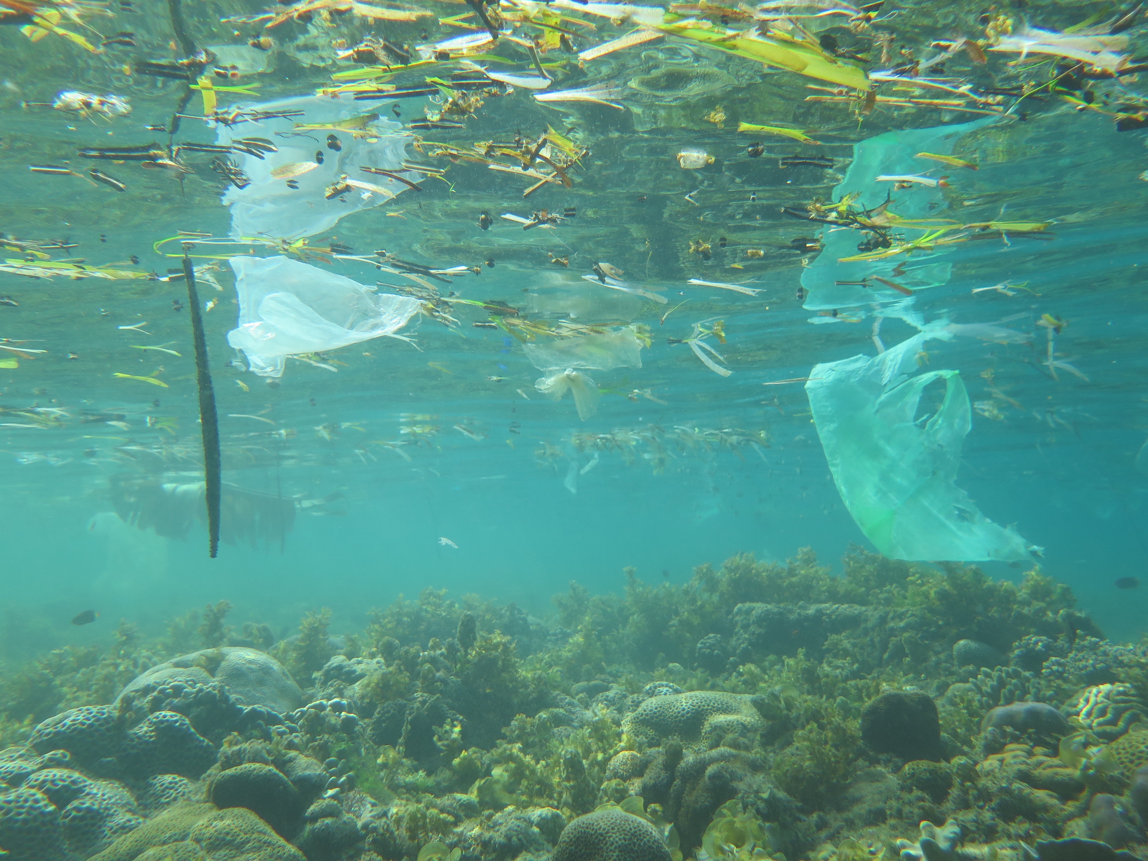
Many fishing lines tangled in benthic fauna and cans of drinks, coke, beers, etc. It was found a sail by car.
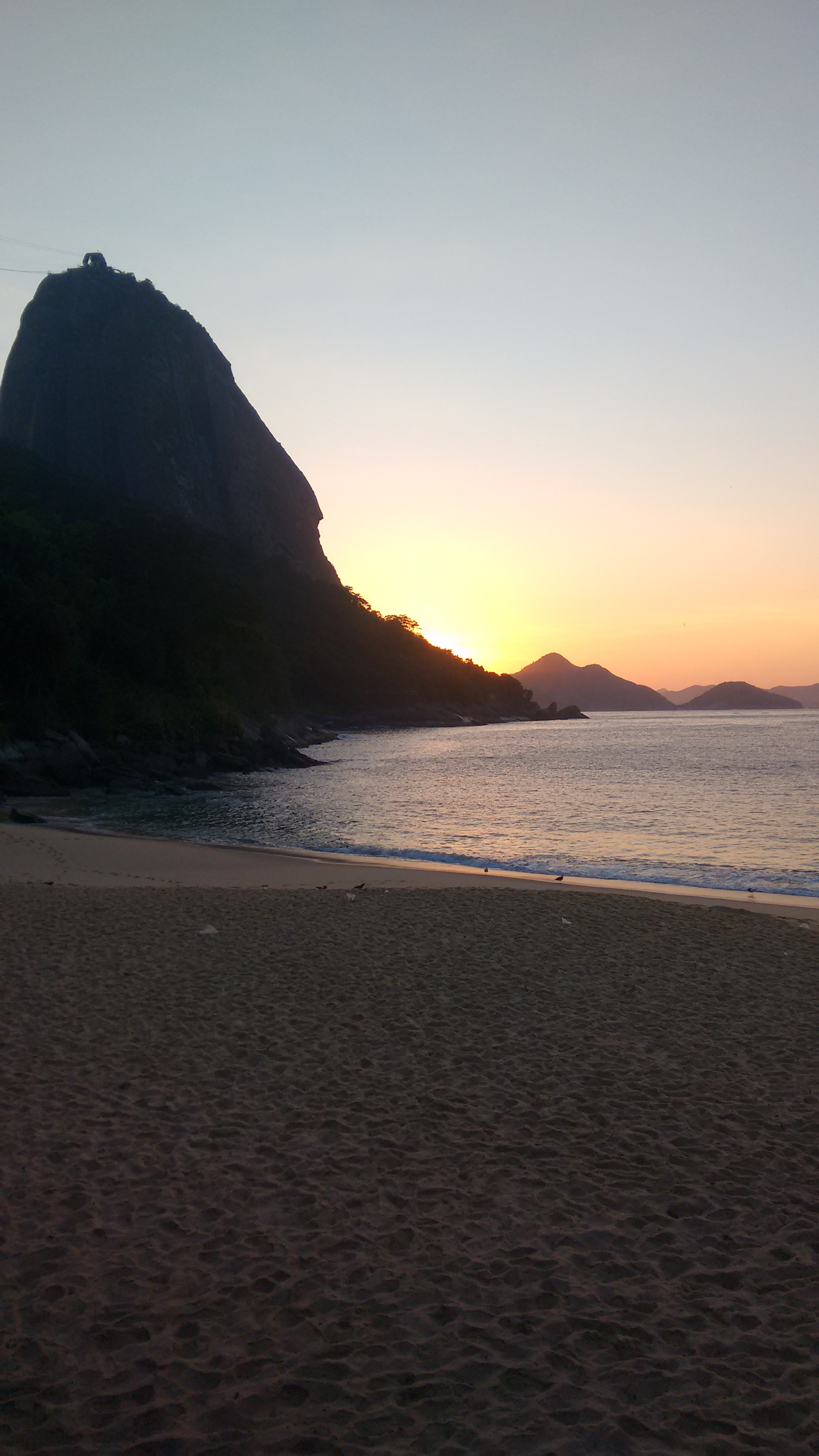
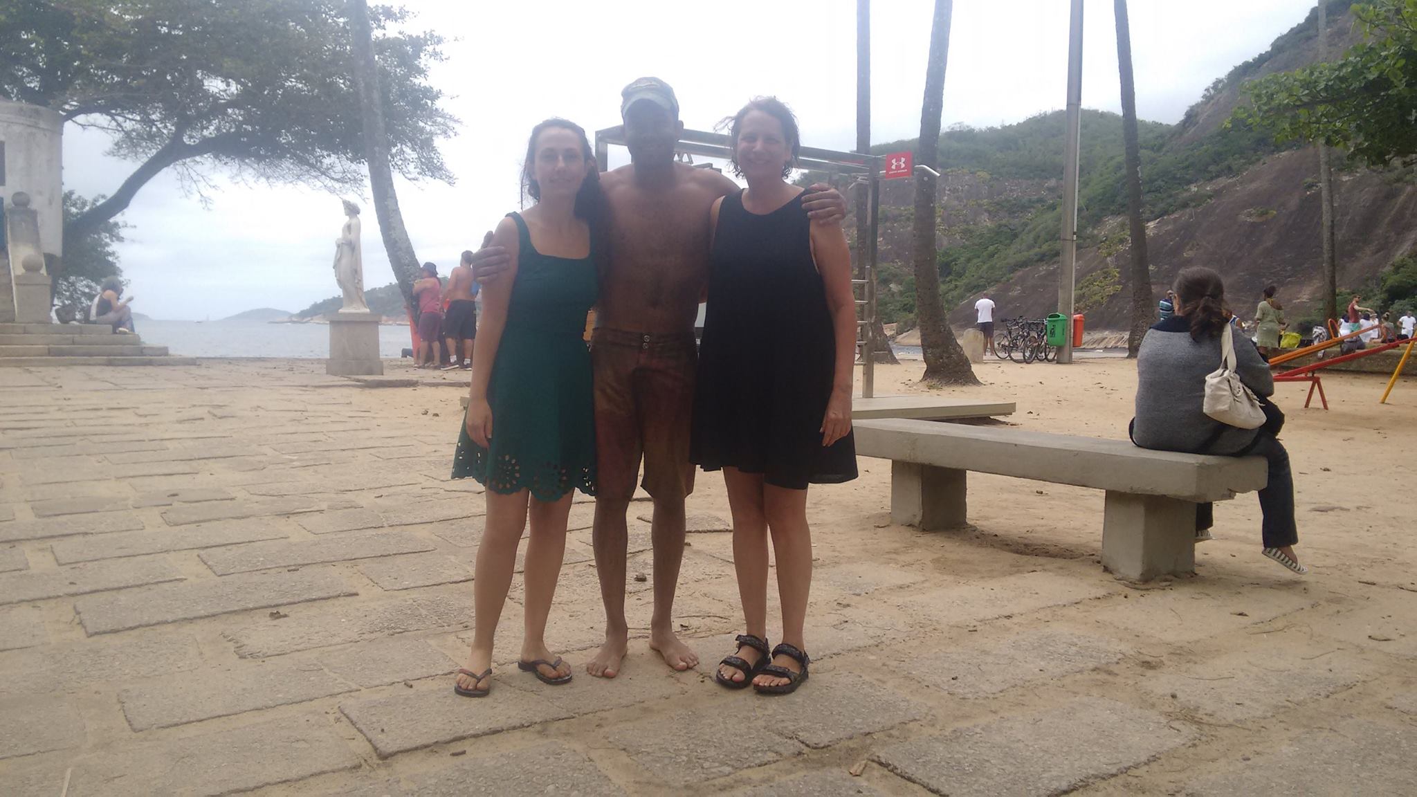
23/10/2016 - Praia Vermelha
Muito obrigado Jordan Davis (DiveMaster PADI) e Ariela Engler (Advanced PADI), por proporcionarem um excelente mergulho nesta manhã de domingo!!!!!
Tivemos a oportunidade de encontrar algumas espécies comuns no litoral brasileiro e nos aperfeiçoarmos na técnica do Mergulho Autônomo.
Tempo Bom, sol e pouco vento. Maré de enchente, temperatura de 23ºC. Visibilidade 1,5 mts
Luiz Carlos do Nascimento
Luiz Carlos do Nascimento
3
3
2
3.00
50
8.00
2.00
estimated
2
1099.00
Plasticos
Aparato de pesca
Latas de metal
On
kilograms
I have debris data to report
Calm (glassy to rippled) for waves 0 – 0.1 meter high
0
m2
meters
rocky reef
1
Brazil
State\Province
RIO DE JANEIRO
City
RIO DE JANEIRO
Map Help
Dive Location
If you know your survey site coordinates, enter them manually in decimal degrees using WGS84 Map Datum. Use the minus sign for latitudes south of the equator and longitudes west of the Prime Meridian to 180 degrees.
If you do not know your survey site coordinates, click the “Map Location” tab to use the map to zoom into your survey site and drop the pin on the map to fall within your survey dive site in the water (not on land or the beach). Ensure you zoom in as much as possible to ensure data accuracy.
Entangled Help
Use the vertical tabs below to record any entangled animals you found of each type.
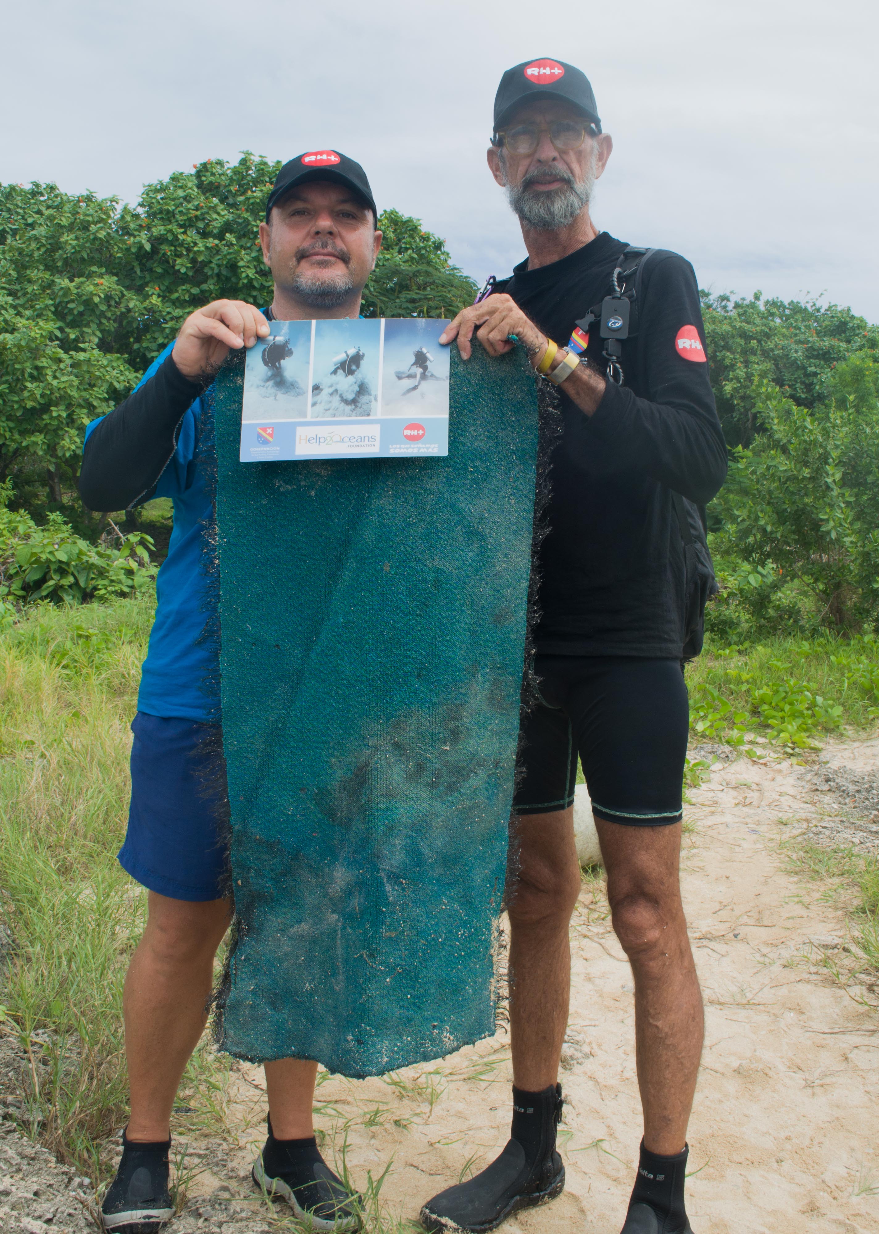
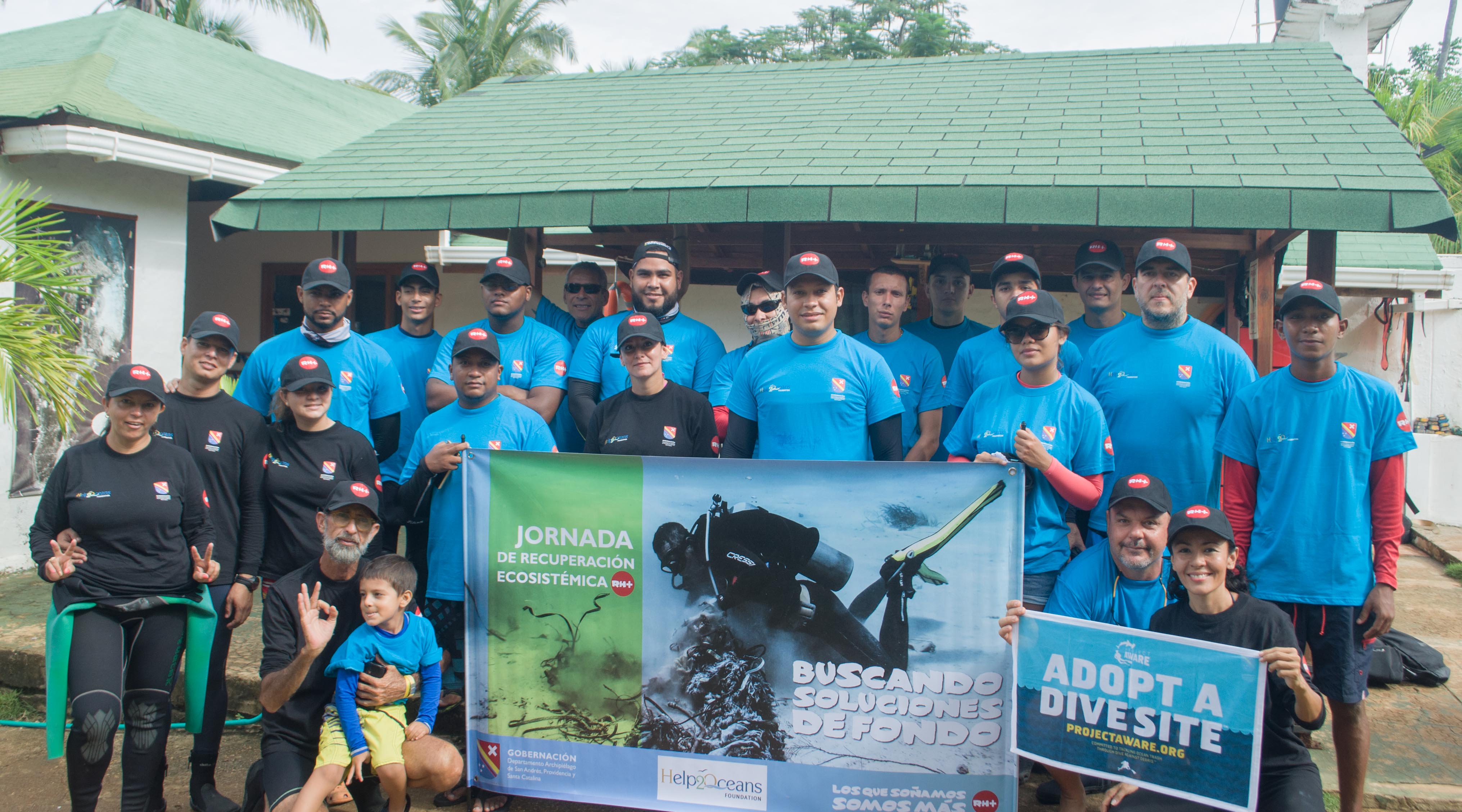
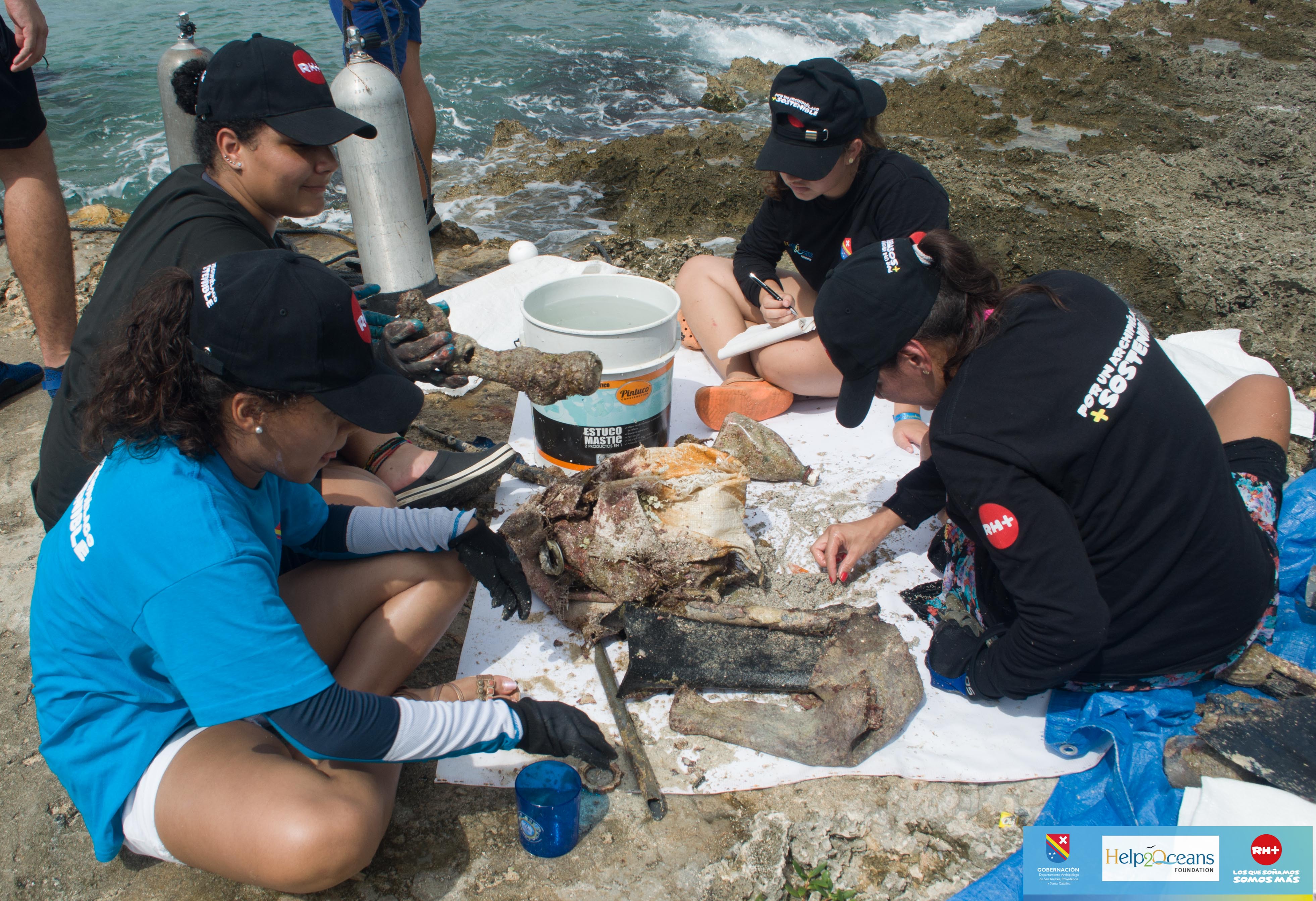
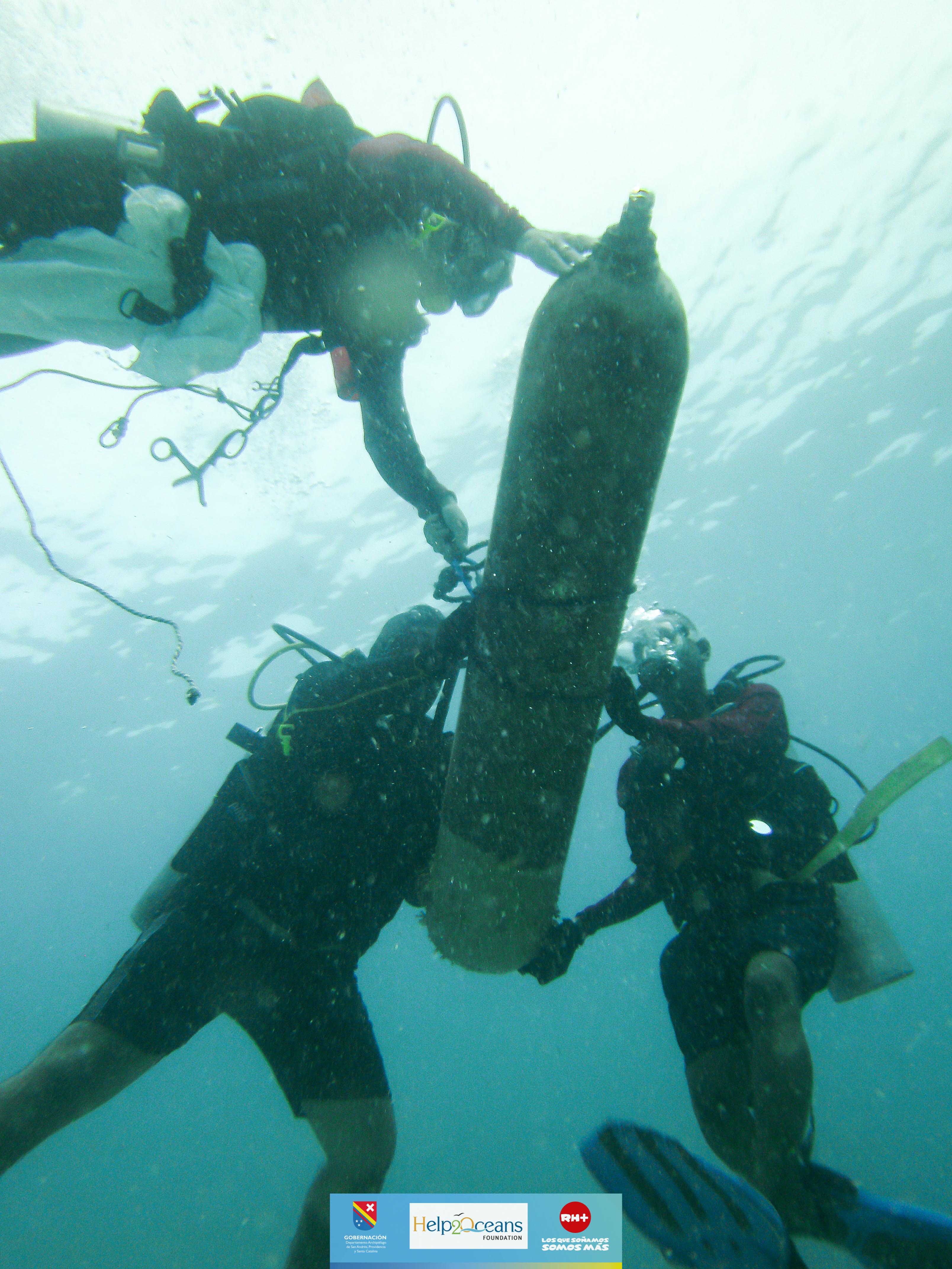
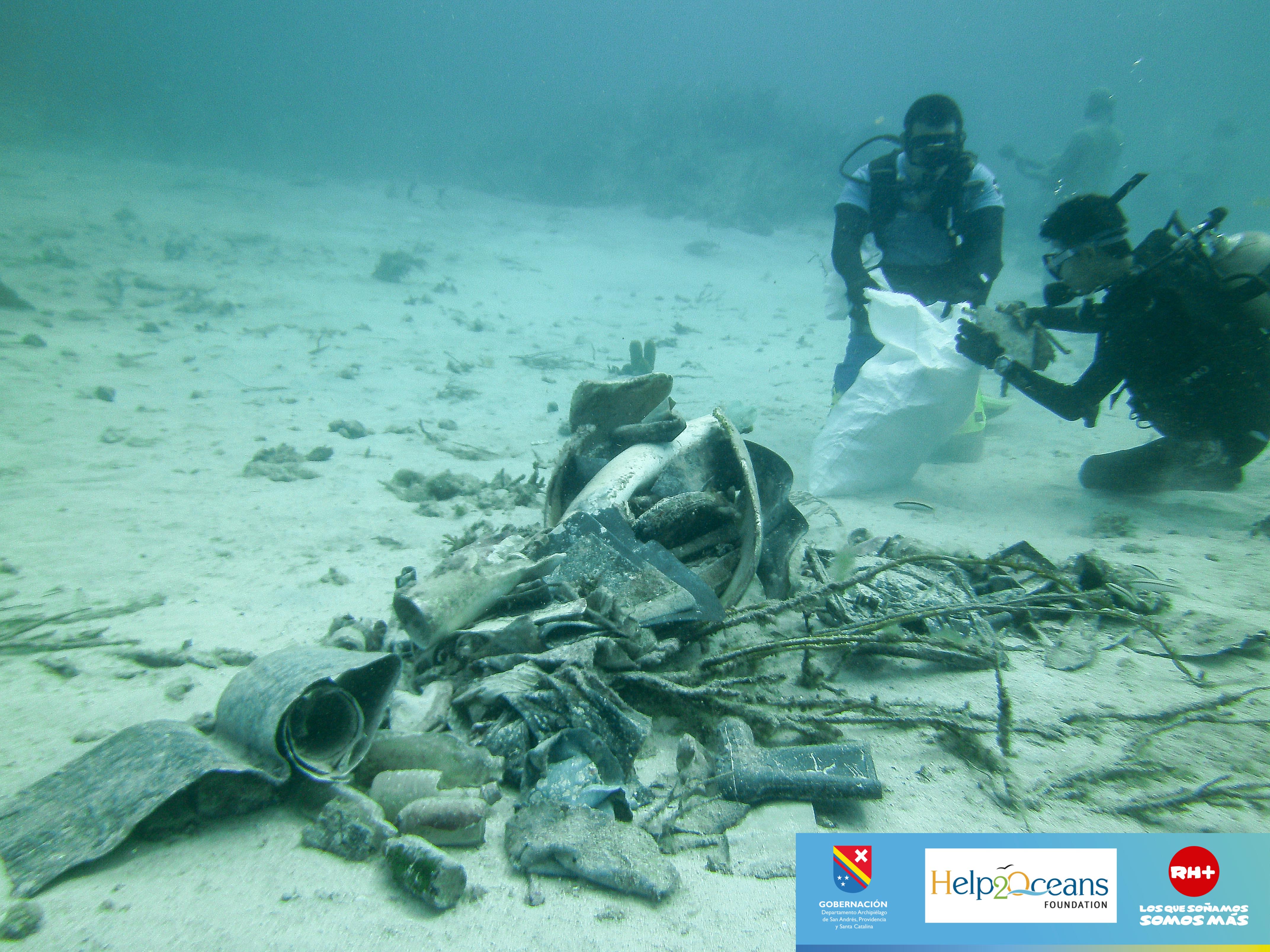
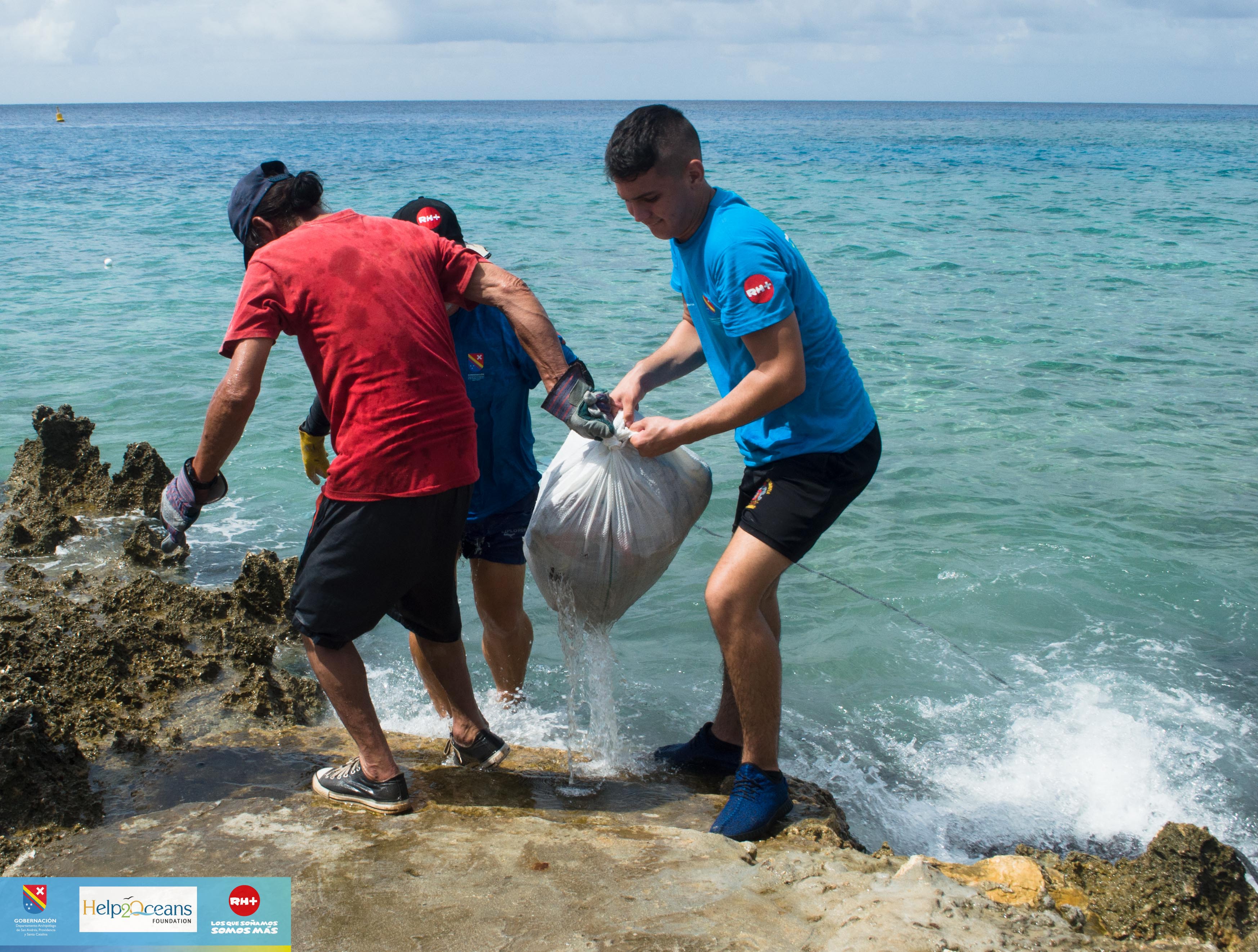
En la cuarta jornada de limpieza de Buscando Soluciones de Fondo patrocinada por la Gobernación del Departamento Archipiélago de San Andrés, Providencia y Santa Catalina, y realizada por la Iniciativa Bajo Tranquilo de la Fundación Help 2 Oceans, se lograron extraer de los fondos marinos del Valle de las Estatuas en total 380kg de residuos sólidos sumergidos, con la ayuda de 25 participantes en la jornada. El residuo que predominó en número fueron las latas de bebidas (52) y las botellas de vidrio de bebidas (49). Se encontraron adicionalmente una alta cantidad de tubos de PVC y fragmentos de plástico, metal y textiles. Los residuos de mayor preocupación son un frente de aire acondicionado que fue extraído, y un cilindro de 1.5m de alto de acetileno. Los residuos encontrados demuestran la falta de educación en la comunidad ya que continúan arrojando sus basuras al mar, y reflejan la necesidad de implementar medidas prontamente para mitigar el impacto ambiental de los residuos sólidos sumergidos en los ecosistemas marinos; sin embargo, con esta jornada de limpieza se entrega un punto de buceo libre de contaminación, y un espacio marino recuperado de 4.000 metros cuadrados (sic). ( Alexandra Pineda-Muñoz Bióloga Investigadora )
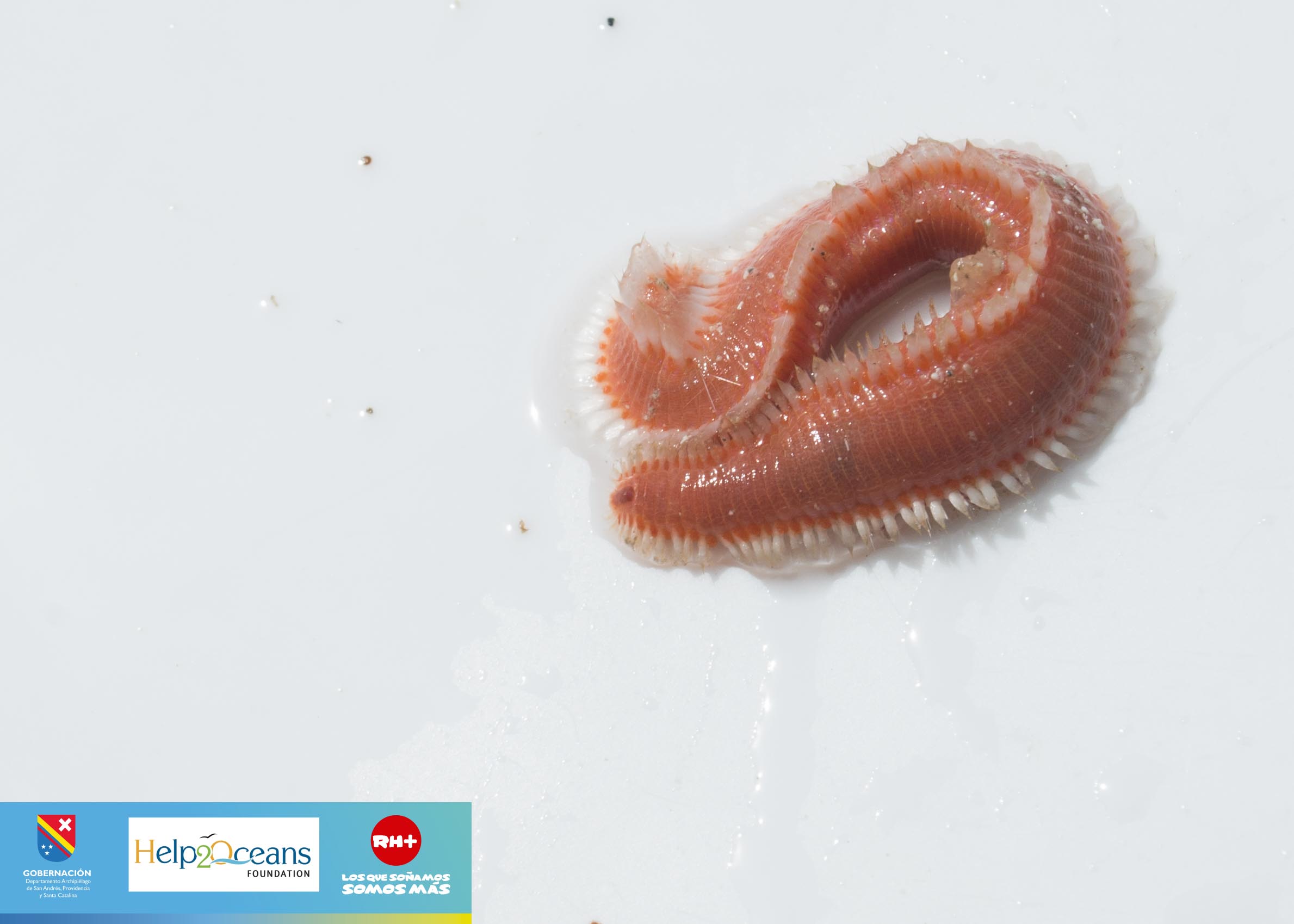
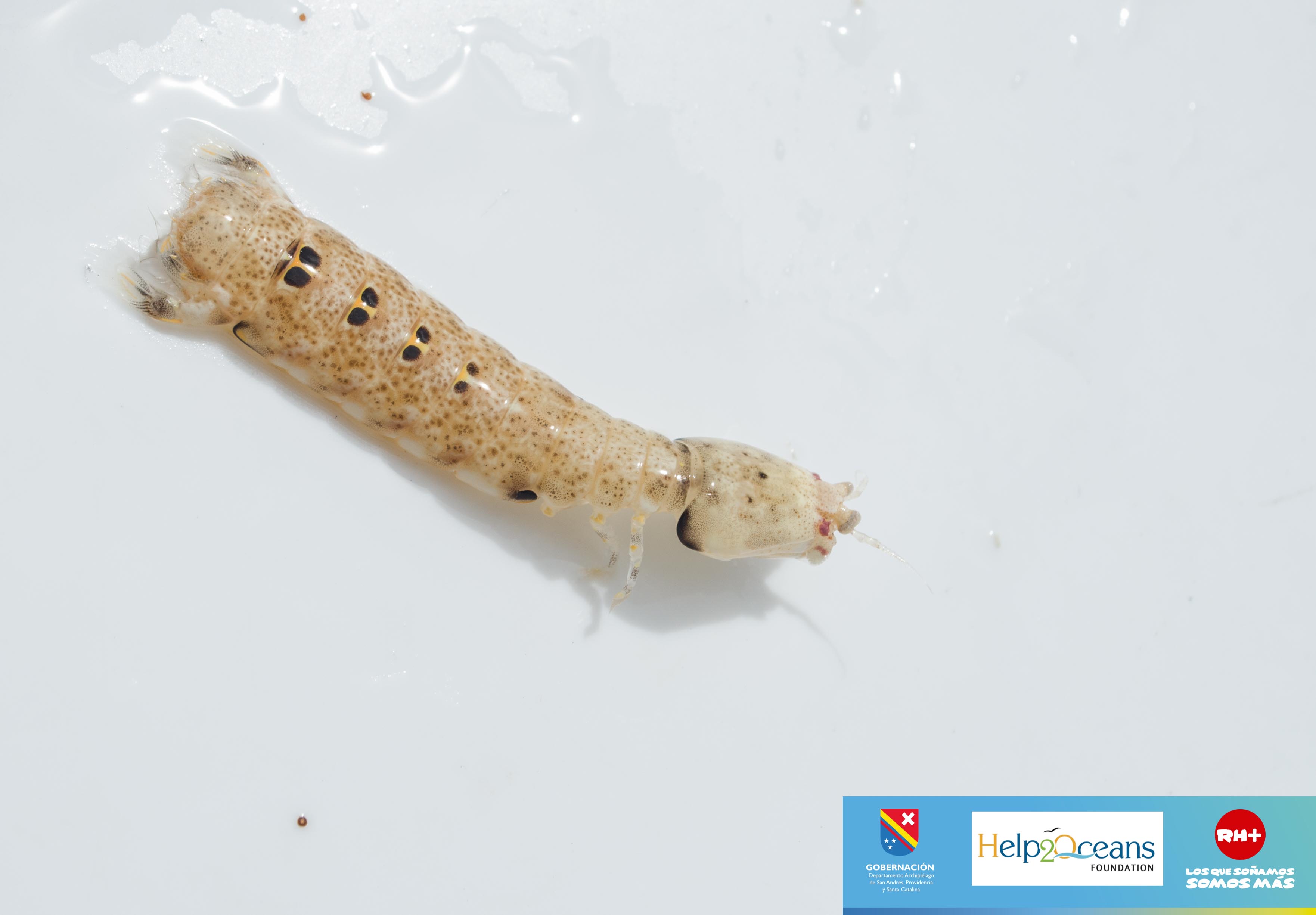
Se logró rescatar a 565 individuos de diferentes familias que se encontraban asociados a los desechos marinos. El grupo predominante fueron los cangrejos (Crustacea:Brachyura) con 137 individuos, lo cual se debe a la presencia de fondos arenosos en la zona, de donde fueron extraídos la mayoría de los residuos. Adicionalmente se encontró alta abundancia de caracoles (Mollusca:Gagtropoda), y otras especies como gusanos, ermitaños, langostas y erizos. Las especies encontradas son típicas de los fondos arenosos, y tienden a buscar resguardo en grietas y corales o bajo la arena para evitar ser depredados fácilmente, por lo cual es de esperarse fueran encontradas entre las llantas. Sin embargo, la asociación de estas especies a los residuos sólidos es preocupante, ya que dicha asociación puede estar causando efectos nocivos en las especies por acumulación de compuestos tóxicos desprendidos de las llantas.
Se logró extraer a la mayoría de las especies asociadas a los residuos sólidos sumergidos con vida, a excepción de 3 peces que fallecieron, sin embargo se considera que el protocolo de extracción y separación en superficie fue exitoso, respetando la vida de las especies marinas al máximo. ( Alexandra Pineda-Muñoz Bióloga Investigadora )
1
1
2
Rejilla de Aire Acondicionado
Fragmento de mesa de planca
Tapetes / alfombras
HELP 2 OCEANS FOUNDATION
Jorge Dos Oceanos
19
7
2
25
18
5
380.00
180
13.50
1.50
100
estimated
4000.00
1
4
Latas de cerveza. bajo nivel de compromiso ambiental
2. Botellas de vidrio. bajo nivel de educación ambiental
3. Llantas. insufiencia de planes de disposición de residuos
On
kilograms
I have debris data to report
49
Calm (glassy to rippled) for waves 0 – 0.1 meter high
8
Botellas / Latas / Telas
Dead
No info
Cangrejos / Camarones / Mantis
Released Unharmed
565
3
Tela
55
1
m2
1
meters
coral reef
30
1
1
1
52
2
Colombia
State\Province
Departamento Archipielago de San Andres, Providencia y Santa Catalina
City
San Andres, Isla
Map Help
Dive Location
If you know your survey site coordinates, enter them manually in decimal degrees using WGS84 Map Datum. Use the minus sign for latitudes south of the equator and longitudes west of the Prime Meridian to 180 degrees.
If you do not know your survey site coordinates, click the “Map Location” tab to use the map to zoom into your survey site and drop the pin on the map to fall within your survey dive site in the water (not on land or the beach). Ensure you zoom in as much as possible to ensure data accuracy.
Entangled Help
Use the vertical tabs below to record any entangled animals you found of each type.