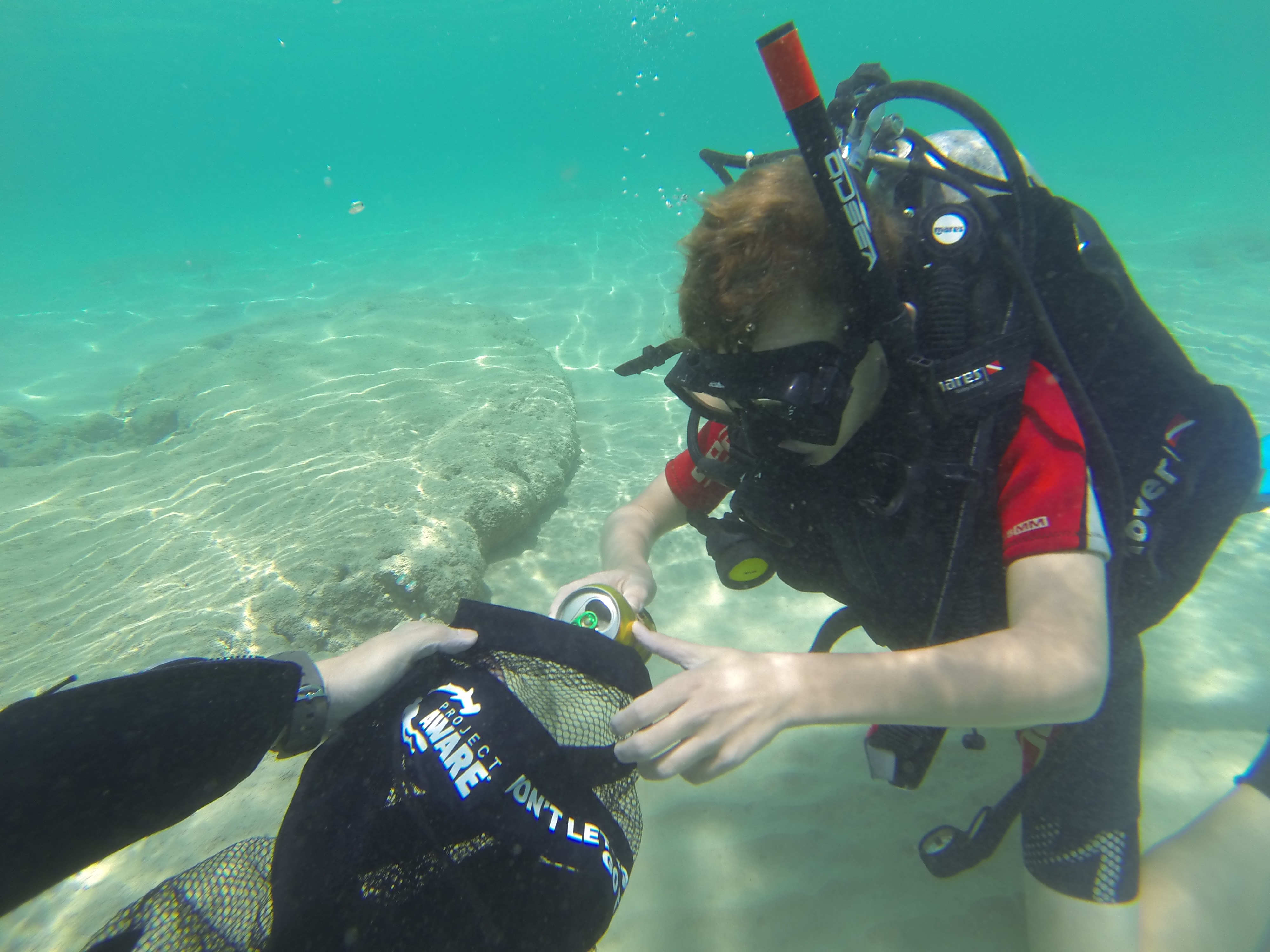
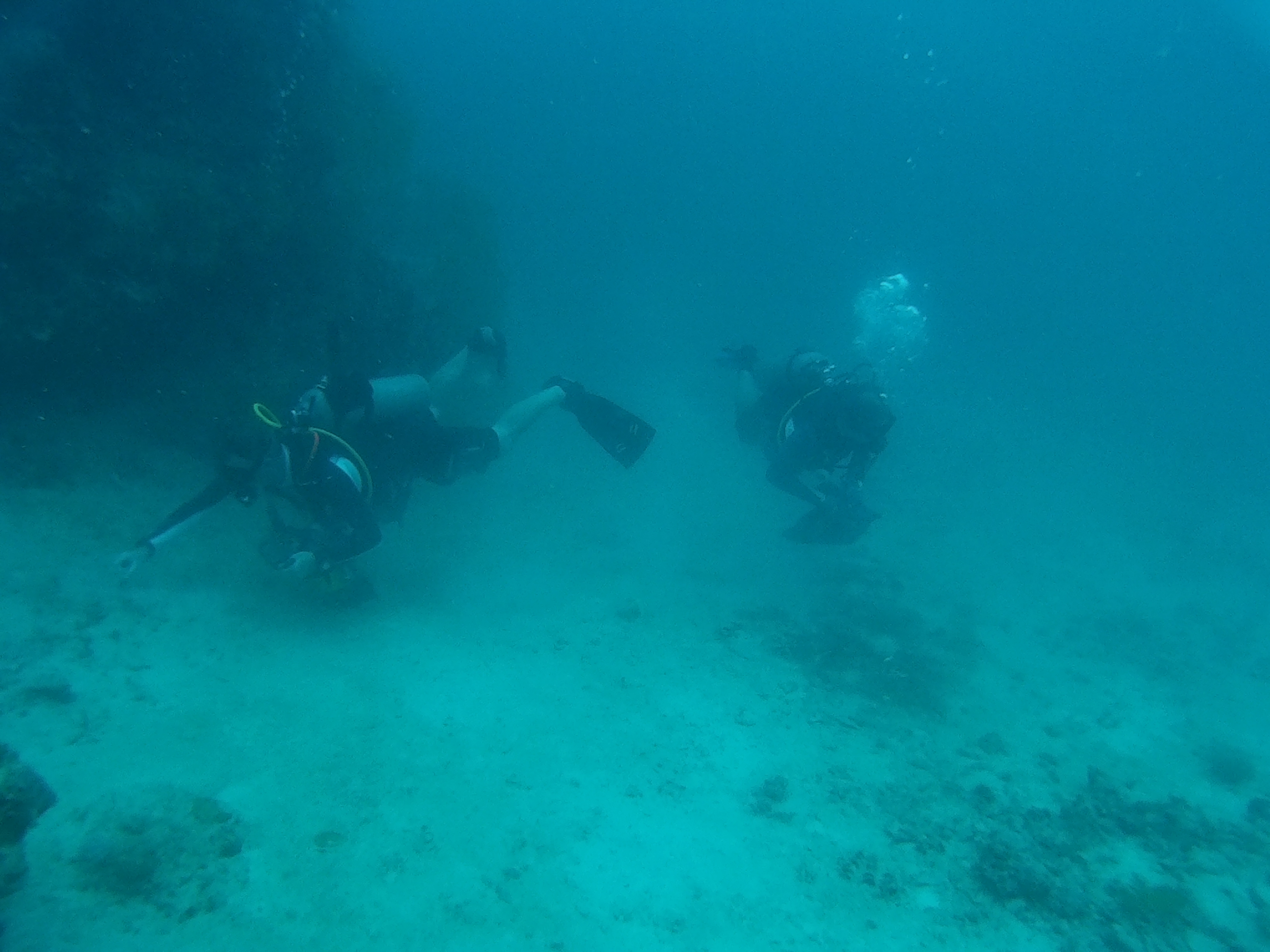
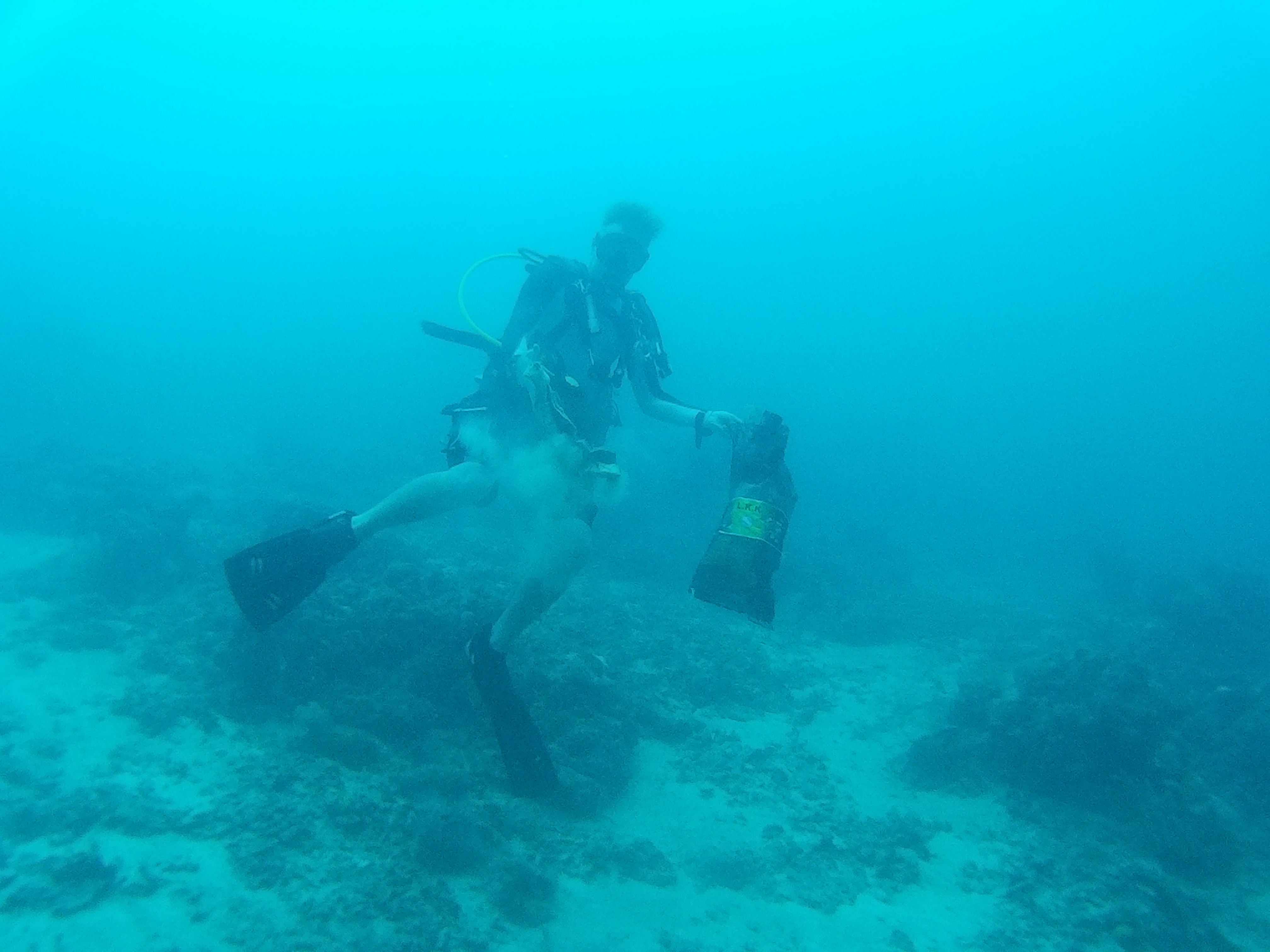
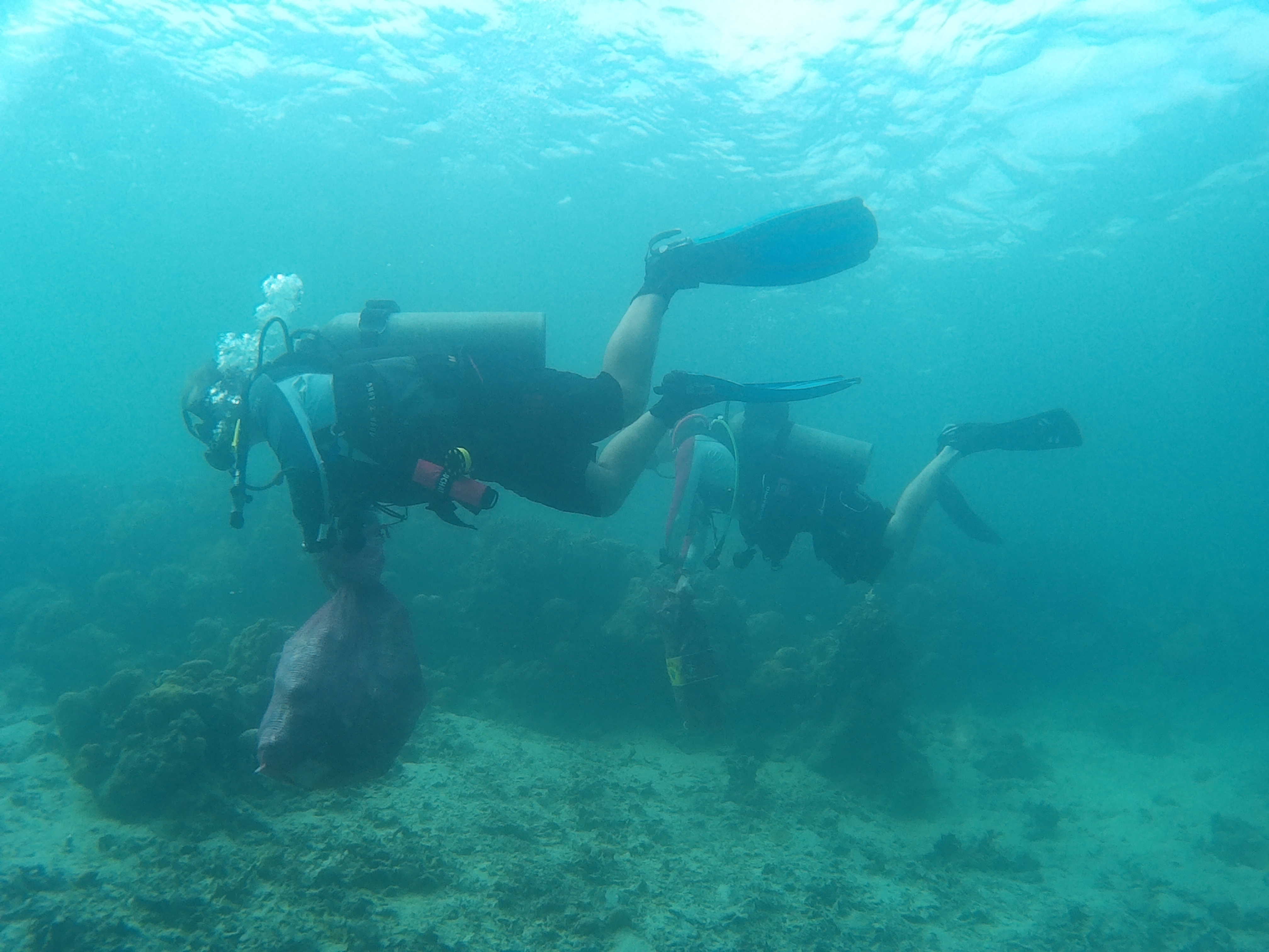
Menu

Neptune Wall

126
1
1
coral
1
2

11.966929908384293, 120.23016929626465

None
DVD
Overcast and some rain
Matrix Reloaded DVD and Case
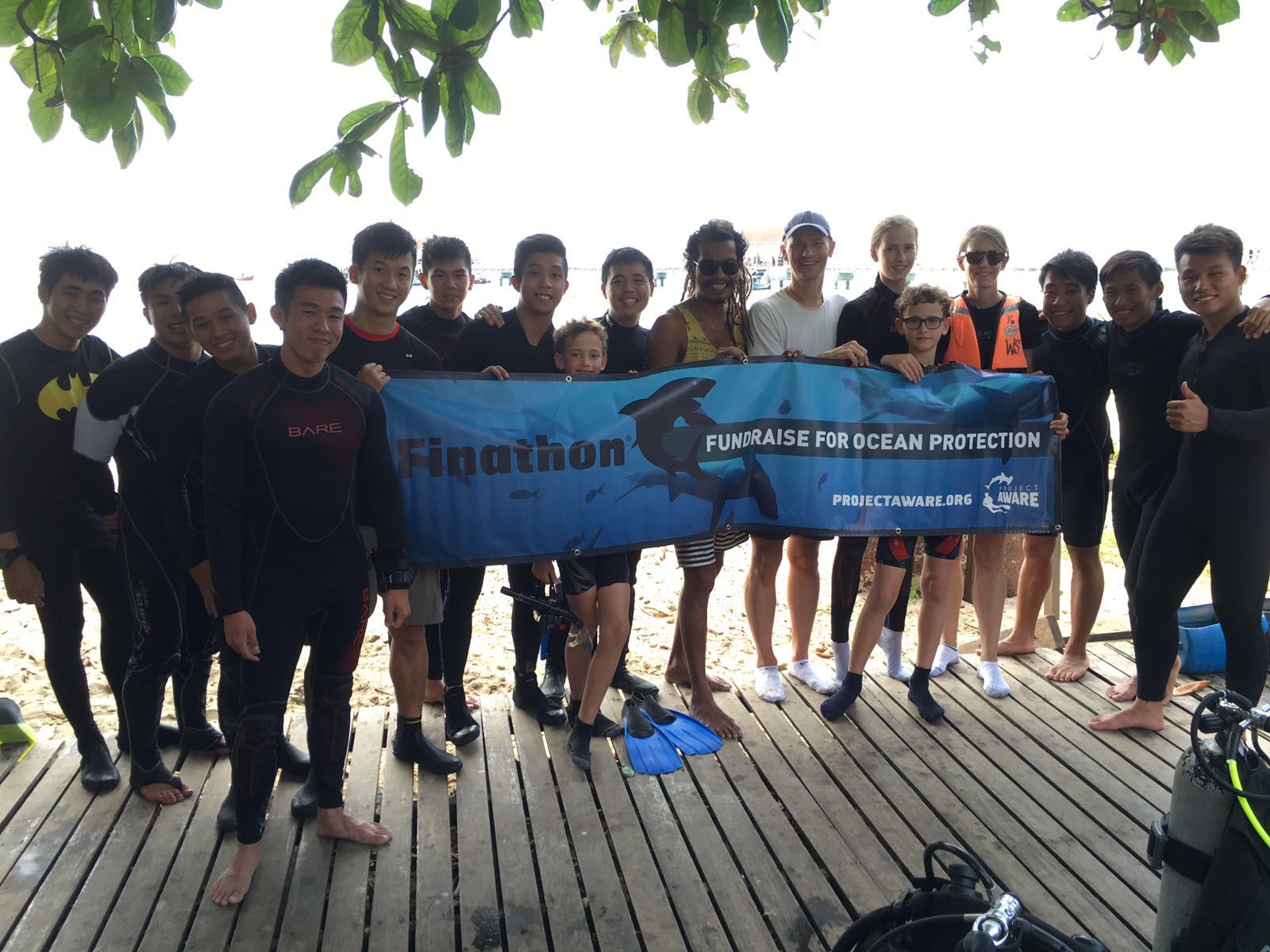
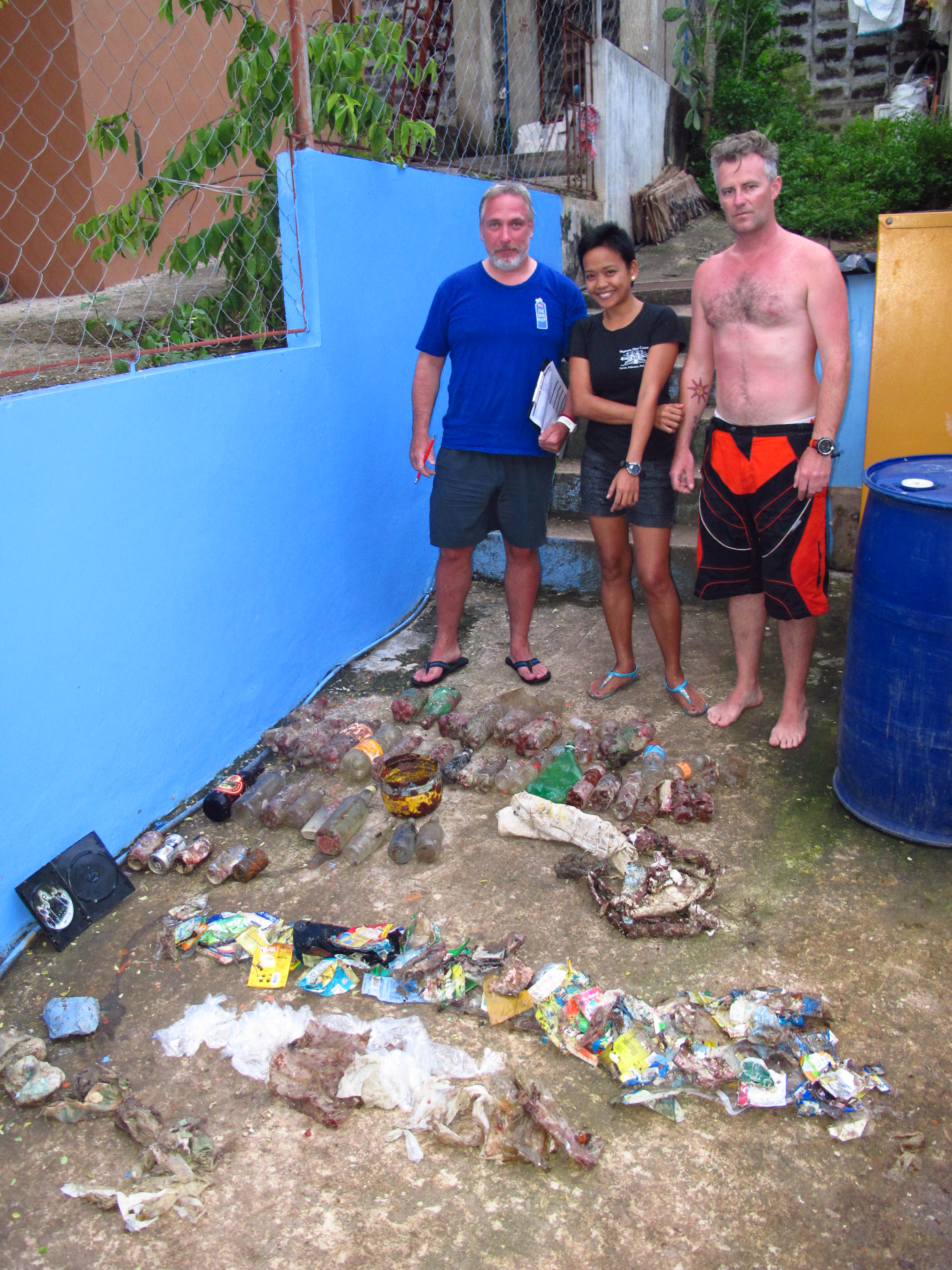
Neptune Dive Center
Patrick Preston
1
6
4
29
9
15.00
60
20.00
5.00
estimated
2250.00
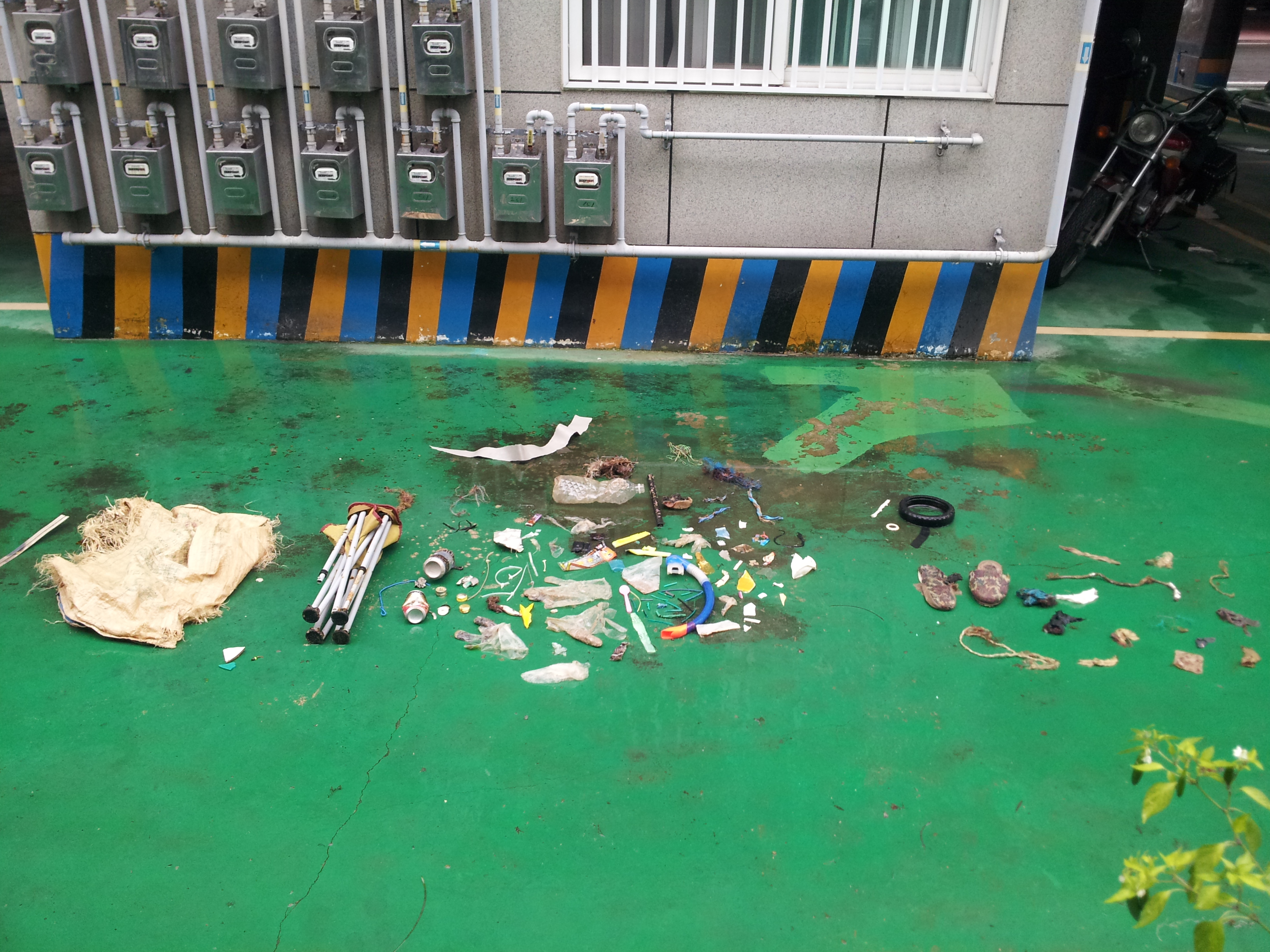
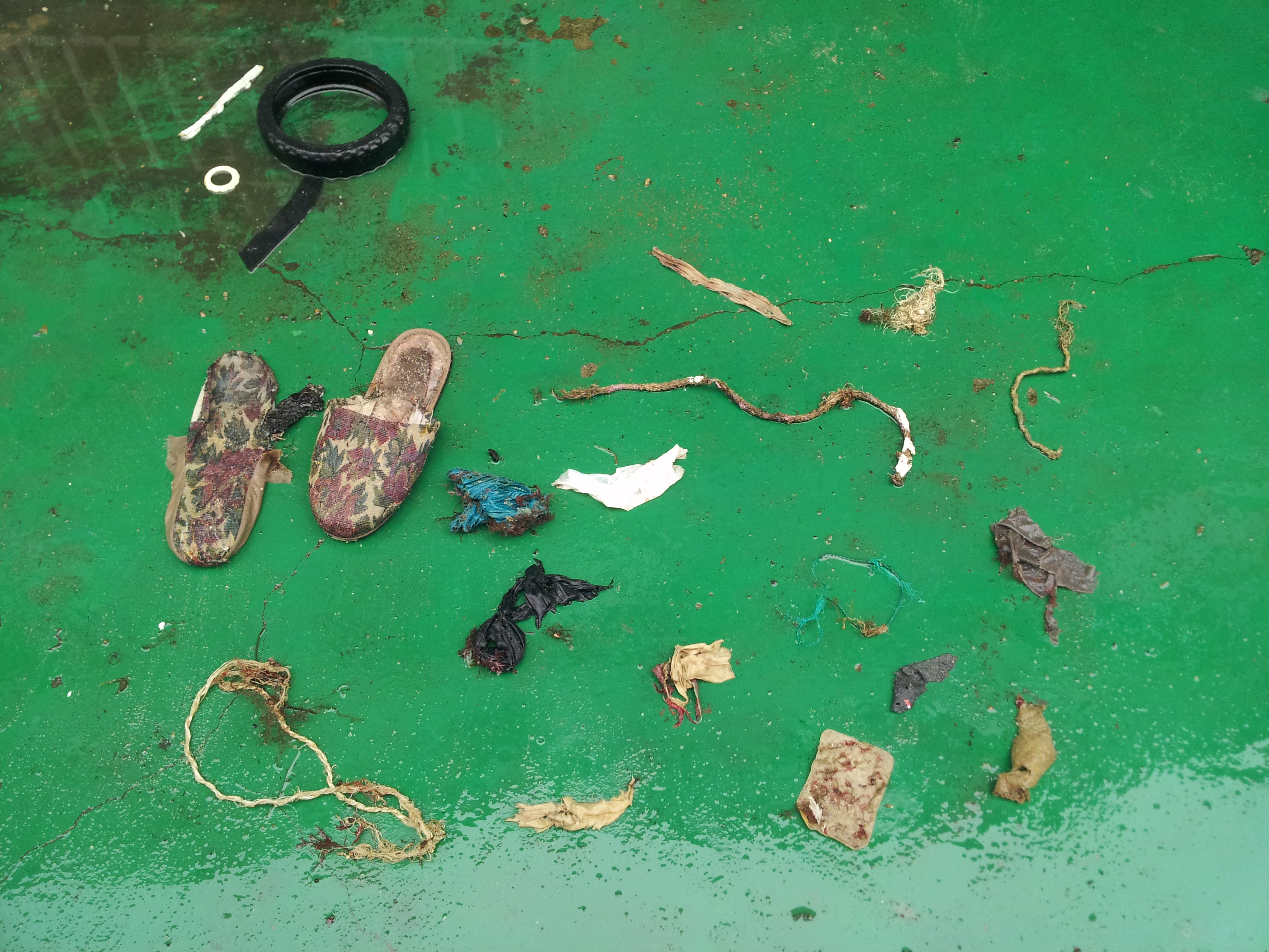
Single Serving food wrappers
On
kilograms
I have debris data to report
9
Calm (glassy to rippled) for waves 0 – 0.1 meter high m2
meters
rocky reef
1
4
Philippines
State\Province
Palawan
City
Coron
Map Help


Dive Location

If you know your survey site coordinates, enter them manually in decimal degrees using WGS84 Map Datum. Use the minus sign for latitudes south of the equator and longitudes west of the Prime Meridian to 180 degrees.

If you do not know your survey site coordinates, click the “Map Location” tab to use the map to zoom into your survey site and drop the pin on the map to fall within your survey dive site in the water (not on land or the beach). Ensure you zoom in as much as possible to ensure data accuracy.

Entangled Help


Use the vertical tabs below to record any entangled animals you found of each type.

Tuvveggen

67.22266880225312, 14.627716541290283

2
rock
3
Saltstraumen DykkeCamp
Fredric Ihrsen
2
1.80
50
35.00
5.00
measured
4
1700.00
On
kilograms
I have debris data to report
Smooth (wavelets) for waves 0.1 - 0.5 meter high m2
meters
kelp
Norway
City
Saltstraumen
Map Help


Dive Location

If you know your survey site coordinates, enter them manually in decimal degrees using WGS84 Map Datum. Use the minus sign for latitudes south of the equator and longitudes west of the Prime Meridian to 180 degrees.

If you do not know your survey site coordinates, click the “Map Location” tab to use the map to zoom into your survey site and drop the pin on the map to fall within your survey dive site in the water (not on land or the beach). Ensure you zoom in as much as possible to ensure data accuracy.

Entangled Help


Use the vertical tabs below to record any entangled animals you found of each type.

ADS116 - Tunnelen

67.23467408813, 14.604692459106

5
rock
6
Saltstraumen DykkeCamp
Fredric Ihrsen
2
2.50
55
30.00
10.00
measured
21
5300.00
On
kilograms
I have debris data to report
Smooth (wavelets) for waves 0.1 - 0.5 meter high m2
meters
kelp
1
Norway
City
Saltstraumen
Map Help


Dive Location

If you know your survey site coordinates, enter them manually in decimal degrees using WGS84 Map Datum. Use the minus sign for latitudes south of the equator and longitudes west of the Prime Meridian to 180 degrees.

If you do not know your survey site coordinates, click the “Map Location” tab to use the map to zoom into your survey site and drop the pin on the map to fall within your survey dive site in the water (not on land or the beach). Ensure you zoom in as much as possible to ensure data accuracy.

Entangled Help


Use the vertical tabs below to record any entangled animals you found of each type.

ADS13 - Shore Road Pipeline

1

50.694, -1.92799999999999

rock
Was covered in juvenile cuttle fish, saw around 30 during the dive!
This was are first night dive of the year and first on this site.
Sunny and calm for most of the week.
Was heavy rain the night before the dive.
Flippas-n-Fins
Ian Craddock
4
1
0.25
63
6.00
1.50
measured
1600.00
Fishing Net
Fishing Floats
Rope
On
kilograms
I have debris data to report
Smooth (wavelets) for waves 0.1 - 0.5 meter high m2
meters
rocky reef
United Kingdom
State\Province
Dorset
City
Wimborne
Map Help


Dive Location

If you know your survey site coordinates, enter them manually in decimal degrees using WGS84 Map Datum. Use the minus sign for latitudes south of the equator and longitudes west of the Prime Meridian to 180 degrees.

If you do not know your survey site coordinates, click the “Map Location” tab to use the map to zoom into your survey site and drop the pin on the map to fall within your survey dive site in the water (not on land or the beach). Ensure you zoom in as much as possible to ensure data accuracy.

Entangled Help


Use the vertical tabs below to record any entangled animals you found of each type.

ADS168 - Abu Sauatir

26.205403139253, 34.219644136246

sand
Onshore winds coming from NE direction
Pharaoh Dive Club
Clare Meadows
2
0.00
60
21.50
1.80
measured
4650.39
On
kilograms
Our Survey Site was free of debris
Smooth (wavelets) for waves 0.1 - 0.5 meter high m2
meters
coral reef
Egypt
State\Province
Red Sea
City
el quseir
Map Help


Dive Location

If you know your survey site coordinates, enter them manually in decimal degrees using WGS84 Map Datum. Use the minus sign for latitudes south of the equator and longitudes west of the Prime Meridian to 180 degrees.

If you do not know your survey site coordinates, click the “Map Location” tab to use the map to zoom into your survey site and drop the pin on the map to fall within your survey dive site in the water (not on land or the beach). Ensure you zoom in as much as possible to ensure data accuracy.

Entangled Help


Use the vertical tabs below to record any entangled animals you found of each type.

ADS126 - Chilpo Beach Northern Rocky outcrop

8
74

36.136072, 129.398292

1
sand
1
This site was heavily bombarded with what appeared to have been a dumping of wood pulp. The shore and edge of the water were literally covered with this. Hard to explain but i have it on video. Mountains of this stuff.
Foldable fishing chair.
Mostly clear. Typhoon blew through far offshore a week ago. Waves remained at over 1meter until yesterday. Largest earthquake ever recorded in S. Korea 5 days ago about 30 miles South of Dive site.
1
1
1
Aluminum Folding fishing chair w/ canvas seat
Piece of vinyl floor covering
Some type of fiberglas-like something
Dive Against Debris Korea (Daegu)
William Henderson
1
2
1
6
1
1
8.00
44
3.10
0.50
5
estimated
32.00
1
5
Tiny pieces of plastic
On
kilograms
I have debris data to report
Smooth (wavelets) for waves 0.1 - 0.5 meter high
1
2
13
1
m2
4
meters
rocky reef
4
4
2
1
2
2
South Korea
State\Province
Gyeongsang-bukdo
City
Daegu
Map Help


Dive Location

If you know your survey site coordinates, enter them manually in decimal degrees using WGS84 Map Datum. Use the minus sign for latitudes south of the equator and longitudes west of the Prime Meridian to 180 degrees.

If you do not know your survey site coordinates, click the “Map Location” tab to use the map to zoom into your survey site and drop the pin on the map to fall within your survey dive site in the water (not on land or the beach). Ensure you zoom in as much as possible to ensure data accuracy.

Entangled Help


Use the vertical tabs below to record any entangled animals you found of each type.

ADS142 - Sabang Bay Puerto Galera

11
10

13.521685, 120.975398

sand
2
75
Increasing sightings of fisherman fishing on local reefs, at times metres away from shore - despite Sabang being a government protected area.
Rice bags filled with sand
Mostly sunny with westerly prevailing winds
1
8
Sanitary napkin
Large Paint Chips
Asia Divers
Sabine Henkel
2
1
6
1
13.00
45
18.00
6.00
measured
500.00
1
Fishing lines
Food wrappers
ropes and strings
On
kilograms
I have debris data to report
Smooth (wavelets) for waves 0.1 - 0.5 meter high
4
1
1
m2
5
2
meters
coral reef
1
1
2
Philippines
City
Puerto Galera
Map Help


Dive Location

If you know your survey site coordinates, enter them manually in decimal degrees using WGS84 Map Datum. Use the minus sign for latitudes south of the equator and longitudes west of the Prime Meridian to 180 degrees.

If you do not know your survey site coordinates, click the “Map Location” tab to use the map to zoom into your survey site and drop the pin on the map to fall within your survey dive site in the water (not on land or the beach). Ensure you zoom in as much as possible to ensure data accuracy.

Entangled Help


Use the vertical tabs below to record any entangled animals you found of each type.

ADS03 - Liquid House Reef - Mainit

1
sand
2
21

9.212637826578193, 123.28627816401422

On request of the Dauin Municipality all dive shops in Dauin did a cleanup dive on the morning of the 1st of September to start the celebration of the Fiesta. We collected one large fishing net with floaters weighing a total of 8,5kg. Fishing lines weighed 3,5kg.
No
Trousers
Sunny, calm seas.
Liquid Dive Dumaguete
Berlinda Koolen
7
14.00
56
12.00
3.00
measured
695.00
Fishing net
Fishing line
Paint cans
On
kilograms
I have debris data to report
Calm (glassy to rippled) for waves 0 – 0.1 meter high m2
meters
coral reef
1
2
Philippines
State\Province
Negros Oriental
City
Dauin
Map Help


Dive Location

If you know your survey site coordinates, enter them manually in decimal degrees using WGS84 Map Datum. Use the minus sign for latitudes south of the equator and longitudes west of the Prime Meridian to 180 degrees.

If you do not know your survey site coordinates, click the “Map Location” tab to use the map to zoom into your survey site and drop the pin on the map to fall within your survey dive site in the water (not on land or the beach). Ensure you zoom in as much as possible to ensure data accuracy.

Entangled Help


Use the vertical tabs below to record any entangled animals you found of each type.

Tioman Salang Shore

9
sand
2

2.7902494, 104.16984630000002

Rubbish collection point on the shoreline - Some of the trash may have been washed into the ocean from that point
Very enriching event as we combined finathon together with Dive Against Debris with help from Michelle Davidov from Project Aware team. Involved Juniors as part of the education about Ocean protection
Cloth hanger
Great, calm and peaceful
1
Cloth Hanger
The Dive Ship
Jason
15
4
22
1
2
6.00
180
8.00
1.00
3
estimated
7
8100.00
Unwanted fishing nets
Fishing lines with hooks
Rusty sharp objects
On
kilograms
I have debris data to report
Smooth (wavelets) for waves 0.1 - 0.5 meter high
1
1
m2
3
meters
coral reef
18
Malaysia
Map Help


Dive Location

If you know your survey site coordinates, enter them manually in decimal degrees using WGS84 Map Datum. Use the minus sign for latitudes south of the equator and longitudes west of the Prime Meridian to 180 degrees.

If you do not know your survey site coordinates, click the “Map Location” tab to use the map to zoom into your survey site and drop the pin on the map to fall within your survey dive site in the water (not on land or the beach). Ensure you zoom in as much as possible to ensure data accuracy.

Entangled Help


Use the vertical tabs below to record any entangled animals you found of each type.

ADS169 - Chichiriviche de la Costa

10.550588, -67.240362

sand
we will repeat it again next week for beach cleanup day
I hope it will
Calmed water, small rain
Scubatec Dive Center
Jorge Gomez
1
1
2
3
3
5
8.00
50
21.00
4.00
estimated
5
1000.00
On
kilograms
I have debris data to report
Calm (glassy to rippled) for waves 0 – 0.1 meter high
1
m2
1
meters
rocky reef
3
1
Venezuela
State\Province
Vargas
City
La Guaira
Map Help


Dive Location

If you know your survey site coordinates, enter them manually in decimal degrees using WGS84 Map Datum. Use the minus sign for latitudes south of the equator and longitudes west of the Prime Meridian to 180 degrees.

If you do not know your survey site coordinates, click the “Map Location” tab to use the map to zoom into your survey site and drop the pin on the map to fall within your survey dive site in the water (not on land or the beach). Ensure you zoom in as much as possible to ensure data accuracy.

Entangled Help


Use the vertical tabs below to record any entangled animals you found of each type.

Subscribe to